
Mount Inaboshi
稲星山
Taketa, Oita · Elevation 1,774 m
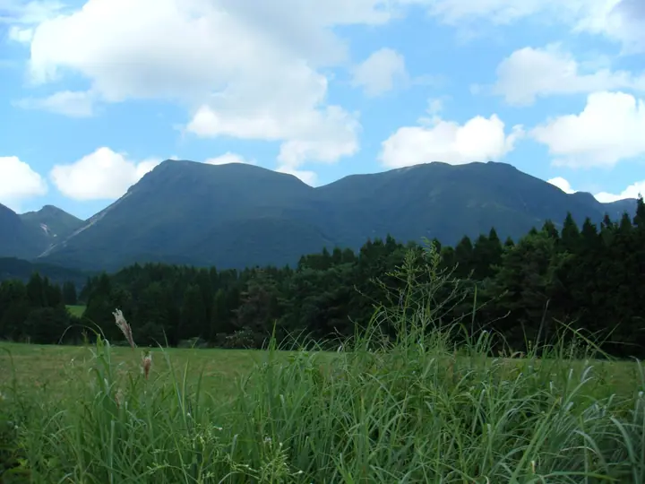
Mount Inaboshi (1,774 m) rises in Taketa City, Oita Prefecture, as a principal peak of the Kuju range within Aso-Kuju National Park. Between Mount Kuju, Nakadake and Shirakuchidake, it has fewer visitors than its prominent neighbors but equally broad summit views. It is approached from the South Kuju trailhead, ninety minutes on foot from the Kuju branch office. Shinmei-shimizu water source and the historic Inoshika-oji shrine ruins remain along the ridge. The old route from Somi observation point has been designated for removal.
Mount Inaboshi at a glance
- Weather: The most settled day in the next 7 days is Sun, November 8: cloudy, gusts up to 6 m/s. Fri, Nov 6: strong wind (gusts up to 17 m/s).
- Route: The shortest is Tengugajo–Nakadake–Inaboshiyama–Kujusan Circuit from Makinoto Pass: about 6 h 46 min, 11.4 km, about 850 m of climbing.
Mount Inaboshi weather (hourly, 14 days)
Sunrise today 06:34, sunset 17:23
| Tue, 11/3 | Wed, 11/4 | Thu, 11/5 | Fri, 11/6 | Sat, 11/7 | Sun, 11/8 | Mon, 11/9 | Tue, 11/10 | Wed, 11/11 | Thu, 11/12 | Fri, 11/13 | Sat, 11/14 | Sun, 11/15 | Mon, 11/16 | Tue, 11/17 | |||||||||||||||||||||||||||||||||||||||||||||||||||||||||||||||||||||||
|---|---|---|---|---|---|---|---|---|---|---|---|---|---|---|---|---|---|---|---|---|---|---|---|---|---|---|---|---|---|---|---|---|---|---|---|---|---|---|---|---|---|---|---|---|---|---|---|---|---|---|---|---|---|---|---|---|---|---|---|---|---|---|---|---|---|---|---|---|---|---|---|---|---|---|---|---|---|---|---|---|---|---|---|---|---|
| Japan time | 15 | 17 | 19 | 21 | 23 | 1 | 3 | 5 | 7 | 9 | 11 | 13 | 15 | 18 | 21 | 0 | 3 | 6 | 9 | 12 | 15 | 18 | 21 | 0 | 3 | 6 | 9 | 12 | 15 | 18 | 21 | 0 | 3 | 6 | 9 | 12 | 15 | 18 | 21 | 0 | 3 | 6 | 9 | 12 | 15 | 18 | 21 | 0 | 3 | 6 | 9 | 15 | 21 | 3 | 9 | 15 | 21 | 3 | 9 | 15 | 21 | 3 | 9 | 15 | 21 | 3 | 9 | 15 | 21 | 3 | 9 | 15 | 21 | 3 | 9 | 15 | 21 | 3 | 9 | 15 | 21 | 3 | 9 | 15 | |
  |   |   |   | | | | |   | | | | |   | | |   |   |  |   | | | | | | | | | |  | | | | | | | | | | | | | | | | | | | | | | | |   | | | | |   | |   | | | |  | | | | | | | | | | | | | | |   | | | | | ||
| Temperature | °C | 8° | 6° | 4° | 4° | 2° | 2° | 3° | 2° | 3° | 5° | 9° | 9° | 10° | 6° | 6° | 6° | 6° | 6° | 9° | 12° | 12° | 10° | 10° | 9° | 7° | 5° | 6° | 9° | 8° | 2° | 1° | -1° | -3° | -3° | 1° | 5° | 5° | 0° | -3° | -3° | -3° | -3° | 3° | 6° | 7° | 3° | 3° | 2° | 4° | 2° | 5° | 7° | 0° | 0° | 3° | 5° | -1° | -1° | 1° | 4° | -3° | -4° | 2° | 7° | -2° | -3° | 4° | 7° | 0° | 1° | 3° | 9° | 3° | 5° | 8° | 9° | 6° | 8° | 7° | 9° | 2° | 3° | 3° | 9° |
| Precipitation | mm | 0.4 | 0.3 | 0.8 | 0.3 | 1.5 | 1.7 | 1.2 | 0.5 | 0.3 | 0.1 | 0.2 | 3.4 | 3.7 | 0.2 | 0.1 | 0.1 | ||||||||||||||||||||||||||||||||||||||||||||||||||||||||||||||||||||
| New snow | cm | ||||||||||||||||||||||||||||||||||||||||||||||||||||||||||||||||||||||||||||||||||||
| Snow depth | cm | 0 | 0 | 0 | 0 | 0 | 0 | 0 | 0 | 0 | 0 | 0 | 0 | 0 | 0 | 0 | 0 | 0 | 0 | 0 | 0 | 0 | 0 | 0 | 0 | 0 | 0 | 0 | 0 | 0 | 0 | 0 | 0 | 0 | 0 | 0 | 0 | 0 | 0 | 0 | 0 | 0 | 0 | 0 | 0 | 0 | 0 | 0 | 0 | 0 | 0 | 0 | 0 | 0 | 0 | 0 | 0 | 0 | 0 | 0 | 0 | 0 | 0 | 0 | 0 | 0 | 0 | 0 | 0 | 0 | 0 | 0 | 0 | 0 | 0 | 0 | 0 | 0 | 0 | 0 | 0 | 0 | 0 | 0 | 0 |
| Wind | m/s | 2 | 2 | 1 | 1 | 1 | 1 | 1 | 1 | 1 | 2 | 3 | 2 | 2 | 2 | 2 | 0 | 0 | 0 | 1 | 2 | 4 | 4 | 5 | 4 | 4 | 4 | 5 | 6 | 5 | 4 | 5 | 4 | 4 | 3 | 3 | 3 | 3 | 2 | 1 | 0 | 0 | 0 | 1 | 1 | 2 | 1 | 0 | 1 | 1 | 1 | 1 | 3 | 2 | 2 | 3 | 5 | 3 | 2 | 3 | 2 | 1 | 1 | 1 | 2 | 2 | 1 | 1 | 2 | 1 | 1 | 1 | 2 | 0 | 1 | 2 | 2 | 2 | 3 | 4 | 4 | 1 | 2 | 1 | 1 |
| Wind gusts | m/s | 7 | 7 | 5 | 4 | 4 | 3 | 3 | 4 | 5 | 6 | 8 | 9 | 7 | 6 | 6 | 6 | 3 | 3 | 5 | 8 | 12 | 13 | 14 | 14 | 13 | 14 | 14 | 17 | 17 | 15 | 15 | 15 | 15 | 14 | 13 | 12 | 10 | 8 | 6 | 3 | 2 | 2 | 4 | 5 | 6 | 6 | 3 | 5 | 6 | 6 | 5 | 9 | 9 | 7 | 10 | 13 | 13 | 11 | 10 | 10 | 8 | 4 | 5 | 7 | 7 | 6 | 5 | 8 | 6 | 4 | 4 | 7 | 6 | 5 | 10 | 12 | 9 | 10 | 12 | 12 | 11 | 5 | 4 | 6 |
| Wind dir. | ↓ | ↓ | ↓ | ↓ | ↓ | ↓ | ↓ | ↓ | ↓ | ↓ | ↓ | ↓ | ↓ | ↓ | ↓ | ↓ | ↓ | ↓ | ↓ | ↓ | ↓ | ↓ | ↓ | ↓ | ↓ | ↓ | ↓ | ↓ | ↓ | ↓ | ↓ | ↓ | ↓ | ↓ | ↓ | ↓ | ↓ | ↓ | ↓ | ↓ | ↓ | ↓ | ↓ | ↓ | ↓ | ↓ | ↓ | ↓ | ↓ | ↓ | ↓ | ↓ | ↓ | ↓ | ↓ | ↓ | ↓ | ↓ | ↓ | ↓ | ↓ | ↓ | ↓ | ↓ | ↓ | ↓ | ↓ | ↓ | ↓ | ↓ | ↓ | ↓ | ↓ | ↓ | ↓ | ↓ | ↓ | ↓ | ↓ | ↓ | ↓ | ↓ | ↓ | ↓ | |
Mount Inaboshi hiking routes
Hiking times are estimates calculated from the terrain.
Huts, campsites and lodging near Mount Inaboshi
Mountain huts
- 池ノ小屋 unstaffed
- Kuju Refuge Hut unstaffed
- Hokkein Onsen Sanso reservation required · sleeps 224
- スガモリ小屋跡
- あせび小屋 reservation required
Campsites
- Bokketsuru Camping Ground
- 沢水キャンプ場
- 久住山荘南登山口キャンプ場
Lodging
- Kan-no-jigoku Ryokan
- 九重観光ホテル
- Hanasansui
- オーベルジュ・コスモス
Lists that include Mount Inaboshi
Mount Inaboshi facts
- Elevation
- 1,774 m
- Location
- Taketa, Oita
33.080898, 131.250476 - National Park
- 阿蘇くじゅう国立公園
- Volcano
- Active volcano (九重山)
- Website
- oita-osoto.jp
- Wikipedia
- ja.wikipedia.org