
Mount Hanabuchi
花渕山
Ōsaki-shi, Miyagi · Elevation 985 m
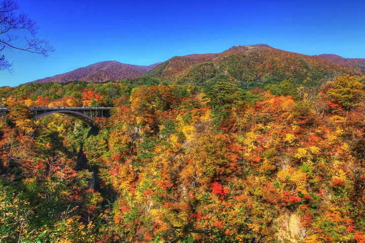
Mount Hanabuchi is a 984.6 m peak rising northwest of the Naruko-Onsen district of Ōsaki City, Miyagi Prefecture, in the Ōu Mountains within the Onikōbe sector of Kurikoma Quasi-National Park. The summit forms the southern end of the rim of the Onikōbe caldera, from which a ridge of roughly 1,000 m peaks runs west through Mount Koshiba and Mount Ōshiba. Despite its proximity to the town the slopes are blanketed in primeval beech forest, and Lake Ōnuma in the upper valleys is the subject of a local rain-prayer legend; the south face was once home to the Naruko (formerly Hanabuchi) Ski Area, which closed in 2002.
Mount Hanabuchi at a glance
- Weather: The most settled day in the next 7 days is Mon, November 9: cloudy, gusts up to 11 m/s. Fri, Nov 6, Sat, Nov 7, Sun, Nov 8: strong wind (gusts up to 24 m/s).
Mount Hanabuchi weather (hourly, 14 days)
Sunrise today 06:05, sunset 16:36
| Tue, 11/3 | Wed, 11/4 | Thu, 11/5 | Fri, 11/6 | Sat, 11/7 | Sun, 11/8 | Mon, 11/9 | Tue, 11/10 | Wed, 11/11 | Thu, 11/12 | Fri, 11/13 | Sat, 11/14 | Sun, 11/15 | Mon, 11/16 | Tue, 11/17 | |||||||||||||||||||||||||||||||||||||||||||||||||||||||||||||||||||||||
|---|---|---|---|---|---|---|---|---|---|---|---|---|---|---|---|---|---|---|---|---|---|---|---|---|---|---|---|---|---|---|---|---|---|---|---|---|---|---|---|---|---|---|---|---|---|---|---|---|---|---|---|---|---|---|---|---|---|---|---|---|---|---|---|---|---|---|---|---|---|---|---|---|---|---|---|---|---|---|---|---|---|---|---|---|---|
| Japan time | 15 | 17 | 19 | 21 | 23 | 1 | 3 | 5 | 7 | 9 | 11 | 13 | 15 | 18 | 21 | 0 | 3 | 6 | 9 | 12 | 15 | 18 | 21 | 0 | 3 | 6 | 9 | 12 | 15 | 18 | 21 | 0 | 3 | 6 | 9 | 12 | 15 | 18 | 21 | 0 | 3 | 6 | 9 | 12 | 15 | 18 | 21 | 0 | 3 | 6 | 9 | 15 | 21 | 3 | 9 | 15 | 21 | 3 | 9 | 15 | 21 | 3 | 9 | 15 | 21 | 3 | 9 | 15 | 21 | 3 | 9 | 15 | 21 | 3 | 9 | 15 | 21 | 3 | 9 | 15 | 21 | 3 | 9 | 15 | |
 |  |   | | | | |   |   | |   |   | | | | |   | |   | | | | |   | | | | | | | | | |   |   | |   |   | | | | |   | | | | | | | | | |   | | | | | | |   | |   | | | | | | | | | | |  | | | | | | | |   | | | | ||
| Temperature | °C | 7° | 4° | 2° | 2° | 1° | 1° | 1° | 2° | 3° | 7° | 9° | 10° | 9° | 5° | 4° | 4° | 4° | 5° | 6° | 8° | 9° | 8° | 8° | 8° | 7° | 8° | 10° | 11° | 10° | 7° | 4° | 1° | 0° | -1° | 0° | 0° | 0° | -1° | -1° | -1° | -1° | -1° | 2° | 3° | 2° | 1° | 0° | 0° | 0° | -1° | 2° | 3° | -3° | -4° | 2° | 4° | 1° | 0° | 1° | 4° | -1° | -1° | 4° | 4° | 1° | 2° | 2° | 3° | 0° | -2° | 3° | 6° | -2° | -2° | 5° | 8° | 4° | 4° | 7° | 4° | -1° | -1° | 1° | 4° |
| Precipitation | mm | 0.4 | 3.9 | 7 | 4.1 | 1.7 | 0.2 | 0.4 | 1.7 | 0.6 | 0.1 | 1.2 | 1.2 | 0.1 | 0.6 | 0.5 | 1.2 | 1.8 | 2.2 | 1.6 | 2.5 | 1.3 | 0.6 | 0.9 | 0.9 | 0.6 | 0.5 | 0.2 | 0.1 | 4.0 | 2.0 | 0.3 | 0.1 | 4.5 | 1.0 | 0.8 | 5 | 1.9 | 1.7 | 2.2 | |||||||||||||||||||||||||||||||||||||||||||||
| New snow | cm | <.1 | 0.3 | 1.0 | 0.3 | 0.2 | 0.4 | 0.2 | <.1 | <.1 | |||||||||||||||||||||||||||||||||||||||||||||||||||||||||||||||||||||||||||
| Snow depth | cm | 0 | 0 | 0 | 0 | 0 | 0 | 0 | 0 | 0 | 0 | 0 | 0 | 0 | 0 | 0 | 0 | 0 | 0 | 0 | 0 | 0 | 0 | 0 | 0 | 0 | 0 | 0 | 0 | 0 | 0 | 0 | 0 | 0 | 0 | 0 | <1 | <1 | <1 | <1 | <1 | <1 | <1 | <1 | 0 | 0 | 0 | 0 | 0 | 0 | 0 | 0 | 0 | 0 | 0 | 0 | 0 | 0 | 0 | 0 | 0 | 0 | 0 | 0 | 0 | 0 | 0 | 0 | 0 | 0 | 0 | 0 | 0 | 0 | 0 | 0 | 0 | 0 | 0 | 0 | 0 | 0 | 0 | 0 | 0 |
| Wind | m/s | 5 | 4 | 3 | 3 | 3 | 3 | 3 | 3 | 3 | 4 | 4 | 3 | 1 | 1 | 1 | 2 | 1 | 1 | 2 | 2 | 2 | 0 | 0 | 1 | 2 | 2 | 4 | 8 | 8 | 6 | 6 | 6 | 6 | 7 | 6 | 7 | 8 | 7 | 7 | 7 | 8 | 8 | 8 | 9 | 8 | 6 | 5 | 4 | 4 | 2 | 3 | 4 | 2 | 2 | 2 | 6 | 2 | 5 | 5 | 5 | 3 | 2 | 4 | 5 | 1 | 2 | 5 | 6 | 3 | 2 | 3 | 3 | 1 | 2 | 1 | 1 | 1 | 1 | 2 | 5 | 6 | 4 | 4 | 3 |
| Wind gusts | m/s | 15 | 13 | 9 | 8 | 8 | 8 | 8 | 9 | 9 | 11 | 11 | 9 | 7 | 4 | 4 | 5 | 5 | 4 | 4 | 4 | 7 | 6 | 2 | 4 | 7 | 7 | 10 | 21 | 22 | 20 | 16 | 16 | 16 | 17 | 17 | 19 | 20 | 20 | 19 | 19 | 19 | 20 | 20 | 23 | 24 | 20 | 15 | 12 | 10 | 9 | 8 | 11 | 9 | 6 | 6 | 13 | 14 | 11 | 14 | 15 | 12 | 8 | 11 | 13 | 12 | 6 | 12 | 16 | 15 | 9 | 9 | 10 | 7 | 5 | 5 | 5 | 4 | 4 | 6 | 14 | 19 | 17 | 11 | 10 |
| Wind dir. | ↓ | ↓ | ↓ | ↓ | ↓ | ↓ | ↓ | ↓ | ↓ | ↓ | ↓ | ↓ | ↓ | ↓ | ↓ | ↓ | ↓ | ↓ | ↓ | ↓ | ↓ | ↓ | ↓ | ↓ | ↓ | ↓ | ↓ | ↓ | ↓ | ↓ | ↓ | ↓ | ↓ | ↓ | ↓ | ↓ | ↓ | ↓ | ↓ | ↓ | ↓ | ↓ | ↓ | ↓ | ↓ | ↓ | ↓ | ↓ | ↓ | ↓ | ↓ | ↓ | ↓ | ↓ | ↓ | ↓ | ↓ | ↓ | ↓ | ↓ | ↓ | ↓ | ↓ | ↓ | ↓ | ↓ | ↓ | ↓ | ↓ | ↓ | ↓ | ↓ | ↓ | ↓ | ↓ | ↓ | ↓ | ↓ | ↓ | ↓ | ↓ | ↓ | ↓ | ↓ | |
Huts, campsites and lodging near Mount Hanabuchi
Campsites
- 荒雄湖畔公園キャンプ場
- 吹上高原キャンプ場
Lodging
- Hanabuchiso
- Nakayama Sanso
- Fukiyuso
- Yasuragiso
- 農民の家
Mount Hanabuchi facts
- Elevation
- 985 m
- Location
- Ōsaki-shi, Miyagi
38.758363, 140.679443 - National Park
- 栗駒国定公園
- Wikipedia
- ja.wikipedia.org