
Kattadake
刈田岳
Shichikashuku, Miyagi · Elevation 1,758 m
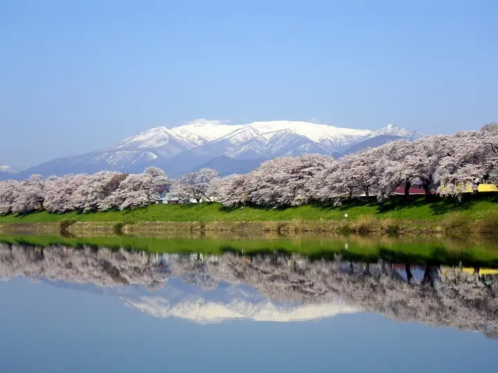
Mount Katta (1,758 m) is an active volcano in Shichikashuku Town, Miyagi Prefecture, forming the southern rim of the crater lake Okama on the southeastern flank of the Zaō Range. The inner shrine of Katta-mine-jinja stands at its summit. The Zaō Echo Line and the Zaō Highline toll road climb to a parking area just below the top, making the peak the easiest gateway to Okama, the Uma-no-Se ridge, and Mount Kumano. The mountain lies within Zaō Quasi-National Park.
Kattadake at a glance
- Weather: The most settled day in the next 7 days is Wed, November 4: clear, gusts up to 8 m/s. Fri, Nov 6, Sat, Nov 7, Sun, Nov 8: strong wind (gusts up to 28 m/s).
- Route: The shortest is Mount Zao Kumanodake and Kattadake Loop via Okama and Umanose: about 2 h 31 min, 5.0 km, about 170 m of climbing.
Kattadake weather (hourly, 14 days)
Sunrise today 06:05, sunset 16:38
| Tue, 11/3 | Wed, 11/4 | Thu, 11/5 | Fri, 11/6 | Sat, 11/7 | Sun, 11/8 | Mon, 11/9 | Tue, 11/10 | Wed, 11/11 | Thu, 11/12 | Fri, 11/13 | Sat, 11/14 | Sun, 11/15 | Mon, 11/16 | Tue, 11/17 | |||||||||||||||||||||||||||||||||||||||||||||||||||||||||||||||||||||||
|---|---|---|---|---|---|---|---|---|---|---|---|---|---|---|---|---|---|---|---|---|---|---|---|---|---|---|---|---|---|---|---|---|---|---|---|---|---|---|---|---|---|---|---|---|---|---|---|---|---|---|---|---|---|---|---|---|---|---|---|---|---|---|---|---|---|---|---|---|---|---|---|---|---|---|---|---|---|---|---|---|---|---|---|---|---|
| Japan time | 15 | 17 | 19 | 21 | 23 | 1 | 3 | 5 | 7 | 9 | 11 | 13 | 15 | 18 | 21 | 0 | 3 | 6 | 9 | 12 | 15 | 18 | 21 | 0 | 3 | 6 | 9 | 12 | 15 | 18 | 21 | 0 | 3 | 6 | 9 | 12 | 15 | 18 | 21 | 0 | 3 | 6 | 9 | 12 | 15 | 18 | 21 | 0 | 3 | 6 | 9 | 15 | 21 | 3 | 9 | 15 | 21 | 3 | 9 | 15 | 21 | 3 | 9 | 15 | 21 | 3 | 9 | 15 | 21 | 3 | 9 | 15 | 21 | 3 | 9 | 15 | 21 | 3 | 9 | 15 | 21 | 3 | 9 | 15 | |
 |  | | | | |   | |   | | |   |   | | |   |   | |   | | | | |   |   | | |   | | | | | | |   | |   |   |   | | | |   | | |   | | | | | | | |   | | | | |   | | | | | |   | |   | | | | | |  | | | | | | | | | | | | ||
| Temperature | °C | 4° | 0° | -2° | -1° | -1° | -1° | -2° | -2° | 1° | 5° | 6° | 8° | 7° | 1° | 2° | 3° | 4° | 5° | 6° | 7° | 7° | 7° | 6° | 7° | 5° | 7° | 8° | 10° | 9° | 5° | 3° | 1° | 0° | -2° | -2° | -2° | -2° | -4° | -3° | -3° | -3° | -3° | -2° | 0° | 0° | -3° | -3° | -3° | -3° | -3° | 0° | 1° | -4° | -5° | 0° | 0° | -1° | -1° | -1° | 1° | -3° | -3° | 1° | 1° | -2° | 0° | 0° | -1° | -4° | -5° | 1° | 4° | -2° | -1° | 7° | 8° | 4° | 3° | 7° | 3° | -3° | -5° | -1° | 1° |
| Precipitation | mm | 1.5 | 9 | 8 | 2.9 | 0.8 | 0.7 | 0.4 | 0.6 | 0.4 | 0.6 | 0.7 | 0.7 | 1.2 | 1.9 | 1.7 | 1.1 | 0.8 | 0.7 | 0.4 | 0.2 | 0.2 | 0.2 | 0.3 | 0.1 | 0.2 | 0.5 | 6 | 1.6 | 1.0 | 0.2 | 0.7 | 1.0 | 0.2 | 2.4 | 7 | 0.8 | 3.5 | 2.2 | ||||||||||||||||||||||||||||||||||||||||||||||
| New snow | cm | 1.0 | 1.0 | 0.7 | 0.7 | 0.6 | 0.2 | 0.2 | 0.2 | <.1 | <.1 | 0.2 | 0.4 | 1.2 | 0.7 | ||||||||||||||||||||||||||||||||||||||||||||||||||||||||||||||||||||||
| Snow depth | cm | 0 | 0 | 0 | 0 | 0 | 0 | 0 | 0 | 0 | 0 | 0 | 0 | 0 | 0 | 0 | 0 | 0 | 0 | 0 | 0 | 0 | 0 | 0 | 0 | 0 | 0 | 0 | 0 | 0 | 0 | 0 | 0 | 0 | 0 | <1 | <1 | <1 | <1 | 2 | 2 | 2 | <1 | <1 | <1 | <1 | <1 | 0 | 0 | 0 | <1 | <1 | 0 | 0 | 0 | 0 | 0 | 0 | <1 | <1 | 0 | 0 | 0 | 0 | 0 | 0 | 0 | 0 | 0 | 0 | 0 | 0 | 0 | 0 | 0 | 0 | 0 | 0 | 0 | 0 | 0 | 0 | 0 | 0 | 0 |
| Wind | m/s | 4 | 2 | 2 | 1 | 1 | 1 | 1 | 1 | 2 | 2 | 1 | 1 | 2 | 2 | 2 | 2 | 2 | 2 | 1 | 1 | 1 | 1 | 1 | 2 | 2 | 3 | 4 | 5 | 7 | 4 | 4 | 5 | 5 | 4 | 4 | 5 | 5 | 5 | 6 | 6 | 6 | 6 | 6 | 7 | 7 | 3 | 2 | 2 | 1 | 1 | 1 | 2 | 1 | 1 | 1 | 3 | 2 | 3 | 4 | 5 | 2 | 2 | 2 | 3 | 2 | 1 | 4 | 6 | 3 | 2 | 2 | 1 | 1 | 1 | 1 | 1 | 1 | 1 | 2 | 4 | 5 | 3 | 2 | 1 |
| Wind gusts | m/s | 18 | 14 | 10 | 9 | 9 | 8 | 8 | 8 | 8 | 8 | 8 | 6 | 6 | 8 | 10 | 12 | 12 | 11 | 8 | 9 | 6 | 6 | 6 | 9 | 11 | 14 | 17 | 20 | 23 | 23 | 18 | 18 | 19 | 19 | 21 | 26 | 28 | 23 | 23 | 23 | 23 | 23 | 22 | 22 | 23 | 21 | 13 | 10 | 10 | 9 | 8 | 10 | 9 | 8 | 7 | 10 | 13 | 13 | 15 | 20 | 17 | 11 | 9 | 11 | 11 | 10 | 14 | 20 | 19 | 12 | 10 | 8 | 5 | 7 | 8 | 6 | 9 | 9 | 11 | 17 | 22 | 18 | 13 | 8 |
| Wind dir. | ↓ | ↓ | ↓ | ↓ | ↓ | ↓ | ↓ | ↓ | ↓ | ↓ | ↓ | ↓ | ↓ | ↓ | ↓ | ↓ | ↓ | ↓ | ↓ | ↓ | ↓ | ↓ | ↓ | ↓ | ↓ | ↓ | ↓ | ↓ | ↓ | ↓ | ↓ | ↓ | ↓ | ↓ | ↓ | ↓ | ↓ | ↓ | ↓ | ↓ | ↓ | ↓ | ↓ | ↓ | ↓ | ↓ | ↓ | ↓ | ↓ | ↓ | ↓ | ↓ | ↓ | ↓ | ↓ | ↓ | ↓ | ↓ | ↓ | ↓ | ↓ | ↓ | ↓ | ↓ | ↓ | ↓ | ↓ | ↓ | ↓ | ↓ | ↓ | ↓ | ↓ | ↓ | ↓ | ↓ | ↓ | ↓ | ↓ | ↓ | ↓ | ↓ | ↓ | ↓ | |
Kattadake live cameras
Kattadake hiking routes
- Mount Zao Kumanodake and Kattadake Loop via Okama and Umanose 5.0 km · Ascent 171 m 蔵王刈田山頂 (Bus stop), 第1駐車場, 第2駐車場
- Mount Zao Return from Daikokuten over Kattadake and the Umanose Ridge to Kumanodake 8.3 km · Ascent 463 m 大黒天 (Bus stop) (parking)
Hiking times are estimates calculated from the terrain.
Huts, campsites and lodging near Kattadake
Mountain huts
- Mt. Katta Emergency Shelter
- 清渓小屋
- Katta Pass Emergency Shelter unstaffed
- 仙台一高井戸沢小屋
- 御田の神避難小屋 unstaffed
Campsites
- Zaobodaira Camping Ground
Lodging
- 宮城蔵王高原ホテル
- 蔵王坊平高原ライザウッディロッジ
- Gaga Onsen
Lists that include Kattadake
Elevations of 1003 Mountains of Japan · 1000 Mountains of Japan
Kattadake facts
- Elevation
- 1,758 m
- Location
- Shichikashuku, Miyagi
38.127750, 140.448200 - National Park
- 蔵王国定公園
- Volcano
- Active volcano (蔵王山)
- Website
- www.zao-machi.com
- Trail Map
- www.police.pref.miyagi.jp
- Wikipedia
- ja.wikipedia.org