
Ryū Zan
瀧山
Yamagata, Yamagata · Elevation 1,362 m
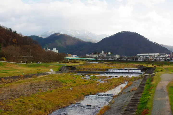
Ryū Zan (1,362.1 m) rises above Zao-Onsen in Yamagata City, Yamagata Prefecture, as a frontal peak of the Zao Range. Like the central Zao peaks, it has long been a mountain of religious devotion, with Ryuzan-jinja at its summit. Several maintained trails climb the mountain — from Maetaki, Ubagami and Zao Skycable — each taking about two hours one way. The summit overlooks the Zao range and Yamagata Basin, and the mountain lies inside Zao Quasi-National Park.
Ryū Zan at a glance
- Weather: The most settled day in the next 7 days is Wed, November 4: clear, gusts up to 6 m/s. Fri, Nov 6, Sat, Nov 7, Sun, Nov 8: strong wind (gusts up to 20 m/s).
- Route: The shortest is Mount Ryuzan Return from Zao Onsen via Koedo Pass: about 3 h 42 min, 5.9 km, about 680 m of climbing.
Ryū Zan weather (hourly, 14 days)
Sunrise today 06:06, sunset 16:38
| Tue, 11/3 | Wed, 11/4 | Thu, 11/5 | Fri, 11/6 | Sat, 11/7 | Sun, 11/8 | Mon, 11/9 | Tue, 11/10 | Wed, 11/11 | Thu, 11/12 | Fri, 11/13 | Sat, 11/14 | Sun, 11/15 | Mon, 11/16 | Tue, 11/17 | |||||||||||||||||||||||||||||||||||||||||||||||||||||||||||||||||||||||
|---|---|---|---|---|---|---|---|---|---|---|---|---|---|---|---|---|---|---|---|---|---|---|---|---|---|---|---|---|---|---|---|---|---|---|---|---|---|---|---|---|---|---|---|---|---|---|---|---|---|---|---|---|---|---|---|---|---|---|---|---|---|---|---|---|---|---|---|---|---|---|---|---|---|---|---|---|---|---|---|---|---|---|---|---|---|
| Japan time | 15 | 17 | 19 | 21 | 23 | 1 | 3 | 5 | 7 | 9 | 11 | 13 | 15 | 18 | 21 | 0 | 3 | 6 | 9 | 12 | 15 | 18 | 21 | 0 | 3 | 6 | 9 | 12 | 15 | 18 | 21 | 0 | 3 | 6 | 9 | 12 | 15 | 18 | 21 | 0 | 3 | 6 | 9 | 12 | 15 | 18 | 21 | 0 | 3 | 6 | 9 | 15 | 21 | 3 | 9 | 15 | 21 | 3 | 9 | 15 | 21 | 3 | 9 | 15 | 21 | 3 | 9 | 15 | 21 | 3 | 9 | 15 | 21 | 3 | 9 | 15 | 21 | 3 | 9 | 15 | 21 | 3 | 9 | 15 | |
 |  | | | |   | | |   | |   | | | | |   |   | |   | | | |   |   | | | |   | | | | | | |   | |   |   |   | | | | | | | | | | | | |   | |   | | | | | |   | | | | | | | | | | | | |  | | | | | | | | | | | | ||
| Temperature | °C | 4° | 0° | -1° | -1° | -2° | -2° | -2° | -2° | -1° | 3° | 5° | 7° | 6° | 0° | 1° | 2° | 3° | 3° | 4° | 5° | 6° | 5° | 5° | 5° | 4° | 5° | 7° | 9° | 8° | 4° | 2° | 0° | -1° | -2° | -2° | -2° | -2° | -4° | -3° | -3° | -3° | -3° | -2° | 0° | 0° | -3° | -3° | -3° | -3° | -4° | -1° | 0° | -4° | -6° | 0° | 0° | -2° | -2° | -2° | 0° | -4° | -4° | 0° | 1° | -3° | -1° | -1° | -1° | -5° | -6° | -1° | 3° | -3° | -2° | 5° | 7° | 2° | 2° | 5° | 3° | -4° | -6° | -2° | 0° |
| Precipitation | mm | 1.5 | 10 | 8 | 2.9 | 0.6 | 0.9 | 0.2 | 0.5 | 0.1 | 1.0 | 0.9 | 0.8 | 0.9 | 1.5 | 2.1 | 2.1 | 1.5 | 1.1 | 1.2 | 0.7 | 0.3 | 0.2 | 0.2 | 0.2 | 0.1 | 0.1 | 0.4 | 3.9 | 1.5 | 0.1 | 0.1 | 0.8 | 0.9 | 1.0 | 0.1 | 2.5 | 7 | 1.0 | 3.0 | 1.2 | ||||||||||||||||||||||||||||||||||||||||||||
| New snow | cm | 0.1 | 0.3 | <.1 | 0.4 | 0.3 | <.1 | <.1 | <.1 | <.1 | <.1 | <.1 | <.1 | 0.3 | 0.2 | ||||||||||||||||||||||||||||||||||||||||||||||||||||||||||||||||||||||
| Snow depth | cm | 0 | 0 | 0 | 0 | 0 | 0 | 0 | 0 | 0 | 0 | 0 | 0 | 0 | 0 | 0 | 0 | 0 | 0 | 0 | 0 | 0 | 0 | 0 | 0 | 0 | 0 | 0 | 0 | 0 | 0 | 0 | 0 | 0 | 0 | <1 | <1 | <1 | <1 | <1 | <1 | <1 | <1 | <1 | <1 | <1 | <1 | 0 | 0 | 0 | <1 | <1 | 0 | 0 | 0 | 0 | 0 | 0 | <1 | <1 | 0 | 0 | 0 | 0 | 0 | 0 | 0 | 0 | 0 | 0 | 0 | 0 | 0 | 0 | 0 | 0 | 0 | 0 | 0 | 0 | 0 | 0 | 0 | 0 | 0 |
| Wind | m/s | 4 | 2 | 1 | 1 | 0 | 1 | 2 | 2 | 2 | 1 | 1 | 1 | 1 | 2 | 3 | 4 | 3 | 2 | 1 | 1 | 1 | 1 | 1 | 2 | 2 | 2 | 4 | 5 | 6 | 3 | 3 | 4 | 3 | 3 | 4 | 4 | 6 | 4 | 5 | 5 | 5 | 4 | 5 | 6 | 6 | 2 | 1 | 1 | 0 | 1 | 1 | 3 | 0 | 0 | 0 | 3 | 3 | 2 | 2 | 5 | 1 | 1 | 1 | 3 | 2 | 2 | 3 | 6 | 2 | 0 | 1 | 1 | 1 | 1 | 2 | 1 | 1 | 1 | 1 | 4 | 4 | 3 | 2 | 1 |
| Wind gusts | m/s | 13 | 10 | 6 | 4 | 4 | 4 | 5 | 5 | 5 | 6 | 5 | 4 | 5 | 6 | 9 | 10 | 10 | 9 | 6 | 5 | 5 | 3 | 4 | 6 | 8 | 9 | 13 | 18 | 19 | 18 | 14 | 13 | 13 | 13 | 16 | 18 | 20 | 19 | 17 | 18 | 16 | 15 | 14 | 16 | 17 | 15 | 7 | 5 | 5 | 4 | 4 | 8 | 7 | 4 | 4 | 9 | 10 | 11 | 9 | 16 | 13 | 5 | 5 | 9 | 9 | 7 | 10 | 16 | 15 | 8 | 5 | 5 | 4 | 5 | 6 | 6 | 6 | 6 | 6 | 14 | 15 | 13 | 8 | 6 |
| Wind dir. | ↓ | ↓ | ↓ | ↓ | ↓ | ↓ | ↓ | ↓ | ↓ | ↓ | ↓ | ↓ | ↓ | ↓ | ↓ | ↓ | ↓ | ↓ | ↓ | ↓ | ↓ | ↓ | ↓ | ↓ | ↓ | ↓ | ↓ | ↓ | ↓ | ↓ | ↓ | ↓ | ↓ | ↓ | ↓ | ↓ | ↓ | ↓ | ↓ | ↓ | ↓ | ↓ | ↓ | ↓ | ↓ | ↓ | ↓ | ↓ | ↓ | ↓ | ↓ | ↓ | ↓ | ↓ | ↓ | ↓ | ↓ | ↓ | ↓ | ↓ | ↓ | ↓ | ↓ | ↓ | ↓ | ↓ | ↓ | ↓ | ↓ | ↓ | ↓ | ↓ | ↓ | ↓ | ↓ | ↓ | ↓ | ↓ | ↓ | ↓ | ↓ | ↓ | ↓ | ↓ | |
Ryū Zan hiking routes
Hiking times are estimates calculated from the terrain.
Huts, campsites and lodging near Ryū Zan
Mountain huts
Campsites
- 古竜湖キャンプ場
- 西蔵王公園キャンプ場
Lodging
- Unite Zao Jonida Resort
- OakHill Hotel
- Genghis Khan Lodge
- Hutte Pechka
- Petit Resort Hotel Der Barte
Lists that include Ryū Zan
Ryū Zan facts
- Elevation
- 1,362 m
- Location
- Yamagata, Yamagata
38.183051, 140.394706 - National Park
- 蔵王国定公園
- Website
- yamagatayama.com