
Mt. Miune
三峰山
Mitsue, Nara / Matsusaka, Mie / Tsu, Mie · Elevation 1,235 m
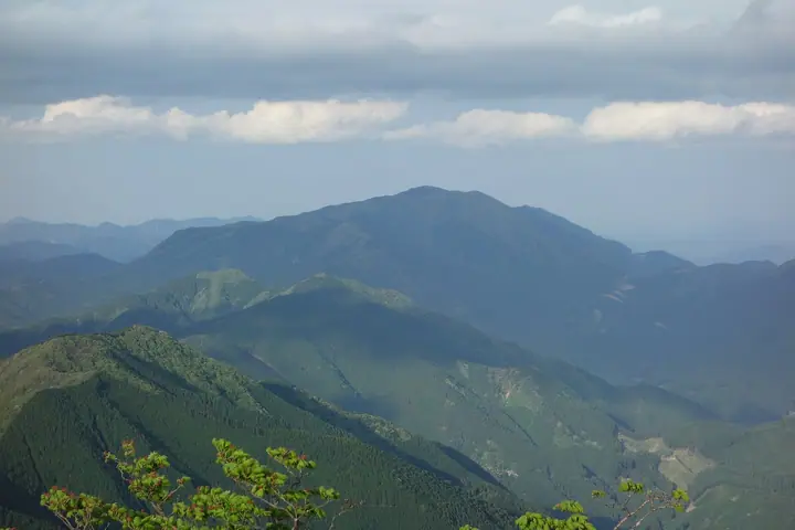
Miuneyama is a 1,235 m peak straddling the prefectural border between Mitsue Village in Nara Prefecture and the cities of Matsusaka and Tsu in Mie Prefecture, in the northern Daikō Range. Its broad summit plateau and adjoining grassland of Hatchō-daira open onto westward views of Takamiyama. The mountain is renowned for its early-summer shiroyashio rhododendron and for its rime ice (muhyō) in the depths of winter — a Rime Ice Festival (Muhyō Matsuri) is held at its base each January through February. It lies within Muro-Akame-Aoyama Quasi-National Park and is listed in the Japanese 300 Famous Mountains, the Kansai 100, and the Kinki 100, among others.
Mt. Miune at a glance
- Weather: The most settled day in the next 7 days is Thu, November 5: cloudy, gusts up to 6 m/s. Fri, Nov 6, Sat, Nov 7: strong wind (gusts up to 21 m/s).
- Route: The shortest is Mount Miune, Return from the Yuriware Trailhead on the Iitaka Side via Hatchodaira: about 3 h 25 min, 5.2 km, about 540 m of climbing.
Mt. Miune weather (hourly, 14 days)
Sunrise today 06:16, sunset 17:01
| Tue, 11/3 | Wed, 11/4 | Thu, 11/5 | Fri, 11/6 | Sat, 11/7 | Sun, 11/8 | Mon, 11/9 | Tue, 11/10 | Wed, 11/11 | Thu, 11/12 | Fri, 11/13 | Sat, 11/14 | Sun, 11/15 | Mon, 11/16 | Tue, 11/17 | |||||||||||||||||||||||||||||||||||||||||||||||||||||||||||||||||||||||
|---|---|---|---|---|---|---|---|---|---|---|---|---|---|---|---|---|---|---|---|---|---|---|---|---|---|---|---|---|---|---|---|---|---|---|---|---|---|---|---|---|---|---|---|---|---|---|---|---|---|---|---|---|---|---|---|---|---|---|---|---|---|---|---|---|---|---|---|---|---|---|---|---|---|---|---|---|---|---|---|---|---|---|---|---|---|
| Japan time | 15 | 17 | 19 | 21 | 23 | 1 | 3 | 5 | 7 | 9 | 11 | 13 | 15 | 18 | 21 | 0 | 3 | 6 | 9 | 12 | 15 | 18 | 21 | 0 | 3 | 6 | 9 | 12 | 15 | 18 | 21 | 0 | 3 | 6 | 9 | 12 | 15 | 18 | 21 | 0 | 3 | 6 | 9 | 12 | 15 | 18 | 21 | 0 | 3 | 6 | 9 | 15 | 21 | 3 | 9 | 15 | 21 | 3 | 9 | 15 | 21 | 3 | 9 | 15 | 21 | 3 | 9 | 15 | 21 | 3 | 9 | 15 | 21 | 3 | 9 | 15 | 21 | 3 | 9 | 15 | 21 | 3 | 9 | 15 | |
  | |   | | | | | | |   |   | | |   | | | |   | |   | | | |   | | | | | |   | | |  | | | | | | | | | | | | | | | | | |  | | | | | | | | | | |  | | | | | |   | | | | | | | |   | |   | | | | | | | ||
| Temperature | °C | 12° | 8° | 7° | 6° | 4° | 4° | 4° | 3° | 4° | 9° | 11° | 10° | 9° | 8° | 7° | 8° | 8° | 8° | 10° | 14° | 14° | 10° | 9° | 8° | 9° | 10° | 10° | 13° | 12° | 9° | 6° | 4° | 3° | 2° | 5° | 6° | 6° | 3° | 1° | 1° | 1° | 1° | 5° | 8° | 7° | 3° | 3° | 4° | 2° | 4° | 8° | 9° | 4° | 2° | 8° | 10° | 4° | 1° | 3° | 5° | 1° | 0° | 5° | 7° | 1° | 3° | 5° | 6° | 2° | 0° | 6° | 10° | 3° | 5° | 7° | 9° | 7° | 7° | 10° | 10° | 4° | 1° | 4° | 7° |
| Precipitation | mm | 0.4 | 1.3 | 0.8 | 0.4 | 0.4 | 0.4 | 0.4 | 0.6 | 0.3 | 0.2 | 0.2 | 0.1 | 0.3 | 1.3 | 2.0 | 14 | 0.2 | 1.3 | 0.1 | |||||||||||||||||||||||||||||||||||||||||||||||||||||||||||||||||
| New snow | cm | ||||||||||||||||||||||||||||||||||||||||||||||||||||||||||||||||||||||||||||||||||||
| Snow depth | cm | 0 | 0 | 0 | 0 | 0 | 0 | 0 | 0 | 0 | 0 | 0 | 0 | 0 | 0 | 0 | 0 | 0 | 0 | 0 | 0 | 0 | 0 | 0 | 0 | 0 | 0 | 0 | 0 | 0 | 0 | 0 | 0 | 0 | 0 | 0 | 0 | 0 | 0 | 0 | 0 | 0 | 0 | 0 | 0 | 0 | 0 | 0 | 0 | 0 | 0 | 0 | 0 | 0 | 0 | 0 | 0 | 0 | 0 | 0 | 0 | 0 | 0 | 0 | 0 | 0 | 0 | 0 | 0 | 0 | 0 | 0 | 0 | 0 | 0 | 0 | 0 | 0 | 0 | 0 | 0 | 0 | 0 | 0 | 0 |
| Wind | m/s | 4 | 3 | 3 | 3 | 3 | 3 | 3 | 2 | 2 | 1 | 2 | 2 | 2 | 3 | 2 | 3 | 2 | 0 | 1 | 2 | 2 | 1 | 1 | 2 | 3 | 5 | 6 | 6 | 6 | 5 | 6 | 7 | 7 | 6 | 8 | 8 | 7 | 6 | 5 | 4 | 4 | 4 | 5 | 5 | 4 | 3 | 2 | 2 | 2 | 3 | 5 | 4 | 3 | 2 | 1 | 4 | 4 | 8 | 7 | 7 | 5 | 3 | 4 | 4 | 3 | 5 | 5 | 7 | 5 | 3 | 1 | 3 | 1 | 0 | 2 | 2 | 1 | 2 | 4 | 6 | 5 | 6 | 5 | 3 |
| Wind gusts | m/s | 10 | 10 | 8 | 8 | 7 | 7 | 7 | 7 | 6 | 5 | 7 | 7 | 6 | 8 | 9 | 9 | 9 | 6 | 3 | 6 | 6 | 5 | 4 | 6 | 9 | 15 | 15 | 15 | 16 | 15 | 15 | 18 | 19 | 19 | 21 | 21 | 20 | 18 | 15 | 13 | 11 | 12 | 12 | 13 | 12 | 11 | 8 | 6 | 6 | 8 | 12 | 13 | 9 | 7 | 6 | 10 | 11 | 21 | 21 | 21 | 18 | 13 | 10 | 11 | 10 | 12 | 13 | 17 | 17 | 13 | 7 | 10 | 9 | 3 | 5 | 8 | 7 | 9 | 13 | 16 | 17 | 15 | 14 | 12 |
| Wind dir. | ↓ | ↓ | ↓ | ↓ | ↓ | ↓ | ↓ | ↓ | ↓ | ↓ | ↓ | ↓ | ↓ | ↓ | ↓ | ↓ | ↓ | ↓ | ↓ | ↓ | ↓ | ↓ | ↓ | ↓ | ↓ | ↓ | ↓ | ↓ | ↓ | ↓ | ↓ | ↓ | ↓ | ↓ | ↓ | ↓ | ↓ | ↓ | ↓ | ↓ | ↓ | ↓ | ↓ | ↓ | ↓ | ↓ | ↓ | ↓ | ↓ | ↓ | ↓ | ↓ | ↓ | ↓ | ↓ | ↓ | ↓ | ↓ | ↓ | ↓ | ↓ | ↓ | ↓ | ↓ | ↓ | ↓ | ↓ | ↓ | ↓ | ↓ | ↓ | ↓ | ↓ | ↓ | ↓ | ↓ | ↓ | ↓ | ↓ | ↓ | ↓ | ↓ | ↓ | ↓ | |
Mt. Miune hiking routes
- Mount Miune, Return from the Yuriware Trailhead on the Iitaka Side via Hatchodaira 5.2 km · Ascent 537 m ゆりわれ登山口 (parking)
- Mount Miune Loop via Fudo Falls and the Noborio Trail 7.3 km · Ascent 687 m
- Mount Miune Loop via Noborio and Shindo Routes 9.5 km · Ascent 744 m
Hiking times are estimates calculated from the terrain.
Huts, campsites and lodging near Mt. Miune
Mountain huts
- 五本杉避難小屋
Campsites
- オートサイト
Lists that include Mt. Miune
Japan's 300 Famous Mountains · Kansai 100 Famous Mountains · Tokai 100 Mountains · Kinki 100 Famous Mountains · Nara 100 Mountains to Explore · Matsusaka Kahada 11 · Elevations of 1003 Mountains of Japan · 1000 Mountains of Japan
Mt. Miune facts
- Also known as
- 三畝山(みうねやま)・三嶺山(みむねやま)
- Elevation
- 1,235 m
- Location
- Mitsue, Nara / Matsusaka, Mie / Tsu, Mie
34.448702, 136.206259 - National Park
- 室生赤目青山国定公園
- Website
- www.mitsue-kanko.jp
- Trail Map
- www.vill.mitsue.nara.jp (PDF)
- Wikipedia
- ja.wikipedia.org