
Mt. Kurosoyama
倶留尊山
Soni, Nara · Elevation 1,037 m
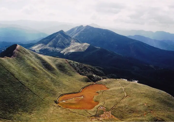
Mt. Kurosoyama (1,037 m) straddles the border between Tsu City (Mie) and Soni Village (Nara), in the Takamiyama range within Muroo-Akame-Aoyama Quasi-National Park. Columnar-jointed cliffs on its Mie-side flank record Neogene volcanic activity, and its tidy profile has earned it the nickname Iga Fuji. The peak is included in Japan's 300 Famous Mountains, the 100 Mountains of Kansai and the 100 Mountains of Kinki. The standard ascent climbs from the silver-grass plateau of Soni-kogen via Nihon-boso to the summit; the section beyond Nihon-boso crosses private land and a ¥500 environmental cooperation fee is collected at the trail hut.
Mt. Kurosoyama at a glance
- Weather: The most settled day in the next 7 days is Wed, November 4: cloudy, gusts up to 8 m/s. Fri, Nov 6, Sat, Nov 7: strong wind (gusts up to 18 m/s).
- Route: The shortest is Soni Highland–Nihon-boso, Mount Kuroso and Kameyama Circuit: about 4 h 46 min, 8.2 km, about 760 m of climbing.
Mt. Kurosoyama weather (hourly, 14 days)
Sunrise today 06:17, sunset 17:01
| Tue, 11/3 | Wed, 11/4 | Thu, 11/5 | Fri, 11/6 | Sat, 11/7 | Sun, 11/8 | Mon, 11/9 | Tue, 11/10 | Wed, 11/11 | Thu, 11/12 | Fri, 11/13 | Sat, 11/14 | Sun, 11/15 | Mon, 11/16 | Tue, 11/17 | |||||||||||||||||||||||||||||||||||||||||||||||||||||||||||||||||||||||
|---|---|---|---|---|---|---|---|---|---|---|---|---|---|---|---|---|---|---|---|---|---|---|---|---|---|---|---|---|---|---|---|---|---|---|---|---|---|---|---|---|---|---|---|---|---|---|---|---|---|---|---|---|---|---|---|---|---|---|---|---|---|---|---|---|---|---|---|---|---|---|---|---|---|---|---|---|---|---|---|---|---|---|---|---|---|
| Japan time | 15 | 17 | 19 | 21 | 23 | 1 | 3 | 5 | 7 | 9 | 11 | 13 | 15 | 18 | 21 | 0 | 3 | 6 | 9 | 12 | 15 | 18 | 21 | 0 | 3 | 6 | 9 | 12 | 15 | 18 | 21 | 0 | 3 | 6 | 9 | 12 | 15 | 18 | 21 | 0 | 3 | 6 | 9 | 12 | 15 | 18 | 21 | 0 | 3 | 6 | 9 | 15 | 21 | 3 | 9 | 15 | 21 | 3 | 9 | 15 | 21 | 3 | 9 | 15 | 21 | 3 | 9 | 15 | 21 | 3 | 9 | 15 | 21 | 3 | 9 | 15 | 21 | 3 | 9 | 15 | 21 | 3 | 9 | 15 | |
  |   |   | | | | | | |   | | | |   | | | | | |   | |   |   | |   | | | |   |   | | |  | | | | | | | | | | | | | | | | | |  | | |   | | | | | | | |  | | | | | | | | | | | | | | | | | | | | | | | ||
| Temperature | °C | 13° | 9° | 7° | 7° | 6° | 6° | 5° | 4° | 5° | 9° | 12° | 12° | 10° | 9° | 9° | 9° | 9° | 9° | 13° | 14° | 15° | 11° | 10° | 10° | 11° | 11° | 11° | 14° | 12° | 10° | 7° | 5° | 4° | 4° | 6° | 7° | 7° | 4° | 2° | 2° | 2° | 1° | 6° | 9° | 8° | 4° | 5° | 4° | 3° | 5° | 8° | 10° | 4° | 3° | 9° | 10° | 5° | 2° | 5° | 6° | 2° | 0° | 6° | 8° | 2° | 4° | 6° | 7° | 2° | 0° | 7° | 12° | 4° | 6° | 9° | 10° | 9° | 9° | 11° | 11° | 4° | 2° | 5° | 8° |
| Precipitation | mm | 0.1 | 0.4 | 0.2 | 0.2 | 0.1 | 1.3 | 1.5 | 1.1 | 0.4 | 0.6 | 0.5 | 0.1 | 0.2 | 0.1 | 0.2 | 0.9 | 0.2 | 0.7 | 11 | 0.4 | 1.7 | 0.3 | ||||||||||||||||||||||||||||||||||||||||||||||||||||||||||||||
| New snow | cm | ||||||||||||||||||||||||||||||||||||||||||||||||||||||||||||||||||||||||||||||||||||
| Snow depth | cm | 0 | 0 | 0 | 0 | 0 | 0 | 0 | 0 | 0 | 0 | 0 | 0 | 0 | 0 | 0 | 0 | 0 | 0 | 0 | 0 | 0 | 0 | 0 | 0 | 0 | 0 | 0 | 0 | 0 | 0 | 0 | 0 | 0 | 0 | 0 | 0 | 0 | 0 | 0 | 0 | 0 | 0 | 0 | 0 | 0 | 0 | 0 | 0 | 0 | 0 | 0 | 0 | 0 | 0 | 0 | 0 | 0 | 0 | 0 | 0 | 0 | 0 | 0 | 0 | 0 | 0 | 0 | 0 | 0 | 0 | 0 | 0 | 0 | 0 | 0 | 0 | 0 | 0 | 0 | 0 | 0 | 0 | 0 | 0 |
| Wind | m/s | 4 | 2 | 2 | 2 | 1 | 1 | 1 | 1 | 1 | 1 | 2 | 3 | 3 | 5 | 5 | 5 | 3 | 1 | 1 | 2 | 2 | 1 | 1 | 3 | 4 | 5 | 6 | 6 | 6 | 5 | 5 | 6 | 6 | 5 | 7 | 8 | 7 | 5 | 4 | 3 | 3 | 2 | 3 | 4 | 3 | 2 | 1 | 1 | 1 | 2 | 4 | 4 | 2 | 2 | 3 | 4 | 4 | 7 | 6 | 7 | 3 | 2 | 3 | 3 | 2 | 4 | 4 | 6 | 2 | 1 | 1 | 2 | 1 | 1 | 3 | 3 | 1 | 3 | 4 | 7 | 4 | 4 | 4 | 3 |
| Wind gusts | m/s | 9 | 8 | 5 | 5 | 5 | 4 | 4 | 4 | 3 | 4 | 6 | 7 | 8 | 11 | 14 | 13 | 11 | 8 | 5 | 6 | 6 | 4 | 3 | 6 | 11 | 13 | 15 | 15 | 15 | 13 | 12 | 14 | 14 | 13 | 17 | 18 | 17 | 16 | 12 | 9 | 8 | 8 | 9 | 11 | 11 | 9 | 5 | 4 | 4 | 6 | 9 | 12 | 9 | 6 | 7 | 11 | 10 | 16 | 16 | 18 | 16 | 7 | 8 | 10 | 8 | 9 | 10 | 14 | 14 | 6 | 4 | 8 | 7 | 3 | 7 | 10 | 8 | 7 | 11 | 16 | 16 | 11 | 10 | 9 |
| Wind dir. | ↓ | ↓ | ↓ | ↓ | ↓ | ↓ | ↓ | ↓ | ↓ | ↓ | ↓ | ↓ | ↓ | ↓ | ↓ | ↓ | ↓ | ↓ | ↓ | ↓ | ↓ | ↓ | ↓ | ↓ | ↓ | ↓ | ↓ | ↓ | ↓ | ↓ | ↓ | ↓ | ↓ | ↓ | ↓ | ↓ | ↓ | ↓ | ↓ | ↓ | ↓ | ↓ | ↓ | ↓ | ↓ | ↓ | ↓ | ↓ | ↓ | ↓ | ↓ | ↓ | ↓ | ↓ | ↓ | ↓ | ↓ | ↓ | ↓ | ↓ | ↓ | ↓ | ↓ | ↓ | ↓ | ↓ | ↓ | ↓ | ↓ | ↓ | ↓ | ↓ | ↓ | ↓ | ↓ | ↓ | ↓ | ↓ | ↓ | ↓ | ↓ | ↓ | ↓ | ↓ | |
Mt. Kurosoyama hiking routes
Hiking times are estimates calculated from the terrain.
Huts, campsites and lodging near Mt. Kurosoyama
Campsites
- Kotaroiwa Camping Ground
- Sun Village Soni
Lodging
- 国立青少年教育振興機構国立曽爾青少年自然の家
- Kijiya
- そに木霊リゾート~垰tawa~
- Minshuku 2.7
- 民宿 豊栄
Lists that include Mt. Kurosoyama
Japan's 300 Famous Mountains · 100 Fujis of Japan · Kansai 100 Famous Mountains · Tokai 100 Mountains · Kinki 100 Famous Mountains · Nara 100 Mountains to Explore · 10 Mountains of Tsu · Elevations of 1003 Mountains of Japan · 1000 Mountains of Japan
Mt. Kurosoyama facts
- Also known as
- 伊賀富士
- Elevation
- 1,037 m
- Location
- Soni, Nara
34.530906, 136.170296 - National Park
- 室生赤目青山国定公園
- Website
- www.vill.soni.nara.jp
- Trail Map
- www3.pref.nara.jp (PDF)
- Access Information
- www.vill.soni.nara.jp
- Wikipedia
- ja.wikipedia.org