
Mount Gakunodō
学能堂山
Mitsue, Nara / Tsu, Mie · Elevation 1,021 m
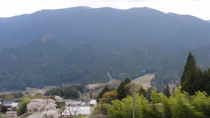
Mount Gakunodō is a 1,021 m peak in the northern Takamiyama range on the boundary between Misugi (Tsu, Mie) and Mitsue (Uda, Nara); the Mie-side name 'Take-no-hora' is also used. Named for a now-vanished Manjuśrī shrine that drew pilgrims seeking wisdom, the summit is a treeless silver-grass meadow offering a 360-degree panorama over Mount Mimine, Mount Takami, Mount Ōhora and Mount Amagatake. Listed in the Kansai 100 and Kinki 100 Mountains.
Mount Gakunodō at a glance
- Weather: The most settled day in the next 7 days is Thu, November 5: cloudy, gusts up to 6 m/s. Fri, Nov 6, Sat, Nov 7: strong wind (gusts up to 21 m/s).
- Route: The shortest is Mount Gakunodo in Misugi, Return from Mitake and Sugihira via Sugihira Pass: about 4 h 23 min, 8.8 km, about 770 m of climbing.
Mount Gakunodō weather (hourly, 14 days)
Sunrise today 06:16, sunset 17:01
| Tue, 11/3 | Wed, 11/4 | Thu, 11/5 | Fri, 11/6 | Sat, 11/7 | Sun, 11/8 | Mon, 11/9 | Tue, 11/10 | Wed, 11/11 | Thu, 11/12 | Fri, 11/13 | Sat, 11/14 | Sun, 11/15 | Mon, 11/16 | Tue, 11/17 | |||||||||||||||||||||||||||||||||||||||||||||||||||||||||||||||||||||||
|---|---|---|---|---|---|---|---|---|---|---|---|---|---|---|---|---|---|---|---|---|---|---|---|---|---|---|---|---|---|---|---|---|---|---|---|---|---|---|---|---|---|---|---|---|---|---|---|---|---|---|---|---|---|---|---|---|---|---|---|---|---|---|---|---|---|---|---|---|---|---|---|---|---|---|---|---|---|---|---|---|---|---|---|---|---|
| Japan time | 15 | 17 | 19 | 21 | 23 | 1 | 3 | 5 | 7 | 9 | 11 | 13 | 15 | 18 | 21 | 0 | 3 | 6 | 9 | 12 | 15 | 18 | 21 | 0 | 3 | 6 | 9 | 12 | 15 | 18 | 21 | 0 | 3 | 6 | 9 | 12 | 15 | 18 | 21 | 0 | 3 | 6 | 9 | 12 | 15 | 18 | 21 | 0 | 3 | 6 | 9 | 15 | 21 | 3 | 9 | 15 | 21 | 3 | 9 | 15 | 21 | 3 | 9 | 15 | 21 | 3 | 9 | 15 | 21 | 3 | 9 | 15 | 21 | 3 | 9 | 15 | 21 | 3 | 9 | 15 | 21 | 3 | 9 | 15 | |
  | |   | | | | | | |   |   | | |   | | | |   | |   | | | |   | | | | | |   | | |  | | | | | | | | | | | | | | | | | |  | | | | | | | | | | |  | | | | | |   | | | | | | | |   | |   | | | | | | | ||
| Temperature | °C | 13° | 10° | 8° | 7° | 6° | 5° | 5° | 4° | 5° | 11° | 12° | 11° | 10° | 9° | 9° | 9° | 9° | 10° | 12° | 15° | 15° | 11° | 10° | 9° | 10° | 11° | 11° | 14° | 13° | 10° | 7° | 6° | 4° | 4° | 6° | 7° | 7° | 4° | 3° | 2° | 3° | 3° | 6° | 9° | 8° | 5° | 5° | 5° | 3° | 5° | 9° | 10° | 5° | 3° | 10° | 11° | 6° | 3° | 5° | 7° | 3° | 1° | 6° | 8° | 2° | 4° | 7° | 8° | 3° | 1° | 7° | 11° | 4° | 6° | 8° | 10° | 9° | 9° | 12° | 11° | 5° | 2° | 5° | 8° |
| Precipitation | mm | 0.4 | 1.3 | 0.8 | 0.4 | 0.4 | 0.4 | 0.4 | 0.6 | 0.3 | 0.2 | 0.2 | 0.1 | 0.3 | 1.3 | 2.0 | 14 | 0.2 | 1.3 | 0.1 | |||||||||||||||||||||||||||||||||||||||||||||||||||||||||||||||||
| New snow | cm | ||||||||||||||||||||||||||||||||||||||||||||||||||||||||||||||||||||||||||||||||||||
| Snow depth | cm | 0 | 0 | 0 | 0 | 0 | 0 | 0 | 0 | 0 | 0 | 0 | 0 | 0 | 0 | 0 | 0 | 0 | 0 | 0 | 0 | 0 | 0 | 0 | 0 | 0 | 0 | 0 | 0 | 0 | 0 | 0 | 0 | 0 | 0 | 0 | 0 | 0 | 0 | 0 | 0 | 0 | 0 | 0 | 0 | 0 | 0 | 0 | 0 | 0 | 0 | 0 | 0 | 0 | 0 | 0 | 0 | 0 | 0 | 0 | 0 | 0 | 0 | 0 | 0 | 0 | 0 | 0 | 0 | 0 | 0 | 0 | 0 | 0 | 0 | 0 | 0 | 0 | 0 | 0 | 0 | 0 | 0 | 0 | 0 |
| Wind | m/s | 4 | 3 | 3 | 3 | 3 | 3 | 3 | 2 | 2 | 1 | 2 | 2 | 2 | 3 | 2 | 3 | 2 | 0 | 1 | 2 | 2 | 1 | 1 | 2 | 3 | 5 | 6 | 6 | 6 | 5 | 6 | 7 | 7 | 6 | 8 | 8 | 7 | 6 | 5 | 4 | 4 | 4 | 5 | 5 | 4 | 3 | 2 | 2 | 2 | 3 | 5 | 4 | 3 | 2 | 1 | 4 | 4 | 8 | 7 | 7 | 5 | 3 | 4 | 4 | 3 | 5 | 5 | 7 | 5 | 3 | 1 | 3 | 1 | 0 | 2 | 2 | 1 | 2 | 4 | 6 | 5 | 6 | 5 | 3 |
| Wind gusts | m/s | 10 | 10 | 8 | 8 | 7 | 7 | 7 | 7 | 6 | 5 | 7 | 7 | 6 | 8 | 9 | 9 | 9 | 6 | 3 | 6 | 6 | 5 | 4 | 6 | 9 | 15 | 15 | 15 | 16 | 15 | 15 | 18 | 19 | 19 | 21 | 21 | 20 | 18 | 15 | 13 | 11 | 12 | 12 | 13 | 12 | 11 | 8 | 6 | 6 | 8 | 12 | 13 | 9 | 7 | 6 | 10 | 11 | 21 | 21 | 21 | 18 | 13 | 10 | 11 | 10 | 12 | 13 | 17 | 17 | 13 | 7 | 10 | 9 | 3 | 5 | 8 | 7 | 9 | 13 | 16 | 17 | 15 | 14 | 12 |
| Wind dir. | ↓ | ↓ | ↓ | ↓ | ↓ | ↓ | ↓ | ↓ | ↓ | ↓ | ↓ | ↓ | ↓ | ↓ | ↓ | ↓ | ↓ | ↓ | ↓ | ↓ | ↓ | ↓ | ↓ | ↓ | ↓ | ↓ | ↓ | ↓ | ↓ | ↓ | ↓ | ↓ | ↓ | ↓ | ↓ | ↓ | ↓ | ↓ | ↓ | ↓ | ↓ | ↓ | ↓ | ↓ | ↓ | ↓ | ↓ | ↓ | ↓ | ↓ | ↓ | ↓ | ↓ | ↓ | ↓ | ↓ | ↓ | ↓ | ↓ | ↓ | ↓ | ↓ | ↓ | ↓ | ↓ | ↓ | ↓ | ↓ | ↓ | ↓ | ↓ | ↓ | ↓ | ↓ | ↓ | ↓ | ↓ | ↓ | ↓ | ↓ | ↓ | ↓ | ↓ | ↓ | |
Mount Gakunodō hiking routes
Hiking times are estimates calculated from the terrain.
Huts, campsites and lodging near Mount Gakunodō
Campsites
- オートサイト
- スカイランドおおぼら
Lists that include Mount Gakunodō
Kansai 100 Famous Mountains · Kinki 100 Famous Mountains · Nara 100 Mountains to Explore
Mount Gakunodō facts
- Also known as
- 岳の洞 · がくのうどうやま
- Elevation
- 1,021 m
- Location
- Mitsue, Nara / Tsu, Mie
34.491941, 136.229766 - Website
- www.mitsue-kanko.jp
- Trail Map
- www.mitsue-kanko.jp (PDF)
- Wikipedia
- ja.wikipedia.org