
Mt. Koureizan
孝霊山
Daisen, Tottori · Elevation 751 m
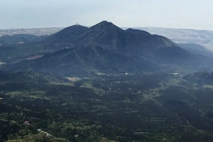
A 751.4 m peak straddling the border between Daisen Town and Yonago City in Tottori Prefecture, formed as a parasitic cone in the early stages of the younger Mt. Daisen volcanism. Also written Karayama (瓦山 or 韓山), the peak is the subject of a legend that Korean settlers carried it across the sea so that Mt. Daisen could measure itself against it. At its base lie the large-scale Yayoi-period Mukibanda Site and the Ama-no-Manai spring, listed among Japan's 100 Selected Waters. The peak appears on the Chūgoku Hyakumeizan and is climbed as a roughly three-and-a-half-hour satoyama hike.
Mt. Koureizan at a glance
- Weather: The most settled day in the next 7 days is Wed, November 4: clear, gusts up to 10 m/s.
Mt. Koureizan weather (hourly, 14 days)
Sunrise today 06:29, sunset 17:11
| Tue, 11/3 | Wed, 11/4 | Thu, 11/5 | Fri, 11/6 | Sat, 11/7 | Sun, 11/8 | Mon, 11/9 | Tue, 11/10 | Wed, 11/11 | Thu, 11/12 | Fri, 11/13 | Sat, 11/14 | Sun, 11/15 | Mon, 11/16 | Tue, 11/17 | |||||||||||||||||||||||||||||||||||||||||||||||||||||||||||||||||||||||
|---|---|---|---|---|---|---|---|---|---|---|---|---|---|---|---|---|---|---|---|---|---|---|---|---|---|---|---|---|---|---|---|---|---|---|---|---|---|---|---|---|---|---|---|---|---|---|---|---|---|---|---|---|---|---|---|---|---|---|---|---|---|---|---|---|---|---|---|---|---|---|---|---|---|---|---|---|---|---|---|---|---|---|---|---|---|
| Japan time | 15 | 17 | 19 | 21 | 23 | 1 | 3 | 5 | 7 | 9 | 11 | 13 | 15 | 18 | 21 | 0 | 3 | 6 | 9 | 12 | 15 | 18 | 21 | 0 | 3 | 6 | 9 | 12 | 15 | 18 | 21 | 0 | 3 | 6 | 9 | 12 | 15 | 18 | 21 | 0 | 3 | 6 | 9 | 12 | 15 | 18 | 21 | 0 | 3 | 6 | 9 | 15 | 21 | 3 | 9 | 15 | 21 | 3 | 9 | 15 | 21 | 3 | 9 | 15 | 21 | 3 | 9 | 15 | 21 | 3 | 9 | 15 | 21 | 3 | 9 | 15 | 21 | 3 | 9 | 15 | 21 | 3 | 9 | 15 | |
  | |   |   | | | |   |   | | | |   | | |   |   | |   | |   | | | | | | | | | | | | | |   | | | | |  | | | | | | | | | | | | |   | | | | | | | | | |  | | | | | | |  | | | | | | | | | | | | | | | ||
| Temperature | °C | 11° | 10° | 9° | 9° | 8° | 8° | 7° | 7° | 7° | 11° | 13° | 13° | 13° | 11° | 10° | 10° | 10° | 10° | 13° | 14° | 12° | 12° | 12° | 11° | 10° | 10° | 12° | 13° | 11° | 10° | 9° | 9° | 7° | 7° | 8° | 9° | 9° | 8° | 7° | 5° | 5° | 5° | 8° | 10° | 10° | 9° | 8° | 7° | 8° | 7° | 8° | 10° | 7° | 6° | 8° | 10° | 6° | 6° | 7° | 7° | 6° | 6° | 8° | 11° | 8° | 8° | 9° | 9° | 8° | 5° | 8° | 12° | 8° | 10° | 12° | 11° | 10° | 11° | 11° | 9° | 7° | 6° | 7° | 7° |
| Precipitation | mm | 0.4 | 0.8 | 1.0 | 0.5 | 0.3 | 0.2 | 0.2 | 0.1 | 0.1 | 0.5 | 3.9 | 3.1 | 1.5 | 5 | 0.8 | 0.2 | 0.1 | 0.2 | 0.2 | 0.2 | 0.6 | 1.0 | 1.9 | 0.2 | 1.3 | 1.2 | 1.3 | 0.8 | 0.2 | 0.6 | 0.2 | 1.2 | 1.6 | 4.6 | 17 | 1.0 | 8 | 7 | 1.8 | 0.4 | ||||||||||||||||||||||||||||||||||||||||||||
| New snow | cm | ||||||||||||||||||||||||||||||||||||||||||||||||||||||||||||||||||||||||||||||||||||
| Snow depth | cm | 0 | 0 | 0 | 0 | 0 | 0 | 0 | 0 | 0 | 0 | 0 | 0 | 0 | 0 | 0 | 0 | 0 | 0 | 0 | 0 | 0 | 0 | 0 | 0 | 0 | 0 | 0 | 0 | 0 | 0 | 0 | 0 | 0 | 0 | 0 | 0 | 0 | 0 | 0 | 0 | 0 | 0 | 0 | 0 | 0 | 0 | 0 | 0 | 0 | 0 | 0 | 0 | 0 | 0 | 0 | 0 | 0 | 0 | 0 | 0 | 0 | 0 | 0 | 0 | 0 | 0 | 0 | 0 | 0 | 0 | 0 | 0 | 0 | 0 | 0 | 0 | 0 | 0 | 0 | 0 | 0 | 0 | 0 | 0 |
| Wind | m/s | 4 | 3 | 2 | 1 | 1 | 2 | 2 | 2 | 3 | 3 | 4 | 5 | 5 | 3 | 2 | 0 | 1 | 1 | 1 | 1 | 2 | 2 | 2 | 2 | 4 | 4 | 5 | 7 | 7 | 6 | 7 | 6 | 7 | 7 | 7 | 6 | 6 | 4 | 2 | 2 | 3 | 3 | 3 | 4 | 3 | 1 | 2 | 2 | 2 | 3 | 4 | 3 | 3 | 4 | 6 | 7 | 7 | 7 | 6 | 3 | 1 | 3 | 3 | 5 | 3 | 4 | 6 | 5 | 4 | 3 | 2 | 3 | 2 | 3 | 1 | 0 | 2 | 3 | 4 | 9 | 6 | 4 | 4 | 3 |
| Wind gusts | m/s | 8 | 8 | 4 | 3 | 3 | 3 | 3 | 4 | 5 | 6 | 8 | 9 | 10 | 9 | 6 | 4 | 3 | 5 | 3 | 3 | 5 | 6 | 4 | 6 | 7 | 8 | 9 | 14 | 13 | 13 | 13 | 13 | 13 | 13 | 13 | 13 | 12 | 11 | 7 | 5 | 6 | 6 | 6 | 8 | 8 | 5 | 4 | 4 | 4 | 6 | 7 | 9 | 8 | 7 | 12 | 13 | 14 | 17 | 13 | 11 | 7 | 6 | 7 | 10 | 10 | 9 | 11 | 11 | 10 | 7 | 6 | 7 | 7 | 7 | 6 | 6 | 10 | 10 | 8 | 17 | 16 | 10 | 8 | 8 |
| Wind dir. | ↓ | ↓ | ↓ | ↓ | ↓ | ↓ | ↓ | ↓ | ↓ | ↓ | ↓ | ↓ | ↓ | ↓ | ↓ | ↓ | ↓ | ↓ | ↓ | ↓ | ↓ | ↓ | ↓ | ↓ | ↓ | ↓ | ↓ | ↓ | ↓ | ↓ | ↓ | ↓ | ↓ | ↓ | ↓ | ↓ | ↓ | ↓ | ↓ | ↓ | ↓ | ↓ | ↓ | ↓ | ↓ | ↓ | ↓ | ↓ | ↓ | ↓ | ↓ | ↓ | ↓ | ↓ | ↓ | ↓ | ↓ | ↓ | ↓ | ↓ | ↓ | ↓ | ↓ | ↓ | ↓ | ↓ | ↓ | ↓ | ↓ | ↓ | ↓ | ↓ | ↓ | ↓ | ↓ | ↓ | ↓ | ↓ | ↓ | ↓ | ↓ | ↓ | ↓ | ↓ | |
Lists that include Mt. Koureizan
Mt. Koureizan facts
- Also known as
- 瓦山 · 韓山
- Elevation
- 751 m
- Location
- Daisen, Tottori
35.437697, 133.479263 - Wikipedia
- ja.wikipedia.org