
Mt. Koshirakimine
小白木峰
Hida, Gifu · Elevation 1,437 m
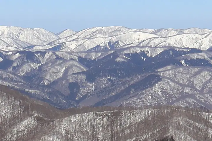
A 1,437-meter peak on the border of Toyama City (Toyama Prefecture) and Hida City (Gifu Prefecture), lying southwest of and adjoining its better-known neighbor Shirakimine. Its summit plateau holds high-altitude wetlands dotted with small ponds, supporting nikko-kisuge daylilies, cotton grass, and other alpine flora. It is commonly traversed together with Shirakimine and is included in the prefectural mountain guides for Toyama and Gifu, the Etchu Hyakuzan, the Hida Hyakuzan, and the Tokai-shuhen-no-yama 110 lists.
Mt. Koshirakimine at a glance
- Weather: The most settled day in the next 7 days is Wed, November 4: clear, gusts up to 6 m/s.
Mt. Koshirakimine weather (hourly, 14 days)
Sunrise today 06:16, sunset 16:55
| Tue, 11/3 | Wed, 11/4 | Thu, 11/5 | Fri, 11/6 | Sat, 11/7 | Sun, 11/8 | Mon, 11/9 | Tue, 11/10 | Wed, 11/11 | Thu, 11/12 | Fri, 11/13 | Sat, 11/14 | Sun, 11/15 | Mon, 11/16 | Tue, 11/17 | |||||||||||||||||||||||||||||||||||||||||||||||||||||||||||||||||||||||
|---|---|---|---|---|---|---|---|---|---|---|---|---|---|---|---|---|---|---|---|---|---|---|---|---|---|---|---|---|---|---|---|---|---|---|---|---|---|---|---|---|---|---|---|---|---|---|---|---|---|---|---|---|---|---|---|---|---|---|---|---|---|---|---|---|---|---|---|---|---|---|---|---|---|---|---|---|---|---|---|---|---|---|---|---|---|
| Japan time | 15 | 17 | 19 | 21 | 23 | 1 | 3 | 5 | 7 | 9 | 11 | 13 | 15 | 18 | 21 | 0 | 3 | 6 | 9 | 12 | 15 | 18 | 21 | 0 | 3 | 6 | 9 | 12 | 15 | 18 | 21 | 0 | 3 | 6 | 9 | 12 | 15 | 18 | 21 | 0 | 3 | 6 | 9 | 12 | 15 | 18 | 21 | 0 | 3 | 6 | 9 | 15 | 21 | 3 | 9 | 15 | 21 | 3 | 9 | 15 | 21 | 3 | 9 | 15 | 21 | 3 | 9 | 15 | 21 | 3 | 9 | 15 | 21 | 3 | 9 | 15 | 21 | 3 | 9 | 15 | 21 | 3 | 9 | 15 | |
  |   | |  | | | | |   |  | | |   |   |   |   | | |   |   | | |   | | | | |   | | | | | | |   | | | | | | | | | | | | | | | | | | | | | |   |   |   |   | | | | | | | | | | | | | | | | | | | | | | | | | ||
| Temperature | °C | 8° | 4° | 2° | 1° | 1° | 0° | 0° | -1° | -1° | 6° | 10° | 13° | 12° | 8° | 7° | 6° | 6° | 6° | 7° | 12° | 14° | 10° | 9° | 8° | 8° | 8° | 9° | 12° | 8° | 5° | 4° | 3° | 2° | 1° | 0° | 1° | 1° | 0° | 0° | -1° | -1° | -1° | 2° | 5° | 3° | 1° | 1° | 1° | 1° | 2° | 7° | 5° | 2° | 0° | 5° | 9° | 2° | -2° | 0° | 1° | 0° | -2° | 2° | 4° | -2° | 1° | 2° | 3° | -2° | -4° | 3° | 10° | 2° | 2° | 7° | 8° | 7° | 7° | 8° | 5° | 1° | -1° | 1° | 4° |
| Precipitation | mm | 2.7 | 6 | 3.9 | 3.9 | 0.4 | 0.6 | 1.3 | 6 | 2.2 | 0.7 | 0.9 | 0.6 | 0.6 | 0.8 | 1.3 | 1.0 | 1.6 | 2.4 | 1.8 | 1.1 | 0.7 | 0.4 | 0.4 | 0.1 | 0.7 | 0.7 | 1.0 | 0.3 | 2.5 | 6 | 1.5 | 2.3 | 0.3 | 0.4 | 5.0 | 0.2 | 0.6 | 5 | 3.9 | 6 | 8 | 2.5 | 0.5 | |||||||||||||||||||||||||||||||||||||||||
| New snow | cm | 0.1 | 0.2 | 3.8 | 1.4 | <.1 | |||||||||||||||||||||||||||||||||||||||||||||||||||||||||||||||||||||||||||||||
| Snow depth | cm | 0 | 0 | 0 | 0 | 0 | 0 | 0 | 0 | 0 | 0 | 0 | 0 | 0 | 0 | 0 | 0 | 0 | 0 | 0 | 0 | 0 | 0 | 0 | 0 | 0 | 0 | 0 | 0 | 0 | 0 | 0 | 0 | 0 | 0 | 0 | 0 | 0 | 0 | 0 | 0 | 0 | 0 | 0 | 0 | 0 | 0 | 0 | 0 | 0 | 0 | 0 | 0 | 0 | 0 | 0 | 0 | 0 | 2 | 3 | <1 | <1 | <1 | <1 | 0 | 0 | 0 | 0 | 0 | 0 | 0 | 0 | 0 | 0 | 0 | 0 | 0 | 0 | 0 | 0 | 0 | 0 | 0 | 0 | 0 |
| Wind | m/s | 2 | 2 | 0 | 1 | 1 | 1 | 1 | 1 | 0 | 1 | 1 | 1 | 0 | 1 | 1 | 1 | 1 | 1 | 1 | 2 | 0 | 0 | 1 | 2 | 1 | 1 | 2 | 4 | 4 | 2 | 3 | 3 | 2 | 2 | 2 | 3 | 2 | 2 | 2 | 1 | 1 | 1 | 2 | 3 | 2 | 1 | 1 | 0 | 0 | 1 | 0 | 2 | 2 | 1 | 3 | 4 | 1 | 4 | 3 | 4 | 1 | 0 | 0 | 3 | 1 | 1 | 3 | 3 | 1 | 0 | 2 | 1 | 2 | 2 | 3 | 3 | 3 | 2 | 2 | 3 | 3 | 2 | 1 | 2 |
| Wind gusts | m/s | 8 | 6 | 4 | 3 | 3 | 3 | 3 | 3 | 3 | 3 | 4 | 5 | 6 | 5 | 6 | 6 | 5 | 8 | 5 | 6 | 6 | 3 | 4 | 6 | 6 | 6 | 8 | 13 | 13 | 12 | 10 | 11 | 11 | 10 | 8 | 10 | 10 | 7 | 7 | 7 | 6 | 6 | 6 | 10 | 10 | 7 | 4 | 3 | 3 | 4 | 4 | 9 | 7 | 5 | 8 | 13 | 11 | 15 | 15 | 14 | 11 | 5 | 3 | 9 | 8 | 6 | 9 | 11 | 10 | 6 | 5 | 7 | 7 | 6 | 10 | 14 | 12 | 14 | 7 | 11 | 11 | 10 | 6 | 6 |
| Wind dir. | ↓ | ↓ | ↓ | ↓ | ↓ | ↓ | ↓ | ↓ | ↓ | ↓ | ↓ | ↓ | ↓ | ↓ | ↓ | ↓ | ↓ | ↓ | ↓ | ↓ | ↓ | ↓ | ↓ | ↓ | ↓ | ↓ | ↓ | ↓ | ↓ | ↓ | ↓ | ↓ | ↓ | ↓ | ↓ | ↓ | ↓ | ↓ | ↓ | ↓ | ↓ | ↓ | ↓ | ↓ | ↓ | ↓ | ↓ | ↓ | ↓ | ↓ | ↓ | ↓ | ↓ | ↓ | ↓ | ↓ | ↓ | ↓ | ↓ | ↓ | ↓ | ↓ | ↓ | ↓ | ↓ | ↓ | ↓ | ↓ | ↓ | ↓ | ↓ | ↓ | ↓ | ↓ | ↓ | ↓ | ↓ | ↓ | ↓ | ↓ | ↓ | ↓ | ↓ | ↓ | |
Huts, campsites and lodging near Mt. Koshirakimine
Mountain huts
Mt. Koshirakimine facts
- Also known as
- こしろきみね
- Elevation
- 1,437 m
- Location
- Hida, Gifu
36.396998, 137.092906 - Website
- www.city.toyama.lg.jp
- Trail Map
- www.city.toyama.lg.jp (PDF)
- Wikipedia
- ja.wikipedia.org