
Mt. Kaoredake
川上岳
Takayama, Gifu · Elevation 1,626 m
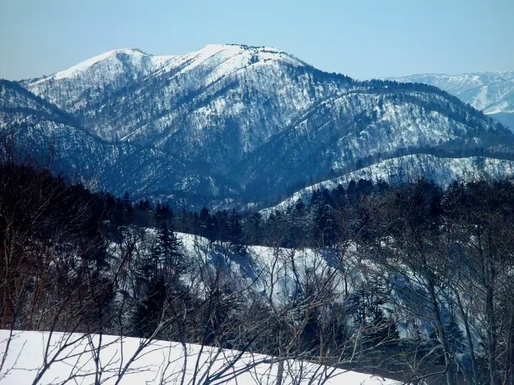
Mt. Kaoredake (1,626 m) lies on the boundary between Takayama City and Gero City in central Gifu Prefecture, in the Hida Highlands, and is the highest summit in central Gifu. Together with Mt. Kuraiyama and Mt. Funayama it forms the Kuraiyama Sanzan trio, and the area is designated as Kuraiyama-Funayama Prefectural Natural Park. The treeless summit offers 360° views across Mt. Ontake, Norikura, the Northern Alps and Hakusan, and is known for Sasa-yuri lilies in summer and brilliant dodan-tsutsuji autumn colour. The peak is included in Japan's 300 Famous Mountains, the 100 Mountains of Gifu and the 100 Mountains of Tokai.
Mt. Kaoredake at a glance
- Weather: The most settled day in the next 7 days is Mon, November 9: clear, gusts up to 8 m/s.
Mt. Kaoredake weather (hourly, 14 days)
Sunrise today 06:15, sunset 16:55
| Tue, 11/3 | Wed, 11/4 | Thu, 11/5 | Fri, 11/6 | Sat, 11/7 | Sun, 11/8 | Mon, 11/9 | Tue, 11/10 | Wed, 11/11 | Thu, 11/12 | Fri, 11/13 | Sat, 11/14 | Sun, 11/15 | Mon, 11/16 | Tue, 11/17 | |||||||||||||||||||||||||||||||||||||||||||||||||||||||||||||||||||||||
|---|---|---|---|---|---|---|---|---|---|---|---|---|---|---|---|---|---|---|---|---|---|---|---|---|---|---|---|---|---|---|---|---|---|---|---|---|---|---|---|---|---|---|---|---|---|---|---|---|---|---|---|---|---|---|---|---|---|---|---|---|---|---|---|---|---|---|---|---|---|---|---|---|---|---|---|---|---|---|---|---|---|---|---|---|---|
| Japan time | 15 | 17 | 19 | 21 | 23 | 1 | 3 | 5 | 7 | 9 | 11 | 13 | 15 | 18 | 21 | 0 | 3 | 6 | 9 | 12 | 15 | 18 | 21 | 0 | 3 | 6 | 9 | 12 | 15 | 18 | 21 | 0 | 3 | 6 | 9 | 12 | 15 | 18 | 21 | 0 | 3 | 6 | 9 | 12 | 15 | 18 | 21 | 0 | 3 | 6 | 9 | 15 | 21 | 3 | 9 | 15 | 21 | 3 | 9 | 15 | 21 | 3 | 9 | 15 | 21 | 3 | 9 | 15 | 21 | 3 | 9 | 15 | 21 | 3 | 9 | 15 | 21 | 3 | 9 | 15 | 21 | 3 | 9 | 15 | |
  |  | |   | | | | | | |  | |   |   | |   | | |   |   |   |   | | | | | | | |   | | |   | | | | | | | | | | | | | | | | | | | | | | | | |   |   | | | | | | | | |   |  | | | | | | | | | | | | | | | | ||
| Temperature | °C | 8° | 4° | 1° | 0° | 0° | 0° | -1° | -2° | -1° | 5° | 10° | 12° | 11° | 6° | 6° | 5° | 5° | 5° | 6° | 9° | 11° | 8° | 7° | 7° | 7° | 7° | 8° | 10° | 10° | 5° | 4° | 2° | 1° | 0° | 2° | 3° | 2° | -1° | -2° | -2° | -4° | -4° | 2° | 6° | 3° | 0° | 0° | 0° | 0° | 0° | 5° | 7° | 0° | -1° | 4° | 6° | 1° | -2° | -1° | 1° | -2° | -3° | 1° | 7° | -3° | -1° | 1° | 2° | -3° | -5° | 2° | 7° | 2° | 2° | 6° | 6° | 6° | 7° | 7° | 6° | 0° | -2° | -1° | 7° |
| Precipitation | mm | 3.8 | 7 | 4.9 | 3.2 | 0.2 | 0.5 | 2.4 | 0.9 | 0.8 | 1.2 | 0.5 | 0.6 | 1.6 | 1.3 | 0.4 | 0.2 | 0.4 | 0.2 | 0.1 | 0.2 | 1.9 | 1.5 | 0.3 | 0.3 | 0.6 | 0.2 | 0.2 | 2.7 | 7 | 10 | 3.8 | 0.8 | 0.7 | 0.2 | ||||||||||||||||||||||||||||||||||||||||||||||||||
| New snow | cm | <.1 | 0.2 | <.1 | |||||||||||||||||||||||||||||||||||||||||||||||||||||||||||||||||||||||||||||||||
| Snow depth | cm | 0 | 0 | 0 | 0 | 0 | 0 | 0 | 0 | 0 | 0 | 0 | 0 | 0 | 0 | 0 | 0 | 0 | 0 | 0 | 0 | 0 | 0 | 0 | 0 | 0 | 0 | 0 | 0 | 0 | 0 | 0 | 0 | 0 | 0 | 0 | 0 | 0 | 0 | 0 | 0 | 0 | 0 | 0 | 0 | 0 | 0 | 0 | 0 | 0 | 0 | 0 | 0 | 0 | 0 | 0 | 0 | 0 | 0 | 0 | 0 | 0 | 0 | 0 | 0 | 0 | 0 | 0 | 0 | 0 | 0 | 0 | 0 | 0 | 0 | 0 | 0 | 0 | 0 | 0 | 0 | 0 | 0 | 0 | 0 |
| Wind | m/s | 3 | 2 | 2 | 1 | 1 | 1 | 1 | 1 | 1 | 1 | 0 | 3 | 3 | 2 | 1 | 1 | 0 | 1 | 1 | 1 | 1 | 1 | 2 | 2 | 1 | 1 | 0 | 1 | 1 | 0 | 0 | 0 | 2 | 1 | 4 | 4 | 4 | 4 | 4 | 3 | 3 | 3 | 3 | 4 | 4 | 2 | 1 | 0 | 1 | 0 | 1 | 3 | 2 | 1 | 4 | 4 | 2 | 2 | 7 | 6 | 4 | 1 | 1 | 1 | 0 | 0 | 4 | 6 | 3 | 1 | 1 | 4 | 2 | 2 | 4 | 3 | 4 | 2 | 2 | 6 | 4 | 3 | 2 | 2 |
| Wind gusts | m/s | 9 | 8 | 5 | 4 | 3 | 3 | 4 | 4 | 3 | 4 | 5 | 9 | 9 | 8 | 5 | 5 | 5 | 5 | 3 | 4 | 4 | 4 | 5 | 5 | 5 | 4 | 3 | 5 | 5 | 5 | 3 | 4 | 5 | 5 | 10 | 11 | 12 | 11 | 9 | 9 | 8 | 8 | 9 | 10 | 12 | 10 | 5 | 3 | 3 | 3 | 3 | 8 | 8 | 4 | 9 | 15 | 11 | 9 | 16 | 18 | 15 | 10 | 4 | 8 | 9 | 2 | 11 | 14 | 14 | 8 | 4 | 10 | 10 | 6 | 10 | 12 | 10 | 13 | 7 | 15 | 14 | 11 | 8 | 6 |
| Wind dir. | ↓ | ↓ | ↓ | ↓ | ↓ | ↓ | ↓ | ↓ | ↓ | ↓ | ↓ | ↓ | ↓ | ↓ | ↓ | ↓ | ↓ | ↓ | ↓ | ↓ | ↓ | ↓ | ↓ | ↓ | ↓ | ↓ | ↓ | ↓ | ↓ | ↓ | ↓ | ↓ | ↓ | ↓ | ↓ | ↓ | ↓ | ↓ | ↓ | ↓ | ↓ | ↓ | ↓ | ↓ | ↓ | ↓ | ↓ | ↓ | ↓ | ↓ | ↓ | ↓ | ↓ | ↓ | ↓ | ↓ | ↓ | ↓ | ↓ | ↓ | ↓ | ↓ | ↓ | ↓ | ↓ | ↓ | ↓ | ↓ | ↓ | ↓ | ↓ | ↓ | ↓ | ↓ | ↓ | ↓ | ↓ | ↓ | ↓ | ↓ | ↓ | ↓ | ↓ | ↓ | |
Lists that include Mt. Kaoredake
Japan's 300 Famous Mountains · Tokai 100 Mountains · 100 Mountains of Gifu · Elevations of 1003 Mountains of Japan · 1000 Mountains of Japan
Mt. Kaoredake facts
- Elevation
- 1,626 m
- Location
- Takayama, Gifu
36.008206, 137.149581 - Website
- www.city.gero.lg.jp
- Trail Map
- www.city.gero.lg.jp (PDF)
- Wikipedia
- ja.wikipedia.org