
Mount Kurai
位山
Takayama, Gifu · Elevation 1,529 m
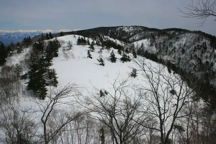
Mount Kurai is a 1,529 m peak in Takayama City, Gifu Prefecture, sitting near the geographic centre of the Hida region and forming the divide between the Miya and Hida river systems that separates northern from southern Hida. Long venerated as the sacred body of Hida-Ichinomiya Minashi Shrine, its slopes are dotted with iwakura — large worship stones — that tie into ancient legends of Tenson Kōrin and the Ama-no-Iwato. It is listed in the Nihon Nihyaku Meizan, the Gifu Hyakusan, the Nihon Hyaku Reizan, and the Nihon Hyakuteizan, and together with Mount Kawakami and Mount Funa it makes up the Kuraiyama Sanzan. The standard ascents start at Michi-no-Eki Mont Deus Hida-Kuraiyama via the megalith course, or from the Ama-no-Iwato trailhead on the Ichinomiya side — both well-graded paths suitable for casual hikers.
Mount Kurai at a glance
- Weather: The most settled day in the next 7 days is Mon, November 9: clear, gusts up to 8 m/s.
- Route: The shortest is Mount Kurai Return from Mont Deus Hida Kurai Roadside Station: about 5 h 32 min, 9.9 km, about 640 m of climbing.
Mount Kurai weather (hourly, 14 days)
Sunrise today 06:15, sunset 16:55
| Tue, 11/3 | Wed, 11/4 | Thu, 11/5 | Fri, 11/6 | Sat, 11/7 | Sun, 11/8 | Mon, 11/9 | Tue, 11/10 | Wed, 11/11 | Thu, 11/12 | Fri, 11/13 | Sat, 11/14 | Sun, 11/15 | Mon, 11/16 | Tue, 11/17 | |||||||||||||||||||||||||||||||||||||||||||||||||||||||||||||||||||||||
|---|---|---|---|---|---|---|---|---|---|---|---|---|---|---|---|---|---|---|---|---|---|---|---|---|---|---|---|---|---|---|---|---|---|---|---|---|---|---|---|---|---|---|---|---|---|---|---|---|---|---|---|---|---|---|---|---|---|---|---|---|---|---|---|---|---|---|---|---|---|---|---|---|---|---|---|---|---|---|---|---|---|---|---|---|---|
| Japan time | 15 | 17 | 19 | 21 | 23 | 1 | 3 | 5 | 7 | 9 | 11 | 13 | 15 | 18 | 21 | 0 | 3 | 6 | 9 | 12 | 15 | 18 | 21 | 0 | 3 | 6 | 9 | 12 | 15 | 18 | 21 | 0 | 3 | 6 | 9 | 12 | 15 | 18 | 21 | 0 | 3 | 6 | 9 | 12 | 15 | 18 | 21 | 0 | 3 | 6 | 9 | 15 | 21 | 3 | 9 | 15 | 21 | 3 | 9 | 15 | 21 | 3 | 9 | 15 | 21 | 3 | 9 | 15 | 21 | 3 | 9 | 15 | 21 | 3 | 9 | 15 | 21 | 3 | 9 | 15 | 21 | 3 | 9 | 15 | |
  |  | |   | | | | | | |  | |   |   | |   | | |   |   |   |   | | | | | | | |   | | |   | | | | | | | | | | | | | | | | | | | | | | | | |   |   | | | | | | | | |   |  | | | | | | | | | | | | | | | | ||
| Temperature | °C | 9° | 5° | 2° | 1° | 0° | 0° | 0° | -1° | -1° | 5° | 10° | 13° | 11° | 7° | 6° | 6° | 6° | 6° | 6° | 10° | 12° | 8° | 8° | 7° | 7° | 7° | 9° | 11° | 11° | 6° | 5° | 3° | 1° | 0° | 2° | 3° | 3° | 0° | -1° | -2° | -3° | -3° | 2° | 6° | 4° | 1° | 1° | 0° | 1° | 1° | 6° | 7° | 1° | -1° | 5° | 6° | 2° | -2° | 0° | 1° | -1° | -2° | 1° | 7° | -2° | 0° | 2° | 3° | -2° | -5° | 3° | 8° | 2° | 2° | 6° | 7° | 7° | 8° | 8° | 6° | 0° | -2° | 0° | 7° |
| Precipitation | mm | 3.8 | 7 | 4.9 | 3.2 | 0.2 | 0.5 | 2.4 | 0.9 | 0.8 | 1.2 | 0.5 | 0.6 | 1.6 | 1.3 | 0.4 | 0.2 | 0.4 | 0.2 | 0.1 | 0.2 | 1.9 | 1.5 | 0.3 | 0.3 | 0.6 | 0.2 | 0.2 | 2.7 | 7 | 10 | 3.8 | 0.8 | 0.7 | 0.2 | ||||||||||||||||||||||||||||||||||||||||||||||||||
| New snow | cm | <.1 | 0.2 | <.1 | |||||||||||||||||||||||||||||||||||||||||||||||||||||||||||||||||||||||||||||||||
| Snow depth | cm | 0 | 0 | 0 | 0 | 0 | 0 | 0 | 0 | 0 | 0 | 0 | 0 | 0 | 0 | 0 | 0 | 0 | 0 | 0 | 0 | 0 | 0 | 0 | 0 | 0 | 0 | 0 | 0 | 0 | 0 | 0 | 0 | 0 | 0 | 0 | 0 | 0 | 0 | 0 | 0 | 0 | 0 | 0 | 0 | 0 | 0 | 0 | 0 | 0 | 0 | 0 | 0 | 0 | 0 | 0 | 0 | 0 | 0 | 0 | 0 | 0 | 0 | 0 | 0 | 0 | 0 | 0 | 0 | 0 | 0 | 0 | 0 | 0 | 0 | 0 | 0 | 0 | 0 | 0 | 0 | 0 | 0 | 0 | 0 |
| Wind | m/s | 3 | 2 | 2 | 1 | 1 | 1 | 1 | 1 | 1 | 1 | 0 | 3 | 3 | 2 | 1 | 1 | 0 | 1 | 1 | 1 | 1 | 1 | 2 | 2 | 1 | 1 | 0 | 1 | 1 | 0 | 0 | 0 | 2 | 1 | 4 | 4 | 4 | 4 | 4 | 3 | 3 | 3 | 3 | 4 | 4 | 2 | 1 | 0 | 1 | 0 | 1 | 3 | 2 | 1 | 4 | 4 | 2 | 2 | 7 | 6 | 4 | 1 | 1 | 1 | 0 | 0 | 4 | 6 | 3 | 1 | 1 | 4 | 2 | 2 | 4 | 3 | 4 | 2 | 2 | 6 | 4 | 3 | 2 | 2 |
| Wind gusts | m/s | 9 | 8 | 5 | 4 | 3 | 3 | 4 | 4 | 3 | 4 | 5 | 9 | 9 | 8 | 5 | 5 | 5 | 5 | 3 | 4 | 4 | 4 | 5 | 5 | 5 | 4 | 3 | 5 | 5 | 5 | 3 | 4 | 5 | 5 | 10 | 11 | 12 | 11 | 9 | 9 | 8 | 8 | 9 | 10 | 12 | 10 | 5 | 3 | 3 | 3 | 3 | 8 | 8 | 4 | 9 | 15 | 11 | 9 | 16 | 18 | 15 | 10 | 4 | 8 | 9 | 2 | 11 | 14 | 14 | 8 | 4 | 10 | 10 | 6 | 10 | 12 | 10 | 13 | 7 | 15 | 14 | 11 | 8 | 6 |
| Wind dir. | ↓ | ↓ | ↓ | ↓ | ↓ | ↓ | ↓ | ↓ | ↓ | ↓ | ↓ | ↓ | ↓ | ↓ | ↓ | ↓ | ↓ | ↓ | ↓ | ↓ | ↓ | ↓ | ↓ | ↓ | ↓ | ↓ | ↓ | ↓ | ↓ | ↓ | ↓ | ↓ | ↓ | ↓ | ↓ | ↓ | ↓ | ↓ | ↓ | ↓ | ↓ | ↓ | ↓ | ↓ | ↓ | ↓ | ↓ | ↓ | ↓ | ↓ | ↓ | ↓ | ↓ | ↓ | ↓ | ↓ | ↓ | ↓ | ↓ | ↓ | ↓ | ↓ | ↓ | ↓ | ↓ | ↓ | ↓ | ↓ | ↓ | ↓ | ↓ | ↓ | ↓ | ↓ | ↓ | ↓ | ↓ | ↓ | ↓ | ↓ | ↓ | ↓ | ↓ | ↓ | |
Mount Kurai hiking routes
Hiking times are estimates calculated from the terrain.
Lists that include Mount Kurai
Japan 200 Famous Mountains · Japan's 300 Famous Mountains · Tokai 100 Mountains · 100 Mountains of Gifu · Elevations of 1003 Mountains of Japan · 1000 Mountains of Japan
Mount Kurai facts
- Elevation
- 1,529 m
- Location
- Takayama, Gifu
36.038247, 137.196713 - Website
- www.city.takayama.lg.jp
- Trail Map
- www.city.takayama.lg.jp (PDF)
- Wikipedia
- ja.wikipedia.org