
Mt. Bishamondake
毘沙門岳
Gujō-shi, Gifu · Elevation 1,385 m
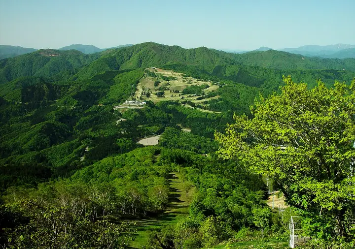
Mt. Bishamondake is a 1,385-meter peak straddling Ōno City in Fukui Prefecture and Gujō City in Gifu Prefecture in the Ryōhaku Range, with a deep connection to the Hakusan worship tradition. The Nagataki-Hakusan Shrine at its eastern foot is one of the three traditional Hakusan baba and served as the starting point of the Mino Zenjō-dō pilgrim trail to Mt. Hakusan. A ridge trail from the Hinoki Pass on the north side was opened in 1996, making it a popular hiking destination. A second-class triangulation station marks the summit, which overlooks Mt. Hakusan, Mt. Bessan, and Mt. Nobushiga-take to the north and the Hirugano Plateau, Mt. Nōgōhakusan, and Mt. Arashima to the south. The peak is included in the Gifu Hyakuzan list.
Mt. Bishamondake at a glance
- Weather: The most settled day in the next 7 days is Thu, November 5: cloudy, gusts up to 4 m/s. Fri, Nov 6, Sat, Nov 7: strong wind (gusts up to 16 m/s).
Mt. Bishamondake weather (hourly, 14 days)
Sunrise today 06:16, sunset 16:57
| Tue, 11/3 | Wed, 11/4 | Thu, 11/5 | Fri, 11/6 | Sat, 11/7 | Sun, 11/8 | Mon, 11/9 | Tue, 11/10 | Wed, 11/11 | Thu, 11/12 | Fri, 11/13 | Sat, 11/14 | Sun, 11/15 | Mon, 11/16 | Tue, 11/17 | |||||||||||||||||||||||||||||||||||||||||||||||||||||||||||||||||||||||
|---|---|---|---|---|---|---|---|---|---|---|---|---|---|---|---|---|---|---|---|---|---|---|---|---|---|---|---|---|---|---|---|---|---|---|---|---|---|---|---|---|---|---|---|---|---|---|---|---|---|---|---|---|---|---|---|---|---|---|---|---|---|---|---|---|---|---|---|---|---|---|---|---|---|---|---|---|---|---|---|---|---|---|---|---|---|
| Japan time | 21 | 23 | 1 | 3 | 5 | 7 | 9 | 11 | 13 | 15 | 17 | 19 | 21 | 0 | 3 | 6 | 9 | 12 | 15 | 18 | 21 | 0 | 3 | 6 | 9 | 12 | 15 | 18 | 21 | 0 | 3 | 6 | 9 | 12 | 15 | 18 | 21 | 0 | 3 | 6 | 9 | 12 | 15 | 18 | 21 | 0 | 3 | 6 | 9 | 12 | 15 | 21 | 3 | 9 | 15 | 21 | 3 | 9 | 15 | 21 | 3 | 9 | 15 | 21 | 3 | 9 | 15 | 21 | 3 | 9 | 15 | 21 | 3 | 9 | 15 | 21 | 3 | 9 | 15 | 21 | 3 | 9 | 15 | 21 | |
  | | |  | |   | | | |   |   | | |   | |   |   |   | | | | | | | | |   | | | | | | | |   |   | | | | | | | | | | | | |  | | | | | | | |   | | | |  | | | | | | | | | | | | | | | | | | | | | | | | ||
| Temperature | °C | 1° | 0° | 0° | 0° | -1° | -1° | 8° | 12° | 13° | 12° | 9° | 8° | 8° | 8° | 8° | 7° | 10° | 14° | 14° | 11° | 9° | 9° | 9° | 8° | 9° | 10° | 8° | 5° | 4° | 3° | 2° | 1° | 2° | 4° | 3° | 1° | 1° | 0° | -1° | -1° | 3° | 8° | 7° | 3° | 2° | 4° | 3° | 4° | 7° | 9° | 8° | 0° | -1° | 5° | 7° | 3° | -1° | 2° | 3° | -2° | -5° | 4° | 6° | -2° | 2° | 4° | 6° | -2° | -4° | 6° | 9° | 4° | 4° | 7° | 8° | 7° | 7° | 9° | 8° | 2° | -1° | 4° | 7° | 4° |
| Precipitation | mm | 4.2 | 4.3 | 1.2 | 0.1 | 0.2 | 0.6 | 3.3 | 8 | 6 | 1.0 | 0.3 | 1.0 | 1.0 | 0.5 | 1.0 | 0.6 | 0.5 | 0.4 | 0.4 | 0.4 | 0.2 | 0.3 | 6 | 3.5 | 0.2 | 0.2 | 1.0 | 0.2 | 0.2 | 0.4 | 7 | 12 | 4.3 | 0.4 | 0.3 | 1.3 | ||||||||||||||||||||||||||||||||||||||||||||||||
| New snow | cm | 0.3 | |||||||||||||||||||||||||||||||||||||||||||||||||||||||||||||||||||||||||||||||||||
| Snow depth | cm | 0 | 0 | 0 | 0 | 0 | 0 | 0 | 0 | 0 | 0 | 0 | 0 | 0 | 0 | 0 | 0 | 0 | 0 | 0 | 0 | 0 | 0 | 0 | 0 | 0 | 0 | 0 | 0 | 0 | 0 | 0 | 0 | 0 | 0 | 0 | 0 | 0 | 0 | 0 | 0 | 0 | 0 | 0 | 0 | 0 | 0 | 0 | 0 | 0 | 0 | 0 | 0 | 0 | 0 | 0 | 0 | 0 | 0 | 0 | 0 | 0 | 0 | 0 | 0 | 0 | 0 | 0 | 0 | 0 | 0 | 0 | 0 | 0 | 0 | 0 | 0 | 0 | 0 | 0 | 0 | 0 | 0 | 0 | 0 |
| Wind | m/s | 2 | 2 | 2 | 2 | 2 | 2 | 1 | 2 | 2 | 2 | 1 | 1 | 1 | 1 | 1 | 1 | 1 | 0 | 0 | 1 | 2 | 1 | 3 | 3 | 4 | 6 | 5 | 4 | 3 | 3 | 4 | 3 | 4 | 6 | 5 | 3 | 2 | 3 | 2 | 1 | 1 | 2 | 2 | 1 | 2 | 2 | 1 | 1 | 2 | 4 | 4 | 2 | 2 | 2 | 3 | 3 | 6 | 4 | 4 | 2 | 1 | 1 | 4 | 1 | 2 | 3 | 3 | 1 | 1 | 2 | 2 | 1 | 2 | 2 | 2 | 2 | 0 | 2 | 5 | 2 | 1 | 0 | 1 | 1 |
| Wind gusts | m/s | 4 | 4 | 4 | 4 | 4 | 5 | 5 | 6 | 7 | 8 | 5 | 3 | 4 | 6 | 6 | 4 | 3 | 4 | 4 | 2 | 5 | 6 | 9 | 9 | 10 | 15 | 16 | 14 | 11 | 11 | 10 | 11 | 11 | 15 | 16 | 14 | 9 | 8 | 8 | 6 | 6 | 6 | 7 | 5 | 4 | 4 | 4 | 3 | 5 | 12 | 12 | 8 | 5 | 6 | 11 | 10 | 19 | 17 | 14 | 11 | 5 | 4 | 10 | 10 | 5 | 7 | 10 | 9 | 4 | 6 | 8 | 7 | 4 | 6 | 7 | 8 | 8 | 6 | 13 | 12 | 8 | 5 | 6 | 5 |
| Wind dir. | ↓ | ↓ | ↓ | ↓ | ↓ | ↓ | ↓ | ↓ | ↓ | ↓ | ↓ | ↓ | ↓ | ↓ | ↓ | ↓ | ↓ | ↓ | ↓ | ↓ | ↓ | ↓ | ↓ | ↓ | ↓ | ↓ | ↓ | ↓ | ↓ | ↓ | ↓ | ↓ | ↓ | ↓ | ↓ | ↓ | ↓ | ↓ | ↓ | ↓ | ↓ | ↓ | ↓ | ↓ | ↓ | ↓ | ↓ | ↓ | ↓ | ↓ | ↓ | ↓ | ↓ | ↓ | ↓ | ↓ | ↓ | ↓ | ↓ | ↓ | ↓ | ↓ | ↓ | ↓ | ↓ | ↓ | ↓ | ↓ | ↓ | ↓ | ↓ | ↓ | ↓ | ↓ | ↓ | ↓ | ↓ | ↓ | ↓ | ↓ | ↓ | ↓ | ↓ | ↓ | |
Huts, campsites and lodging near Mt. Bishamondake
Lodging
- 奥美濃園
- いとしろ旅館
Lists that include Mt. Bishamondake
Mt. Bishamondake facts
- Elevation
- 1,385 m
- Location
- Gujō-shi, Gifu
35.939109, 136.792343 - Website
- www.city.gujo.gifu.jp
- Wikipedia
- ja.wikipedia.org