
Mount Yakeishi
焼石岳
Ōshū-shi, Iwate · Elevation 1,548 m
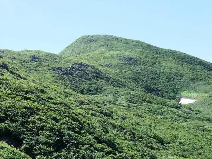
Mount Yakeishi is a 1,547.3 m extinct stratovolcano on the boundary of Ōshū City and Nishiwaga Town in Iwate Prefecture, the principal summit of the Yakeishi Range within the Ōu Mountains. Designated within the Kurikoma Quasi-National Park, it is included in the Nihon Nihyaku Meizan, the Ittō-Sankakuten Hyakumeizan, the Tōhoku Hyakumeizan, and the Onsen Hyakumeizan. The name "burnt-stone peak" refers to the rust-coloured pyroxene andesite blocks scattered near the summit. Old-growth beech forest blankets the slopes, and the Ubaishi-daira meadow blooms with Miyamashiogama, Hakusan-ichige, Yukiwari-kozakura, and other alpine flowers, making Yakeishi a celebrated flower mountain. Trails climb from Nakanuma and Tsubunuma in Ōshū and from the Higashinaruse trailhead in Akita's Higashinaruse Village; the Kinmeisui and Ginmeisui emergency huts shelter climbers along the way. The inter-municipal Yakeishi Tourism Development Council, comprising Ōshū, Higashinaruse, and Yokote, maintains the official climbing information.
Mount Yakeishi at a glance
- Weather: The most settled day in the next 7 days is Mon, November 9: cloudy, gusts up to 12 m/s. Fri, Nov 6, Sat, Nov 7, Sun, Nov 8: strong wind (gusts up to 30 m/s).
- Route: The shortest is Mount Yakeishi Round Trip via the Nakanuma Course: about 7 h 4 min, 12.2 km, about 840 m of climbing.
Mount Yakeishi weather (hourly, 14 days)
Sunrise today 06:06, sunset 16:35
| Tue, 11/3 | Wed, 11/4 | Thu, 11/5 | Fri, 11/6 | Sat, 11/7 | Sun, 11/8 | Mon, 11/9 | Tue, 11/10 | Wed, 11/11 | Thu, 11/12 | Fri, 11/13 | Sat, 11/14 | Sun, 11/15 | Mon, 11/16 | Tue, 11/17 | |||||||||||||||||||||||||||||||||||||||||||||||||||||||||||||||||||||||
|---|---|---|---|---|---|---|---|---|---|---|---|---|---|---|---|---|---|---|---|---|---|---|---|---|---|---|---|---|---|---|---|---|---|---|---|---|---|---|---|---|---|---|---|---|---|---|---|---|---|---|---|---|---|---|---|---|---|---|---|---|---|---|---|---|---|---|---|---|---|---|---|---|---|---|---|---|---|---|---|---|---|---|---|---|---|
| Japan time | 15 | 17 | 19 | 21 | 23 | 1 | 3 | 5 | 7 | 9 | 11 | 13 | 15 | 18 | 21 | 0 | 3 | 6 | 9 | 12 | 15 | 18 | 21 | 0 | 3 | 6 | 9 | 12 | 15 | 18 | 21 | 0 | 3 | 6 | 9 | 12 | 15 | 18 | 21 | 0 | 3 | 6 | 9 | 12 | 15 | 18 | 21 | 0 | 3 | 6 | 9 | 15 | 21 | 3 | 9 | 15 | 21 | 3 | 9 | 15 | 21 | 3 | 9 | 15 | 21 | 3 | 9 | 15 | 21 | 3 | 9 | 15 | 21 | 3 | 9 | 15 | 21 | 3 | 9 | 15 | 21 | 3 | 9 | 15 | |
  |   | | | | | |   |   | | | | | | | |   |   |   | | | | | | | | | | | | |   | |   |   | | | | | | | |   |   |   | | | | |   | | | | |  | | | |   | |   | | | | | |   | |   | | | |  | | | | | | | | | | | | ||
| Temperature | °C | 2° | 0° | -1° | -1° | -2° | -1° | -1° | 0° | 1° | 5° | 6° | 6° | 6° | 2° | 2° | 2° | 3° | 4° | 5° | 6° | 6° | 6° | 6° | 6° | 6° | 6° | 7° | 8° | 6° | 3° | 0° | -2° | -3° | -4° | -4° | -4° | -4° | -5° | -5° | -5° | -5° | -5° | -3° | -2° | -3° | -4° | -5° | -5° | -5° | -5° | -2° | -2° | -4° | -6° | -2° | -1° | -2° | -2° | -2° | -1° | -5° | -3° | 0° | 0° | -3° | -2° | -3° | -2° | -5° | -6° | -1° | 2° | -4° | -2° | 4° | 6° | 2° | 2° | 4° | 0° | -5° | -5° | -2° | -1° |
| Precipitation | mm | 2.2 | 4.3 | 4.2 | 1.4 | 0.4 | 0.4 | 1.9 | 1.3 | 0.3 | 1.6 | 3.5 | 1.3 | 3.4 | 1.9 | 3.6 | 2.7 | 4.2 | 2.7 | 3.9 | 2.1 | 1.8 | 2.4 | 2.1 | 2.1 | 2.4 | 0.2 | 0.2 | 0.1 | 0.9 | 8 | 3.0 | 1.1 | 0.7 | 7 | 1.3 | 0.1 | 1.0 | 4.1 | 2.1 | 4.9 | 6 | 0.2 | ||||||||||||||||||||||||||||||||||||||||||
| New snow | cm | 0.3 | 1.4 | 3.8 | 2.6 | 3.8 | 2.1 | 1.8 | 2.4 | 2.1 | 2.1 | 2.4 | 0.2 | <.1 | <.1 | 0.2 | <.1 | <.1 | 0.3 | 0.7 | 1.0 | 0.3 | 0.2 | 0.1 | <.1 | 2.2 | 0.2 | ||||||||||||||||||||||||||||||||||||||||||||||||||||||||||
| Snow depth | cm | 0 | 0 | 0 | 0 | 0 | 0 | 0 | 0 | 0 | 0 | 0 | 0 | 0 | 0 | 0 | 0 | 0 | 0 | 0 | 0 | 0 | 0 | 0 | 0 | 0 | 0 | 0 | 0 | 0 | 0 | 0 | 0 | <1 | 3 | 4 | 6 | 7 | 8 | 9 | 10 | 11 | 13 | 12 | 11 | 11 | 10 | 10 | 10 | 9 | 9 | 9 | 8 | 8 | 8 | 7 | 6 | 5 | 4 | 5 | 3 | 3 | 3 | 3 | 2 | 2 | 2 | 2 | 1 | 1 | 1 | 1 | <1 | <1 | <1 | <1 | <1 | <1 | 0 | 0 | 0 | 1 | 1 | 1 | <1 |
| Wind | m/s | 6 | 5 | 4 | 3 | 3 | 3 | 3 | 4 | 3 | 4 | 4 | 3 | 2 | 1 | 3 | 4 | 4 | 4 | 3 | 1 | 2 | 1 | 2 | 2 | 3 | 2 | 3 | 5 | 6 | 7 | 7 | 6 | 6 | 6 | 5 | 5 | 7 | 6 | 6 | 5 | 6 | 7 | 9 | 10 | 9 | 7 | 4 | 4 | 4 | 2 | 3 | 3 | 2 | 1 | 1 | 4 | 4 | 1 | 4 | 4 | 2 | 2 | 4 | 3 | 2 | 2 | 4 | 7 | 4 | 2 | 3 | 2 | 0 | 1 | 1 | 1 | 3 | 1 | 2 | 6 | 7 | 4 | 3 | 3 |
| Wind gusts | m/s | 20 | 18 | 14 | 12 | 11 | 10 | 11 | 12 | 12 | 13 | 13 | 11 | 10 | 5 | 10 | 12 | 13 | 13 | 13 | 9 | 6 | 6 | 6 | 7 | 9 | 9 | 10 | 19 | 19 | 20 | 20 | 21 | 18 | 18 | 18 | 22 | 24 | 22 | 19 | 19 | 19 | 20 | 25 | 30 | 30 | 24 | 19 | 13 | 12 | 11 | 10 | 12 | 10 | 7 | 5 | 12 | 15 | 14 | 13 | 14 | 11 | 8 | 12 | 12 | 10 | 8 | 13 | 18 | 18 | 12 | 9 | 10 | 7 | 5 | 5 | 7 | 12 | 12 | 7 | 16 | 23 | 21 | 13 | 10 |
| Wind dir. | ↓ | ↓ | ↓ | ↓ | ↓ | ↓ | ↓ | ↓ | ↓ | ↓ | ↓ | ↓ | ↓ | ↓ | ↓ | ↓ | ↓ | ↓ | ↓ | ↓ | ↓ | ↓ | ↓ | ↓ | ↓ | ↓ | ↓ | ↓ | ↓ | ↓ | ↓ | ↓ | ↓ | ↓ | ↓ | ↓ | ↓ | ↓ | ↓ | ↓ | ↓ | ↓ | ↓ | ↓ | ↓ | ↓ | ↓ | ↓ | ↓ | ↓ | ↓ | ↓ | ↓ | ↓ | ↓ | ↓ | ↓ | ↓ | ↓ | ↓ | ↓ | ↓ | ↓ | ↓ | ↓ | ↓ | ↓ | ↓ | ↓ | ↓ | ↓ | ↓ | ↓ | ↓ | ↓ | ↓ | ↓ | ↓ | ↓ | ↓ | ↓ | ↓ | ↓ | ↓ | |
Mount Yakeishi hiking routes
Hiking times are estimates calculated from the terrain.
Huts, campsites and lodging near Mount Yakeishi
Mountain huts
Lists that include Mount Yakeishi
Japan 200 Famous Mountains · Japan's 300 Famous Mountains · 100 Famous Mountains with First-order Triangulation Points · 100 Famous Hot Spring Mountains · Tohoku 100 Famous Mountains · Iwate 100 Famous Mountains · Elevations of 1003 Mountains of Japan · 1000 Mountains of Japan
Mount Yakeishi facts
- Elevation
- 1,548 m
- Location
- Ōshū-shi, Iwate
39.163700, 140.828821 - National Park
- 栗駒国定公園
- Website
- www.yakeishi.com
- Trail Map
- www.yakeishi.com (PDF)
- Access Information
- www.yakeishi.com
- Wikipedia
- ja.wikipedia.org