
Mount Yakeishi
焼石岳
โอชู, อิวาเตะ · ความสูง 1,548 ม.
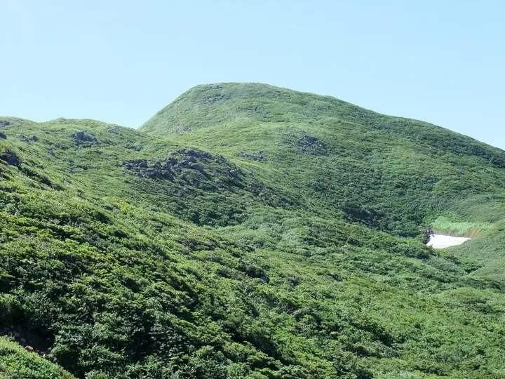
Mount Yakeishi is a 1,547.3 m extinct stratovolcano on the boundary of Ōshū City and Nishiwaga Town in Iwate Prefecture, the principal summit of the Yakeishi Range within the Ōu Mountains. Designated within the Kurikoma Quasi-National Park, it is included in the Nihon Nihyaku Meizan, the Ittō-Sankakuten Hyakumeizan, the Tōhoku Hyakumeizan, and the Onsen Hyakumeizan. The name "burnt-stone peak" refers to the rust-coloured pyroxene andesite blocks scattered near the summit. Old-growth beech forest blankets the slopes, and the Ubaishi-daira meadow blooms with Miyamashiogama, Hakusan-ichige, Yukiwari-kozakura, and other alpine flowers, making Yakeishi a celebrated flower mountain. Trails climb from Nakanuma and Tsubunuma in Ōshū and from the Higashinaruse trailhead in Akita's Higashinaruse Village; the Kinmeisui and Ginmeisui emergency huts shelter climbers along the way. The inter-municipal Yakeishi Tourism Development Council, comprising Ōshū, Higashinaruse, and Yokote, maintains the official climbing information.
สรุป Mount Yakeishi
- อากาศ: วันที่อากาศคงที่ที่สุดใน 7 วันข้างหน้าคือ จันทร์ 9 พฤศจิกายน: มีเมฆมาก ลมกระโชกสูงสุด 12 ม./วินาที ศุกร์ 6 พ.ย., เสาร์ 7 พ.ย., อาทิตย์ 8 พ.ย. ลมแรง (ลมกระโชกสูงสุด 30 ม./วินาที)
- เส้นทาง: เส้นทางที่สั้นที่สุดคือ Mount Yakeishi Round Trip via the Nakanuma Course: ประมาณ 7 ชม. 4 นาที 12.2 km ขึ้นประมาณ 840 m
อากาศ Mount Yakeishi (รายชั่วโมง 2 สัปดาห์)
วันนี้พระอาทิตย์ขึ้น 06:06 ตก 16:35
| อังคาร 3/11 | พุธ 4/11 | พฤหัส 5/11 | ศุกร์ 6/11 | เสาร์ 7/11 | อาทิตย์ 8/11 | จันทร์ 9/11 | อังคาร 10/11 | พุธ 11/11 | พฤหัส 12/11 | ศุกร์ 13/11 | เสาร์ 14/11 | อาทิตย์ 15/11 | จันทร์ 16/11 | อังคาร 17/11 | |||||||||||||||||||||||||||||||||||||||||||||||||||||||||||||||||||||||
|---|---|---|---|---|---|---|---|---|---|---|---|---|---|---|---|---|---|---|---|---|---|---|---|---|---|---|---|---|---|---|---|---|---|---|---|---|---|---|---|---|---|---|---|---|---|---|---|---|---|---|---|---|---|---|---|---|---|---|---|---|---|---|---|---|---|---|---|---|---|---|---|---|---|---|---|---|---|---|---|---|---|---|---|---|---|
| เวลาญี่ปุ่น | 15 | 17 | 19 | 21 | 23 | 1 | 3 | 5 | 7 | 9 | 11 | 13 | 15 | 18 | 21 | 0 | 3 | 6 | 9 | 12 | 15 | 18 | 21 | 0 | 3 | 6 | 9 | 12 | 15 | 18 | 21 | 0 | 3 | 6 | 9 | 12 | 15 | 18 | 21 | 0 | 3 | 6 | 9 | 12 | 15 | 18 | 21 | 0 | 3 | 6 | 9 | 15 | 21 | 3 | 9 | 15 | 21 | 3 | 9 | 15 | 21 | 3 | 9 | 15 | 21 | 3 | 9 | 15 | 21 | 3 | 9 | 15 | 21 | 3 | 9 | 15 | 21 | 3 | 9 | 15 | 21 | 3 | 9 | 15 | |
  |   | | | | | |   |   | | | | | | | |   |   |   | | | | | | | | | | | | |   | |   |   | | | | | | | |   |   |   | | | | |   | | | | |  | | | |   | |   | | | | | |   | |   | | | |  | | | | | | | | | | | | ||
| อุณหภูมิ | °C | 2° | 0° | -1° | -1° | -2° | -1° | -1° | 0° | 1° | 5° | 6° | 6° | 6° | 2° | 2° | 2° | 3° | 4° | 5° | 6° | 6° | 6° | 6° | 6° | 6° | 6° | 7° | 8° | 6° | 3° | 0° | -2° | -3° | -4° | -4° | -4° | -4° | -5° | -5° | -5° | -5° | -5° | -3° | -2° | -3° | -4° | -5° | -5° | -5° | -5° | -2° | -2° | -4° | -6° | -2° | -1° | -2° | -2° | -2° | -1° | -5° | -3° | 0° | 0° | -3° | -2° | -3° | -2° | -5° | -6° | -1° | 2° | -4° | -2° | 4° | 6° | 2° | 2° | 4° | 0° | -5° | -5° | -2° | -1° |
| ฝนและหิมะ | mm | 2.2 | 4.3 | 4.2 | 1.4 | 0.4 | 0.4 | 1.9 | 1.3 | 0.3 | 1.6 | 3.5 | 1.3 | 3.4 | 1.9 | 3.6 | 2.7 | 4.2 | 2.7 | 3.9 | 2.1 | 1.8 | 2.4 | 2.1 | 2.1 | 2.4 | 0.2 | 0.2 | 0.1 | 0.9 | 8 | 3.0 | 1.1 | 0.7 | 7 | 1.3 | 0.1 | 1.0 | 4.1 | 2.1 | 4.9 | 6 | 0.2 | ||||||||||||||||||||||||||||||||||||||||||
| หิมะตก | cm | 0.3 | 1.4 | 3.8 | 2.6 | 3.8 | 2.1 | 1.8 | 2.4 | 2.1 | 2.1 | 2.4 | 0.2 | <.1 | <.1 | 0.2 | <.1 | <.1 | 0.3 | 0.7 | 1.0 | 0.3 | 0.2 | 0.1 | <.1 | 2.2 | 0.2 | ||||||||||||||||||||||||||||||||||||||||||||||||||||||||||
| หิมะสะสม | cm | 0 | 0 | 0 | 0 | 0 | 0 | 0 | 0 | 0 | 0 | 0 | 0 | 0 | 0 | 0 | 0 | 0 | 0 | 0 | 0 | 0 | 0 | 0 | 0 | 0 | 0 | 0 | 0 | 0 | 0 | 0 | 0 | <1 | 3 | 4 | 6 | 7 | 8 | 9 | 10 | 11 | 13 | 12 | 11 | 11 | 10 | 10 | 10 | 9 | 9 | 9 | 8 | 8 | 8 | 7 | 6 | 5 | 4 | 5 | 3 | 3 | 3 | 3 | 2 | 2 | 2 | 2 | 1 | 1 | 1 | 1 | <1 | <1 | <1 | <1 | <1 | <1 | 0 | 0 | 0 | 1 | 1 | 1 | <1 |
| ลม | m/s | 6 | 5 | 4 | 3 | 3 | 3 | 3 | 4 | 3 | 4 | 4 | 3 | 2 | 1 | 3 | 4 | 4 | 4 | 3 | 1 | 2 | 1 | 2 | 2 | 3 | 2 | 3 | 5 | 6 | 7 | 7 | 6 | 6 | 6 | 5 | 5 | 7 | 6 | 6 | 5 | 6 | 7 | 9 | 10 | 9 | 7 | 4 | 4 | 4 | 2 | 3 | 3 | 2 | 1 | 1 | 4 | 4 | 1 | 4 | 4 | 2 | 2 | 4 | 3 | 2 | 2 | 4 | 7 | 4 | 2 | 3 | 2 | 0 | 1 | 1 | 1 | 3 | 1 | 2 | 6 | 7 | 4 | 3 | 3 |
| ลมกระโชก | m/s | 20 | 18 | 14 | 12 | 11 | 10 | 11 | 12 | 12 | 13 | 13 | 11 | 10 | 5 | 10 | 12 | 13 | 13 | 13 | 9 | 6 | 6 | 6 | 7 | 9 | 9 | 10 | 19 | 19 | 20 | 20 | 21 | 18 | 18 | 18 | 22 | 24 | 22 | 19 | 19 | 19 | 20 | 25 | 30 | 30 | 24 | 19 | 13 | 12 | 11 | 10 | 12 | 10 | 7 | 5 | 12 | 15 | 14 | 13 | 14 | 11 | 8 | 12 | 12 | 10 | 8 | 13 | 18 | 18 | 12 | 9 | 10 | 7 | 5 | 5 | 7 | 12 | 12 | 7 | 16 | 23 | 21 | 13 | 10 |
| ทิศทางลม | ↓ | ↓ | ↓ | ↓ | ↓ | ↓ | ↓ | ↓ | ↓ | ↓ | ↓ | ↓ | ↓ | ↓ | ↓ | ↓ | ↓ | ↓ | ↓ | ↓ | ↓ | ↓ | ↓ | ↓ | ↓ | ↓ | ↓ | ↓ | ↓ | ↓ | ↓ | ↓ | ↓ | ↓ | ↓ | ↓ | ↓ | ↓ | ↓ | ↓ | ↓ | ↓ | ↓ | ↓ | ↓ | ↓ | ↓ | ↓ | ↓ | ↓ | ↓ | ↓ | ↓ | ↓ | ↓ | ↓ | ↓ | ↓ | ↓ | ↓ | ↓ | ↓ | ↓ | ↓ | ↓ | ↓ | ↓ | ↓ | ↓ | ↓ | ↓ | ↓ | ↓ | ↓ | ↓ | ↓ | ↓ | ↓ | ↓ | ↓ | ↓ | ↓ | ↓ | ↓ | |
เส้นทางเดินป่า Mount Yakeishi
เวลาเดินเป็นค่าประมาณที่คำนวณจากภูมิประเทศ
กระท่อม ที่ตั้งแคมป์ และที่พักใกล้ Mount Yakeishi
กระท่อมบนภูเขา
รายชื่อที่มี Mount Yakeishi
200 ภูเขาที่มีชื่อเสียงของญี่ปุ่น · 300 ภูเขาที่มีชื่อเสียงของญี่ปุ่น · 100 ภูเขาที่มีชื่อเสียงซึ่งมีหมุดสามเหลี่ยมชั้นหนึ่ง · 100 ภูเขาที่มีชื่อเสียงด้านน้ำพุร้อน · 100 ภูเขาที่มีชื่อเสียงของโทโฮกุ · 100 ภูเขาที่มีชื่อเสียงของอิวาเตะ · ระดับความสูงของภูเขา 1003 แห่งในญี่ปุ่น · ภูเขา 1000 แห่งของญี่ปุ่น
ข้อมูลพื้นฐาน Mount Yakeishi
- ความสูง
- 1,548 ม.
- ที่ตั้ง
- โอชู, อิวาเตะ
39.163700, 140.828821 - อุทยานแห่งชาติ
- 栗駒国定公園
- เว็บไซต์
- www.yakeishi.com
- แผนที่เส้นทางเดินเขา
- www.yakeishi.com (PDF)
- ข้อมูลการเดินทาง
- www.yakeishi.com
- วิกิพีเดีย
- ja.wikipedia.org