
Mount Tashiro
田代山
Minamiaizu, Fukushima · Elevation 1,971 m
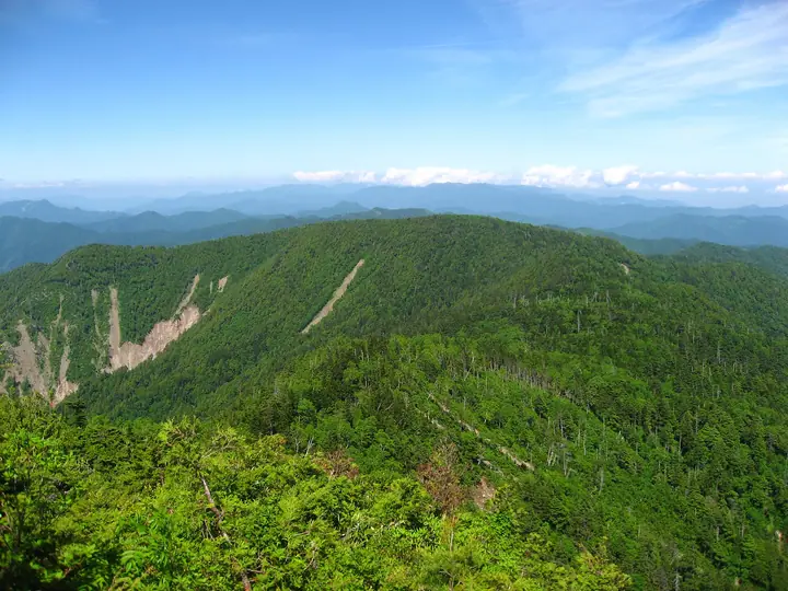
Mount Tashiro is a 1,971 m peak on the border between Minamiaizu Town in Fukushima and Nikko City in Tochigi, set in the Taishaku range within Oze National Park. The summit is a sprawling 25-hectare high-elevation marsh, the Tashiroyama Shitsugen, traversed by Oze-style boardwalks; cottongrass, day-lilies, and chinguruma create the floral spectacle that earned it a place in Hana no Hyakumeizan. Standard routes climb from the Sarukura trailhead beyond Yunohana Onsen or from Mabasaka Pass via neighbouring Mount Taishaku, with the summit straddling the watershed between the Pacific and Sea of Japan to support a richly varied flora.
Mount Tashiro at a glance
- Weather: The most settled day in the next 7 days is Wed, November 4: clear, gusts up to 7 m/s. Fri, Nov 6, Sat, Nov 7, Sun, Nov 8: strong wind (gusts up to 21 m/s).
- Route: The shortest is Mount Tashiro and Mount Taishaku Return from Sarukura Trailhead: about 5 h 50 min, 9.3 km, about 830 m of climbing.
Mount Tashiro weather (hourly, 14 days)
Sunrise today 06:07, sunset 16:44
| Tue, 11/3 | Wed, 11/4 | Thu, 11/5 | Fri, 11/6 | Sat, 11/7 | Sun, 11/8 | Mon, 11/9 | Tue, 11/10 | Wed, 11/11 | Thu, 11/12 | Fri, 11/13 | Sat, 11/14 | Sun, 11/15 | Mon, 11/16 | Tue, 11/17 | |||||||||||||||||||||||||||||||||||||||||||||||||||||||||||||||||||||||
|---|---|---|---|---|---|---|---|---|---|---|---|---|---|---|---|---|---|---|---|---|---|---|---|---|---|---|---|---|---|---|---|---|---|---|---|---|---|---|---|---|---|---|---|---|---|---|---|---|---|---|---|---|---|---|---|---|---|---|---|---|---|---|---|---|---|---|---|---|---|---|---|---|---|---|---|---|---|---|---|---|---|---|---|---|---|
| Japan time | 15 | 17 | 19 | 21 | 23 | 1 | 3 | 5 | 7 | 9 | 11 | 13 | 15 | 18 | 21 | 0 | 3 | 6 | 9 | 12 | 15 | 18 | 21 | 0 | 3 | 6 | 9 | 12 | 15 | 18 | 21 | 0 | 3 | 6 | 9 | 12 | 15 | 18 | 21 | 0 | 3 | 6 | 9 | 12 | 15 | 18 | 21 | 0 | 3 | 6 | 9 | 15 | 21 | 3 | 9 | 15 | 21 | 3 | 9 | 15 | 21 | 3 | 9 | 15 | 21 | 3 | 9 | 15 | 21 | 3 | 9 | 15 | 21 | 3 | 9 | 15 | 21 | 3 | 9 | 15 | 21 | 3 | 9 | 15 | |
  |   |  | | | | | |  | | | |   |   | |   | | |   |   |   |   | |  | | | | | | | | |   |   |   | | | | | | | | | | | | | | |   | | | | | | | | | | | | | | | | | | | | | | |  | | | | |   | | | |   | | | ||
| Temperature | °C | 2° | 0° | -2° | -3° | -3° | -3° | -4° | -4° | -1° | 5° | 7° | 9° | 7° | 2° | 3° | 2° | 3° | 3° | 6° | 9° | 10° | 5° | 4° | 4° | 3° | 4° | 6° | 9° | 7° | 4° | 2° | 0° | -2° | -3° | -2° | -2° | -3° | -4° | -4° | -5° | -5° | -5° | -3° | -1° | -2° | -4° | -5° | -3° | -3° | -3° | 2° | 1° | -3° | -4° | 2° | 3° | -1° | -3° | -3° | -3° | -4° | -4° | -1° | 2° | -4° | -3° | -1° | -3° | -5° | -7° | 2° | 4° | -5° | -4° | 6° | 7° | 1° | 3° | 8° | 2° | -3° | -5° | 0° | 1° |
| Precipitation | mm | 0.3 | 9 | 10 | 1.7 | 0.8 | 0.2 | 0.1 | 0.1 | 0.1 | 0.4 | 0.8 | 0.7 | 1.2 | 1.6 | 2.2 | 2.0 | 1.2 | 0.5 | 0.4 | 0.2 | 0.1 | 0.1 | 0.1 | 0.1 | 0.2 | 0.8 | 3.8 | 2.7 | 1.4 | 0.1 | 4.5 | 0.4 | 0.1 | 3.4 | 6 | 1.9 | 4.4 | 0.1 | ||||||||||||||||||||||||||||||||||||||||||||||
| New snow | cm | 0.2 | 1.0 | 1.5 | 2.2 | 2.0 | 1.2 | 0.5 | 0.4 | 0.2 | 0.1 | <.1 | <.1 | <.1 | 0.1 | 0.1 | <.1 | 0.8 | 3.8 | 2.6 | 1.2 | 0.1 | 4.4 | 0.3 | 0.1 | 2.0 | <.1 | ||||||||||||||||||||||||||||||||||||||||||||||||||||||||||
| Snow depth | cm | 0 | 0 | 0 | 0 | 0 | 0 | 0 | 0 | 0 | 0 | 0 | 0 | 0 | 0 | 0 | 0 | 0 | 0 | 0 | 0 | 0 | 0 | 0 | 0 | 0 | 0 | 0 | 0 | 0 | 0 | 0 | 0 | 0 | <1 | 1 | 3 | 4 | 5 | 5 | 5 | 5 | 5 | 5 | 5 | 5 | 5 | 5 | 5 | 5 | 5 | 4 | 3 | 2 | 2 | 2 | 1 | 1 | 1 | 4 | 5 | 6 | 6 | 5 | 4 | 4 | 4 | 7 | 6 | 7 | 6 | 6 | 5 | 5 | 5 | 4 | 3 | 2 | 1 | <1 | <1 | <1 | <1 | <1 | <1 |
| Wind | m/s | 4 | 2 | 3 | 3 | 2 | 2 | 2 | 2 | 2 | 1 | 1 | 1 | 2 | 2 | 2 | 3 | 2 | 2 | 2 | 1 | 0 | 1 | 2 | 1 | 2 | 3 | 6 | 6 | 5 | 5 | 4 | 5 | 5 | 5 | 5 | 7 | 6 | 6 | 6 | 6 | 6 | 5 | 5 | 4 | 4 | 2 | 2 | 2 | 1 | 2 | 1 | 1 | 1 | 2 | 1 | 3 | 1 | 4 | 7 | 7 | 4 | 3 | 1 | 1 | 3 | 3 | 4 | 6 | 3 | 3 | 1 | 1 | 2 | 1 | 1 | 1 | 2 | 4 | 2 | 5 | 6 | 3 | 1 | 2 |
| Wind gusts | m/s | 14 | 12 | 10 | 10 | 9 | 7 | 7 | 7 | 7 | 6 | 5 | 6 | 6 | 8 | 10 | 12 | 11 | 9 | 9 | 8 | 6 | 5 | 7 | 7 | 7 | 10 | 17 | 19 | 17 | 14 | 15 | 16 | 18 | 18 | 18 | 20 | 21 | 20 | 20 | 20 | 21 | 20 | 17 | 15 | 14 | 13 | 9 | 9 | 7 | 8 | 8 | 7 | 5 | 7 | 7 | 11 | 10 | 13 | 23 | 26 | 21 | 13 | 9 | 7 | 9 | 10 | 13 | 17 | 17 | 12 | 9 | 6 | 7 | 6 | 5 | 8 | 8 | 13 | 13 | 20 | 19 | 18 | 10 | 7 |
| Wind dir. | ↓ | ↓ | ↓ | ↓ | ↓ | ↓ | ↓ | ↓ | ↓ | ↓ | ↓ | ↓ | ↓ | ↓ | ↓ | ↓ | ↓ | ↓ | ↓ | ↓ | ↓ | ↓ | ↓ | ↓ | ↓ | ↓ | ↓ | ↓ | ↓ | ↓ | ↓ | ↓ | ↓ | ↓ | ↓ | ↓ | ↓ | ↓ | ↓ | ↓ | ↓ | ↓ | ↓ | ↓ | ↓ | ↓ | ↓ | ↓ | ↓ | ↓ | ↓ | ↓ | ↓ | ↓ | ↓ | ↓ | ↓ | ↓ | ↓ | ↓ | ↓ | ↓ | ↓ | ↓ | ↓ | ↓ | ↓ | ↓ | ↓ | ↓ | ↓ | ↓ | ↓ | ↓ | ↓ | ↓ | ↓ | ↓ | ↓ | ↓ | ↓ | ↓ | ↓ | ↓ | |
Mount Tashiro hiking routes
Hiking times are estimates calculated from the terrain.
Huts, campsites and lodging near Mount Tashiro
Mountain huts
Lists that include Mount Tashiro
100 Famous Mountains of Flowers · Tohoku 100 Famous Mountains · Tochigi 100 Famous Mountains · Utsukushima 100 Famous Mountains (Fukushima Prefecture) · Aizu 100 Famous Mountains · 30 Peaks of Fukushima · Elevations of 1003 Mountains of Japan · 1000 Mountains of Japan
Mount Tashiro facts
- Elevation
- 1,971 m
- Location
- Minamiaizu, Fukushima
36.974397, 139.478538 - National Park
- 尾瀬国立公園
- Website
- www.pref.fukushima.lg.jp
- Wikipedia
- ja.wikipedia.org