
Mount Taishaku
帝釈山
Minamiaizu, Fukushima · Elevation 2,060 m
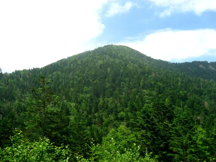
Mount Taishaku is a 2,060 m peak on the Fukushima–Tochigi border, with the summit straddling Minamiaizu Town, Hinoemata Village (Fukushima), and Nikkō City (Tochigi). Together with Mount Tashiro to its north, it was added to Oze National Park in August 2007, and the summit wetland of Tashiro is designated a Special Protection Zone. Listed in the Nihon Nihyaku Meizan, Tochigi Hyakumeizan, Utsukushima Hyakumeizan, and Tōhoku Hyakumeizan, the peak is the principal summit of the Taishaku Range, which forms part of Japan's main Pacific–Sea-of-Japan watershed divide. The name comes from the Buddhist guardian deity Taishakuten (Indra) and reflects the mountain's Shugendō heritage. From the Mazaka Pass trailhead in Hinoemata, the summit is reached in about an hour; a day-long traverse to Tashiro is the typical outing. Hinoemata Village hosts the early-June Osabagusa Festival, and Minamiaizu Town runs the Tashiro yamabiraki around the same week.
Mount Taishaku at a glance
- Weather: The most settled day in the next 7 days is Wed, November 4: clear, gusts up to 7 m/s. Fri, Nov 6, Sat, Nov 7, Sun, Nov 8: strong wind (gusts up to 21 m/s).
- Route: The shortest is Mount Tashiro and Mount Taishaku Return from Sarukura Trailhead: about 5 h 50 min, 9.3 km, about 830 m of climbing.
Mount Taishaku weather (hourly, 14 days)
Sunrise today 06:07, sunset 16:44
| Tue, 11/3 | Wed, 11/4 | Thu, 11/5 | Fri, 11/6 | Sat, 11/7 | Sun, 11/8 | Mon, 11/9 | Tue, 11/10 | Wed, 11/11 | Thu, 11/12 | Fri, 11/13 | Sat, 11/14 | Sun, 11/15 | Mon, 11/16 | Tue, 11/17 | |||||||||||||||||||||||||||||||||||||||||||||||||||||||||||||||||||||||
|---|---|---|---|---|---|---|---|---|---|---|---|---|---|---|---|---|---|---|---|---|---|---|---|---|---|---|---|---|---|---|---|---|---|---|---|---|---|---|---|---|---|---|---|---|---|---|---|---|---|---|---|---|---|---|---|---|---|---|---|---|---|---|---|---|---|---|---|---|---|---|---|---|---|---|---|---|---|---|---|---|---|---|---|---|---|
| Japan time | 15 | 17 | 19 | 21 | 23 | 1 | 3 | 5 | 7 | 9 | 11 | 13 | 15 | 18 | 21 | 0 | 3 | 6 | 9 | 12 | 15 | 18 | 21 | 0 | 3 | 6 | 9 | 12 | 15 | 18 | 21 | 0 | 3 | 6 | 9 | 12 | 15 | 18 | 21 | 0 | 3 | 6 | 9 | 12 | 15 | 18 | 21 | 0 | 3 | 6 | 9 | 15 | 21 | 3 | 9 | 15 | 21 | 3 | 9 | 15 | 21 | 3 | 9 | 15 | 21 | 3 | 9 | 15 | 21 | 3 | 9 | 15 | 21 | 3 | 9 | 15 | 21 | 3 | 9 | 15 | 21 | 3 | 9 | 15 | |
  |   |  | | | | | |  | | | |   |   | |   | | |   |   |   |   | |  | | | | | | | | |   |   |   | | | | | | | | | | | | | | |   | | | | | | | | | | | | | | | | | | | | | | |  | | | | |   | | | |   | | | ||
| Temperature | °C | 2° | -1° | -3° | -3° | -4° | -4° | -4° | -4° | -2° | 4° | 7° | 8° | 7° | 2° | 2° | 2° | 2° | 3° | 6° | 9° | 9° | 5° | 3° | 3° | 2° | 3° | 6° | 8° | 6° | 3° | 1° | -1° | -2° | -3° | -3° | -3° | -3° | -5° | -5° | -5° | -5° | -5° | -3° | -1° | -3° | -5° | -5° | -4° | -4° | -4° | 1° | 1° | -4° | -5° | 1° | 2° | -2° | -4° | -4° | -3° | -4° | -4° | -1° | 1° | -5° | -3° | -2° | -4° | -6° | -7° | 1° | 4° | -6° | -4° | 5° | 6° | 1° | 3° | 8° | 2° | -4° | -6° | -1° | 1° |
| Precipitation | mm | 0.3 | 9 | 10 | 1.7 | 0.8 | 0.2 | 0.1 | 0.1 | 0.1 | 0.4 | 0.8 | 0.7 | 1.2 | 1.6 | 2.2 | 2.0 | 1.2 | 0.5 | 0.4 | 0.2 | 0.1 | 0.1 | 0.1 | 0.1 | 0.2 | 0.8 | 3.8 | 2.7 | 1.4 | 0.1 | 4.5 | 0.4 | 0.1 | 3.4 | 6 | 1.9 | 4.4 | 0.1 | ||||||||||||||||||||||||||||||||||||||||||||||
| New snow | cm | 0.2 | 1.0 | 1.5 | 2.2 | 2.0 | 1.2 | 0.5 | 0.4 | 0.2 | 0.1 | <.1 | <.1 | <.1 | 0.1 | 0.1 | <.1 | 0.8 | 3.8 | 2.6 | 1.2 | 0.1 | 4.4 | 0.3 | 0.1 | 2.0 | <.1 | ||||||||||||||||||||||||||||||||||||||||||||||||||||||||||
| Snow depth | cm | 0 | 0 | 0 | 0 | 0 | 0 | 0 | 0 | 0 | 0 | 0 | 0 | 0 | 0 | 0 | 0 | 0 | 0 | 0 | 0 | 0 | 0 | 0 | 0 | 0 | 0 | 0 | 0 | 0 | 0 | 0 | 0 | 0 | <1 | 1 | 3 | 4 | 5 | 5 | 5 | 5 | 5 | 5 | 5 | 5 | 5 | 5 | 5 | 5 | 5 | 4 | 3 | 2 | 2 | 2 | 1 | 1 | 1 | 4 | 5 | 6 | 6 | 5 | 4 | 4 | 4 | 7 | 6 | 7 | 6 | 6 | 5 | 5 | 5 | 4 | 3 | 2 | 1 | <1 | <1 | <1 | <1 | <1 | <1 |
| Wind | m/s | 4 | 2 | 3 | 3 | 2 | 2 | 2 | 2 | 2 | 1 | 1 | 1 | 2 | 2 | 2 | 3 | 2 | 2 | 2 | 1 | 0 | 1 | 2 | 1 | 2 | 3 | 6 | 6 | 5 | 5 | 4 | 5 | 5 | 5 | 5 | 7 | 6 | 6 | 6 | 6 | 6 | 5 | 5 | 4 | 4 | 2 | 2 | 2 | 1 | 2 | 1 | 1 | 1 | 2 | 1 | 3 | 1 | 4 | 7 | 7 | 4 | 3 | 1 | 1 | 3 | 3 | 4 | 6 | 3 | 3 | 1 | 1 | 2 | 1 | 1 | 1 | 2 | 4 | 2 | 5 | 6 | 3 | 1 | 2 |
| Wind gusts | m/s | 14 | 12 | 10 | 10 | 9 | 7 | 7 | 7 | 7 | 6 | 5 | 6 | 6 | 8 | 10 | 12 | 11 | 9 | 9 | 8 | 6 | 5 | 7 | 7 | 7 | 10 | 17 | 19 | 17 | 14 | 15 | 16 | 18 | 18 | 18 | 20 | 21 | 20 | 20 | 20 | 21 | 20 | 17 | 15 | 14 | 13 | 9 | 9 | 7 | 8 | 8 | 7 | 5 | 7 | 7 | 11 | 10 | 13 | 23 | 26 | 21 | 13 | 9 | 7 | 9 | 10 | 13 | 17 | 17 | 12 | 9 | 6 | 7 | 6 | 5 | 8 | 8 | 13 | 13 | 20 | 19 | 18 | 10 | 7 |
| Wind dir. | ↓ | ↓ | ↓ | ↓ | ↓ | ↓ | ↓ | ↓ | ↓ | ↓ | ↓ | ↓ | ↓ | ↓ | ↓ | ↓ | ↓ | ↓ | ↓ | ↓ | ↓ | ↓ | ↓ | ↓ | ↓ | ↓ | ↓ | ↓ | ↓ | ↓ | ↓ | ↓ | ↓ | ↓ | ↓ | ↓ | ↓ | ↓ | ↓ | ↓ | ↓ | ↓ | ↓ | ↓ | ↓ | ↓ | ↓ | ↓ | ↓ | ↓ | ↓ | ↓ | ↓ | ↓ | ↓ | ↓ | ↓ | ↓ | ↓ | ↓ | ↓ | ↓ | ↓ | ↓ | ↓ | ↓ | ↓ | ↓ | ↓ | ↓ | ↓ | ↓ | ↓ | ↓ | ↓ | ↓ | ↓ | ↓ | ↓ | ↓ | ↓ | ↓ | ↓ | ↓ | |
Mount Taishaku hiking routes
Hiking times are estimates calculated from the terrain.
Huts, campsites and lodging near Mount Taishaku
Mountain huts
Lists that include Mount Taishaku
Japan 200 Famous Mountains · Japan's 300 Famous Mountains · 100 Famous Hot Spring Mountains · Tohoku 100 Famous Mountains · Tochigi 100 Famous Mountains · Utsukushima 100 Famous Mountains (Fukushima Prefecture) · Aizu 100 Famous Mountains · 30 Peaks of Fukushima · Elevations of 1003 Mountains of Japan · 1000 Mountains of Japan
Mount Taishaku facts
- Elevation
- 2,060 m
- Location
- Minamiaizu, Fukushima
36.969820, 139.459993 - National Park
- 尾瀬国立公園
- Website
- www.pref.fukushima.lg.jp
- Trail Map
- www.pref.fukushima.lg.jp
- Access Information
- www.town.minamiaizu.lg.jp
- Wikipedia
- ja.wikipedia.org