
Mount Shinoi
篠井山
Nanbu, Yamanashi · Elevation 1,394 m
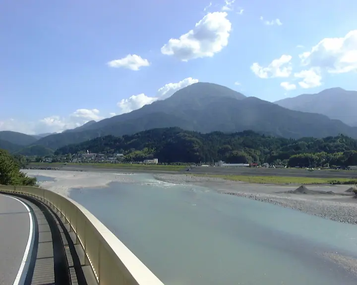
Mount Shinoi (1,394.4 m) stands in Nanbu, Minamikoma District, Yamanashi Prefecture, rising at the northern edge of the Abe-oku range west of the Fuji River. The Okuyama trail follows a stream past Myogen-no-taki, Kannon-no-taki and other falls, and the summit gives views of Mount Fuji, Suruga Bay and the Izu Peninsula. The peak is listed among the 100 Famous Mountains of Yamanashi and the Yamanashi Hiking Course 100 Selection.
Mount Shinoi at a glance
- Weather: The most settled day in the next 7 days is Fri, November 6: clear, gusts up to 9 m/s.
- Route: The shortest is Mount Shinoi from Okuyama Trailhead: about 3 h 47 min, 5.3 km, about 690 m of climbing.
Mount Shinoi weather (hourly, 14 days)
Sunrise today 06:09, sunset 16:51
| Tue, 11/3 | Wed, 11/4 | Thu, 11/5 | Fri, 11/6 | Sat, 11/7 | Sun, 11/8 | Mon, 11/9 | Tue, 11/10 | Wed, 11/11 | Thu, 11/12 | Fri, 11/13 | Sat, 11/14 | Sun, 11/15 | Mon, 11/16 | Tue, 11/17 | |||||||||||||||||||||||||||||||||||||||||||||||||||||||||||||||||||||||
|---|---|---|---|---|---|---|---|---|---|---|---|---|---|---|---|---|---|---|---|---|---|---|---|---|---|---|---|---|---|---|---|---|---|---|---|---|---|---|---|---|---|---|---|---|---|---|---|---|---|---|---|---|---|---|---|---|---|---|---|---|---|---|---|---|---|---|---|---|---|---|---|---|---|---|---|---|---|---|---|---|---|---|---|---|---|
| Japan time | 15 | 17 | 19 | 21 | 23 | 1 | 3 | 5 | 7 | 9 | 11 | 13 | 15 | 18 | 21 | 0 | 3 | 6 | 9 | 12 | 15 | 18 | 21 | 0 | 3 | 6 | 9 | 12 | 15 | 18 | 21 | 0 | 3 | 6 | 9 | 12 | 15 | 18 | 21 | 0 | 3 | 6 | 9 | 12 | 15 | 18 | 21 | 0 | 3 | 6 | 9 | 15 | 21 | 3 | 9 | 15 | 21 | 3 | 9 | 15 | 21 | 3 | 9 | 15 | 21 | 3 | 9 | 15 | 21 | 3 | 9 | 15 | 21 | 3 | 9 | 15 | 21 | 3 | 9 | 15 | 21 | 3 | 9 | 15 | |
  |   | | | |   |   | |   | | | | | |   | | | |   |   | | | | | | |  | | |  | | | | | | |   | | | | | | | | | | | | | | | | | | | | | | | |   | | | | | | | | | | | | | | | | | | | | | | | | ||
| Temperature | °C | 9° | 7° | 6° | 5° | 5° | 4° | 4° | 4° | 5° | 6° | 9° | 9° | 8° | 6° | 6° | 5° | 5° | 5° | 8° | 13° | 9° | 8° | 7° | 5° | 5° | 6° | 12° | 15° | 13° | 7° | 3° | 0° | 0° | -1° | 7° | 9° | 7° | 2° | 2° | 3° | 3° | 3° | 5° | 7° | 7° | 5° | 4° | 3° | 3° | 1° | 4° | 6° | 3° | 1° | 4° | 6° | 0° | -2° | 3° | 7° | -1° | -1° | 4° | 5° | 2° | 0° | 6° | 7° | 2° | 2° | 2° | 5° | 3° | 0° | 6° | 7° | 6° | 5° | 9° | 13° | 6° | 4° | 3° | 4° |
| Precipitation | mm | 0.1 | 0.4 | 0.2 | 0.7 | 0.1 | 0.2 | 0.9 | 12 | 15 | 13 | 3.4 | 1.7 | 0.8 | 0.2 | 0.5 | 0.8 | 0.8 | 0.8 | 0.2 | 0.5 | 0.1 | 0.4 | 1.1 | 21 | 25 | 3.8 | 0.1 | 3.1 | 5 | |||||||||||||||||||||||||||||||||||||||||||||||||||||||
| New snow | cm | ||||||||||||||||||||||||||||||||||||||||||||||||||||||||||||||||||||||||||||||||||||
| Snow depth | cm | 0 | 0 | 0 | 0 | 0 | 0 | 0 | 0 | 0 | 0 | 0 | 0 | 0 | 0 | 0 | 0 | 0 | 0 | 0 | 0 | 0 | 0 | 0 | 0 | 0 | 0 | 0 | 0 | 0 | 0 | 0 | 0 | 0 | 0 | 0 | 0 | 0 | 0 | 0 | 0 | 0 | 0 | 0 | 0 | 0 | 0 | 0 | 0 | 0 | 0 | 0 | 0 | 0 | 0 | 0 | 0 | 0 | 0 | 0 | 0 | 0 | 0 | 0 | 0 | 0 | 0 | 0 | 0 | 0 | 0 | 0 | 0 | 0 | 0 | 0 | 0 | 0 | 0 | 0 | 0 | 0 | 0 | 0 | 0 |
| Wind | m/s | 3 | 1 | 1 | 0 | 0 | 0 | 1 | 1 | 1 | 2 | 1 | 1 | 1 | 2 | 3 | 3 | 4 | 3 | 3 | 0 | 2 | 0 | 0 | 0 | 0 | 0 | 1 | 3 | 2 | 0 | 1 | 1 | 1 | 1 | 2 | 3 | 2 | 0 | 1 | 0 | 0 | 1 | 1 | 2 | 3 | 1 | 1 | 1 | 0 | 0 | 1 | 3 | 1 | 1 | 1 | 3 | 0 | 1 | 3 | 1 | 2 | 1 | 2 | 3 | 1 | 0 | 2 | 2 | 1 | 0 | 1 | 2 | 1 | 0 | 1 | 2 | 1 | 1 | 1 | 2 | 2 | 1 | 1 | 3 |
| Wind gusts | m/s | 10 | 8 | 5 | 4 | 3 | 3 | 3 | 4 | 4 | 6 | 6 | 5 | 4 | 6 | 8 | 10 | 12 | 13 | 10 | 9 | 7 | 6 | 4 | 4 | 4 | 5 | 5 | 9 | 9 | 6 | 6 | 6 | 5 | 5 | 6 | 9 | 9 | 7 | 3 | 4 | 4 | 4 | 4 | 7 | 10 | 9 | 5 | 5 | 4 | 4 | 4 | 10 | 8 | 4 | 5 | 11 | 10 | 8 | 11 | 10 | 7 | 7 | 6 | 11 | 10 | 4 | 7 | 7 | 7 | 4 | 4 | 9 | 7 | 4 | 5 | 9 | 7 | 10 | 7 | 6 | 6 | 7 | 6 | 9 |
| Wind dir. | ↓ | ↓ | ↓ | ↓ | ↓ | ↓ | ↓ | ↓ | ↓ | ↓ | ↓ | ↓ | ↓ | ↓ | ↓ | ↓ | ↓ | ↓ | ↓ | ↓ | ↓ | ↓ | ↓ | ↓ | ↓ | ↓ | ↓ | ↓ | ↓ | ↓ | ↓ | ↓ | ↓ | ↓ | ↓ | ↓ | ↓ | ↓ | ↓ | ↓ | ↓ | ↓ | ↓ | ↓ | ↓ | ↓ | ↓ | ↓ | ↓ | ↓ | ↓ | ↓ | ↓ | ↓ | ↓ | ↓ | ↓ | ↓ | ↓ | ↓ | ↓ | ↓ | ↓ | ↓ | ↓ | ↓ | ↓ | ↓ | ↓ | ↓ | ↓ | ↓ | ↓ | ↓ | ↓ | ↓ | ↓ | ↓ | ↓ | ↓ | ↓ | ↓ | ↓ | ↓ | |
Mount Shinoi hiking routes
Hiking times are estimates calculated from the terrain.
Huts, campsites and lodging near Mount Shinoi
Campsites
- 奥山温泉キャンプ場(青少年旅行村)
- 山水徳間の里(Sansui-Tokuma RIVER SIDE Resort)
- RVパーク Campingcar Trip L
- ランバージャック
Lodging
- そば宿福いち
- 十枚荘温泉
- 山下荘
- 先祖
Lists that include Mount Shinoi
Koshinetsu 100 Famous Mountains · Yamanashi 100 Famous Mountains · Elevations of 1003 Mountains of Japan · 1000 Mountains of Japan
Mount Shinoi facts
- Elevation
- 1,394 m
- Location
- Nanbu, Yamanashi
35.247718, 138.426458 - Website
- yamanashi-hiking100.jp
- Wikipedia
- ja.wikipedia.org