
Mt. Juumaisan
十枚山
Shizuoka, Shizuoka / Nanbu, Yamanashi · Elevation 1,726 m
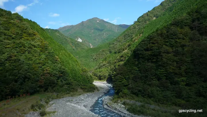
Jūmaisan is a 1,726 m peak straddling the boundary between Nanbu Town in Yamanashi and Aoi Ward of Shizuoka City, forming one of the principal summits of the Abe-Higashi ridge. Together with neighbouring Shimo-Jūmaisan (1,732 m) it makes a twin-peaked massif, and its open summit commands sweeping views of Mount Fuji, Suruga Bay and the Southern Alps. The Shizuoka side lies within Oku-Ōi Prefectural Natural Park, and the peak is included in the Yamanashi 100 and Shizuoka 100 selections.
Mt. Juumaisan at a glance
- Weather: The most settled day in the next 7 days is Fri, November 6: clear, gusts up to 9 m/s.
- Route: The shortest is Mount Jumai Return from Jizo Pass via Mount Iwadake and Lower Mount Jumai: about 6 h 37 min, 10.5 km, about 980 m of climbing.
Mt. Juumaisan weather (hourly, 14 days)
Sunrise today 06:09, sunset 16:51
| Tue, 11/3 | Wed, 11/4 | Thu, 11/5 | Fri, 11/6 | Sat, 11/7 | Sun, 11/8 | Mon, 11/9 | Tue, 11/10 | Wed, 11/11 | Thu, 11/12 | Fri, 11/13 | Sat, 11/14 | Sun, 11/15 | Mon, 11/16 | Tue, 11/17 | |||||||||||||||||||||||||||||||||||||||||||||||||||||||||||||||||||||||
|---|---|---|---|---|---|---|---|---|---|---|---|---|---|---|---|---|---|---|---|---|---|---|---|---|---|---|---|---|---|---|---|---|---|---|---|---|---|---|---|---|---|---|---|---|---|---|---|---|---|---|---|---|---|---|---|---|---|---|---|---|---|---|---|---|---|---|---|---|---|---|---|---|---|---|---|---|---|---|---|---|---|---|---|---|---|
| Japan time | 15 | 17 | 19 | 21 | 23 | 1 | 3 | 5 | 7 | 9 | 11 | 13 | 15 | 18 | 21 | 0 | 3 | 6 | 9 | 12 | 15 | 18 | 21 | 0 | 3 | 6 | 9 | 12 | 15 | 18 | 21 | 0 | 3 | 6 | 9 | 12 | 15 | 18 | 21 | 0 | 3 | 6 | 9 | 12 | 15 | 18 | 21 | 0 | 3 | 6 | 9 | 15 | 21 | 3 | 9 | 15 | 21 | 3 | 9 | 15 | 21 | 3 | 9 | 15 | 21 | 3 | 9 | 15 | 21 | 3 | 9 | 15 | 21 | 3 | 9 | 15 | 21 | 3 | 9 | 15 | 21 | 3 | 9 | 15 | |
  |   | | | |   |   |   |   | | | | | | | | | |   | | | | |  | | |  | | | | | | | | | |   | | |   | | |   | | | | | | | | | | | | |   | | | | |   | | | | | | | | | | | | | | | | | | | | | | | | ||
| Temperature | °C | 8° | 6° | 5° | 5° | 5° | 4° | 3° | 3° | 4° | 5° | 8° | 8° | 7° | 5° | 5° | 5° | 5° | 5° | 9° | 12° | 9° | 8° | 7° | 5° | 6° | 7° | 11° | 15° | 14° | 6° | 2° | -1° | -2° | -2° | 7° | 9° | 8° | 3° | 2° | 3° | 2° | 1° | 4° | 7° | 6° | 4° | 3° | 3° | 3° | 1° | 4° | 6° | 3° | 0° | 4° | 6° | 0° | -1° | 2° | 5° | 0° | -1° | 4° | 5° | 2° | 0° | 5° | 7° | 2° | 2° | 3° | 4° | 2° | 0° | 6° | 7° | 5° | 6° | 10° | 14° | 6° | 4° | 3° | 4° |
| Precipitation | mm | 0.5 | 1.0 | 0.5 | 1.6 | 0.3 | 0.1 | 0.2 | 1.0 | 11 | 17 | 11 | 4.0 | 0.1 | 2.2 | 0.9 | 0.5 | 0.4 | 0.2 | 0.5 | 2.1 | 0.2 | 1.2 | 1.1 | 0.2 | 0.1 | 1.2 | 0.2 | 0.5 | 1.4 | 24 | 28 | 4.8 | 0.2 | 5.0 | 8 | 0.5 | 0.3 | |||||||||||||||||||||||||||||||||||||||||||||||
| New snow | cm | ||||||||||||||||||||||||||||||||||||||||||||||||||||||||||||||||||||||||||||||||||||
| Snow depth | cm | 0 | 0 | 0 | 0 | 0 | 0 | 0 | 0 | 0 | 0 | 0 | 0 | 0 | 0 | 0 | 0 | 0 | 0 | 0 | 0 | 0 | 0 | 0 | 0 | 0 | 0 | 0 | 0 | 0 | 0 | 0 | 0 | 0 | 0 | 0 | 0 | 0 | 0 | 0 | 0 | 0 | 0 | 0 | 0 | 0 | 0 | 0 | 0 | 0 | 0 | 0 | 0 | 0 | 0 | 0 | 0 | 0 | 0 | 0 | 0 | 0 | 0 | 0 | 0 | 0 | 0 | 0 | 0 | 0 | 0 | 0 | 0 | 0 | 0 | 0 | 0 | 0 | 0 | 0 | 0 | 0 | 0 | 0 | 0 |
| Wind | m/s | 3 | 1 | 1 | 1 | 1 | 0 | 0 | 1 | 1 | 2 | 2 | 1 | 1 | 2 | 2 | 2 | 3 | 2 | 1 | 1 | 2 | 1 | 1 | 1 | 1 | 0 | 1 | 2 | 1 | 1 | 2 | 2 | 2 | 2 | 2 | 3 | 2 | 1 | 1 | 1 | 1 | 0 | 1 | 3 | 4 | 1 | 1 | 1 | 1 | 1 | 1 | 3 | 1 | 1 | 1 | 4 | 1 | 3 | 1 | 2 | 1 | 1 | 2 | 4 | 1 | 0 | 1 | 2 | 1 | 1 | 1 | 3 | 1 | 1 | 2 | 2 | 1 | 0 | 1 | 2 | 1 | 2 | 1 | 3 |
| Wind gusts | m/s | 10 | 9 | 5 | 5 | 4 | 4 | 3 | 2 | 3 | 6 | 6 | 6 | 5 | 6 | 7 | 8 | 10 | 12 | 8 | 6 | 7 | 8 | 5 | 5 | 6 | 7 | 7 | 8 | 9 | 6 | 8 | 8 | 8 | 8 | 7 | 9 | 9 | 7 | 4 | 5 | 5 | 5 | 5 | 9 | 12 | 11 | 5 | 5 | 5 | 5 | 5 | 12 | 9 | 5 | 5 | 12 | 11 | 13 | 14 | 8 | 6 | 6 | 8 | 13 | 12 | 4 | 6 | 9 | 8 | 5 | 4 | 10 | 9 | 5 | 7 | 11 | 8 | 11 | 10 | 7 | 6 | 7 | 7 | 10 |
| Wind dir. | ↓ | ↓ | ↓ | ↓ | ↓ | ↓ | ↓ | ↓ | ↓ | ↓ | ↓ | ↓ | ↓ | ↓ | ↓ | ↓ | ↓ | ↓ | ↓ | ↓ | ↓ | ↓ | ↓ | ↓ | ↓ | ↓ | ↓ | ↓ | ↓ | ↓ | ↓ | ↓ | ↓ | ↓ | ↓ | ↓ | ↓ | ↓ | ↓ | ↓ | ↓ | ↓ | ↓ | ↓ | ↓ | ↓ | ↓ | ↓ | ↓ | ↓ | ↓ | ↓ | ↓ | ↓ | ↓ | ↓ | ↓ | ↓ | ↓ | ↓ | ↓ | ↓ | ↓ | ↓ | ↓ | ↓ | ↓ | ↓ | ↓ | ↓ | ↓ | ↓ | ↓ | ↓ | ↓ | ↓ | ↓ | ↓ | ↓ | ↓ | ↓ | ↓ | ↓ | ↓ | |
Mt. Juumaisan hiking routes
Hiking times are estimates calculated from the terrain.
Huts, campsites and lodging near Mt. Juumaisan
Campsites
- 奥山温泉キャンプ場(青少年旅行村)
- 梅ヶ島キャンプ場
Lodging
- 梅ヶ島コンヤ温泉 大野木荘
- 山下荘
Lists that include Mt. Juumaisan
Yamanashi 100 Famous Mountains · 100 Mountains of Shizuoka · Elevations of 1003 Mountains of Japan · 1000 Mountains of Japan
Mt. Juumaisan facts
- Also known as
- 上十枚山
- Elevation
- 1,726 m
- Location
- Shizuoka, Shizuoka / Nanbu, Yamanashi
35.253636, 138.377958 - Website
- www.town.nanbu.yamanashi.jp
- Trail Map
- www.town.nanbu.yamanashi.jp (PDF)
- Access Information
- www.town.nanbu.yamanashi.jp (PDF)
- Wikipedia
- ja.wikipedia.org