
Mount Nekomata
猫又山
Kurobe, Toyama / Uozu, Toyama · Elevation 2,378 m
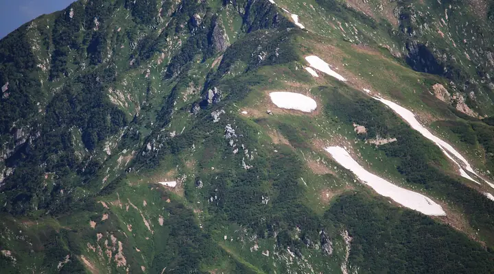
Mount Nekomata (2,378 m) straddles Uozu City and Kurobe City in Toyama Prefecture and is one of the "Kekachi Sanzan" trio together with Mount Kekachi and Mount Kamatani. The peak rises at the northern end of the Northern Alps within Chūbu-Sangaku National Park and forms the head of the Katakai River. The standard approach climbs the Higashi-Ashimi ridge from Babajima, while a snow-corridor route up Kekachi Valley is climbed in late spring; both are demanding, expert-level lines. The peak is one of the One Hundred Mountains of Toyama.
Mount Nekomata at a glance
- Weather: The most settled day in the next 7 days is Wed, November 4: clear, gusts up to 7 m/s. Fri, Nov 6, Sat, Nov 7: strong wind (gusts up to 15 m/s).
Mount Nekomata weather (hourly, 14 days)
Sunrise today 06:14, sunset 16:52
| Tue, 11/3 | Wed, 11/4 | Thu, 11/5 | Fri, 11/6 | Sat, 11/7 | Sun, 11/8 | Mon, 11/9 | Tue, 11/10 | Wed, 11/11 | Thu, 11/12 | Fri, 11/13 | Sat, 11/14 | Sun, 11/15 | Mon, 11/16 | Tue, 11/17 | |||||||||||||||||||||||||||||||||||||||||||||||||||||||||||||||||||||||
|---|---|---|---|---|---|---|---|---|---|---|---|---|---|---|---|---|---|---|---|---|---|---|---|---|---|---|---|---|---|---|---|---|---|---|---|---|---|---|---|---|---|---|---|---|---|---|---|---|---|---|---|---|---|---|---|---|---|---|---|---|---|---|---|---|---|---|---|---|---|---|---|---|---|---|---|---|---|---|---|---|---|---|---|---|---|
| Japan time | 15 | 17 | 19 | 21 | 23 | 1 | 3 | 5 | 7 | 9 | 11 | 13 | 15 | 18 | 21 | 0 | 3 | 6 | 9 | 12 | 15 | 18 | 21 | 0 | 3 | 6 | 9 | 12 | 15 | 18 | 21 | 0 | 3 | 6 | 9 | 12 | 15 | 18 | 21 | 0 | 3 | 6 | 9 | 12 | 15 | 18 | 21 | 0 | 3 | 6 | 9 | 15 | 21 | 3 | 9 | 15 | 21 | 3 | 9 | 15 | 21 | 3 | 9 | 15 | 21 | 3 | 9 | 15 | 21 | 3 | 9 | 15 | 21 | 3 | 9 | 15 | 21 | 3 | 9 | 15 | 21 | 3 | 9 | 15 | |
  |  |   |   | | | | |  | | |   | | | |   | | |   |   | | | | |   | | |   | | |   | | | |   |   |   | | | |   | | | | | | |   | | | | | |   | | | | | | |   | | | | | | |   | |  | | | | | | | | | | | | | | | ||
| Temperature | °C | 1° | -3° | -5° | -6° | -7° | -7° | -6° | -6° | -4° | 2° | 4° | 4° | 4° | 1° | 1° | 1° | 1° | 2° | 4° | 6° | 7° | 4° | 3° | 4° | 2° | 2° | 2° | 2° | 0° | -2° | -3° | -4° | -6° | -6° | -6° | -6° | -6° | -7° | -7° | -9° | -11° | -10° | -4° | -2° | -3° | -5° | -6° | -5° | -5° | -4° | -1° | -1° | -9° | -11° | 0° | 2° | -4° | -9° | -8° | -6° | -8° | -9° | -4° | -4° | -9° | -5° | -5° | -5° | -10° | -10° | -1° | 0° | -5° | -5° | 3° | 2° | 2° | 3° | 1° | -2° | -6° | -9° | -4° | -2° |
| Precipitation | mm | 1.0 | 9 | 7 | 4.4 | 1.5 | 0.2 | 1.4 | 2.1 | 5 | 3.9 | 3.8 | 1.6 | 3.8 | 3.5 | 4.9 | 3.1 | 3.2 | 2.8 | 2.1 | 1.5 | 0.9 | 0.2 | 0.4 | 0.3 | 1.3 | 1.2 | 0.2 | 8 | 15 | 8 | 2.7 | 0.3 | 2.8 | 6 | 0.5 | 0.4 | 6 | 6 | 18 | 19 | 6 | |||||||||||||||||||||||||||||||||||||||||||
| New snow | cm | 0.2 | 1.0 | 0.7 | 1.5 | 1.5 | 1.6 | 1.2 | 0.5 | <.1 | <.1 | <.1 | <.1 | <.1 | 0.3 | 0.3 | <.1 | <.1 | 1.4 | 11 | 8.0 | 2.6 | 0.3 | <.1 | 1.2 | 1.3 | <.1 | 0.2 | 0.5 | ||||||||||||||||||||||||||||||||||||||||||||||||||||||||
| Snow depth | cm | 0 | 0 | 0 | 0 | 0 | 0 | 0 | 0 | 0 | 0 | 0 | 0 | 0 | 0 | 0 | 0 | 0 | 0 | 0 | 0 | 0 | 0 | 0 | 0 | 0 | 0 | 0 | 0 | 0 | 0 | <1 | <1 | 1 | 2 | 3 | 3 | 4 | 4 | 4 | 4 | 4 | 4 | 4 | 3 | 3 | 2 | 2 | 2 | 3 | 3 | 3 | 3 | 3 | 3 | 2 | 2 | 3 | 11 | 16 | 16 | 16 | 15 | 15 | 13 | 12 | 13 | 13 | 12 | 11 | 11 | 11 | 9 | 9 | 9 | 9 | 7 | 5 | 5 | 5 | 4 | 4 | 4 | 4 | 4 |
| Wind | m/s | 2 | 0 | 0 | 1 | 1 | 1 | 1 | 1 | 1 | 0 | 2 | 2 | 1 | 1 | 1 | 1 | 1 | 1 | 0 | 1 | 1 | 0 | 0 | 0 | 0 | 2 | 3 | 3 | 3 | 3 | 4 | 4 | 4 | 4 | 4 | 3 | 3 | 3 | 1 | 1 | 1 | 1 | 1 | 2 | 1 | 0 | 0 | 0 | 0 | 1 | 1 | 1 | 1 | 1 | 0 | 4 | 3 | 6 | 2 | 1 | 1 | 0 | 1 | 1 | 1 | 0 | 2 | 1 | 1 | 1 | 0 | 0 | 0 | 0 | 0 | 2 | 3 | 3 | 2 | 3 | 0 | 0 | 1 | 1 |
| Wind gusts | m/s | 7 | 6 | 3 | 4 | 4 | 5 | 4 | 4 | 4 | 4 | 6 | 7 | 7 | 5 | 7 | 6 | 5 | 6 | 7 | 9 | 9 | 7 | 5 | 7 | 7 | 9 | 12 | 13 | 15 | 14 | 14 | 14 | 16 | 15 | 15 | 15 | 14 | 10 | 9 | 6 | 5 | 5 | 5 | 9 | 8 | 5 | 5 | 5 | 6 | 6 | 7 | 8 | 6 | 6 | 6 | 14 | 15 | 23 | 22 | 12 | 7 | 4 | 4 | 7 | 7 | 7 | 8 | 7 | 6 | 5 | 3 | 5 | 4 | 5 | 6 | 12 | 17 | 20 | 13 | 13 | 13 | 4 | 5 | 6 |
| Wind dir. | ↓ | ↓ | ↓ | ↓ | ↓ | ↓ | ↓ | ↓ | ↓ | ↓ | ↓ | ↓ | ↓ | ↓ | ↓ | ↓ | ↓ | ↓ | ↓ | ↓ | ↓ | ↓ | ↓ | ↓ | ↓ | ↓ | ↓ | ↓ | ↓ | ↓ | ↓ | ↓ | ↓ | ↓ | ↓ | ↓ | ↓ | ↓ | ↓ | ↓ | ↓ | ↓ | ↓ | ↓ | ↓ | ↓ | ↓ | ↓ | ↓ | ↓ | ↓ | ↓ | ↓ | ↓ | ↓ | ↓ | ↓ | ↓ | ↓ | ↓ | ↓ | ↓ | ↓ | ↓ | ↓ | ↓ | ↓ | ↓ | ↓ | ↓ | ↓ | ↓ | ↓ | ↓ | ↓ | ↓ | ↓ | ↓ | ↓ | ↓ | ↓ | ↓ | ↓ | ↓ | |
Huts, campsites and lodging near Mount Nekomata
Mountain huts
Campsites
- 剱岳青少年旅行村 (馬場島野営場)
Lists that include Mount Nekomata
100 Mountains of Toyama · Kekachi 3 Mountains · Elevations of 1003 Mountains of Japan
Mount Nekomata facts
- Elevation
- 2,378 m
- Location
- Kurobe, Toyama / Uozu, Toyama
36.681236, 137.590402 - National Park
- 中部山岳国立公園
- Website
- uozu-kanko.jp
- Wikipedia
- ja.wikipedia.org