
Mount Hiragatake
平ヶ岳
Uonuma, Niigata · Elevation 2,141 m
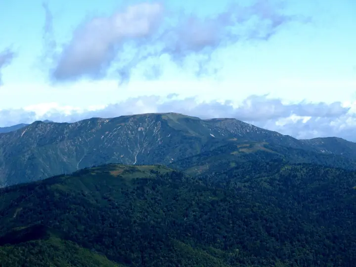
Hiragatake is a 2,141 m peak on the border of Uonuma (Niigata) and Minakami (Gunma), in the northern part of Oze National Park. Its summit plateau holds an expansive raised bog dotted with kettle ponds and the celebrated rock formation Tamago-ishi, and it is listed among the New Flower Hyakumeizan. With no huts or campsites permitted on the mountain, it must be done as a long single-day ascent, making it one of the more remote of the Hyakumeizan.
Mount Hiragatake at a glance
- Weather: The most settled day in the next 7 days is Wed, November 4: clear, gusts up to 6 m/s. Sat, Nov 7: strong wind (gusts up to 18 m/s). Sat, Nov 7: heavy snow (14 cm of new snow during the day).
- Route: The shortest is Mount Hiragatake Nakanomata Prince Route Out-and-Back: about 6 h 3 min, 9.0 km, about 1,010 m of climbing.
Mount Hiragatake weather (hourly, 14 days)
Sunrise today 06:09, sunset 16:45
| Tue, 11/3 | Wed, 11/4 | Thu, 11/5 | Fri, 11/6 | Sat, 11/7 | Sun, 11/8 | Mon, 11/9 | Tue, 11/10 | Wed, 11/11 | Thu, 11/12 | Fri, 11/13 | Sat, 11/14 | Sun, 11/15 | Mon, 11/16 | Tue, 11/17 | |||||||||||||||||||||||||||||||||||||||||||||||||||||||||||||||||||||||
|---|---|---|---|---|---|---|---|---|---|---|---|---|---|---|---|---|---|---|---|---|---|---|---|---|---|---|---|---|---|---|---|---|---|---|---|---|---|---|---|---|---|---|---|---|---|---|---|---|---|---|---|---|---|---|---|---|---|---|---|---|---|---|---|---|---|---|---|---|---|---|---|---|---|---|---|---|---|---|---|---|---|---|---|---|---|
| Japan time | 15 | 17 | 19 | 21 | 23 | 1 | 3 | 5 | 7 | 9 | 11 | 13 | 15 | 18 | 21 | 0 | 3 | 6 | 9 | 12 | 15 | 18 | 21 | 0 | 3 | 6 | 9 | 12 | 15 | 18 | 21 | 0 | 3 | 6 | 9 | 12 | 15 | 18 | 21 | 0 | 3 | 6 | 9 | 12 | 15 | 18 | 21 | 0 | 3 | 6 | 9 | 15 | 21 | 3 | 9 | 15 | 21 | 3 | 9 | 15 | 21 | 3 | 9 | 15 | 21 | 3 | 9 | 15 | 21 | 3 | 9 | 15 | 21 | 3 | 9 | 15 | 21 | 3 | 9 | 15 | 21 | 3 | 9 | 15 | |
  |   |   | |   | | | |  | | | |   | |   | | | |   | |   | | |   | | | | | | | |   | | |   | | |   | | | | |   | | | | | | | | |   | | | | | | | | | | | | | | | | | | | | |  | | | | |   | | | | | | | ||
| Temperature | °C | 0° | -2° | -4° | -6° | -7° | -6° | -5° | -5° | -4° | 2° | 5° | 7° | 6° | 2° | 1° | 2° | 2° | 2° | 4° | 7° | 7° | 4° | 4° | 4° | 3° | 3° | 4° | 4° | 4° | 2° | 0° | -2° | -3° | -5° | -5° | -5° | -6° | -6° | -6° | -6° | -6° | -6° | -5° | -4° | -4° | -5° | -6° | -7° | -6° | -7° | -1° | -2° | -4° | -6° | 0° | 0° | -3° | -6° | -6° | -5° | -5° | -5° | -3° | -3° | -8° | -4° | -4° | -5° | -7° | -7° | -2° | 1° | -9° | -8° | 3° | 3° | -1° | 1° | 2° | 0° | -5° | -7° | -5° | -2° |
| Precipitation | mm | 0.6 | 1.3 | 0.8 | 8 | 7 | 0.6 | 1.9 | 0.3 | 0.2 | 1.4 | 3.4 | 3.3 | 1.2 | 6 | 5 | 5 | 3.7 | 4.4 | 6 | 5 | 4.4 | 2.7 | 1.8 | 1.1 | 0.5 | 0.8 | 1.0 | 0.5 | 0.5 | 0.1 | 0.1 | 0.6 | 0.4 | 0.1 | 7 | 6 | 7 | 4.1 | 1.0 | 0.2 | 0.3 | 0.1 | 14 | 3.0 | 1.2 | 3.8 | 5 | 0.9 | 16 | 11 | 1.4 | |||||||||||||||||||||||||||||||||
| New snow | cm | <.1 | 0.9 | 2.9 | 5.6 | 4.9 | 4.0 | 2.6 | 1.8 | 1.1 | 0.5 | 0.7 | 0.7 | 0.3 | 0.4 | <.1 | 0.1 | 0.5 | 0.4 | 5.8 | 5.7 | 5.1 | 2.5 | 0.4 | <.1 | <.1 | 11 | 2.5 | 1.0 | 1.4 | 0.9 | ||||||||||||||||||||||||||||||||||||||||||||||||||||||
| Snow depth | cm | 0 | 0 | 0 | 0 | 0 | 0 | 0 | 0 | 0 | 0 | 0 | 0 | 0 | 0 | 0 | 0 | 0 | 0 | 0 | 0 | 0 | 0 | 0 | 0 | 0 | 0 | 0 | 0 | 0 | 0 | 0 | 0 | <1 | 2 | 6 | 9 | 11 | 13 | 13 | 13 | 13 | 13 | 14 | 13 | 12 | 12 | 12 | 12 | 12 | 12 | 11 | 8 | 8 | 7 | 7 | 5 | 4 | 8 | 12 | 14 | 15 | 14 | 13 | 11 | 11 | 11 | 18 | 19 | 19 | 19 | 18 | 16 | 16 | 16 | 15 | 13 | 12 | 10 | 9 | 7 | 7 | 7 | 7 | 7 |
| Wind | m/s | 2 | 1 | 1 | 1 | 1 | 1 | 1 | 1 | 1 | 1 | 1 | 1 | 1 | 3 | 4 | 3 | 2 | 2 | 1 | 1 | 0 | 1 | 1 | 1 | 0 | 1 | 3 | 4 | 3 | 3 | 3 | 3 | 3 | 3 | 3 | 4 | 4 | 3 | 3 | 3 | 3 | 2 | 2 | 3 | 2 | 1 | 1 | 1 | 0 | 1 | 1 | 1 | 0 | 1 | 1 | 3 | 2 | 4 | 6 | 5 | 3 | 1 | 2 | 1 | 2 | 2 | 3 | 5 | 2 | 0 | 0 | 1 | 1 | 1 | 1 | 0 | 3 | 3 | 1 | 4 | 5 | 2 | 1 | 1 |
| Wind gusts | m/s | 8 | 8 | 6 | 6 | 5 | 5 | 4 | 4 | 3 | 4 | 5 | 6 | 6 | 11 | 14 | 16 | 11 | 9 | 8 | 6 | 5 | 4 | 4 | 5 | 5 | 7 | 11 | 13 | 13 | 12 | 14 | 13 | 14 | 16 | 13 | 17 | 18 | 17 | 14 | 14 | 14 | 13 | 10 | 11 | 10 | 7 | 5 | 5 | 5 | 5 | 6 | 6 | 5 | 4 | 6 | 11 | 11 | 13 | 23 | 23 | 16 | 10 | 7 | 7 | 6 | 8 | 9 | 14 | 14 | 8 | 4 | 5 | 5 | 5 | 6 | 6 | 10 | 12 | 10 | 16 | 18 | 15 | 6 | 6 |
| Wind dir. | ↓ | ↓ | ↓ | ↓ | ↓ | ↓ | ↓ | ↓ | ↓ | ↓ | ↓ | ↓ | ↓ | ↓ | ↓ | ↓ | ↓ | ↓ | ↓ | ↓ | ↓ | ↓ | ↓ | ↓ | ↓ | ↓ | ↓ | ↓ | ↓ | ↓ | ↓ | ↓ | ↓ | ↓ | ↓ | ↓ | ↓ | ↓ | ↓ | ↓ | ↓ | ↓ | ↓ | ↓ | ↓ | ↓ | ↓ | ↓ | ↓ | ↓ | ↓ | ↓ | ↓ | ↓ | ↓ | ↓ | ↓ | ↓ | ↓ | ↓ | ↓ | ↓ | ↓ | ↓ | ↓ | ↓ | ↓ | ↓ | ↓ | ↓ | ↓ | ↓ | ↓ | ↓ | ↓ | ↓ | ↓ | ↓ | ↓ | ↓ | ↓ | ↓ | ↓ | ↓ | |
Mount Hiragatake hiking routes
- Mount Hiragatake Nakanomata Prince Route Out-and-Back 9.0 km · Ascent 1,008 m 平ヶ岳中ノ岐登山口, 平ヶ岳中ノ岐駐車場
- Mount Hiragatake and Tamagoishi Return from Takanosu Trailhead 22.2 km · Ascent 1,845 m 平ヶ岳登山口, 平ヶ岳 登山口駐車場
Hiking times are estimates calculated from the terrain.
Lists that include Mount Hiragatake
100 Famous Japanese Mountains · Japan 200 Famous Mountains · Japan's 300 Famous Mountains · New 100 Famous Flower Mountains · New Japan 100 Famous Mountains · Koshinetsu 100 Famous Mountains · Gunma 100 Famous Mountains · Niigata 100 Famous Mountains · Elevations of 1003 Mountains of Japan · 1000 Mountains of Japan
Mount Hiragatake facts
- Elevation
- 2,141 m
- Location
- Uonuma, Niigata
37.002227, 139.170862 - National Park
- 尾瀬国立公園
- Website
- niigata-kankou.or.jp
- Wikipedia
- ja.wikipedia.org