
Mount Hayama
葉山
Murayama, Yamagata / Sagae, Yamagata · Elevation 1,462 m
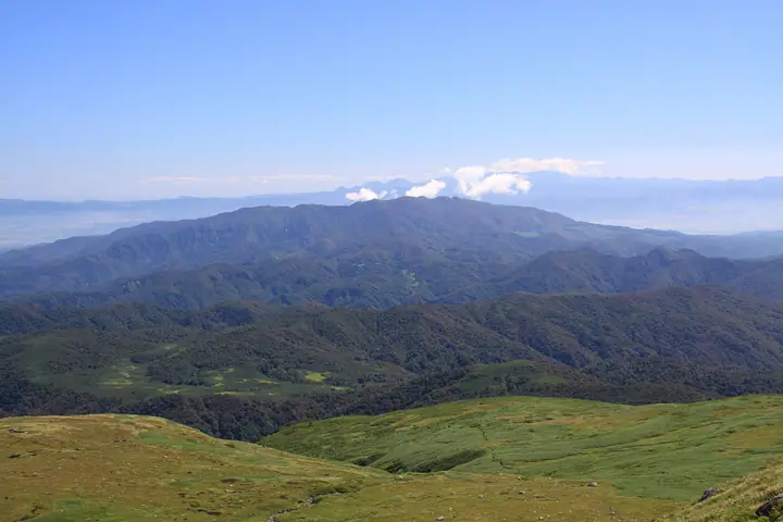
Mount Hayama (1,462 m), also known as Murayama Hayama, rises on the border of Sagae, Murayama, and Ōkura in central Yamagata Prefecture. Opened as a Shugendō sacred peak in the Nara period, it was once counted among the original Three Mountains of Dewa alongside Gassan and Haguro. Beech forest cloaks its slopes nearly to the summit and is home to rare alpine flora such as Togakushi-shōma; from the top, all six of Yamagata's Hyakumeizan can be seen on a clear day. The peak is listed in the Yamagata Hyakumeizan, the Tōhoku Hyakumeizan, and the Hundred Sacred Mountains of Japan.
Mount Hayama at a glance
- Weather: The most settled day in the next 7 days is Wed, November 4: cloudy, gusts up to 6 m/s. Sat, Nov 7, Sun, Nov 8: strong wind (gusts up to 18 m/s).
- Route: The shortest is Sagae, Once One of the Three Dewa Mountains, Up the Shugendo Trail to the Inner Shrine Facing Gassan and Chokai: about 6 h 27 min, 11.4 km, about 930 m of climbing.
Mount Hayama weather (hourly, 14 days)
Sunrise today 06:07, sunset 16:39
| Tue, 11/3 | Wed, 11/4 | Thu, 11/5 | Fri, 11/6 | Sat, 11/7 | Sun, 11/8 | Mon, 11/9 | Tue, 11/10 | Wed, 11/11 | Thu, 11/12 | Fri, 11/13 | Sat, 11/14 | Sun, 11/15 | Mon, 11/16 | Tue, 11/17 | |||||||||||||||||||||||||||||||||||||||||||||||||||||||||||||||||||||||
|---|---|---|---|---|---|---|---|---|---|---|---|---|---|---|---|---|---|---|---|---|---|---|---|---|---|---|---|---|---|---|---|---|---|---|---|---|---|---|---|---|---|---|---|---|---|---|---|---|---|---|---|---|---|---|---|---|---|---|---|---|---|---|---|---|---|---|---|---|---|---|---|---|---|---|---|---|---|---|---|---|---|---|---|---|---|
| Japan time | 21 | 23 | 1 | 3 | 5 | 7 | 9 | 11 | 13 | 15 | 17 | 19 | 21 | 0 | 3 | 6 | 9 | 12 | 15 | 18 | 21 | 0 | 3 | 6 | 9 | 12 | 15 | 18 | 21 | 0 | 3 | 6 | 9 | 12 | 15 | 18 | 21 | 0 | 3 | 6 | 9 | 12 | 15 | 18 | 21 | 0 | 3 | 6 | 9 | 12 | 15 | 21 | 3 | 9 | 15 | 21 | 3 | 9 | 15 | 21 | 3 | 9 | 15 | 21 | 3 | 9 | 15 | 21 | 3 | 9 | 15 | 21 | 3 | 9 | 15 | 21 | 3 | 9 | 15 | 21 | 3 | 9 | 15 | 21 | |
 | |   | |   |   |   |   | | | | | | |   | |   | | |   | |   | | | | | | | | |   | |   | | |   | | | | | | | | | | | | | | | | | |  | | | |   |   | | | | | | | |   |   | | | |  | |   | | | | | | | | | | | ||
| Temperature | °C | -1° | -2° | -2° | -2° | -1° | 1° | 5° | 8° | 9° | 8° | 3° | 2° | 2° | 2° | 2° | 3° | 6° | 7° | 8° | 7° | 6° | 6° | 7° | 6° | 8° | 10° | 8° | 5° | 3° | 0° | -1° | -1° | -1° | -1° | -1° | -2° | -2° | -2° | -3° | -2° | 1° | 2° | 1° | -1° | -1° | -2° | -2° | -2° | -1° | 0° | 1° | -4° | -6° | 0° | 3° | -1° | -1° | 1° | 3° | -2° | -1° | 2° | 2° | -1° | 0° | 1° | 0° | -2° | -4° | 1° | 5° | -3° | -3° | 4° | 8° | 3° | 3° | 5° | 2° | -2° | -2° | 0° | 2° | -3° |
| Precipitation | mm | 0.1 | 1.5 | 7 | 4.1 | 0.6 | 0.4 | 0.5 | 2.0 | 1.0 | 0.8 | 0.8 | 1.1 | 2.0 | 5 | 4.2 | 2.6 | 4.0 | 2.6 | 1.4 | 1.0 | 1.4 | 1.5 | 0.8 | 0.8 | 0.1 | 0.2 | 0.7 | 1.9 | 1.2 | 0.3 | 0.3 | 5 | 1.8 | 0.3 | 0.2 | 0.5 | 5 | 1.7 | 0.3 | 0.1 | 1.6 | 7 | 2.8 | 6 | 4.4 | |||||||||||||||||||||||||||||||||||||||
| New snow | cm | <.1 | 0.2 | 0.1 | 0.3 | 0.2 | 0.1 | 0.1 | 0.2 | 0.2 | <.1 | 0.1 | <.1 | <.1 | <.1 | <.1 | <.1 | <.1 | 0.1 | <.1 | <.1 | 0.3 | 0.1 | <.1 | <.1 | 0.1 | <.1 | <.1 | |||||||||||||||||||||||||||||||||||||||||||||||||||||||||
| Snow depth | cm | 0 | 0 | 0 | 0 | 0 | 0 | 0 | 0 | 0 | 0 | 0 | 0 | 0 | 0 | 0 | 0 | 0 | 0 | 0 | 0 | 0 | 0 | 0 | 0 | 0 | 0 | 0 | 0 | 0 | 0 | <1 | <1 | <1 | <1 | <1 | <1 | <1 | <1 | <1 | 1 | <1 | <1 | <1 | <1 | <1 | <1 | <1 | <1 | <1 | <1 | <1 | <1 | <1 | <1 | <1 | <1 | <1 | <1 | <1 | <1 | <1 | <1 | <1 | <1 | <1 | <1 | <1 | <1 | <1 | <1 | <1 | <1 | <1 | <1 | 0 | 0 | 0 | 0 | 0 | <1 | <1 | <1 | 0 | 0 |
| Wind | m/s | 1 | 1 | 1 | 1 | 1 | 1 | 0 | 1 | 1 | 2 | 0 | 2 | 2 | 2 | 2 | 2 | 1 | 0 | 1 | 1 | 1 | 1 | 0 | 0 | 0 | 3 | 3 | 2 | 2 | 3 | 2 | 2 | 2 | 2 | 4 | 3 | 2 | 1 | 3 | 4 | 5 | 5 | 4 | 1 | 1 | 1 | 1 | 1 | 0 | 2 | 2 | 2 | 1 | 1 | 4 | 3 | 2 | 1 | 4 | 1 | 0 | 0 | 1 | 2 | 0 | 5 | 6 | 2 | 0 | 0 | 1 | 0 | 1 | 1 | 0 | 1 | 2 | 1 | 6 | 3 | 2 | 2 | 2 | 1 |
| Wind gusts | m/s | 5 | 5 | 5 | 5 | 5 | 5 | 5 | 5 | 5 | 6 | 6 | 6 | 7 | 8 | 9 | 8 | 7 | 6 | 5 | 4 | 5 | 5 | 4 | 5 | 9 | 11 | 13 | 12 | 10 | 13 | 13 | 11 | 14 | 16 | 17 | 18 | 16 | 13 | 13 | 15 | 17 | 18 | 15 | 13 | 5 | 4 | 5 | 5 | 5 | 6 | 7 | 8 | 6 | 5 | 12 | 11 | 9 | 8 | 17 | 13 | 6 | 5 | 7 | 6 | 6 | 14 | 18 | 16 | 8 | 5 | 5 | 5 | 4 | 5 | 6 | 6 | 8 | 9 | 19 | 20 | 13 | 10 | 7 | 7 |
| Wind dir. | ↓ | ↓ | ↓ | ↓ | ↓ | ↓ | ↓ | ↓ | ↓ | ↓ | ↓ | ↓ | ↓ | ↓ | ↓ | ↓ | ↓ | ↓ | ↓ | ↓ | ↓ | ↓ | ↓ | ↓ | ↓ | ↓ | ↓ | ↓ | ↓ | ↓ | ↓ | ↓ | ↓ | ↓ | ↓ | ↓ | ↓ | ↓ | ↓ | ↓ | ↓ | ↓ | ↓ | ↓ | ↓ | ↓ | ↓ | ↓ | ↓ | ↓ | ↓ | ↓ | ↓ | ↓ | ↓ | ↓ | ↓ | ↓ | ↓ | ↓ | ↓ | ↓ | ↓ | ↓ | ↓ | ↓ | ↓ | ↓ | ↓ | ↓ | ↓ | ↓ | ↓ | ↓ | ↓ | ↓ | ↓ | ↓ | ↓ | ↓ | ↓ | ↓ | ↓ | ||
Mount Hayama hiking routes
Hiking times are estimates calculated from the terrain.
Lists that include Mount Hayama
Tohoku 100 Famous Mountains · Yamagata 100 Famous Mountains · Elevations of 1003 Mountains of Japan · 1000 Mountains of Japan
Mount Hayama facts
- Also known as
- 村山葉山
- Elevation
- 1,462 m
- Location
- Murayama, Yamagata / Sagae, Yamagata
38.529284, 140.210540 - Website
- www.city.sagae.yamagata.jp
- Wikipedia
- ja.wikipedia.org