
Fujimidai
富士見台
Achi, Nagano · Elevation 1,739 m
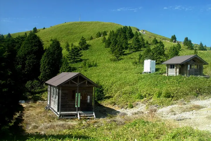
A bamboo-grass plateau at the southern end of the Central Alps, with views of the Northern, Central and Southern Alps. Seasonal scenery includes spring foliage, alpine flowers, autumn colors and winter rime. Nearby Misaka Pass preserves ritual remains where travelers on the ancient Tosando road prayed for safety.
Fujimidai at a glance
- Weather: The most settled day in the next 7 days is Sun, November 8: clear, gusts up to 7 m/s. Fri, Nov 6, Sat, Nov 7: strong wind (gusts up to 21 m/s).
- Route: The shortest is Fujimidai Highland Return from Bangakuso across Bamboo Grass to Mount Minamisawa Facing Mount Ena: about 6 h 23 min, 11.1 km, about 700 m of climbing.
Fujimidai weather (hourly, 14 days)
Sunrise today 06:12, sunset 16:54
| Tue, 11/3 | Wed, 11/4 | Thu, 11/5 | Fri, 11/6 | Sat, 11/7 | Sun, 11/8 | Mon, 11/9 | Tue, 11/10 | Wed, 11/11 | Thu, 11/12 | Fri, 11/13 | Sat, 11/14 | Sun, 11/15 | Mon, 11/16 | Tue, 11/17 | |||||||||||||||||||||||||||||||||||||||||||||||||||||||||||||||||||||||
|---|---|---|---|---|---|---|---|---|---|---|---|---|---|---|---|---|---|---|---|---|---|---|---|---|---|---|---|---|---|---|---|---|---|---|---|---|---|---|---|---|---|---|---|---|---|---|---|---|---|---|---|---|---|---|---|---|---|---|---|---|---|---|---|---|---|---|---|---|---|---|---|---|---|---|---|---|---|---|---|---|---|---|---|---|---|
| Japan time | 15 | 17 | 19 | 21 | 23 | 1 | 3 | 5 | 7 | 9 | 11 | 13 | 15 | 18 | 21 | 0 | 3 | 6 | 9 | 12 | 15 | 18 | 21 | 0 | 3 | 6 | 9 | 12 | 15 | 18 | 21 | 0 | 3 | 6 | 9 | 12 | 15 | 18 | 21 | 0 | 3 | 6 | 9 | 12 | 15 | 18 | 21 | 0 | 3 | 6 | 9 | 15 | 21 | 3 | 9 | 15 | 21 | 3 | 9 | 15 | 21 | 3 | 9 | 15 | 21 | 3 | 9 | 15 | 21 | 3 | 9 | 15 | 21 | 3 | 9 | 15 | 21 | 3 | 9 | 15 | 21 | 3 | 9 | 15 | |
 |   |  | | | | | |   | |   |   |   |   | | | | |   | |   |   | |   | | | | | |  | | | | | | | | | | | | | | | | | | | | | | |   | | | | | | | | |  | | | | | | | | | | | | | | | | | | |  | | | | ||
| Temperature | °C | 11° | 6° | 4° | 3° | 2° | 3° | 4° | 3° | 4° | 10° | 12° | 13° | 10° | 8° | 7° | 7° | 8° | 7° | 10° | 12° | 11° | 8° | 8° | 7° | 7° | 7° | 9° | 12° | 10° | 5° | 2° | 1° | -1° | -2° | 3° | 6° | 4° | -1° | -3° | -4° | -4° | -4° | 6° | 9° | 7° | 2° | 2° | 2° | 2° | 3° | 7° | 8° | 1° | -1° | 6° | 6° | 2° | -2° | 0° | 5° | -2° | -3° | 4° | 6° | -2° | 0° | 5° | 7° | -2° | 0° | 5° | 7° | 0° | 2° | 7° | 8° | 6° | 6° | 8° | 11° | 0° | 2° | 5° | 5° |
| Precipitation | mm | 0.4 | 0.1 | 1.1 | 7 | 10 | 0.7 | 1.3 | 1.0 | 1.8 | 3.1 | 1.0 | 1.3 | 0.1 | 1.1 | 24 | 16 | 0.3 | 0.8 | 1.4 | |||||||||||||||||||||||||||||||||||||||||||||||||||||||||||||||||
| New snow | cm | ||||||||||||||||||||||||||||||||||||||||||||||||||||||||||||||||||||||||||||||||||||
| Snow depth | cm | 0 | 0 | 0 | 0 | 0 | 0 | 0 | 0 | 0 | 0 | 0 | 0 | 0 | 0 | 0 | 0 | 0 | 0 | 0 | 0 | 0 | 0 | 0 | 0 | 0 | 0 | 0 | 0 | 0 | 0 | 0 | 0 | 0 | 0 | 0 | 0 | 0 | 0 | 0 | 0 | 0 | 0 | 0 | 0 | 0 | 0 | 0 | 0 | 0 | 0 | 0 | 0 | 0 | 0 | 0 | 0 | 0 | 0 | 0 | 0 | 0 | 0 | 0 | 0 | 0 | 0 | 0 | 0 | 0 | 0 | 0 | 0 | 0 | 0 | 0 | 0 | 0 | 0 | 0 | 0 | 0 | 0 | 0 | 0 |
| Wind | m/s | 2 | 1 | 1 | 0 | 0 | 0 | 0 | 1 | 1 | 1 | 1 | 2 | 1 | 1 | 1 | 1 | 0 | 1 | 1 | 1 | 0 | 1 | 1 | 0 | 1 | 2 | 3 | 5 | 5 | 3 | 3 | 3 | 3 | 3 | 3 | 6 | 5 | 3 | 2 | 2 | 2 | 1 | 0 | 1 | 1 | 0 | 1 | 1 | 1 | 0 | 1 | 3 | 1 | 0 | 1 | 3 | 2 | 5 | 3 | 3 | 0 | 1 | 1 | 2 | 1 | 2 | 2 | 2 | 1 | 1 | 0 | 2 | 1 | 0 | 1 | 1 | 0 | 1 | 2 | 6 | 2 | 1 | 1 | 1 |
| Wind gusts | m/s | 8 | 7 | 4 | 3 | 3 | 3 | 3 | 3 | 3 | 5 | 5 | 7 | 7 | 5 | 6 | 11 | 12 | 7 | 6 | 4 | 5 | 5 | 4 | 5 | 9 | 10 | 11 | 15 | 16 | 16 | 13 | 13 | 13 | 13 | 14 | 21 | 21 | 15 | 10 | 9 | 7 | 7 | 6 | 6 | 7 | 5 | 4 | 4 | 5 | 5 | 6 | 13 | 10 | 4 | 6 | 12 | 11 | 19 | 19 | 13 | 10 | 4 | 6 | 8 | 7 | 9 | 10 | 10 | 8 | 4 | 3 | 8 | 8 | 4 | 6 | 8 | 11 | 11 | 9 | 20 | 19 | 6 | 5 | 8 |
| Wind dir. | ↓ | ↓ | ↓ | ↓ | ↓ | ↓ | ↓ | ↓ | ↓ | ↓ | ↓ | ↓ | ↓ | ↓ | ↓ | ↓ | ↓ | ↓ | ↓ | ↓ | ↓ | ↓ | ↓ | ↓ | ↓ | ↓ | ↓ | ↓ | ↓ | ↓ | ↓ | ↓ | ↓ | ↓ | ↓ | ↓ | ↓ | ↓ | ↓ | ↓ | ↓ | ↓ | ↓ | ↓ | ↓ | ↓ | ↓ | ↓ | ↓ | ↓ | ↓ | ↓ | ↓ | ↓ | ↓ | ↓ | ↓ | ↓ | ↓ | ↓ | ↓ | ↓ | ↓ | ↓ | ↓ | ↓ | ↓ | ↓ | ↓ | ↓ | ↓ | ↓ | ↓ | ↓ | ↓ | ↓ | ↓ | ↓ | ↓ | ↓ | ↓ | ↓ | ↓ | ↓ | |
Fujimidai hiking routes
- Fujimidai Highland Return from Bangakuso across Bamboo Grass to Mount Minamisawa Facing Mount Ena 11.1 km · Ascent 704 m Bangaku-so Visitor Parking
- Misaka Shrine–Fujimidai Plateau Circuit 12.4 km · Ascent 820 m parking
Hiking times are estimates calculated from the terrain.
Huts, campsites and lodging near Fujimidai
Mountain huts
Campsites
- せいなの森キャンプ場
Lodging
- Heavens Sonohara
Fujimidai facts
- Elevation
- 1,739 m
- Location
- Achi, Nagano
35.483008, 137.629648 - Website
- www.rinya.maff.go.jp
- Wikipedia
- ja.wikipedia.org