
Mt. Yumurayama
湯村山
Kofu, Yamanashi · Elevation 446 m
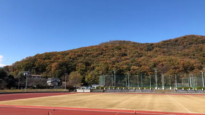
Yumurayama is a 446-meter mountain rising behind the Yumura hot-spring district in Kofu, Yamanashi Prefecture. In 1523 Takeda Nobutora built Yumurayama Castle on its summit, a vantage point over the Kofu Basin equipped with a signal-fire beacon. Footpaths climb from Midorigaoka Sports Park and Hosen-ji as well as from the Yumura spa, and the summit commands views of Mount Fuji and the Kofu Basin. It appears in Yamanashi's Hundred Hiking Courses and the Kofu Famous Mountains, among other lists.
Mt. Yumurayama at a glance
- Weather: The most settled day in the next 7 days is Wed, November 4: cloudy, gusts up to 5 m/s.
- Route: The shortest is Mount Yumura Return on a Path of Burial Mounds to a Warring-States Lookout Castle with a Rebuilt Beacon Tower: about 1 h 16 min, 3.8 km, about 150 m of climbing.
Mt. Yumurayama weather (hourly, 14 days)
Sunrise today 06:09, sunset 16:50
| Tue, 11/3 | Wed, 11/4 | Thu, 11/5 | Fri, 11/6 | Sat, 11/7 | Sun, 11/8 | Mon, 11/9 | Tue, 11/10 | Wed, 11/11 | Thu, 11/12 | Fri, 11/13 | Sat, 11/14 | Sun, 11/15 | Mon, 11/16 | Tue, 11/17 | |||||||||||||||||||||||||||||||||||||||||||||||||||||||||||||||||||||||
|---|---|---|---|---|---|---|---|---|---|---|---|---|---|---|---|---|---|---|---|---|---|---|---|---|---|---|---|---|---|---|---|---|---|---|---|---|---|---|---|---|---|---|---|---|---|---|---|---|---|---|---|---|---|---|---|---|---|---|---|---|---|---|---|---|---|---|---|---|---|---|---|---|---|---|---|---|---|---|---|---|---|---|---|---|---|
| Japan time | 15 | 17 | 19 | 21 | 23 | 1 | 3 | 5 | 7 | 9 | 11 | 13 | 15 | 18 | 21 | 0 | 3 | 6 | 9 | 12 | 15 | 18 | 21 | 0 | 3 | 6 | 9 | 12 | 15 | 18 | 21 | 0 | 3 | 6 | 9 | 12 | 15 | 18 | 21 | 0 | 3 | 6 | 9 | 12 | 15 | 18 | 21 | 0 | 3 | 6 | 9 | 15 | 21 | 3 | 9 | 15 | 21 | 3 | 9 | 15 | 21 | 3 | 9 | 15 | 21 | 3 | 9 | 15 | 21 | 3 | 9 | 15 | 21 | 3 | 9 | 15 | 21 | 3 | 9 | 15 | 21 | 3 | 9 | 15 | |
  |   | | | | |   | |   | | |   | | | | | |   |   | | | | |   | |   |  | | |  | | | | | | | | | | | | |   | | | | | |   | | | | | | | | | | | |   |  | | | | | | | | | | | | | | | | | | | | | | | ||
| Temperature | °C | 16° | 14° | 12° | 12° | 11° | 10° | 10° | 10° | 9° | 12° | 14° | 15° | 14° | 12° | 11° | 11° | 11° | 11° | 13° | 18° | 15° | 14° | 14° | 13° | 12° | 11° | 16° | 21° | 20° | 16° | 12° | 10° | 10° | 9° | 15° | 17° | 16° | 10° | 7° | 6° | 6° | 5° | 12° | 14° | 14° | 11° | 11° | 10° | 10° | 9° | 13° | 16° | 10° | 8° | 11° | 15° | 8° | 6° | 9° | 13° | 4° | 2° | 8° | 12° | 8° | 4° | 10° | 15° | 7° | 5° | 8° | 13° | 7° | 7° | 11° | 16° | 12° | 11° | 14° | 20° | 10° | 9° | 9° | 13° |
| Precipitation | mm | 0.1 | 0.5 | 2.3 | 4.6 | 3.2 | 0.7 | 4.9 | 8 | 6 | 0.4 | 1.8 | 1.1 | 0.1 | 0.2 | 0.1 | 7 | 5 | 0.3 | 0.2 | 0.3 | 0.7 | 0.8 | 0.1 | 8 | 19 | 0.1 | 0.1 | |||||||||||||||||||||||||||||||||||||||||||||||||||||||||
| New snow | cm | ||||||||||||||||||||||||||||||||||||||||||||||||||||||||||||||||||||||||||||||||||||
| Snow depth | cm | 0 | 0 | 0 | 0 | 0 | 0 | 0 | 0 | 0 | 0 | 0 | 0 | 0 | 0 | 0 | 0 | 0 | 0 | 0 | 0 | 0 | 0 | 0 | 0 | 0 | 0 | 0 | 0 | 0 | 0 | 0 | 0 | 0 | 0 | 0 | 0 | 0 | 0 | 0 | 0 | 0 | 0 | 0 | 0 | 0 | 0 | 0 | 0 | 0 | 0 | 0 | 0 | 0 | 0 | 0 | 0 | 0 | 0 | 0 | 0 | 0 | 0 | 0 | 0 | 0 | 0 | 0 | 0 | 0 | 0 | 0 | 0 | 0 | 0 | 0 | 0 | 0 | 0 | 0 | 0 | 0 | 0 | 0 | 0 |
| Wind | m/s | 1 | 0 | 1 | 1 | 1 | 1 | 1 | 1 | 1 | 1 | 1 | 1 | 1 | 1 | 1 | 0 | 0 | 0 | 0 | 1 | 0 | 1 | 0 | 1 | 1 | 1 | 1 | 1 | 1 | 1 | 1 | 1 | 1 | 2 | 3 | 4 | 3 | 2 | 2 | 2 | 2 | 2 | 1 | 1 | 1 | 2 | 2 | 2 | 2 | 2 | 2 | 2 | 2 | 3 | 2 | 2 | 2 | 2 | 0 | 2 | 0 | 1 | 1 | 1 | 1 | 1 | 1 | 1 | 1 | 0 | 1 | 0 | 1 | 0 | 1 | 1 | 2 | 2 | 1 | 3 | 0 | 1 | 1 | 1 |
| Wind gusts | m/s | 6 | 4 | 4 | 4 | 3 | 3 | 3 | 3 | 3 | 4 | 5 | 5 | 5 | 5 | 4 | 3 | 2 | 2 | 3 | 6 | 5 | 3 | 2 | 2 | 2 | 3 | 4 | 5 | 5 | 5 | 5 | 5 | 6 | 7 | 10 | 13 | 13 | 10 | 6 | 5 | 5 | 5 | 5 | 5 | 5 | 7 | 6 | 5 | 5 | 5 | 6 | 7 | 6 | 7 | 7 | 8 | 5 | 5 | 13 | 11 | 7 | 3 | 4 | 6 | 5 | 3 | 4 | 8 | 5 | 2 | 4 | 5 | 4 | 2 | 4 | 6 | 5 | 6 | 5 | 10 | 13 | 4 | 4 | 5 |
| Wind dir. | ↓ | ↓ | ↓ | ↓ | ↓ | ↓ | ↓ | ↓ | ↓ | ↓ | ↓ | ↓ | ↓ | ↓ | ↓ | ↓ | ↓ | ↓ | ↓ | ↓ | ↓ | ↓ | ↓ | ↓ | ↓ | ↓ | ↓ | ↓ | ↓ | ↓ | ↓ | ↓ | ↓ | ↓ | ↓ | ↓ | ↓ | ↓ | ↓ | ↓ | ↓ | ↓ | ↓ | ↓ | ↓ | ↓ | ↓ | ↓ | ↓ | ↓ | ↓ | ↓ | ↓ | ↓ | ↓ | ↓ | ↓ | ↓ | ↓ | ↓ | ↓ | ↓ | ↓ | ↓ | ↓ | ↓ | ↓ | ↓ | ↓ | ↓ | ↓ | ↓ | ↓ | ↓ | ↓ | ↓ | ↓ | ↓ | ↓ | ↓ | ↓ | ↓ | ↓ | ↓ | |
Mt. Yumurayama hiking routes
- Mount Yumura Return on a Path of Burial Mounds to a Warring-States Lookout Castle with a Rebuilt Beacon Tower 3.8 km · Ascent 153 m 法泉寺
- Mount Yumura from Nobutora's Lookout Castle along a Ridge of Burial Mounds to the Peak Called Hakusan 7.0 km · Ascent 500 m 法泉寺
Hiking times are estimates calculated from the terrain.
Huts, campsites and lodging near Mt. Yumurayama
Lodging
- 湯村ホテル別館
- 湯村ホテルB&B
- 甲府記念日ホテル
- 常磐ホテル
- 湯志摩の郷楽水園
Lists that include Mt. Yumurayama
Mt. Yumurayama facts
- Elevation
- 446 m
- Location
- Kofu, Yamanashi
35.683915, 138.552264 - Website
- yumura.org
- Trail Map
- www.city.kofu.yamanashi.jp (PDF)
- Wikipedia
- ja.wikipedia.org