
Mt. Daizokyojiyama
大蔵経寺山
Fuefuki, Yamanashi · Elevation 716 m
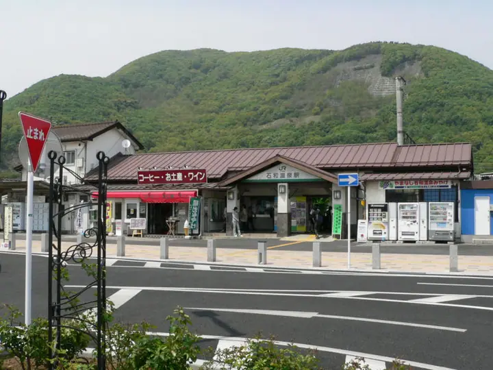
Mt. Daizōkyō-ji is a 715.6 m peak on the boundary between Kōfu and Fuefuki cities in Yamanashi Prefecture, at the southern end of the Oku-Chichibu range on the northern rim of the Kōfu Basin. Its name derives from Daizōkyō-ji, the Shingon-sect temple at its foot, and the trail starts a 10-minute walk from JR Isawa-Onsen Station. The first viewpoint on the trail is said to be the spot from which Katsushika Hokusai composed 'Kōshū Isawa no Akatsuki' in his Thirty-Six Views of Mt. Fuji; the summit area also gives an open prospect over the Kōfu Basin that is especially fine at night. The mountain features in the Yamanashi 100 Famous Mountains, the Kōfu Famous Mountains, the Kōshū 100 and the Yamanashi 100 Selected Hiking Courses — a beginner-friendly low mountain easily reached from the station.
Mt. Daizokyojiyama at a glance
- Weather: The most settled day in the next 7 days is Sun, November 8: clear, gusts up to 5 m/s.
Mt. Daizokyojiyama weather (hourly, 14 days)
Sunrise today 06:09, sunset 16:50
| Tue, 11/3 | Wed, 11/4 | Thu, 11/5 | Fri, 11/6 | Sat, 11/7 | Sun, 11/8 | Mon, 11/9 | Tue, 11/10 | Wed, 11/11 | Thu, 11/12 | Fri, 11/13 | Sat, 11/14 | Sun, 11/15 | Mon, 11/16 | Tue, 11/17 | |||||||||||||||||||||||||||||||||||||||||||||||||||||||||||||||||||||||
|---|---|---|---|---|---|---|---|---|---|---|---|---|---|---|---|---|---|---|---|---|---|---|---|---|---|---|---|---|---|---|---|---|---|---|---|---|---|---|---|---|---|---|---|---|---|---|---|---|---|---|---|---|---|---|---|---|---|---|---|---|---|---|---|---|---|---|---|---|---|---|---|---|---|---|---|---|---|---|---|---|---|---|---|---|---|
| Japan time | 15 | 17 | 19 | 21 | 23 | 1 | 3 | 5 | 7 | 9 | 11 | 13 | 15 | 18 | 21 | 0 | 3 | 6 | 9 | 12 | 15 | 18 | 21 | 0 | 3 | 6 | 9 | 12 | 15 | 18 | 21 | 0 | 3 | 6 | 9 | 12 | 15 | 18 | 21 | 0 | 3 | 6 | 9 | 12 | 15 | 18 | 21 | 0 | 3 | 6 | 9 | 15 | 21 | 3 | 9 | 15 | 21 | 3 | 9 | 15 | 21 | 3 | 9 | 15 | 21 | 3 | 9 | 15 | 21 | 3 | 9 | 15 | 21 | 3 | 9 | 15 | 21 | 3 | 9 | 15 | 21 | 3 | 9 | 15 | |
  |   |   | | | | | |   | | | | | | | | | |   |   |   |   | |   | | |  | | |  | | | | | | | | | |   | | | | | | | | | | | | | | | | | |   | | |   |  | | | | | | | | | | | | | | | | | | | | | | | ||
| Temperature | °C | 14° | 11° | 10° | 9° | 9° | 8° | 8° | 8° | 8° | 10° | 12° | 12° | 10° | 8° | 8° | 8° | 9° | 9° | 12° | 16° | 13° | 12° | 11° | 10° | 10° | 10° | 14° | 18° | 18° | 13° | 10° | 8° | 6° | 4° | 11° | 13° | 12° | 6° | 3° | 4° | 4° | 3° | 9° | 12° | 12° | 8° | 8° | 6° | 6° | 6° | 9° | 12° | 6° | 5° | 8° | 12° | 5° | 3° | 6° | 10° | 1° | 1° | 6° | 10° | 6° | 2° | 8° | 12° | 4° | 3° | 6° | 11° | 5° | 5° | 9° | 13° | 9° | 9° | 12° | 18° | 7° | 6° | 7° | 10° |
| Precipitation | mm | 1.0 | 2.0 | 2.4 | 0.5 | 0.4 | 5 | 10 | 9 | 0.7 | 1.8 | 1.5 | 0.1 | 0.1 | 0.2 | 2.8 | 2.4 | 0.2 | 7 | 21 | 0.2 | ||||||||||||||||||||||||||||||||||||||||||||||||||||||||||||||||
| New snow | cm | ||||||||||||||||||||||||||||||||||||||||||||||||||||||||||||||||||||||||||||||||||||
| Snow depth | cm | 0 | 0 | 0 | 0 | 0 | 0 | 0 | 0 | 0 | 0 | 0 | 0 | 0 | 0 | 0 | 0 | 0 | 0 | 0 | 0 | 0 | 0 | 0 | 0 | 0 | 0 | 0 | 0 | 0 | 0 | 0 | 0 | 0 | 0 | 0 | 0 | 0 | 0 | 0 | 0 | 0 | 0 | 0 | 0 | 0 | 0 | 0 | 0 | 0 | 0 | 0 | 0 | 0 | 0 | 0 | 0 | 0 | 0 | 0 | 0 | 0 | 0 | 0 | 0 | 0 | 0 | 0 | 0 | 0 | 0 | 0 | 0 | 0 | 0 | 0 | 0 | 0 | 0 | 0 | 0 | 0 | 0 | 0 | 0 |
| Wind | m/s | 1 | 1 | 2 | 2 | 2 | 2 | 2 | 2 | 2 | 2 | 2 | 2 | 3 | 3 | 2 | 1 | 1 | 1 | 1 | 0 | 0 | 1 | 1 | 0 | 1 | 1 | 1 | 1 | 1 | 1 | 1 | 1 | 1 | 1 | 1 | 3 | 3 | 3 | 2 | 2 | 2 | 2 | 1 | 1 | 1 | 3 | 2 | 3 | 3 | 2 | 3 | 2 | 3 | 4 | 3 | 2 | 2 | 2 | 2 | 3 | 0 | 1 | 1 | 2 | 1 | 0 | 2 | 2 | 0 | 0 | 0 | 1 | 1 | 0 | 2 | 2 | 2 | 1 | 1 | 4 | 0 | 1 | 1 | 2 |
| Wind gusts | m/s | 6 | 5 | 6 | 6 | 6 | 5 | 5 | 5 | 5 | 6 | 6 | 7 | 7 | 8 | 7 | 6 | 5 | 5 | 4 | 5 | 5 | 3 | 2 | 2 | 2 | 3 | 4 | 6 | 6 | 4 | 3 | 3 | 4 | 5 | 7 | 10 | 10 | 7 | 6 | 6 | 5 | 4 | 4 | 5 | 5 | 8 | 7 | 6 | 6 | 6 | 7 | 8 | 9 | 10 | 9 | 9 | 6 | 5 | 15 | 13 | 8 | 2 | 4 | 7 | 6 | 3 | 6 | 9 | 7 | 2 | 4 | 5 | 4 | 2 | 5 | 7 | 5 | 8 | 4 | 12 | 13 | 3 | 5 | 6 |
| Wind dir. | ↓ | ↓ | ↓ | ↓ | ↓ | ↓ | ↓ | ↓ | ↓ | ↓ | ↓ | ↓ | ↓ | ↓ | ↓ | ↓ | ↓ | ↓ | ↓ | ↓ | ↓ | ↓ | ↓ | ↓ | ↓ | ↓ | ↓ | ↓ | ↓ | ↓ | ↓ | ↓ | ↓ | ↓ | ↓ | ↓ | ↓ | ↓ | ↓ | ↓ | ↓ | ↓ | ↓ | ↓ | ↓ | ↓ | ↓ | ↓ | ↓ | ↓ | ↓ | ↓ | ↓ | ↓ | ↓ | ↓ | ↓ | ↓ | ↓ | ↓ | ↓ | ↓ | ↓ | ↓ | ↓ | ↓ | ↓ | ↓ | ↓ | ↓ | ↓ | ↓ | ↓ | ↓ | ↓ | ↓ | ↓ | ↓ | ↓ | ↓ | ↓ | ↓ | ↓ | ↓ | |
Huts, campsites and lodging near Mt. Daizokyojiyama
Campsites
- ほったらかしキャンプ場
- ダイノジ⑥
- ダイノジ⑧
- ダイノジ②
- ダイノジ③
Lodging
- 旅館 日の出温泉
- ホテル 花いさわ
- シャトレーゼホテル 石和
- 石和温泉ユースホステル (Isawa Onsen youth hostel)
- 石和名湯館 糸柳
Lists that include Mt. Daizokyojiyama
Mt. Daizokyojiyama facts
- Elevation
- 716 m
- Location
- Fuefuki, Yamanashi
35.668916, 138.626127 - Website
- www.city.kofu.yamanashi.jp
- Trail Map
- www.pref.yamanashi.jp (PDF)
- Access Information
- yamanashi-hiking100.jp
- Wikipedia
- ja.wikipedia.org