
Mt. Yōgaisan
要害山
Kofu, Yamanashi · Elevation 780 m
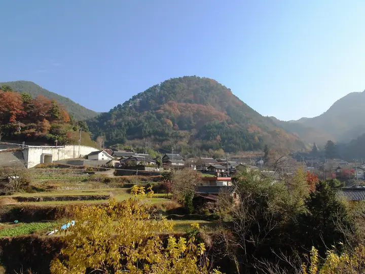
Yōgaisan is a 780-meter peak in Kamisekisuiji, Kōfu City, Yamanashi Prefecture, occupied by the ruins of Yōgaisanjō, the mountain castle built in 1520 by Takeda Nobutora and traditionally regarded as the birthplace of Takeda Shingen. The summit area was designated a National Historic Site in 1991 and named one of the Continued Top 100 Japanese Castles (No. 128). It is included in the Yamanashi 100 and Kōfu Famous Mountains lists, and the Yōgaisan–Fukakusa Kannon historical loop is one of the Yamanashi Hiking 100 Courses.
Mt. Yōgaisan at a glance
- Weather: The most settled day in the next 7 days is Sun, November 8: clear, gusts up to 6 m/s. Sat, Nov 7: strong wind (gusts up to 16 m/s).
- Route: The shortest is Mount Yogai and Yogai Castle Ruins Return from Old Yogai Onsen: about 1 h 10 min, 1.7 km, about 220 m of climbing.
Mt. Yōgaisan weather (hourly, 14 days)
Sunrise today 06:09, sunset 16:50
| Tue, 11/3 | Wed, 11/4 | Thu, 11/5 | Fri, 11/6 | Sat, 11/7 | Sun, 11/8 | Mon, 11/9 | Tue, 11/10 | Wed, 11/11 | Thu, 11/12 | Fri, 11/13 | Sat, 11/14 | Sun, 11/15 | Mon, 11/16 | Tue, 11/17 | |||||||||||||||||||||||||||||||||||||||||||||||||||||||||||||||||||||||
|---|---|---|---|---|---|---|---|---|---|---|---|---|---|---|---|---|---|---|---|---|---|---|---|---|---|---|---|---|---|---|---|---|---|---|---|---|---|---|---|---|---|---|---|---|---|---|---|---|---|---|---|---|---|---|---|---|---|---|---|---|---|---|---|---|---|---|---|---|---|---|---|---|---|---|---|---|---|---|---|---|---|---|---|---|---|
| Japan time | 15 | 17 | 19 | 21 | 23 | 1 | 3 | 5 | 7 | 9 | 11 | 13 | 15 | 18 | 21 | 0 | 3 | 6 | 9 | 12 | 15 | 18 | 21 | 0 | 3 | 6 | 9 | 12 | 15 | 18 | 21 | 0 | 3 | 6 | 9 | 12 | 15 | 18 | 21 | 0 | 3 | 6 | 9 | 12 | 15 | 18 | 21 | 0 | 3 | 6 | 9 | 15 | 21 | 3 | 9 | 15 | 21 | 3 | 9 | 15 | 21 | 3 | 9 | 15 | 21 | 3 | 9 | 15 | 21 | 3 | 9 | 15 | 21 | 3 | 9 | 15 | 21 | 3 | 9 | 15 | 21 | 3 | 9 | 15 | |
  |   |   | | | | |   |   |   | | |   | | | | | |   | |   | |   |  |   | |  | | | | | | | | | | | | | | | | | | | | | | | | | | | | | | |   | | | |  | | | | | | | | | | | | | | | | | | | | | | | ||
| Temperature | °C | 15° | 12° | 11° | 11° | 10° | 10° | 10° | 9° | 9° | 12° | 14° | 14° | 13° | 11° | 11° | 11° | 11° | 11° | 14° | 18° | 15° | 13° | 14° | 13° | 11° | 11° | 17° | 22° | 21° | 15° | 12° | 11° | 10° | 9° | 13° | 15° | 14° | 8° | 5° | 5° | 5° | 4° | 12° | 14° | 13° | 9° | 10° | 9° | 9° | 9° | 12° | 14° | 9° | 8° | 10° | 13° | 7° | 5° | 9° | 12° | 3° | 2° | 8° | 11° | 8° | 3° | 11° | 14° | 5° | 4° | 9° | 11° | 6° | 6° | 11° | 14° | 11° | 11° | 16° | 19° | 9° | 7° | 9° | 11° |
| Precipitation | mm | 0.2 | 2.7 | 1.4 | 1.1 | 0.2 | 0.1 | 0.1 | 4.6 | 8 | 5 | 0.3 | 2.0 | 0.2 | 0.1 | 0.5 | 4.5 | 5 | 2.1 | 0.1 | 0.9 | 0.2 | 7 | 14 | |||||||||||||||||||||||||||||||||||||||||||||||||||||||||||||
| New snow | cm | ||||||||||||||||||||||||||||||||||||||||||||||||||||||||||||||||||||||||||||||||||||
| Snow depth | cm | 0 | 0 | 0 | 0 | 0 | 0 | 0 | 0 | 0 | 0 | 0 | 0 | 0 | 0 | 0 | 0 | 0 | 0 | 0 | 0 | 0 | 0 | 0 | 0 | 0 | 0 | 0 | 0 | 0 | 0 | 0 | 0 | 0 | 0 | 0 | 0 | 0 | 0 | 0 | 0 | 0 | 0 | 0 | 0 | 0 | 0 | 0 | 0 | 0 | 0 | 0 | 0 | 0 | 0 | 0 | 0 | 0 | 0 | 0 | 0 | 0 | 0 | 0 | 0 | 0 | 0 | 0 | 0 | 0 | 0 | 0 | 0 | 0 | 0 | 0 | 0 | 0 | 0 | 0 | 0 | 0 | 0 | 0 | 0 |
| Wind | m/s | 2 | 0 | 1 | 1 | 1 | 1 | 0 | 1 | 1 | 1 | 1 | 1 | 1 | 1 | 1 | 0 | 0 | 1 | 0 | 2 | 1 | 1 | 1 | 1 | 1 | 2 | 1 | 2 | 1 | 4 | 4 | 4 | 4 | 5 | 6 | 6 | 5 | 3 | 2 | 2 | 2 | 2 | 1 | 1 | 2 | 2 | 2 | 2 | 2 | 2 | 2 | 2 | 2 | 2 | 3 | 2 | 2 | 3 | 4 | 4 | 2 | 1 | 1 | 2 | 0 | 2 | 1 | 2 | 2 | 1 | 1 | 1 | 1 | 1 | 1 | 2 | 1 | 1 | 1 | 6 | 3 | 2 | 1 | 1 |
| Wind gusts | m/s | 7 | 6 | 3 | 3 | 3 | 3 | 3 | 2 | 2 | 4 | 5 | 5 | 5 | 4 | 4 | 3 | 3 | 3 | 4 | 6 | 6 | 4 | 3 | 3 | 4 | 6 | 6 | 8 | 7 | 10 | 10 | 11 | 12 | 14 | 15 | 16 | 16 | 13 | 8 | 6 | 5 | 5 | 5 | 6 | 6 | 6 | 5 | 5 | 4 | 4 | 6 | 7 | 6 | 5 | 8 | 9 | 6 | 8 | 18 | 15 | 11 | 6 | 4 | 6 | 5 | 5 | 6 | 11 | 8 | 4 | 4 | 6 | 4 | 3 | 4 | 6 | 5 | 5 | 4 | 17 | 17 | 8 | 5 | 6 |
| Wind dir. | ↓ | ↓ | ↓ | ↓ | ↓ | ↓ | ↓ | ↓ | ↓ | ↓ | ↓ | ↓ | ↓ | ↓ | ↓ | ↓ | ↓ | ↓ | ↓ | ↓ | ↓ | ↓ | ↓ | ↓ | ↓ | ↓ | ↓ | ↓ | ↓ | ↓ | ↓ | ↓ | ↓ | ↓ | ↓ | ↓ | ↓ | ↓ | ↓ | ↓ | ↓ | ↓ | ↓ | ↓ | ↓ | ↓ | ↓ | ↓ | ↓ | ↓ | ↓ | ↓ | ↓ | ↓ | ↓ | ↓ | ↓ | ↓ | ↓ | ↓ | ↓ | ↓ | ↓ | ↓ | ↓ | ↓ | ↓ | ↓ | ↓ | ↓ | ↓ | ↓ | ↓ | ↓ | ↓ | ↓ | ↓ | ↓ | ↓ | ↓ | ↓ | ↓ | ↓ | ↓ | |
Mt. Yōgaisan hiking routes
Hiking times are estimates calculated from the terrain.
Huts, campsites and lodging near Mt. Yōgaisan
Campsites
- ほったらかしキャンプ場
- 頂上サイト②
- デッキサイト③
- デッキサイト②
- 頂上サイト①
Lodging
- (Kofu Highland youth hostel)
- ビジネスホテル日商
- ホテルニューステーション
- Hotel Crown Hills Koufu
- 城のホテル
Lists that include Mt. Yōgaisan
Mt. Yōgaisan facts
- Also known as
- 要害山城跡 · 丸山
- Elevation
- 780 m
- Location
- Kofu, Yamanashi
35.703075, 138.598537 - Website
- www.city.kofu.yamanashi.jp
- Trail Map
- www.rinya.maff.go.jp (PDF)
- Access Information
- yamanashi-hiking100.jp
- Wikipedia
- ja.wikipedia.org