
Mt. Sanjōgatake
山上ヶ岳
Tenkawa, Nara · Elevation 1,719 m
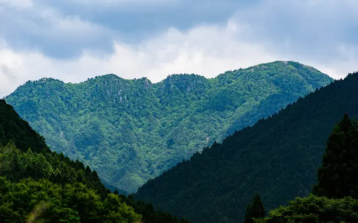
Sanjōgatake is the 1,719 m principal sacred peak of the Mt. Ōmine massif, in Tenkawa Village, Yoshino District, Nara Prefecture, and the historical birthplace of Shugendō Buddhist mountain asceticism. Said to have been opened by the seventh-century ascetic En no Gyōja, its summit is crowned by Ōminesan-ji — a component of the UNESCO World Heritage Sacred Sites and Pilgrimage Routes in the Kii Mountain Range. The temple opens with the Tobiraki-shiki ceremony on 3 May and closes with the Tojime-shiki ceremony on 23 September each year, and the mountain is one of the very few in Japan still upholding the traditional Nyonin Kinsei (women's prohibition) within its sacred core. It lies within Yoshino-Kumano National Park, sits on the Ōmine Okugake-michi pilgrimage route, and is listed in the Japanese 300 Famous Mountains, the Hundred First-Order Triangulation Mountains, and the Kansai 100, among others.
Mt. Sanjōgatake at a glance
- Weather: The most settled day in the next 7 days is Mon, November 9: clear, gusts up to 10 m/s. Fri, Nov 6, Sat, Nov 7: strong wind (gusts up to 19 m/s).
- Route: The shortest is Mount Sanjogatake and Renge Pass Loop from Shojo Bridge: about 5 h 46 min, 9.4 km, about 880 m of climbing.
Mt. Sanjōgatake weather (hourly, 14 days)
Sunrise today 06:17, sunset 17:03
| Tue, 11/3 | Wed, 11/4 | Thu, 11/5 | Fri, 11/6 | Sat, 11/7 | Sun, 11/8 | Mon, 11/9 | Tue, 11/10 | Wed, 11/11 | Thu, 11/12 | Fri, 11/13 | Sat, 11/14 | Sun, 11/15 | Mon, 11/16 | Tue, 11/17 | |||||||||||||||||||||||||||||||||||||||||||||||||||||||||||||||||||||||
|---|---|---|---|---|---|---|---|---|---|---|---|---|---|---|---|---|---|---|---|---|---|---|---|---|---|---|---|---|---|---|---|---|---|---|---|---|---|---|---|---|---|---|---|---|---|---|---|---|---|---|---|---|---|---|---|---|---|---|---|---|---|---|---|---|---|---|---|---|---|---|---|---|---|---|---|---|---|---|---|---|---|---|---|---|---|
| Japan time | 15 | 17 | 19 | 21 | 23 | 1 | 3 | 5 | 7 | 9 | 11 | 13 | 15 | 18 | 21 | 0 | 3 | 6 | 9 | 12 | 15 | 18 | 21 | 0 | 3 | 6 | 9 | 12 | 15 | 18 | 21 | 0 | 3 | 6 | 9 | 12 | 15 | 18 | 21 | 0 | 3 | 6 | 9 | 12 | 15 | 18 | 21 | 0 | 3 | 6 | 9 | 15 | 21 | 3 | 9 | 15 | 21 | 3 | 9 | 15 | 21 | 3 | 9 | 15 | 21 | 3 | 9 | 15 | 21 | 3 | 9 | 15 | 21 | 3 | 9 | 15 | 21 | 3 | 9 | 15 | 21 | 3 | 9 | 15 | |
  | |   |   | | | | | |   |   | |   |   | | | |   | |   | | | | | | | | | |   | |   | | | | | | | | | | | | | | | | | | |  | | | | | | | |   | |   |  | | | | | | | | | | | | | | | | | | | | | | | ||
| Temperature | °C | 8° | 5° | 3° | 3° | 2° | 2° | 2° | 1° | 2° | 8° | 11° | 10° | 8° | 6° | 6° | 7° | 7° | 7° | 11° | 13° | 14° | 9° | 8° | 8° | 10° | 8° | 7° | 9° | 9° | 6° | 3° | 2° | 0° | -1° | 2° | 3° | 3° | 0° | -2° | -3° | -2° | -2° | 3° | 6° | 5° | 0° | 1° | 1° | 1° | 1° | 6° | 6° | 0° | 0° | 5° | 6° | 1° | -2° | -1° | 2° | -3° | -4° | 2° | 5° | -1° | -2° | 1° | 3° | -3° | -3° | 5° | 9° | 0° | 2° | 7° | 8° | 8° | 9° | 8° | 7° | 1° | -2° | 0° | 5° |
| Precipitation | mm | 0.1 | 0.3 | 0.3 | 0.3 | 0.1 | 0.8 | 0.4 | 0.3 | 3.1 | 1.1 | 1.0 | 0.1 | 0.1 | 0.3 | 0.4 | 0.3 | 1.1 | 0.3 | 0.2 | 0.1 | 0.9 | 1.2 | 3.2 | 8 | 1.1 | 4.3 | 1.8 | 0.2 | ||||||||||||||||||||||||||||||||||||||||||||||||||||||||
| New snow | cm | ||||||||||||||||||||||||||||||||||||||||||||||||||||||||||||||||||||||||||||||||||||
| Snow depth | cm | 0 | 0 | 0 | 0 | 0 | 0 | 0 | 0 | 0 | 0 | 0 | 0 | 0 | 0 | 0 | 0 | 0 | 0 | 0 | 0 | 0 | 0 | 0 | 0 | 0 | 0 | 0 | 0 | 0 | 0 | 0 | 0 | 0 | 0 | 0 | 0 | 0 | 0 | 0 | 0 | 0 | 0 | 0 | 0 | 0 | 0 | 0 | 0 | 0 | 0 | 0 | 0 | 0 | 0 | 0 | 0 | 0 | 0 | 0 | 0 | 0 | 0 | 0 | 0 | 0 | 0 | 0 | 0 | 0 | 0 | 0 | 0 | 0 | 0 | 0 | 0 | 0 | 0 | 0 | 0 | 0 | 0 | 0 | 0 |
| Wind | m/s | 3 | 1 | 1 | 1 | 1 | 1 | 2 | 1 | 1 | 1 | 2 | 2 | 3 | 3 | 3 | 2 | 2 | 1 | 1 | 1 | 1 | 1 | 2 | 2 | 3 | 4 | 3 | 4 | 5 | 4 | 4 | 4 | 4 | 4 | 6 | 6 | 6 | 4 | 3 | 2 | 3 | 3 | 3 | 3 | 2 | 1 | 0 | 0 | 0 | 0 | 2 | 2 | 0 | 0 | 1 | 3 | 3 | 5 | 6 | 7 | 3 | 1 | 2 | 2 | 0 | 1 | 4 | 5 | 2 | 0 | 1 | 1 | 1 | 2 | 3 | 3 | 5 | 2 | 3 | 5 | 5 | 2 | 2 | 2 |
| Wind gusts | m/s | 9 | 8 | 5 | 5 | 4 | 4 | 5 | 6 | 5 | 5 | 7 | 7 | 8 | 9 | 10 | 11 | 9 | 8 | 5 | 5 | 5 | 5 | 8 | 10 | 13 | 12 | 14 | 14 | 16 | 15 | 14 | 15 | 15 | 15 | 18 | 19 | 19 | 17 | 14 | 12 | 11 | 12 | 11 | 11 | 9 | 8 | 4 | 3 | 3 | 4 | 7 | 10 | 8 | 4 | 5 | 10 | 11 | 18 | 21 | 22 | 19 | 10 | 6 | 8 | 7 | 8 | 13 | 16 | 14 | 8 | 6 | 6 | 6 | 8 | 11 | 12 | 17 | 17 | 11 | 15 | 16 | 15 | 8 | 8 |
| Wind dir. | ↓ | ↓ | ↓ | ↓ | ↓ | ↓ | ↓ | ↓ | ↓ | ↓ | ↓ | ↓ | ↓ | ↓ | ↓ | ↓ | ↓ | ↓ | ↓ | ↓ | ↓ | ↓ | ↓ | ↓ | ↓ | ↓ | ↓ | ↓ | ↓ | ↓ | ↓ | ↓ | ↓ | ↓ | ↓ | ↓ | ↓ | ↓ | ↓ | ↓ | ↓ | ↓ | ↓ | ↓ | ↓ | ↓ | ↓ | ↓ | ↓ | ↓ | ↓ | ↓ | ↓ | ↓ | ↓ | ↓ | ↓ | ↓ | ↓ | ↓ | ↓ | ↓ | ↓ | ↓ | ↓ | ↓ | ↓ | ↓ | ↓ | ↓ | ↓ | ↓ | ↓ | ↓ | ↓ | ↓ | ↓ | ↓ | ↓ | ↓ | ↓ | ↓ | ↓ | ↓ | |
Mt. Sanjōgatake hiking routes
- Mount Sanjogatake and Renge Pass Loop from Shojo Bridge 9.4 km · Ascent 878 m
- Tenkawa Omine Sanjogatake to Inamuragatake, the Women's Omine, Loop by Dorotsuji, Renge-tsuji and Horiki Pass 16.2 km · Ascent 1,237 m
Hiking times are estimates calculated from the terrain.
Huts, campsites and lodging near Mt. Sanjōgatake
Mountain huts
Lists that include Mt. Sanjōgatake
Japan's 300 Famous Mountains · 100 Famous Mountains with First-order Triangulation Points · Illustrated Collection of Japan's Famous Mountains · Kansai 100 Famous Mountains · Kinki 100 Famous Mountains · Ōmine Okugakemichi · Elevations of 1003 Mountains of Japan · 1000 Mountains of Japan
Mt. Sanjōgatake facts
- Elevation
- 1,719 m
- Location
- Tenkawa, Nara
34.252415, 135.941048 - National Park
- 吉野熊野国立公園
- Season Opens
- May 3
- Season Closes
- September 23
- Website
- www.vill.tenkawa.nara.jp
- Trail Map
- www.vill.tenkawa.nara.jp (PDF)
- Wikipedia
- ja.wikipedia.org