
Mt. Aonegamine
青根ヶ峰
Yoshino, Nara / Kurotaki, Nara / Kawakami, Nara · Elevation 858 m
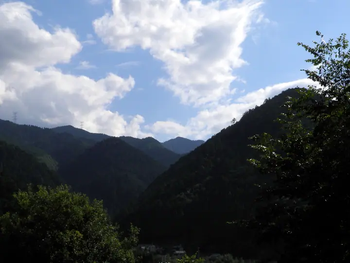
Mt. Aonegamine (858.1 m) is the highest peak of the Yoshino range, rising at its southern end in Yoshino Town, Yoshino District, Nara Prefecture. Sitting on the northern fringe of the Omine Mountains, it is crossed near the summit by the Omine Okugake-michi pilgrimage route — part of the UNESCO World Heritage "Sacred Sites and Pilgrimage Routes in the Kii Mountain Range" — and has long been venerated as a sacred mountain because four rivers rise from its slopes. The peak lies within Yoshino-Kumano National Park and is included in lists such as the Kansai Hyakumeizan, Nihon Hyaku-teizan and Nara Hyakuyūzan.
Mt. Aonegamine at a glance
- Weather: The most settled day in the next 7 days is Mon, November 9: clear, gusts up to 6 m/s.
Mt. Aonegamine weather (hourly, 14 days)
Sunrise today 06:18, sunset 17:03
| Tue, 11/3 | Wed, 11/4 | Thu, 11/5 | Fri, 11/6 | Sat, 11/7 | Sun, 11/8 | Mon, 11/9 | Tue, 11/10 | Wed, 11/11 | Thu, 11/12 | Fri, 11/13 | Sat, 11/14 | Sun, 11/15 | Mon, 11/16 | Tue, 11/17 | |||||||||||||||||||||||||||||||||||||||||||||||||||||||||||||||||||||||
|---|---|---|---|---|---|---|---|---|---|---|---|---|---|---|---|---|---|---|---|---|---|---|---|---|---|---|---|---|---|---|---|---|---|---|---|---|---|---|---|---|---|---|---|---|---|---|---|---|---|---|---|---|---|---|---|---|---|---|---|---|---|---|---|---|---|---|---|---|---|---|---|---|---|---|---|---|---|---|---|---|---|---|---|---|---|
| Japan time | 21 | 23 | 1 | 3 | 5 | 7 | 9 | 11 | 13 | 15 | 17 | 19 | 21 | 0 | 3 | 6 | 9 | 12 | 15 | 18 | 21 | 0 | 3 | 6 | 9 | 12 | 15 | 18 | 21 | 0 | 3 | 6 | 9 | 12 | 15 | 18 | 21 | 0 | 3 | 6 | 9 | 12 | 15 | 18 | 21 | 0 | 3 | 6 | 9 | 12 | 15 | 21 | 3 | 9 | 15 | 21 | 3 | 9 | 15 | 21 | 3 | 9 | 15 | 21 | 3 | 9 | 15 | 21 | 3 | 9 | 15 | 21 | 3 | 9 | 15 | 21 | 3 | 9 | 15 | 21 | 3 | 9 | 15 | 21 | |
  | |  | |   |   | |   |   | | |   | | | |   | |   |   | |   | |   | |   | | |  | | | | | | | | | | | | | |  | | | | | | | | | | | | | | | | | |   |  | | | | | | | | | | | | | | | | | | | |  | | | | ||
| Temperature | °C | 8° | 6° | 6° | 5° | 5° | 7° | 11° | 12° | 13° | 13° | 11° | 11° | 10° | 10° | 10° | 10° | 14° | 16° | 17° | 13° | 12° | 13° | 12° | 11° | 11° | 14° | 14° | 10° | 8° | 7° | 5° | 4° | 7° | 8° | 8° | 5° | 3° | 2° | 2° | 2° | 5° | 9° | 8° | 5° | 5° | 5° | 6° | 6° | 8° | 11° | 11° | 5° | 3° | 9° | 11° | 6° | 3° | 5° | 7° | 3° | 1° | 6° | 8° | 2° | 3° | 6° | 8° | 3° | 0° | 8° | 12° | 1° | 3° | 12° | 13° | 11° | 11° | 12° | 12° | 6° | 3° | 5° | 8° | 1° |
| Precipitation | mm | 0.5 | 0.2 | 0.2 | 0.1 | 0.4 | 2.2 | 2.1 | 1.0 | 0.6 | 0.1 | 0.1 | 0.2 | 1.0 | 0.1 | 0.5 | 0.5 | 1.8 | 16 | 1.1 | 2.9 | 1.1 | |||||||||||||||||||||||||||||||||||||||||||||||||||||||||||||||
| New snow | cm | ||||||||||||||||||||||||||||||||||||||||||||||||||||||||||||||||||||||||||||||||||||
| Snow depth | cm | 0 | 0 | 0 | 0 | 0 | 0 | 0 | 0 | 0 | 0 | 0 | 0 | 0 | 0 | 0 | 0 | 0 | 0 | 0 | 0 | 0 | 0 | 0 | 0 | 0 | 0 | 0 | 0 | 0 | 0 | 0 | 0 | 0 | 0 | 0 | 0 | 0 | 0 | 0 | 0 | 0 | 0 | 0 | 0 | 0 | 0 | 0 | 0 | 0 | 0 | 0 | 0 | 0 | 0 | 0 | 0 | 0 | 0 | 0 | 0 | 0 | 0 | 0 | 0 | 0 | 0 | 0 | 0 | 0 | 0 | 0 | 0 | 0 | 0 | 0 | 0 | 0 | 0 | 0 | 0 | 0 | 0 | 0 | 0 |
| Wind | m/s | 0 | 1 | 1 | 1 | 1 | 2 | 2 | 2 | 2 | 2 | 1 | 2 | 1 | 1 | 1 | 1 | 0 | 1 | 2 | 0 | 2 | 3 | 3 | 2 | 4 | 5 | 5 | 3 | 2 | 3 | 3 | 1 | 4 | 5 | 5 | 3 | 1 | 1 | 0 | 0 | 1 | 3 | 2 | 0 | 1 | 0 | 0 | 0 | 1 | 2 | 1 | 1 | 1 | 2 | 3 | 2 | 4 | 3 | 5 | 0 | 0 | 1 | 2 | 1 | 2 | 2 | 4 | 0 | 1 | 0 | 2 | 1 | 2 | 1 | 2 | 2 | 2 | 3 | 4 | 3 | 0 | 1 | 2 | 1 |
| Wind gusts | m/s | 2 | 2 | 3 | 3 | 3 | 4 | 5 | 5 | 6 | 7 | 6 | 5 | 5 | 4 | 4 | 3 | 4 | 3 | 6 | 5 | 5 | 8 | 9 | 9 | 10 | 12 | 13 | 11 | 7 | 8 | 8 | 7 | 11 | 13 | 13 | 13 | 7 | 4 | 4 | 3 | 5 | 8 | 8 | 6 | 2 | 2 | 2 | 1 | 3 | 6 | 6 | 7 | 3 | 5 | 8 | 7 | 10 | 11 | 15 | 13 | 2 | 4 | 7 | 5 | 5 | 7 | 12 | 10 | 2 | 3 | 7 | 5 | 5 | 5 | 5 | 8 | 7 | 7 | 11 | 11 | 7 | 4 | 7 | 5 |
| Wind dir. | ↓ | ↓ | ↓ | ↓ | ↓ | ↓ | ↓ | ↓ | ↓ | ↓ | ↓ | ↓ | ↓ | ↓ | ↓ | ↓ | ↓ | ↓ | ↓ | ↓ | ↓ | ↓ | ↓ | ↓ | ↓ | ↓ | ↓ | ↓ | ↓ | ↓ | ↓ | ↓ | ↓ | ↓ | ↓ | ↓ | ↓ | ↓ | ↓ | ↓ | ↓ | ↓ | ↓ | ↓ | ↓ | ↓ | ↓ | ↓ | ↓ | ↓ | ↓ | ↓ | ↓ | ↓ | ↓ | ↓ | ↓ | ↓ | ↓ | ↓ | ↓ | ↓ | ↓ | ↓ | ↓ | ↓ | ↓ | ↓ | ↓ | ↓ | ↓ | ↓ | ↓ | ↓ | ↓ | ↓ | ↓ | ↓ | ↓ | ↓ | ↓ | ↓ | ↓ | ↓ | |
Huts, campsites and lodging near Mt. Aonegamine
Lodging
- Chikurin-in
- Chikurin-in Gumpo-en West Wing
- Hounkan
- Ikkyu-an
- Ohkadan
Lists that include Mt. Aonegamine
100 Low Mountains of Japan · Illustrated Collection of Japan's Famous Mountains · Kansai 100 Famous Mountains · Nara 100 Mountains to Explore
Mt. Aonegamine facts
- Also known as
- 吉野山最高峰 · 吉野水分峯
- Elevation
- 858 m
- Location
- Yoshino, Nara / Kurotaki, Nara / Kawakami, Nara
34.341390, 135.887945 - National Park
- 吉野熊野国立公園
- Website
- www.pref.nara.lg.jp
- Wikipedia
- ja.wikipedia.org