
Mt. Ootenjougatake
大天井ヶ岳
Tenkawa, Nara · Elevation 1,439 m
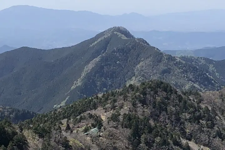
Ōtenjōgatake is a 1,438.98 m peak where the three villages of Tenkawa, Kurotaki and Kawakami meet in Yoshino District, Nara Prefecture, marking the highest point on the northern (Yoshino–Sanjōgatake) stretch of the Ōmine Okugakemichi pilgrim trail — a component of the UNESCO World Heritage "Sacred Sites and Pilgrimage Routes in the Kii Mountain Range". The ridge running south crosses the Gobanseki Gate, traditional entrance to the women-prohibited Sanjōgatake section, and the small Nisō-shuku shelter lies on the northern ridge. The peak appears on regional lists such as the "Nara Hyaku-Yūzan", "Kansai-shūhen no Yama 130" and the "Kōbō-Daishi-no-Michi".
Mt. Ootenjougatake at a glance
- Weather: The most settled day in the next 7 days is Mon, November 9: clear, gusts up to 10 m/s. Fri, Nov 6, Sat, Nov 7: strong wind (gusts up to 19 m/s).
Mt. Ootenjougatake weather (hourly, 14 days)
Sunrise today 06:17, sunset 17:03
| Tue, 11/3 | Wed, 11/4 | Thu, 11/5 | Fri, 11/6 | Sat, 11/7 | Sun, 11/8 | Mon, 11/9 | Tue, 11/10 | Wed, 11/11 | Thu, 11/12 | Fri, 11/13 | Sat, 11/14 | Sun, 11/15 | Mon, 11/16 | Tue, 11/17 | |||||||||||||||||||||||||||||||||||||||||||||||||||||||||||||||||||||||
|---|---|---|---|---|---|---|---|---|---|---|---|---|---|---|---|---|---|---|---|---|---|---|---|---|---|---|---|---|---|---|---|---|---|---|---|---|---|---|---|---|---|---|---|---|---|---|---|---|---|---|---|---|---|---|---|---|---|---|---|---|---|---|---|---|---|---|---|---|---|---|---|---|---|---|---|---|---|---|---|---|---|---|---|---|---|
| Japan time | 15 | 17 | 19 | 21 | 23 | 1 | 3 | 5 | 7 | 9 | 11 | 13 | 15 | 18 | 21 | 0 | 3 | 6 | 9 | 12 | 15 | 18 | 21 | 0 | 3 | 6 | 9 | 12 | 15 | 18 | 21 | 0 | 3 | 6 | 9 | 12 | 15 | 18 | 21 | 0 | 3 | 6 | 9 | 12 | 15 | 18 | 21 | 0 | 3 | 6 | 9 | 15 | 21 | 3 | 9 | 15 | 21 | 3 | 9 | 15 | 21 | 3 | 9 | 15 | 21 | 3 | 9 | 15 | 21 | 3 | 9 | 15 | 21 | 3 | 9 | 15 | 21 | 3 | 9 | 15 | 21 | 3 | 9 | 15 | |
  | |   |   | | | | | |   |   | |   |   | | | |   | |   | | | | | | | | | |   | |   | | | | | | | | | | | | | | | | | | |  | | | | | | | |   | |   |  | | | | | | | | | | | | | | | | | | | | | | | ||
| Temperature | °C | 10° | 7° | 5° | 5° | 4° | 3° | 3° | 3° | 4° | 10° | 13° | 12° | 10° | 8° | 8° | 9° | 9° | 9° | 13° | 15° | 15° | 11° | 10° | 10° | 11° | 10° | 9° | 11° | 11° | 7° | 5° | 4° | 2° | 1° | 4° | 4° | 5° | 1° | 0° | -1° | -1° | 0° | 5° | 7° | 7° | 2° | 3° | 3° | 3° | 3° | 7° | 8° | 2° | 2° | 7° | 8° | 3° | 0° | 1° | 4° | -1° | -2° | 4° | 6° | 1° | 0° | 3° | 5° | -1° | -1° | 7° | 11° | 1° | 4° | 9° | 10° | 10° | 10° | 10° | 8° | 3° | 0° | 2° | 7° |
| Precipitation | mm | 0.1 | 0.3 | 0.3 | 0.3 | 0.1 | 0.8 | 0.4 | 0.3 | 3.1 | 1.1 | 1.0 | 0.1 | 0.1 | 0.3 | 0.4 | 0.3 | 1.1 | 0.3 | 0.2 | 0.1 | 0.9 | 1.2 | 3.2 | 8 | 1.1 | 4.3 | 1.8 | 0.2 | ||||||||||||||||||||||||||||||||||||||||||||||||||||||||
| New snow | cm | ||||||||||||||||||||||||||||||||||||||||||||||||||||||||||||||||||||||||||||||||||||
| Snow depth | cm | 0 | 0 | 0 | 0 | 0 | 0 | 0 | 0 | 0 | 0 | 0 | 0 | 0 | 0 | 0 | 0 | 0 | 0 | 0 | 0 | 0 | 0 | 0 | 0 | 0 | 0 | 0 | 0 | 0 | 0 | 0 | 0 | 0 | 0 | 0 | 0 | 0 | 0 | 0 | 0 | 0 | 0 | 0 | 0 | 0 | 0 | 0 | 0 | 0 | 0 | 0 | 0 | 0 | 0 | 0 | 0 | 0 | 0 | 0 | 0 | 0 | 0 | 0 | 0 | 0 | 0 | 0 | 0 | 0 | 0 | 0 | 0 | 0 | 0 | 0 | 0 | 0 | 0 | 0 | 0 | 0 | 0 | 0 | 0 |
| Wind | m/s | 3 | 1 | 1 | 1 | 1 | 1 | 2 | 1 | 1 | 1 | 2 | 2 | 3 | 3 | 3 | 2 | 2 | 1 | 1 | 1 | 1 | 1 | 2 | 2 | 3 | 4 | 3 | 4 | 5 | 4 | 4 | 4 | 4 | 4 | 6 | 6 | 6 | 4 | 3 | 2 | 3 | 3 | 3 | 3 | 2 | 1 | 0 | 0 | 0 | 0 | 2 | 2 | 0 | 0 | 1 | 3 | 3 | 5 | 6 | 7 | 3 | 1 | 2 | 2 | 0 | 1 | 4 | 5 | 2 | 0 | 1 | 1 | 1 | 2 | 3 | 3 | 5 | 2 | 3 | 5 | 5 | 2 | 2 | 2 |
| Wind gusts | m/s | 9 | 8 | 5 | 5 | 4 | 4 | 5 | 6 | 5 | 5 | 7 | 7 | 8 | 9 | 10 | 11 | 9 | 8 | 5 | 5 | 5 | 5 | 8 | 10 | 13 | 12 | 14 | 14 | 16 | 15 | 14 | 15 | 15 | 15 | 18 | 19 | 19 | 17 | 14 | 12 | 11 | 12 | 11 | 11 | 9 | 8 | 4 | 3 | 3 | 4 | 7 | 10 | 8 | 4 | 5 | 10 | 11 | 18 | 21 | 22 | 19 | 10 | 6 | 8 | 7 | 8 | 13 | 16 | 14 | 8 | 6 | 6 | 6 | 8 | 11 | 12 | 17 | 17 | 11 | 15 | 16 | 15 | 8 | 8 |
| Wind dir. | ↓ | ↓ | ↓ | ↓ | ↓ | ↓ | ↓ | ↓ | ↓ | ↓ | ↓ | ↓ | ↓ | ↓ | ↓ | ↓ | ↓ | ↓ | ↓ | ↓ | ↓ | ↓ | ↓ | ↓ | ↓ | ↓ | ↓ | ↓ | ↓ | ↓ | ↓ | ↓ | ↓ | ↓ | ↓ | ↓ | ↓ | ↓ | ↓ | ↓ | ↓ | ↓ | ↓ | ↓ | ↓ | ↓ | ↓ | ↓ | ↓ | ↓ | ↓ | ↓ | ↓ | ↓ | ↓ | ↓ | ↓ | ↓ | ↓ | ↓ | ↓ | ↓ | ↓ | ↓ | ↓ | ↓ | ↓ | ↓ | ↓ | ↓ | ↓ | ↓ | ↓ | ↓ | ↓ | ↓ | ↓ | ↓ | ↓ | ↓ | ↓ | ↓ | ↓ | ↓ | |
Huts, campsites and lodging near Mt. Ootenjougatake
Mountain huts
- 二蔵宿小屋 unstaffed
- 宿坊 龍泉寺
- 宿坊 櫻本坊
- 宿坊 竹林院
- 稲村ヶ岳山荘 2026: open April 25–November 25 · reservation required · sleeps 20
Campsites
- 洞川キャンプ場
- 松林オートキャンプ場
- 小広荘
- 白の平オートキャンプ場
Lodging
- ゲストハウス一休
- 彰武
- 洞川温泉 大豊旅館
- 花あかりの宿 柳屋
- 観峯荘にしぎ
Lists that include Mt. Ootenjougatake
Mt. Ootenjougatake facts
- Elevation
- 1,439 m
- Location
- Tenkawa, Nara
34.284586, 135.914381 - Website
- www.vill.kawakami.nara.jp
- Wikipedia
- ja.wikipedia.org