
Mt. Takatori
高取山
Takatori, Nara · Elevation 584 m
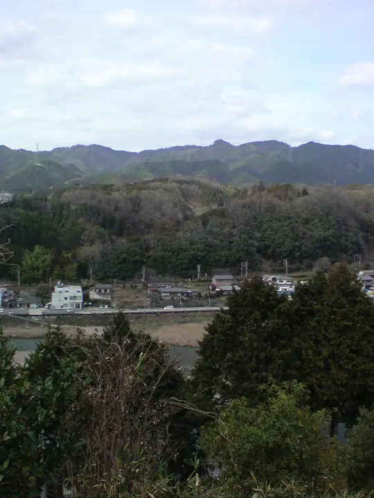
Takatoriyama is a 583.6 m peak in Takatori Town, Takaichi District of Nara, whose summit holds the ruins of Takatori Castle—one of Japan's three great mountain castles alongside Bicchū Matsuyama and Mino Iwamura. The vertical rise of 390 m from the Kuro-mon gate to the keep is the largest of the three, and extensive stone walls survive on the ridge. The standard route from Kintetsu Tsubosakayama Station leads up through the old castle town of Tosa Kaidō and past Tsubosakadera (Saigoku Kannon No. 6) for a roughly 4.5 km, two-hour climb; the surrounding forest is designated by the Forestry Agency as the Takatoriyama Scenic Forest.
Mt. Takatori at a glance
- Weather: The most settled day in the next 7 days is Mon, November 9: clear, gusts up to 8 m/s.
- Route: The shortest is Takatori Castle Ruins, Tsubosaka Temple, and Five Hundred Arhats Loop: about 3 h 57 min, 9.0 km, about 490 m of climbing.
Mt. Takatori weather (hourly, 14 days)
Sunrise today 06:18, sunset 17:03
| Tue, 11/3 | Wed, 11/4 | Thu, 11/5 | Fri, 11/6 | Sat, 11/7 | Sun, 11/8 | Mon, 11/9 | Tue, 11/10 | Wed, 11/11 | Thu, 11/12 | Fri, 11/13 | Sat, 11/14 | Sun, 11/15 | Mon, 11/16 | Tue, 11/17 | |||||||||||||||||||||||||||||||||||||||||||||||||||||||||||||||||||||||
|---|---|---|---|---|---|---|---|---|---|---|---|---|---|---|---|---|---|---|---|---|---|---|---|---|---|---|---|---|---|---|---|---|---|---|---|---|---|---|---|---|---|---|---|---|---|---|---|---|---|---|---|---|---|---|---|---|---|---|---|---|---|---|---|---|---|---|---|---|---|---|---|---|---|---|---|---|---|---|---|---|---|---|---|---|---|
| Japan time | 15 | 17 | 19 | 21 | 23 | 1 | 3 | 5 | 7 | 9 | 11 | 13 | 15 | 18 | 21 | 0 | 3 | 6 | 9 | 12 | 15 | 18 | 21 | 0 | 3 | 6 | 9 | 12 | 15 | 18 | 21 | 0 | 3 | 6 | 9 | 12 | 15 | 18 | 21 | 0 | 3 | 6 | 9 | 12 | 15 | 18 | 21 | 0 | 3 | 6 | 9 | 15 | 21 | 3 | 9 | 15 | 21 | 3 | 9 | 15 | 21 | 3 | 9 | 15 | 21 | 3 | 9 | 15 | 21 | 3 | 9 | 15 | 21 | 3 | 9 | 15 | 21 | 3 | 9 | 15 | 21 | 3 | 9 | 15 | |
  | |   |   | | | | | |   | | |   |   | | | | | |   | | | | |   |   | | |   | | | | |  | | | | | | | | | | | | | | |   | |  | | | | | | | | | | |  | | | | | | | | | | | | | | |   | |   | | |  | | | ||
| Temperature | °C | 16° | 13° | 11° | 11° | 9° | 8° | 7° | 6° | 7° | 13° | 15° | 17° | 16° | 14° | 13° | 14° | 13° | 13° | 16° | 17° | 18° | 15° | 13° | 13° | 13° | 14° | 15° | 17° | 16° | 14° | 11° | 10° | 8° | 7° | 10° | 11° | 11° | 8° | 6° | 5° | 4° | 4° | 10° | 12° | 12° | 9° | 8° | 9° | 8° | 8° | 12° | 14° | 9° | 5° | 12° | 14° | 8° | 6° | 8° | 10° | 5° | 3° | 9° | 12° | 5° | 5° | 9° | 11° | 5° | 2° | 9° | 14° | 4° | 4° | 13° | 16° | 12° | 12° | 14° | 15° | 9° | 5° | 8° | 11° |
| Precipitation | mm | 1.2 | 6 | 0.8 | 0.3 | 0.3 | 0.3 | 0.1 | 0.2 | 0.1 | 0.8 | 17 | 0.7 | 1.6 | 0.2 | ||||||||||||||||||||||||||||||||||||||||||||||||||||||||||||||||||||||
| New snow | cm | ||||||||||||||||||||||||||||||||||||||||||||||||||||||||||||||||||||||||||||||||||||
| Snow depth | cm | 0 | 0 | 0 | 0 | 0 | 0 | 0 | 0 | 0 | 0 | 0 | 0 | 0 | 0 | 0 | 0 | 0 | 0 | 0 | 0 | 0 | 0 | 0 | 0 | 0 | 0 | 0 | 0 | 0 | 0 | 0 | 0 | 0 | 0 | 0 | 0 | 0 | 0 | 0 | 0 | 0 | 0 | 0 | 0 | 0 | 0 | 0 | 0 | 0 | 0 | 0 | 0 | 0 | 0 | 0 | 0 | 0 | 0 | 0 | 0 | 0 | 0 | 0 | 0 | 0 | 0 | 0 | 0 | 0 | 0 | 0 | 0 | 0 | 0 | 0 | 0 | 0 | 0 | 0 | 0 | 0 | 0 | 0 | 0 |
| Wind | m/s | 2 | 1 | 1 | 1 | 1 | 1 | 1 | 1 | 2 | 1 | 2 | 2 | 3 | 3 | 2 | 1 | 2 | 1 | 1 | 2 | 1 | 0 | 1 | 1 | 0 | 3 | 2 | 4 | 5 | 3 | 2 | 3 | 3 | 2 | 5 | 5 | 5 | 3 | 1 | 1 | 1 | 1 | 0 | 3 | 3 | 1 | 0 | 0 | 0 | 1 | 1 | 3 | 0 | 1 | 2 | 3 | 1 | 4 | 3 | 5 | 1 | 1 | 1 | 2 | 1 | 2 | 2 | 4 | 1 | 1 | 1 | 2 | 1 | 1 | 1 | 1 | 1 | 2 | 3 | 5 | 2 | 1 | 1 | 2 |
| Wind gusts | m/s | 6 | 6 | 4 | 2 | 3 | 3 | 3 | 3 | 4 | 4 | 6 | 7 | 9 | 9 | 8 | 6 | 4 | 4 | 3 | 4 | 4 | 4 | 3 | 5 | 7 | 7 | 7 | 11 | 12 | 12 | 9 | 8 | 8 | 7 | 11 | 12 | 12 | 12 | 7 | 3 | 3 | 3 | 3 | 7 | 9 | 7 | 2 | 1 | 1 | 2 | 4 | 8 | 7 | 2 | 5 | 9 | 8 | 10 | 10 | 14 | 13 | 3 | 4 | 7 | 5 | 5 | 6 | 12 | 10 | 2 | 3 | 6 | 5 | 4 | 5 | 5 | 6 | 7 | 6 | 12 | 12 | 6 | 4 | 7 |
| Wind dir. | ↓ | ↓ | ↓ | ↓ | ↓ | ↓ | ↓ | ↓ | ↓ | ↓ | ↓ | ↓ | ↓ | ↓ | ↓ | ↓ | ↓ | ↓ | ↓ | ↓ | ↓ | ↓ | ↓ | ↓ | ↓ | ↓ | ↓ | ↓ | ↓ | ↓ | ↓ | ↓ | ↓ | ↓ | ↓ | ↓ | ↓ | ↓ | ↓ | ↓ | ↓ | ↓ | ↓ | ↓ | ↓ | ↓ | ↓ | ↓ | ↓ | ↓ | ↓ | ↓ | ↓ | ↓ | ↓ | ↓ | ↓ | ↓ | ↓ | ↓ | ↓ | ↓ | ↓ | ↓ | ↓ | ↓ | ↓ | ↓ | ↓ | ↓ | ↓ | ↓ | ↓ | ↓ | ↓ | ↓ | ↓ | ↓ | ↓ | ↓ | ↓ | ↓ | ↓ | ↓ | |
Mt. Takatori hiking routes
Hiking times are estimates calculated from the terrain.
Huts, campsites and lodging near Mt. Takatori
Lodging
- Hotel M
Lists that include Mt. Takatori
Mt. Takatori facts
- Elevation
- 584 m
- Location
- Takatori, Nara
34.429288, 135.827504 - Website
- www.town.takatori.nara.jp
- Trail Map
- www.town.takatori.nara.jp (PDF)