
Mt. Sangokusan
三国山
Nakatsugawa, Gifu · Elevation 1,611 m
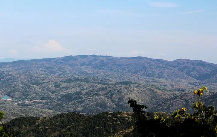
Mt. Sangoku-san (1,611 m) stands at the meeting of Gero City and Nakatsugawa City in Gifu Prefecture with Ōtaki Village in Kiso District, Nagano Prefecture, its name reflecting the old border between the Hida, Mino, and Shinano provinces. Part of the Atera Range, the mountain was protected as a feudal-era "shogun's forest" during the Owari domain. It appears in both the Gifu Hyakuzan and Hida Hyakuzan lists, but the collapse of the former Nakatsugawa forestry road has left access along largely abandoned routes.
Mt. Sangokusan at a glance
- Weather: The most settled day in the next 7 days is Sun, November 8: clear, gusts up to 8 m/s. Fri, Nov 6: strong wind (gusts up to 15 m/s).
Mt. Sangokusan weather (hourly, 14 days)
Sunrise today 06:14, sunset 16:54
| Tue, 11/3 | Wed, 11/4 | Thu, 11/5 | Fri, 11/6 | Sat, 11/7 | Sun, 11/8 | Mon, 11/9 | Tue, 11/10 | Wed, 11/11 | Thu, 11/12 | Fri, 11/13 | Sat, 11/14 | Sun, 11/15 | Mon, 11/16 | Tue, 11/17 | |||||||||||||||||||||||||||||||||||||||||||||||||||||||||||||||||||||||
|---|---|---|---|---|---|---|---|---|---|---|---|---|---|---|---|---|---|---|---|---|---|---|---|---|---|---|---|---|---|---|---|---|---|---|---|---|---|---|---|---|---|---|---|---|---|---|---|---|---|---|---|---|---|---|---|---|---|---|---|---|---|---|---|---|---|---|---|---|---|---|---|---|---|---|---|---|---|---|---|---|---|---|---|---|---|
| Japan time | 15 | 17 | 19 | 21 | 23 | 1 | 3 | 5 | 7 | 9 | 11 | 13 | 15 | 18 | 21 | 0 | 3 | 6 | 9 | 12 | 15 | 18 | 21 | 0 | 3 | 6 | 9 | 12 | 15 | 18 | 21 | 0 | 3 | 6 | 9 | 12 | 15 | 18 | 21 | 0 | 3 | 6 | 9 | 12 | 15 | 18 | 21 | 0 | 3 | 6 | 9 | 15 | 21 | 3 | 9 | 15 | 21 | 3 | 9 | 15 | 21 | 3 | 9 | 15 | 21 | 3 | 9 | 15 | 21 | 3 | 9 | 15 | 21 | 3 | 9 | 15 | 21 | 3 | 9 | 15 | 21 | 3 | 9 | 15 | |
 |  | | |   | | | |   | | | |   |   | |   | | |   |   | |   | | | | |   | | |  | | | | | | | | | | | | | | | | | | | | | | |   | | | |   |   |   | | |  | | | | | | | | | | | | |   | | | | | | | | | | ||
| Temperature | °C | 9° | 4° | 1° | 0° | 1° | 1° | 0° | -1° | 1° | 9° | 11° | 11° | 10° | 6° | 6° | 5° | 5° | 6° | 8° | 11° | 11° | 7° | 7° | 6° | 7° | 6° | 8° | 11° | 8° | 4° | 3° | 1° | 0° | -1° | 2° | 3° | 2° | -2° | -3° | -5° | -5° | -6° | 5° | 7° | 7° | 2° | 3° | 3° | 3° | 2° | 5° | 7° | -1° | -3° | 4° | 5° | 1° | -3° | -1° | 1° | -5° | -5° | 3° | 5° | -3° | -1° | 2° | 4° | -5° | -2° | 3° | 5° | 0° | 2° | 6° | 7° | 6° | 6° | 7° | 7° | 0° | -4° | 4° | 5° |
| Precipitation | mm | 5 | 11 | 2.6 | 2.3 | 0.8 | 0.7 | 0.2 | 0.1 | 0.3 | 1.6 | 0.4 | 0.1 | 0.1 | 0.7 | 15 | 14 | 1.8 | 1.1 | ||||||||||||||||||||||||||||||||||||||||||||||||||||||||||||||||||
| New snow | cm | <.1 | <.1 | ||||||||||||||||||||||||||||||||||||||||||||||||||||||||||||||||||||||||||||||||||
| Snow depth | cm | 0 | 0 | 0 | 0 | 0 | 0 | 0 | 0 | 0 | 0 | 0 | 0 | 0 | 0 | 0 | 0 | 0 | 0 | 0 | 0 | 0 | 0 | 0 | 0 | 0 | 0 | 0 | 0 | 0 | 0 | 0 | 0 | 0 | 0 | 0 | 0 | 0 | 0 | 0 | 0 | 0 | 0 | 0 | 0 | 0 | 0 | 0 | 0 | 0 | 0 | 0 | 0 | 0 | 0 | 0 | 0 | 0 | 0 | 0 | 0 | 0 | 0 | 0 | 0 | 0 | 0 | 0 | 0 | 0 | 0 | 0 | 0 | 0 | 0 | 0 | 0 | 0 | 0 | 0 | 0 | 0 | 0 | 0 | 0 |
| Wind | m/s | 3 | 2 | 2 | 1 | 1 | 1 | 1 | 1 | 1 | 1 | 2 | 2 | 2 | 0 | 1 | 1 | 1 | 1 | 1 | 1 | 1 | 0 | 1 | 1 | 0 | 1 | 2 | 5 | 5 | 4 | 3 | 3 | 2 | 2 | 4 | 4 | 5 | 3 | 3 | 3 | 3 | 2 | 0 | 2 | 1 | 2 | 0 | 0 | 0 | 0 | 1 | 3 | 1 | 1 | 2 | 3 | 2 | 4 | 6 | 5 | 2 | 1 | 2 | 2 | 1 | 1 | 4 | 4 | 2 | 1 | 1 | 2 | 1 | 2 | 3 | 3 | 2 | 2 | 2 | 6 | 3 | 1 | 1 | 2 |
| Wind gusts | m/s | 9 | 9 | 5 | 4 | 3 | 2 | 2 | 3 | 3 | 4 | 7 | 8 | 8 | 6 | 4 | 4 | 9 | 8 | 4 | 4 | 4 | 3 | 3 | 3 | 4 | 5 | 6 | 14 | 15 | 14 | 12 | 10 | 9 | 7 | 10 | 13 | 12 | 12 | 9 | 9 | 8 | 7 | 5 | 7 | 8 | 5 | 5 | 3 | 3 | 3 | 5 | 11 | 7 | 4 | 7 | 11 | 9 | 14 | 20 | 19 | 14 | 4 | 7 | 9 | 6 | 5 | 12 | 14 | 12 | 5 | 4 | 9 | 7 | 5 | 7 | 9 | 9 | 8 | 6 | 17 | 17 | 10 | 4 | 7 |
| Wind dir. | ↓ | ↓ | ↓ | ↓ | ↓ | ↓ | ↓ | ↓ | ↓ | ↓ | ↓ | ↓ | ↓ | ↓ | ↓ | ↓ | ↓ | ↓ | ↓ | ↓ | ↓ | ↓ | ↓ | ↓ | ↓ | ↓ | ↓ | ↓ | ↓ | ↓ | ↓ | ↓ | ↓ | ↓ | ↓ | ↓ | ↓ | ↓ | ↓ | ↓ | ↓ | ↓ | ↓ | ↓ | ↓ | ↓ | ↓ | ↓ | ↓ | ↓ | ↓ | ↓ | ↓ | ↓ | ↓ | ↓ | ↓ | ↓ | ↓ | ↓ | ↓ | ↓ | ↓ | ↓ | ↓ | ↓ | ↓ | ↓ | ↓ | ↓ | ↓ | ↓ | ↓ | ↓ | ↓ | ↓ | ↓ | ↓ | ↓ | ↓ | ↓ | ↓ | ↓ | ||
Huts, campsites and lodging near Mt. Sangokusan
Mountain huts
Campsites
- 乙女渓谷キャンプ場
Lists that include Mt. Sangokusan
Mt. Sangokusan facts
- Also known as
- 三国岳
- Elevation
- 1,611 m
- Location
- Nakatsugawa, Gifu
35.795878, 137.360274 - Wikipedia
- ja.wikipedia.org