
Mount Kohide
小秀山
Ōtaki-mura, Nagano / Nakatsugawa, Gifu · Elevation 1,982 m
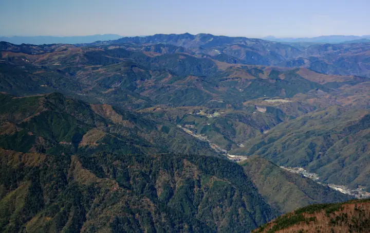
Mount Kohide is a 1,981.68 m peak straddling Nakatsugawa City in Gifu Prefecture and Ōtaki Village in Kiso District, Nagano Prefecture, and the highest summit of the Atera Range within the Ontake mountain system. It is listed in the Nihon Nihyaku Meizan, the Gifu Hyakusan, and the Shinshū Hyakumeizan. The summit is celebrated as a viewing platform for Mount Ontake just to the north, and the standard ascents start from the Otome Gorge in Kashimo, Nakatsugawa: the Ninotani route, which threads a chain of waterfalls including the noted Meoto-daki, and the Sannotani route. A summit shelter, Shūhō-sha, is operated by Nakatsugawa City just below the top. The peak forms an important watershed at the headwaters of the Shirakawa and Ōtaki rivers in the upper Kiso river system.
Mount Kohide at a glance
- Weather: The most settled day in the next 7 days is Sun, November 8: clear, gusts up to 8 m/s. Fri, Nov 6: strong wind (gusts up to 15 m/s).
- Route: The shortest is Mount Kohide via the Nino-tani and Sanno-tani Routes from Otome Gorge: about 7 h 43 min, 12.6 km, about 1,240 m of climbing.
Mount Kohide weather (hourly, 14 days)
Sunrise today 06:14, sunset 16:54
| Tue, 11/3 | Wed, 11/4 | Thu, 11/5 | Fri, 11/6 | Sat, 11/7 | Sun, 11/8 | Mon, 11/9 | Tue, 11/10 | Wed, 11/11 | Thu, 11/12 | Fri, 11/13 | Sat, 11/14 | Sun, 11/15 | Mon, 11/16 | Tue, 11/17 | |||||||||||||||||||||||||||||||||||||||||||||||||||||||||||||||||||||||
|---|---|---|---|---|---|---|---|---|---|---|---|---|---|---|---|---|---|---|---|---|---|---|---|---|---|---|---|---|---|---|---|---|---|---|---|---|---|---|---|---|---|---|---|---|---|---|---|---|---|---|---|---|---|---|---|---|---|---|---|---|---|---|---|---|---|---|---|---|---|---|---|---|---|---|---|---|---|---|---|---|---|---|---|---|---|
| Japan time | 15 | 17 | 19 | 21 | 23 | 1 | 3 | 5 | 7 | 9 | 11 | 13 | 15 | 18 | 21 | 0 | 3 | 6 | 9 | 12 | 15 | 18 | 21 | 0 | 3 | 6 | 9 | 12 | 15 | 18 | 21 | 0 | 3 | 6 | 9 | 12 | 15 | 18 | 21 | 0 | 3 | 6 | 9 | 12 | 15 | 18 | 21 | 0 | 3 | 6 | 9 | 15 | 21 | 3 | 9 | 15 | 21 | 3 | 9 | 15 | 21 | 3 | 9 | 15 | 21 | 3 | 9 | 15 | 21 | 3 | 9 | 15 | 21 | 3 | 9 | 15 | 21 | 3 | 9 | 15 | 21 | 3 | 9 | 15 | |
 |  | | |   | | | |   | | | |   |   | |   | | |   |   | |   | | | | |   | | |  | | | | | | | | | | | | | | | | | | | | | | |   | | | |   |   |   | | |  | | | | | | | | | | | | |   | | | | | | | | | | ||
| Temperature | °C | 7° | 2° | -1° | -2° | -2° | -2° | -2° | -3° | -1° | 7° | 8° | 9° | 7° | 4° | 4° | 3° | 3° | 4° | 6° | 8° | 8° | 5° | 5° | 3° | 5° | 4° | 6° | 8° | 6° | 2° | 0° | -1° | -2° | -4° | 0° | 1° | 0° | -4° | -6° | -7° | -7° | -8° | 3° | 5° | 4° | -1° | 0° | 0° | 0° | 0° | 2° | 5° | -3° | -5° | 2° | 2° | -2° | -5° | -4° | -1° | -8° | -7° | 1° | 2° | -6° | -4° | 0° | 1° | -8° | -5° | 1° | 3° | -2° | -1° | 4° | 5° | 4° | 4° | 5° | 5° | -2° | -6° | 2° | 3° |
| Precipitation | mm | 5 | 11 | 2.6 | 2.3 | 0.8 | 0.7 | 0.2 | 0.1 | 0.3 | 1.6 | 0.4 | 0.1 | 0.1 | 0.7 | 15 | 14 | 1.8 | 1.1 | ||||||||||||||||||||||||||||||||||||||||||||||||||||||||||||||||||
| New snow | cm | <.1 | <.1 | ||||||||||||||||||||||||||||||||||||||||||||||||||||||||||||||||||||||||||||||||||
| Snow depth | cm | 0 | 0 | 0 | 0 | 0 | 0 | 0 | 0 | 0 | 0 | 0 | 0 | 0 | 0 | 0 | 0 | 0 | 0 | 0 | 0 | 0 | 0 | 0 | 0 | 0 | 0 | 0 | 0 | 0 | 0 | 0 | 0 | 0 | 0 | 0 | 0 | 0 | 0 | 0 | 0 | 0 | 0 | 0 | 0 | 0 | 0 | 0 | 0 | 0 | 0 | 0 | 0 | 0 | 0 | 0 | 0 | 0 | 0 | 0 | 0 | 0 | 0 | 0 | 0 | 0 | 0 | 0 | 0 | 0 | 0 | 0 | 0 | 0 | 0 | 0 | 0 | 0 | 0 | 0 | 0 | 0 | 0 | 0 | 0 |
| Wind | m/s | 3 | 2 | 2 | 1 | 1 | 1 | 1 | 1 | 1 | 1 | 2 | 2 | 2 | 0 | 1 | 1 | 1 | 1 | 1 | 1 | 1 | 0 | 1 | 1 | 0 | 1 | 2 | 5 | 5 | 4 | 3 | 3 | 2 | 2 | 4 | 4 | 5 | 3 | 3 | 3 | 3 | 2 | 0 | 2 | 1 | 2 | 0 | 0 | 0 | 0 | 1 | 3 | 1 | 1 | 2 | 3 | 2 | 4 | 6 | 5 | 2 | 1 | 2 | 2 | 1 | 1 | 4 | 4 | 2 | 1 | 1 | 2 | 1 | 2 | 3 | 3 | 2 | 2 | 2 | 6 | 3 | 1 | 1 | 2 |
| Wind gusts | m/s | 9 | 9 | 5 | 4 | 3 | 2 | 2 | 3 | 3 | 4 | 7 | 8 | 8 | 6 | 4 | 4 | 9 | 8 | 4 | 4 | 4 | 3 | 3 | 3 | 4 | 5 | 6 | 14 | 15 | 14 | 12 | 10 | 9 | 7 | 10 | 13 | 12 | 12 | 9 | 9 | 8 | 7 | 5 | 7 | 8 | 5 | 5 | 3 | 3 | 3 | 5 | 11 | 7 | 4 | 7 | 11 | 9 | 14 | 20 | 19 | 14 | 4 | 7 | 9 | 6 | 5 | 12 | 14 | 12 | 5 | 4 | 9 | 7 | 5 | 7 | 9 | 9 | 8 | 6 | 17 | 17 | 10 | 4 | 7 |
| Wind dir. | ↓ | ↓ | ↓ | ↓ | ↓ | ↓ | ↓ | ↓ | ↓ | ↓ | ↓ | ↓ | ↓ | ↓ | ↓ | ↓ | ↓ | ↓ | ↓ | ↓ | ↓ | ↓ | ↓ | ↓ | ↓ | ↓ | ↓ | ↓ | ↓ | ↓ | ↓ | ↓ | ↓ | ↓ | ↓ | ↓ | ↓ | ↓ | ↓ | ↓ | ↓ | ↓ | ↓ | ↓ | ↓ | ↓ | ↓ | ↓ | ↓ | ↓ | ↓ | ↓ | ↓ | ↓ | ↓ | ↓ | ↓ | ↓ | ↓ | ↓ | ↓ | ↓ | ↓ | ↓ | ↓ | ↓ | ↓ | ↓ | ↓ | ↓ | ↓ | ↓ | ↓ | ↓ | ↓ | ↓ | ↓ | ↓ | ↓ | ↓ | ↓ | ↓ | ↓ | ||
Mount Kohide hiking routes
Hiking times are estimates calculated from the terrain.
Huts, campsites and lodging near Mount Kohide
Mountain huts
Campsites
- 乙女渓谷キャンプ場
Lists that include Mount Kohide
Japan 200 Famous Mountains · Japan's 300 Famous Mountains · Shinshu 100 Famous Mountains · 100 Mountains of Gifu · Elevations of 1003 Mountains of Japan · 1000 Mountains of Japan
Mount Kohide facts
- Elevation
- 1,982 m
- Location
- Ōtaki-mura, Nagano / Nakatsugawa, Gifu
35.785439, 137.397020 - Website
- www.city.nakatsugawa.lg.jp
- Trail Map
- www.city.nakatsugawa.lg.jp (PDF)
- Wikipedia
- ja.wikipedia.org