
Mt. Kuwasakiyama
鍬崎山
Toyama, Toyama · Elevation 2,090 m
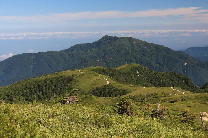
Mt. Kuwasakiyama (2,090 m) is a peak in the Tateyama Range of the Hida Mountains (Northern Alps) in Toyama City, Toyama Prefecture, lying within Chubu Sangaku National Park. Set forward of the main Tateyama ridge, the summit commands views of Tsurugi, Tateyama, Yakushi and the Tateyama Caldera, and the mountain is included in Japan's 300 Famous Mountains and the 100 Mountains of Toyama. Local folklore links it to the buried-gold legend of the Sengoku-era warlord Sassa Narimasa. The standard climb from Awasuno Ski Resort over Setogura-yama and Oshina-yama is a demanding round trip of about 13 km with roughly 1,700 m of elevation gain.
Mt. Kuwasakiyama at a glance
- Weather: The most settled day in the next 7 days is Wed, November 4: clear, gusts up to 7 m/s.
Mt. Kuwasakiyama weather (hourly, 14 days)
Sunrise today 06:15, sunset 16:53
| Tue, 11/3 | Wed, 11/4 | Thu, 11/5 | Fri, 11/6 | Sat, 11/7 | Sun, 11/8 | Mon, 11/9 | Tue, 11/10 | Wed, 11/11 | Thu, 11/12 | Fri, 11/13 | Sat, 11/14 | Sun, 11/15 | Mon, 11/16 | Tue, 11/17 | |||||||||||||||||||||||||||||||||||||||||||||||||||||||||||||||||||||||
|---|---|---|---|---|---|---|---|---|---|---|---|---|---|---|---|---|---|---|---|---|---|---|---|---|---|---|---|---|---|---|---|---|---|---|---|---|---|---|---|---|---|---|---|---|---|---|---|---|---|---|---|---|---|---|---|---|---|---|---|---|---|---|---|---|---|---|---|---|---|---|---|---|---|---|---|---|---|---|---|---|---|---|---|---|---|
| Japan time | 15 | 17 | 19 | 21 | 23 | 1 | 3 | 5 | 7 | 9 | 11 | 13 | 15 | 18 | 21 | 0 | 3 | 6 | 9 | 12 | 15 | 18 | 21 | 0 | 3 | 6 | 9 | 12 | 15 | 18 | 21 | 0 | 3 | 6 | 9 | 12 | 15 | 18 | 21 | 0 | 3 | 6 | 9 | 12 | 15 | 18 | 21 | 0 | 3 | 6 | 9 | 15 | 21 | 3 | 9 | 15 | 21 | 3 | 9 | 15 | 21 | 3 | 9 | 15 | 21 | 3 | 9 | 15 | 21 | 3 | 9 | 15 | 21 | 3 | 9 | 15 | 21 | 3 | 9 | 15 | 21 | 3 | 9 | 15 | |
  |   | |  | | | | | |  | | |   |   | |   | | |   | | | |   | | | | |   | | |   | | | |   | | |   |   | | | | | | | | | | | | |   | | | | | | |   | | | | | | | | |   |  | | | | | | | | | | | | | | | | ||
| Temperature | °C | 2° | -2° | -4° | -4° | -4° | -5° | -4° | -4° | -3° | 2° | 4° | 5° | 4° | 2° | 3° | 2° | 2° | 3° | 4° | 6° | 8° | 4° | 4° | 4° | 3° | 3° | 3° | 4° | 1° | -1° | -2° | -3° | -5° | -5° | -5° | -4° | -5° | -6° | -6° | -7° | -9° | -8° | -2° | -1° | -2° | -4° | -4° | -3° | -3° | -2° | 0° | 0° | -7° | -8° | 1° | 2° | -3° | -8° | -6° | -5° | -7° | -7° | -3° | -3° | -8° | -4° | -4° | -3° | -8° | -7° | 0° | 2° | -5° | -2° | 4° | 3° | 3° | 4° | 2° | -1° | -5° | -7° | -3° | -2° |
| Precipitation | mm | 1.7 | 8 | 6 | 4.3 | 1.0 | 0.5 | 1.4 | 1.5 | 3.7 | 2.9 | 3.7 | 1.6 | 3.1 | 3.0 | 5 | 3.1 | 3.0 | 3.3 | 2.3 | 0.9 | 0.3 | 0.2 | 0.2 | 1.1 | 1.0 | 0.2 | 6 | 10 | 6 | 1.9 | 0.6 | 2.4 | 7 | 1.3 | 0.4 | 5 | 4.5 | 15 | 17 | 7 | ||||||||||||||||||||||||||||||||||||||||||||
| New snow | cm | <.1 | 0.8 | 0.5 | 0.8 | 1.5 | 1.5 | 0.1 | <.1 | <.1 | <.1 | 0.2 | 0.2 | <.1 | <.1 | 0.7 | 6.8 | 5.4 | 1.5 | 0.2 | 0.4 | 0.9 | <.1 | 0.1 | 0.5 | ||||||||||||||||||||||||||||||||||||||||||||||||||||||||||||
| Snow depth | cm | 0 | 0 | 0 | 0 | 0 | 0 | 0 | 0 | 0 | 0 | 0 | 0 | 0 | 0 | 0 | 0 | 0 | 0 | 0 | 0 | 0 | 0 | 0 | 0 | 0 | 0 | 0 | 0 | 0 | 0 | 0 | <1 | <1 | 1 | 2 | 3 | 3 | 2 | 2 | 2 | 2 | 2 | 2 | 2 | 2 | 2 | 2 | 2 | 2 | 2 | 2 | 2 | 2 | 2 | 2 | 1 | 2 | 6 | 10 | 10 | 9 | 9 | 9 | 7 | 7 | 7 | 7 | 6 | 6 | 6 | 6 | 5 | 5 | 5 | 5 | 4 | 3 | 2 | 2 | 2 | 2 | 2 | 2 | 2 |
| Wind | m/s | 2 | 0 | 0 | 0 | 0 | 1 | 1 | 1 | 1 | 1 | 2 | 2 | 1 | 0 | 1 | 1 | 1 | 0 | 1 | 1 | 1 | 0 | 1 | 1 | 0 | 1 | 2 | 2 | 3 | 3 | 3 | 3 | 3 | 3 | 3 | 3 | 2 | 1 | 1 | 1 | 1 | 1 | 1 | 3 | 2 | 1 | 0 | 0 | 0 | 1 | 1 | 1 | 1 | 1 | 1 | 5 | 3 | 4 | 1 | 2 | 1 | 0 | 1 | 1 | 2 | 0 | 2 | 2 | 2 | 1 | 0 | 1 | 2 | 3 | 4 | 3 | 6 | 4 | 2 | 3 | 2 | 1 | 1 | 1 |
| Wind gusts | m/s | 8 | 6 | 2 | 2 | 3 | 3 | 3 | 3 | 2 | 5 | 7 | 7 | 7 | 5 | 5 | 5 | 3 | 4 | 6 | 8 | 8 | 5 | 5 | 6 | 6 | 6 | 8 | 9 | 11 | 11 | 11 | 11 | 11 | 11 | 11 | 12 | 10 | 8 | 6 | 5 | 4 | 4 | 5 | 9 | 8 | 6 | 3 | 4 | 5 | 5 | 5 | 8 | 5 | 5 | 7 | 16 | 15 | 17 | 15 | 10 | 8 | 4 | 4 | 7 | 6 | 6 | 6 | 8 | 7 | 5 | 3 | 6 | 6 | 10 | 12 | 15 | 18 | 22 | 13 | 10 | 11 | 5 | 4 | 6 |
| Wind dir. | ↓ | ↓ | ↓ | ↓ | ↓ | ↓ | ↓ | ↓ | ↓ | ↓ | ↓ | ↓ | ↓ | ↓ | ↓ | ↓ | ↓ | ↓ | ↓ | ↓ | ↓ | ↓ | ↓ | ↓ | ↓ | ↓ | ↓ | ↓ | ↓ | ↓ | ↓ | ↓ | ↓ | ↓ | ↓ | ↓ | ↓ | ↓ | ↓ | ↓ | ↓ | ↓ | ↓ | ↓ | ↓ | ↓ | ↓ | ↓ | ↓ | ↓ | ↓ | ↓ | ↓ | ↓ | ↓ | ↓ | ↓ | ↓ | ↓ | ↓ | ↓ | ↓ | ↓ | ↓ | ↓ | ↓ | ↓ | ↓ | ↓ | ↓ | ↓ | ↓ | ↓ | ↓ | ↓ | ↓ | ↓ | ↓ | ↓ | ↓ | ↓ | ↓ | ↓ | ↓ | |
Lists that include Mt. Kuwasakiyama
Japan's 300 Famous Mountains · 100 Mountains of Hokuriku · 100 Mountains of Toyama · Elevations of 1003 Mountains of Japan · 1000 Mountains of Japan
Mt. Kuwasakiyama facts
- Elevation
- 2,090 m
- Location
- Toyama, Toyama
36.539937, 137.478034 - National Park
- 中部山岳国立公園
- Website
- awasuno.com
- Trail Map
- www.pref.toyama.jp (PDF)
- Access Information
- awasuno.com
- Wikipedia
- ja.wikipedia.org