
Mt. Iwahashiyama
岩橋山
Katsuragi, Nara / Kanan, Osaka · Elevation 659 m
Iwahashiyama is a 659 m peak on the border of Kanan Town (Osaka) and Katsuragi City (Nara), straddling the ridgeline of the Kongo range traversed by the Diamond Trail. Its name derives from the legend that En no Gyoja ordered the Katsuragi gods to build a stone bridge from this range to Mount Kinpu in Yoshino; remnants of that mythical work are said to survive as megaliths along the trail, including the Kume no Iwahashi, Jinmen-seki, Nabegama-ishi, Hokotate-ishi, and Tainai-kuguri. The mountain is included in several regional lists, among them the Osaka 50 Mountains and the Nara Hyakuyuzan.
Mt. Iwahashiyama at a glance
- Weather: The most settled day in the next 7 days is Thu, November 5: cloudy, gusts up to 4 m/s.
- Route: The shortest is Diamond Trail Traverse from Iwaya Pass to Kimitōge Station: about 17 h 29 min, 33.4 km, about 2,310 m of climbing.
Mt. Iwahashiyama weather (hourly, 14 days)
Sunrise today 06:19, sunset 17:03
| Tue, 11/3 | Wed, 11/4 | Thu, 11/5 | Fri, 11/6 | Sat, 11/7 | Sun, 11/8 | Mon, 11/9 | Tue, 11/10 | Wed, 11/11 | Thu, 11/12 | Fri, 11/13 | Sat, 11/14 | Sun, 11/15 | Mon, 11/16 | Tue, 11/17 | |||||||||||||||||||||||||||||||||||||||||||||||||||||||||||||||||||||||
|---|---|---|---|---|---|---|---|---|---|---|---|---|---|---|---|---|---|---|---|---|---|---|---|---|---|---|---|---|---|---|---|---|---|---|---|---|---|---|---|---|---|---|---|---|---|---|---|---|---|---|---|---|---|---|---|---|---|---|---|---|---|---|---|---|---|---|---|---|---|---|---|---|---|---|---|---|---|---|---|---|---|---|---|---|---|
| Japan time | 15 | 17 | 19 | 21 | 23 | 1 | 3 | 5 | 7 | 9 | 11 | 13 | 15 | 18 | 21 | 0 | 3 | 6 | 9 | 12 | 15 | 18 | 21 | 0 | 3 | 6 | 9 | 12 | 15 | 18 | 21 | 0 | 3 | 6 | 9 | 12 | 15 | 18 | 21 | 0 | 3 | 6 | 9 | 12 | 15 | 18 | 21 | 0 | 3 | 6 | 9 | 15 | 21 | 3 | 9 | 15 | 21 | 3 | 9 | 15 | 21 | 3 | 9 | 15 | 21 | 3 | 9 | 15 | 21 | 3 | 9 | 15 | 21 | 3 | 9 | 15 | 21 | 3 | 9 | 15 | 21 | 3 | 9 | 15 | |
  | |   |   | | | | | |   | | | | |   |   |   | | |   |  | | | | | |   | | |  | | | | | |   | | | | | | | | | | | | | | | | |   |   | | | | | | | |  | | | | | | | | | | | | | |   | | | | | |  | | | ||
| Temperature | °C | 16° | 14° | 11° | 11° | 10° | 9° | 8° | 7° | 8° | 12° | 14° | 17° | 17° | 13° | 13° | 13° | 12° | 12° | 15° | 17° | 18° | 15° | 13° | 12° | 15° | 14° | 15° | 17° | 17° | 14° | 11° | 10° | 8° | 8° | 11° | 12° | 12° | 8° | 6° | 5° | 4° | 3° | 10° | 13° | 12° | 9° | 9° | 8° | 7° | 7° | 12° | 14° | 9° | 5° | 12° | 14° | 9° | 7° | 9° | 11° | 6° | 3° | 9° | 12° | 5° | 6° | 10° | 12° | 6° | 2° | 9° | 14° | 7° | 5° | 13° | 17° | 12° | 11° | 14° | 15° | 9° | 5° | 8° | 12° |
| Precipitation | mm | 0.7 | 0.2 | 0.3 | 6 | 0.4 | 0.5 | 0.3 | 0.3 | 0.1 | 0.2 | 0.2 | 0.2 | 0.2 | 1.8 | 25 | 0.5 | 1.3 | 0.2 | ||||||||||||||||||||||||||||||||||||||||||||||||||||||||||||||||||
| New snow | cm | ||||||||||||||||||||||||||||||||||||||||||||||||||||||||||||||||||||||||||||||||||||
| Snow depth | cm | 0 | 0 | 0 | 0 | 0 | 0 | 0 | 0 | 0 | 0 | 0 | 0 | 0 | 0 | 0 | 0 | 0 | 0 | 0 | 0 | 0 | 0 | 0 | 0 | 0 | 0 | 0 | 0 | 0 | 0 | 0 | 0 | 0 | 0 | 0 | 0 | 0 | 0 | 0 | 0 | 0 | 0 | 0 | 0 | 0 | 0 | 0 | 0 | 0 | 0 | 0 | 0 | 0 | 0 | 0 | 0 | 0 | 0 | 0 | 0 | 0 | 0 | 0 | 0 | 0 | 0 | 0 | 0 | 0 | 0 | 0 | 0 | 0 | 0 | 0 | 0 | 0 | 0 | 0 | 0 | 0 | 0 | 0 | 0 |
| Wind | m/s | 2 | 1 | 1 | 0 | 0 | 0 | 1 | 1 | 1 | 1 | 2 | 2 | 3 | 2 | 2 | 0 | 1 | 1 | 1 | 1 | 1 | 0 | 1 | 1 | 3 | 1 | 3 | 4 | 5 | 3 | 2 | 3 | 1 | 1 | 4 | 4 | 4 | 2 | 1 | 1 | 1 | 1 | 0 | 2 | 2 | 1 | 0 | 0 | 0 | 1 | 0 | 2 | 0 | 1 | 2 | 3 | 2 | 4 | 4 | 5 | 1 | 1 | 1 | 1 | 1 | 2 | 2 | 4 | 1 | 1 | 0 | 1 | 1 | 1 | 1 | 1 | 0 | 1 | 2 | 4 | 2 | 1 | 1 | 1 |
| Wind gusts | m/s | 6 | 5 | 5 | 3 | 2 | 2 | 3 | 3 | 3 | 4 | 6 | 7 | 7 | 7 | 7 | 7 | 5 | 3 | 3 | 4 | 4 | 3 | 3 | 5 | 10 | 9 | 8 | 12 | 13 | 12 | 8 | 8 | 8 | 5 | 11 | 11 | 12 | 11 | 7 | 4 | 4 | 4 | 4 | 7 | 8 | 7 | 3 | 1 | 2 | 3 | 3 | 7 | 6 | 3 | 6 | 9 | 8 | 11 | 11 | 14 | 12 | 4 | 3 | 6 | 4 | 6 | 7 | 11 | 10 | 3 | 4 | 4 | 3 | 4 | 5 | 6 | 6 | 8 | 8 | 12 | 11 | 7 | 4 | 7 |
| Wind dir. | ↓ | ↓ | ↓ | ↓ | ↓ | ↓ | ↓ | ↓ | ↓ | ↓ | ↓ | ↓ | ↓ | ↓ | ↓ | ↓ | ↓ | ↓ | ↓ | ↓ | ↓ | ↓ | ↓ | ↓ | ↓ | ↓ | ↓ | ↓ | ↓ | ↓ | ↓ | ↓ | ↓ | ↓ | ↓ | ↓ | ↓ | ↓ | ↓ | ↓ | ↓ | ↓ | ↓ | ↓ | ↓ | ↓ | ↓ | ↓ | ↓ | ↓ | ↓ | ↓ | ↓ | ↓ | ↓ | ↓ | ↓ | ↓ | ↓ | ↓ | ↓ | ↓ | ↓ | ↓ | ↓ | ↓ | ↓ | ↓ | ↓ | ↓ | ↓ | ↓ | ↓ | ↓ | ↓ | ↓ | ↓ | ↓ | ↓ | ↓ | ↓ | ↓ | ↓ | ↓ | |
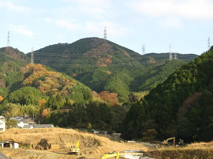
Mt. Iwahashiyama hiking routes
Hiking times are estimates calculated from the terrain.
Huts, campsites and lodging near Mt. Iwahashiyama
Campsites
- 葛城高原キャンプ場
Lodging
- かつらぎの森
Lists that include Mt. Iwahashiyama
Osaka 50 Mountains · Nara 100 Mountains to Explore · Diamond Trail
Mt. Iwahashiyama facts
- Elevation
- 659 m
- Location
- Katsuragi, Nara / Kanan, Osaka
34.493356, 135.679296 - National Park
- 金剛生駒紀泉国定公園
- Website
- www.town.kanan.osaka.jp
- Trail Map
- www.town.kanan.osaka.jp (PDF)
- Wikipedia
- ja.wikipedia.org