
Mt. Takaoyama
高尾山
Kashiwara, Osaka · Elevation 278 m
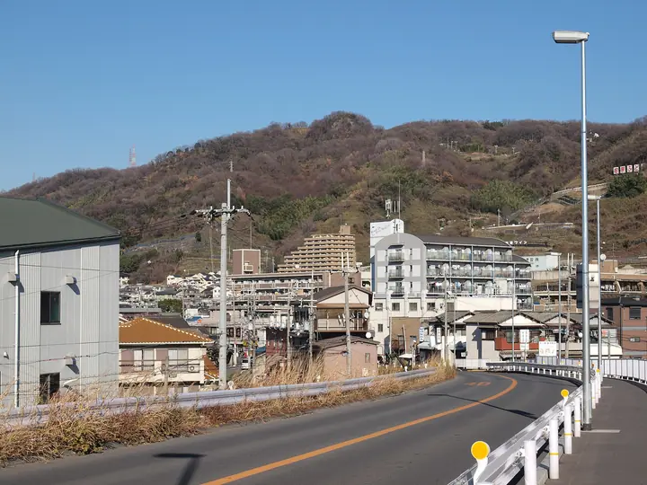
Mt. Takaoyama, 278 m, stands at the southern tip of the Ikoma Range in Kashiwara City, Osaka Prefecture. Its rocky little summit holds the Takao-yama Summit Ruins — a Late Yayoi-to-Early Kofun hilltop settlement — and produced in 1925 a tachū-saimon mirror, one of only eight known examples nationwide and now in the Tokyo National Museum. The mountainside hosts the inner shrine of the Nudehiko-Nudehime-jinja, and the 270,000 m² Takaoyama Souzou-no-Mori forest park, opened in 1998 by Kashiwara City, offers waymarked walks and forest-bathing trails. The peak is listed among the Osaka 50 Mountains and the Osaka 100 Greens (大阪みどりの百選).
Mt. Takaoyama at a glance
- Weather: The most settled day in the next 7 days is Thu, November 5: cloudy, gusts up to 4 m/s.
- Route: The shortest is Kashiwara Loop to Mount Takao, Where a Deity Once Dwelt, past a Yayoi Hilltop Village Site and Two Lookouts: about 2 h 5 min, 4.1 km, about 290 m of climbing.
Mt. Takaoyama weather (hourly, 14 days)
Sunrise today 06:19, sunset 17:03
| Tue, 11/3 | Wed, 11/4 | Thu, 11/5 | Fri, 11/6 | Sat, 11/7 | Sun, 11/8 | Mon, 11/9 | Tue, 11/10 | Wed, 11/11 | Thu, 11/12 | Fri, 11/13 | Sat, 11/14 | Sun, 11/15 | Mon, 11/16 | Tue, 11/17 | |||||||||||||||||||||||||||||||||||||||||||||||||||||||||||||||||||||||
|---|---|---|---|---|---|---|---|---|---|---|---|---|---|---|---|---|---|---|---|---|---|---|---|---|---|---|---|---|---|---|---|---|---|---|---|---|---|---|---|---|---|---|---|---|---|---|---|---|---|---|---|---|---|---|---|---|---|---|---|---|---|---|---|---|---|---|---|---|---|---|---|---|---|---|---|---|---|---|---|---|---|---|---|---|---|
| Japan time | 15 | 17 | 19 | 21 | 23 | 1 | 3 | 5 | 7 | 9 | 11 | 13 | 15 | 18 | 21 | 0 | 3 | 6 | 9 | 12 | 15 | 18 | 21 | 0 | 3 | 6 | 9 | 12 | 15 | 18 | 21 | 0 | 3 | 6 | 9 | 12 | 15 | 18 | 21 | 0 | 3 | 6 | 9 | 12 | 15 | 18 | 21 | 0 | 3 | 6 | 9 | 15 | 21 | 3 | 9 | 15 | 21 | 3 | 9 | 15 | 21 | 3 | 9 | 15 | 21 | 3 | 9 | 15 | 21 | 3 | 9 | 15 | 21 | 3 | 9 | 15 | 21 | 3 | 9 | 15 | 21 | 3 | 9 | 15 | |
  | |   | | | | | | |   | | |   |   |   |   | | |   | | | | |   | | | |   | | |  | | | |  | | | | | | | | | | | | | | | | | |   | | | | | | | |   |  | | | | | | | | | | | | | | | | | | | |  | | | ||
| Temperature | °C | 18° | 15° | 13° | 12° | 12° | 10° | 9° | 8° | 8° | 13° | 15° | 18° | 17° | 15° | 15° | 14° | 14° | 13° | 15° | 17° | 19° | 17° | 15° | 14° | 16° | 15° | 17° | 19° | 18° | 16° | 12° | 11° | 9° | 9° | 11° | 13° | 13° | 10° | 8° | 6° | 5° | 4° | 11° | 13° | 13° | 11° | 11° | 10° | 9° | 9° | 13° | 15° | 11° | 7° | 12° | 15° | 10° | 8° | 9° | 12° | 7° | 4° | 10° | 13° | 7° | 7° | 10° | 13° | 7° | 4° | 9° | 15° | 9° | 6° | 12° | 17° | 13° | 13° | 15° | 16° | 11° | 7° | 9° | 13° |
| Precipitation | mm | 7 | 1.9 | 0.5 | 0.1 | 0.5 | 11 | 0.3 | 0.1 | 0.2 | 0.3 | 0.2 | 2.3 | 17 | 0.3 | 1.0 | |||||||||||||||||||||||||||||||||||||||||||||||||||||||||||||||||||||
| New snow | cm | ||||||||||||||||||||||||||||||||||||||||||||||||||||||||||||||||||||||||||||||||||||
| Snow depth | cm | 0 | 0 | 0 | 0 | 0 | 0 | 0 | 0 | 0 | 0 | 0 | 0 | 0 | 0 | 0 | 0 | 0 | 0 | 0 | 0 | 0 | 0 | 0 | 0 | 0 | 0 | 0 | 0 | 0 | 0 | 0 | 0 | 0 | 0 | 0 | 0 | 0 | 0 | 0 | 0 | 0 | 0 | 0 | 0 | 0 | 0 | 0 | 0 | 0 | 0 | 0 | 0 | 0 | 0 | 0 | 0 | 0 | 0 | 0 | 0 | 0 | 0 | 0 | 0 | 0 | 0 | 0 | 0 | 0 | 0 | 0 | 0 | 0 | 0 | 0 | 0 | 0 | 0 | 0 | 0 | 0 | 0 | 0 | 0 |
| Wind | m/s | 2 | 2 | 1 | 1 | 0 | 0 | 1 | 1 | 1 | 0 | 2 | 3 | 3 | 4 | 4 | 3 | 2 | 1 | 1 | 1 | 1 | 0 | 1 | 1 | 4 | 2 | 3 | 4 | 4 | 3 | 2 | 2 | 2 | 2 | 3 | 4 | 4 | 3 | 1 | 1 | 1 | 1 | 1 | 2 | 2 | 1 | 0 | 0 | 0 | 1 | 0 | 2 | 0 | 1 | 1 | 4 | 2 | 4 | 3 | 5 | 1 | 1 | 1 | 2 | 2 | 1 | 1 | 4 | 1 | 1 | 0 | 2 | 1 | 2 | 1 | 1 | 1 | 2 | 2 | 4 | 2 | 2 | 1 | 1 |
| Wind gusts | m/s | 6 | 6 | 4 | 3 | 1 | 1 | 1 | 2 | 2 | 3 | 5 | 7 | 7 | 8 | 9 | 8 | 7 | 4 | 3 | 3 | 4 | 4 | 3 | 4 | 9 | 9 | 8 | 10 | 11 | 11 | 7 | 5 | 5 | 4 | 9 | 11 | 11 | 10 | 6 | 2 | 2 | 3 | 3 | 6 | 6 | 6 | 2 | 1 | 2 | 3 | 3 | 6 | 5 | 2 | 4 | 10 | 9 | 9 | 9 | 13 | 12 | 3 | 4 | 6 | 5 | 5 | 4 | 11 | 9 | 3 | 4 | 5 | 4 | 4 | 5 | 5 | 4 | 7 | 7 | 12 | 12 | 5 | 4 | 5 |
| Wind dir. | ↓ | ↓ | ↓ | ↓ | ↓ | ↓ | ↓ | ↓ | ↓ | ↓ | ↓ | ↓ | ↓ | ↓ | ↓ | ↓ | ↓ | ↓ | ↓ | ↓ | ↓ | ↓ | ↓ | ↓ | ↓ | ↓ | ↓ | ↓ | ↓ | ↓ | ↓ | ↓ | ↓ | ↓ | ↓ | ↓ | ↓ | ↓ | ↓ | ↓ | ↓ | ↓ | ↓ | ↓ | ↓ | ↓ | ↓ | ↓ | ↓ | ↓ | ↓ | ↓ | ↓ | ↓ | ↓ | ↓ | ↓ | ↓ | ↓ | ↓ | ↓ | ↓ | ↓ | ↓ | ↓ | ↓ | ↓ | ↓ | ↓ | ↓ | ↓ | ↓ | ↓ | ↓ | ↓ | ↓ | ↓ | ↓ | ↓ | ↓ | ↓ | ↓ | ↓ | ||
Mt. Takaoyama hiking routes
Hiking times are estimates calculated from the terrain.
Huts, campsites and lodging near Mt. Takaoyama
Campsites
- 菩提キャンプ場
Lodging
- Kashiwara Ryokan
- Guest House Bed&Bicycle
- 山常園
- Miyako Ryokan
- Kikusui Ryokan
Lists that include Mt. Takaoyama
Mt. Takaoyama facts
- Elevation
- 278 m
- Location
- Kashiwara, Osaka
34.592082, 135.640715 - Website
- www.city.kashiwara.lg.jp
- Trail Map
- www.city.kashiwara.lg.jp (PDF)
- Access Information
- www.city.kashiwara.lg.jp
- Wikipedia
- ja.wikipedia.org