
Mt. Azumaneyama
東根山
Shizukuishi, Iwate / Shiwa, Iwate · Elevation 928 m
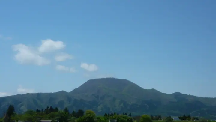
Mt. Azumaneyama is a 928-meter peak rising on the western edge of Shiwa Town in Shiwa District, Iwate Prefecture — a symbol of the town along the eastern edge of the Ōu Range. Counted as one of the Shiwa Three Mountains alongside Mt. Nanshō and Mt. Hakogamori, it is climbed from the trailhead behind the La France Onsen Hotel via Ichi-no-taira, Ni-no-taira, the Hebiishi viewpoint, and the Miharashi viewpoint to the summit. The mountainside is designated as a protection forest, with Shiwa Town maintaining the trail on leased land; September 28 has been ordinance-designated as "Azumaneyama Day." The mountain is included in the Iwate Hyakumeizan, Michinoku 120, and Shin Iwate-no-20 Meizan lists.
Mt. Azumaneyama at a glance
- Weather: The most settled day in the next 7 days is Wed, November 4: clear, gusts up to 7 m/s. Sat, Nov 7, Sun, Nov 8: strong wind (gusts up to 19 m/s).
- Route: The shortest is Mount Azumane Circuit via the Jaishi and Neko-no-Se Courses: about 5 h 55 min, 9.9 km, about 850 m of climbing.
Mt. Azumaneyama weather (hourly, 14 days)
Sunrise today 06:05, sunset 16:33
| Tue, 11/3 | Wed, 11/4 | Thu, 11/5 | Fri, 11/6 | Sat, 11/7 | Sun, 11/8 | Mon, 11/9 | Tue, 11/10 | Wed, 11/11 | Thu, 11/12 | Fri, 11/13 | Sat, 11/14 | Sun, 11/15 | Mon, 11/16 | Tue, 11/17 | |||||||||||||||||||||||||||||||||||||||||||||||||||||||||||||||||||||||
|---|---|---|---|---|---|---|---|---|---|---|---|---|---|---|---|---|---|---|---|---|---|---|---|---|---|---|---|---|---|---|---|---|---|---|---|---|---|---|---|---|---|---|---|---|---|---|---|---|---|---|---|---|---|---|---|---|---|---|---|---|---|---|---|---|---|---|---|---|---|---|---|---|---|---|---|---|---|---|---|---|---|---|---|---|---|
| Japan time | 15 | 17 | 19 | 21 | 23 | 1 | 3 | 5 | 7 | 9 | 11 | 13 | 15 | 18 | 21 | 0 | 3 | 6 | 9 | 12 | 15 | 18 | 21 | 0 | 3 | 6 | 9 | 12 | 15 | 18 | 21 | 0 | 3 | 6 | 9 | 12 | 15 | 18 | 21 | 0 | 3 | 6 | 9 | 12 | 15 | 18 | 21 | 0 | 3 | 6 | 9 | 15 | 21 | 3 | 9 | 15 | 21 | 3 | 9 | 15 | 21 | 3 | 9 | 15 | 21 | 3 | 9 | 15 | 21 | 3 | 9 | 15 | 21 | 3 | 9 | 15 | 21 | 3 | 9 | 15 | 21 | 3 | 9 | 15 | |
 |  | | | |   |   |   |   | | | | | | | |   | |   | | | | | | | | | | |   | | |   | |   | |   |   |   |   | | |   | |   |   | | | |   | | | | | | | | | | |   | | | | | |   | |  | | | | | | |   | | | | | | | | | ||
| Temperature | °C | 7° | 4° | 2° | 2° | 0° | 0° | 1° | 2° | 2° | 7° | 10° | 11° | 11° | 3° | 2° | 2° | 3° | 5° | 6° | 7° | 7° | 7° | 7° | 7° | 7° | 7° | 10° | 12° | 11° | 7° | 4° | 1° | 0° | 0° | 1° | 2° | 1° | 0° | 0° | -1° | 0° | 0° | 2° | 4° | 3° | 1° | 0° | -1° | -1° | -2° | 3° | 3° | -4° | -4° | 2° | 5° | 1° | 1° | 3° | 3° | -2° | -4° | 3° | 5° | 2° | 2° | 2° | 3° | -3° | -6° | 1° | 6° | -4° | -5° | 4° | 8° | 3° | 3° | 6° | 5° | -1° | -3° | 1° | 4° |
| Precipitation | mm | 0.1 | 0.3 | 1.5 | 4.5 | 4.4 | 1.4 | 0.4 | 0.6 | 1.5 | 1.4 | 0.4 | 1.6 | 0.8 | 0.6 | 0.7 | 1.2 | 1.2 | 1.8 | 1.2 | 1.1 | 0.8 | 0.5 | 0.4 | 0.1 | 0.4 | 0.3 | 0.9 | 10 | 3.2 | 0.7 | 2.7 | 0.4 | 3.4 | 2.4 | 1.2 | 1.3 | ||||||||||||||||||||||||||||||||||||||||||||||||
| New snow | cm | 0.1 | 0.6 | 0.5 | 0.3 | 0.3 | 0.2 | 0.2 | <.1 | 0.3 | 0.2 | <.1 | <.1 | 0.4 | <.1 | ||||||||||||||||||||||||||||||||||||||||||||||||||||||||||||||||||||||
| Snow depth | cm | 0 | 0 | 0 | 0 | 0 | 0 | 0 | 0 | 0 | 0 | 0 | 0 | 0 | 0 | 0 | 0 | 0 | 0 | 0 | 0 | 0 | 0 | 0 | 0 | 0 | 0 | 0 | 0 | 0 | 0 | 0 | 0 | 0 | <1 | <1 | <1 | <1 | <1 | <1 | <1 | <1 | <1 | <1 | <1 | <1 | <1 | <1 | 0 | 0 | <1 | 0 | 0 | 0 | 0 | 0 | 0 | <1 | <1 | <1 | 0 | 0 | 0 | 0 | 0 | 0 | 0 | 0 | 0 | 0 | 0 | 0 | 0 | 0 | 0 | 0 | 0 | 0 | 0 | 0 | 0 | 0 | 0 | 0 | 0 |
| Wind | m/s | 4 | 2 | 1 | 1 | 1 | 2 | 2 | 2 | 1 | 1 | 2 | 2 | 2 | 1 | 1 | 1 | 1 | 1 | 1 | 1 | 1 | 1 | 1 | 1 | 1 | 1 | 1 | 4 | 4 | 4 | 6 | 4 | 5 | 3 | 2 | 5 | 4 | 3 | 4 | 4 | 4 | 4 | 7 | 8 | 6 | 4 | 2 | 1 | 1 | 2 | 2 | 3 | 1 | 1 | 1 | 5 | 1 | 1 | 3 | 6 | 1 | 1 | 0 | 3 | 1 | 0 | 3 | 5 | 1 | 1 | 1 | 2 | 1 | 1 | 0 | 1 | 2 | 0 | 1 | 4 | 4 | 1 | 2 | 3 |
| Wind gusts | m/s | 12 | 10 | 5 | 4 | 3 | 5 | 6 | 5 | 5 | 5 | 7 | 7 | 6 | 3 | 3 | 3 | 3 | 4 | 4 | 4 | 4 | 3 | 2 | 4 | 4 | 3 | 4 | 10 | 11 | 13 | 13 | 13 | 11 | 11 | 11 | 16 | 17 | 13 | 9 | 9 | 10 | 9 | 15 | 19 | 19 | 14 | 9 | 5 | 4 | 4 | 6 | 9 | 7 | 3 | 4 | 11 | 11 | 5 | 7 | 17 | 13 | 3 | 5 | 9 | 7 | 4 | 8 | 13 | 12 | 3 | 4 | 6 | 5 | 3 | 3 | 6 | 4 | 4 | 3 | 10 | 13 | 9 | 6 | 8 |
| Wind dir. | ↓ | ↓ | ↓ | ↓ | ↓ | ↓ | ↓ | ↓ | ↓ | ↓ | ↓ | ↓ | ↓ | ↓ | ↓ | ↓ | ↓ | ↓ | ↓ | ↓ | ↓ | ↓ | ↓ | ↓ | ↓ | ↓ | ↓ | ↓ | ↓ | ↓ | ↓ | ↓ | ↓ | ↓ | ↓ | ↓ | ↓ | ↓ | ↓ | ↓ | ↓ | ↓ | ↓ | ↓ | ↓ | ↓ | ↓ | ↓ | ↓ | ↓ | ↓ | ↓ | ↓ | ↓ | ↓ | ↓ | ↓ | ↓ | ↓ | ↓ | ↓ | ↓ | ↓ | ↓ | ↓ | ↓ | ↓ | ↓ | ↓ | ↓ | ↓ | ↓ | ↓ | ↓ | ↓ | ↓ | ↓ | ↓ | ↓ | ↓ | ↓ | ↓ | ↓ | ↓ | |
Mt. Azumaneyama hiking routes
Hiking times are estimates calculated from the terrain.
Huts, campsites and lodging near Mt. Azumaneyama
Lodging
- 紫波町 あづまね温泉保養施設 ききょう荘
Lists that include Mt. Azumaneyama
Iwate 100 Famous Mountains · Elevations of 1003 Mountains of Japan · 1000 Mountains of Japan
Mt. Azumaneyama facts
- Elevation
- 928 m
- Location
- Shizukuishi, Iwate / Shiwa, Iwate
39.587405, 141.059743 - Website
- www.town.shiwa.iwate.jp
- Wikipedia
- ja.wikipedia.org