
Mt. Shiro
城山
Shiwa, Iwate · Elevation 181 m
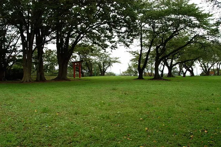
Shiroyama (181 m) is a low hill in Futsukamachi, Shiwa Town, Iwate Prefecture, rising above the western terrace of the Kitakami River and counted among the 150 Mountains of Iwate. The summit holds the ruins of Takamizuji Castle (later renamed Kōriyama Castle), the seat of the Shiba clan that served as the political center of medieval Shiwa County for some four hundred years after Shiba Ienaga was sent here as Ōshū Kanrei in 1335. The hill is now maintained as the town's Shiroyama Park, with footpaths winding through more than a thousand cherry trees on the former castle grounds.
Mt. Shiro at a glance
- Weather: The most settled day in the next 7 days is Wed, November 4: clear, gusts up to 6 m/s. Sat, Nov 7, Sun, Nov 8: strong wind (gusts up to 16 m/s).
Mt. Shiro weather (hourly, 14 days)
Sunrise today 06:05, sunset 16:33
| Tue, 11/3 | Wed, 11/4 | Thu, 11/5 | Fri, 11/6 | Sat, 11/7 | Sun, 11/8 | Mon, 11/9 | Tue, 11/10 | Wed, 11/11 | Thu, 11/12 | Fri, 11/13 | Sat, 11/14 | Sun, 11/15 | Mon, 11/16 | Tue, 11/17 | |||||||||||||||||||||||||||||||||||||||||||||||||||||||||||||||||||||||
|---|---|---|---|---|---|---|---|---|---|---|---|---|---|---|---|---|---|---|---|---|---|---|---|---|---|---|---|---|---|---|---|---|---|---|---|---|---|---|---|---|---|---|---|---|---|---|---|---|---|---|---|---|---|---|---|---|---|---|---|---|---|---|---|---|---|---|---|---|---|---|---|---|---|---|---|---|---|---|---|---|---|---|---|---|---|
| Japan time | 15 | 17 | 19 | 21 | 23 | 1 | 3 | 5 | 7 | 9 | 11 | 13 | 15 | 18 | 21 | 0 | 3 | 6 | 9 | 12 | 15 | 18 | 21 | 0 | 3 | 6 | 9 | 12 | 15 | 18 | 21 | 0 | 3 | 6 | 9 | 12 | 15 | 18 | 21 | 0 | 3 | 6 | 9 | 12 | 15 | 18 | 21 | 0 | 3 | 6 | 9 | 15 | 21 | 3 | 9 | 15 | 21 | 3 | 9 | 15 | 21 | 3 | 9 | 15 | 21 | 3 | 9 | 15 | 21 | 3 | 9 | 15 | 21 | 3 | 9 | 15 | 21 | 3 | 9 | 15 | 21 | 3 | 9 | 15 | |
 |  | | | |   |   |   | | |   | | | | | |   |   |   | | | | | | | |   |   | |   | | | | | |   |   | | | | | | | |   | | | | | | | |   | | | |   | | | | | | |   | | | | | |  | | | | | | | | | | | | | | | ||
| Temperature | °C | 11° | 7° | 6° | 5° | 4° | 3° | 5° | 5° | 5° | 10° | 14° | 15° | 14° | 7° | 6° | 6° | 6° | 8° | 10° | 11° | 11° | 10° | 11° | 10° | 11° | 10° | 14° | 15° | 15° | 11° | 8° | 5° | 4° | 4° | 4° | 6° | 5° | 4° | 3° | 3° | 4° | 4° | 7° | 8° | 7° | 4° | 4° | 3° | 3° | 2° | 7° | 7° | 0° | 0° | 5° | 9° | 5° | 5° | 5° | 6° | 2° | 0° | 7° | 9° | 6° | 5° | 5° | 7° | 0° | -2° | 4° | 9° | 0° | 0° | 7° | 11° | 7° | 7° | 9° | 9° | 2° | 0° | 4° | 8° |
| Precipitation | mm | 0.2 | 1.4 | 4.6 | 4.6 | 1.5 | 1.0 | 0.7 | 1.5 | 1.5 | 0.1 | 1.4 | 0.9 | 0.3 | 0.2 | 0.7 | 0.6 | 1.2 | 1.0 | 1.9 | 1.1 | 0.3 | 0.3 | 0.2 | 0.2 | 0.4 | 8 | 2.9 | 1.0 | 2.1 | 0.4 | 2.8 | 1.9 | 1.2 | 1.5 | ||||||||||||||||||||||||||||||||||||||||||||||||||
| New snow | cm | <.1 | 0.6 | 0.2 | <.1 | ||||||||||||||||||||||||||||||||||||||||||||||||||||||||||||||||||||||||||||||||
| Snow depth | cm | 0 | 0 | 0 | 0 | 0 | 0 | 0 | 0 | 0 | 0 | 0 | 0 | 0 | 0 | 0 | 0 | 0 | 0 | 0 | 0 | 0 | 0 | 0 | 0 | 0 | 0 | 0 | 0 | 0 | 0 | 0 | 0 | 0 | 0 | 0 | <1 | <1 | 0 | 0 | 0 | 0 | 0 | 0 | 0 | 0 | 0 | 0 | 0 | 0 | 0 | 0 | 0 | 0 | 0 | 0 | 0 | 0 | 0 | 0 | 0 | 0 | 0 | 0 | 0 | 0 | 0 | 0 | 0 | 0 | 0 | 0 | 0 | 0 | 0 | 0 | 0 | 0 | 0 | 0 | 0 | 0 | 0 | 0 | 0 |
| Wind | m/s | 4 | 2 | 1 | 1 | 1 | 2 | 2 | 2 | 2 | 2 | 2 | 2 | 1 | 1 | 1 | 1 | 1 | 1 | 2 | 1 | 2 | 1 | 0 | 1 | 0 | 1 | 1 | 3 | 2 | 2 | 4 | 2 | 3 | 3 | 1 | 5 | 5 | 3 | 3 | 3 | 3 | 3 | 6 | 7 | 5 | 2 | 1 | 1 | 1 | 2 | 2 | 2 | 0 | 0 | 1 | 5 | 2 | 1 | 4 | 7 | 1 | 0 | 1 | 3 | 2 | 0 | 3 | 5 | 1 | 1 | 1 | 2 | 1 | 0 | 0 | 2 | 2 | 0 | 1 | 3 | 4 | 1 | 2 | 3 |
| Wind gusts | m/s | 11 | 9 | 4 | 3 | 2 | 4 | 4 | 4 | 4 | 5 | 5 | 6 | 5 | 3 | 3 | 4 | 3 | 4 | 5 | 5 | 4 | 3 | 2 | 3 | 3 | 2 | 4 | 10 | 9 | 10 | 9 | 10 | 8 | 8 | 10 | 15 | 15 | 12 | 7 | 7 | 8 | 8 | 12 | 16 | 16 | 12 | 5 | 3 | 3 | 4 | 6 | 8 | 6 | 2 | 4 | 10 | 11 | 7 | 9 | 18 | 14 | 3 | 4 | 8 | 6 | 4 | 8 | 12 | 11 | 3 | 4 | 5 | 4 | 2 | 3 | 6 | 4 | 5 | 3 | 9 | 11 | 8 | 6 | 7 |
| Wind dir. | ↓ | ↓ | ↓ | ↓ | ↓ | ↓ | ↓ | ↓ | ↓ | ↓ | ↓ | ↓ | ↓ | ↓ | ↓ | ↓ | ↓ | ↓ | ↓ | ↓ | ↓ | ↓ | ↓ | ↓ | ↓ | ↓ | ↓ | ↓ | ↓ | ↓ | ↓ | ↓ | ↓ | ↓ | ↓ | ↓ | ↓ | ↓ | ↓ | ↓ | ↓ | ↓ | ↓ | ↓ | ↓ | ↓ | ↓ | ↓ | ↓ | ↓ | ↓ | ↓ | ↓ | ↓ | ↓ | ↓ | ↓ | ↓ | ↓ | ↓ | ↓ | ↓ | ↓ | ↓ | ↓ | ↓ | ↓ | ↓ | ↓ | ↓ | ↓ | ↓ | ↓ | ↓ | ↓ | ↓ | ↓ | ↓ | ↓ | ↓ | ↓ | ↓ | ↓ | ↓ | |
Huts, campsites and lodging near Mt. Shiro
Lodging
- 紫波グリーンホテル
- 紫波ビジネスホテル
- Hotel egne
Mt. Shiro facts
- Elevation
- 181 m
- Location
- Shiwa, Iwate
39.565346, 141.173260 - Website
- www.shiwa-kanko.jp
- Wikipedia
- ja.wikipedia.org