
Mount Tairappyō
平標山
Yuzawa, Niigata · Elevation 1,984 m
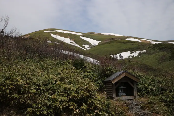
Mount Tairappyō is a 1,983.7 m peak on the border between Yuzawa Town in Niigata and Minakami Town in Gunma, marking the western end of the Tanigawa range within Jōshin'etsu-Kōgen National Park. Gentle bamboo-grass ridges and alpine flower meadows are its signature, and in June the slopes blaze with hakusan-ichige and hakusan-kozakura blossoms — earning it places in Hana no Hyakumeizan and Hana no 50 Meizan. The standard loop starts at the Tairappyō trailhead, passes the Minakami-run Tairappyō-sannoie (open in summer), and many parties continue to neighbouring Mount Sennokura. With a 30-minute drive from Yuzawa IC or a direct bus from JR Echigo-Yuzawa Station, the peak is unusually accessible from the Kantō region.
Mount Tairappyō at a glance
- Weather: The most settled day in the next 7 days is Wed, November 4: clear, gusts up to 10 m/s. Sat, Nov 7: strong wind (gusts up to 18 m/s).
- Route: The shortest is Tairappyo Trailhead, Mount Matsute, Mount Tairappyo, Mount Sennokura, and Tairamoto New Trail Loop: about 8 h 36 min, 14.4 km, about 1,310 m of climbing.
Mount Tairappyō weather (hourly, 14 days)
Sunrise today 06:10, sunset 16:47
| Tue, 11/3 | Wed, 11/4 | Thu, 11/5 | Fri, 11/6 | Sat, 11/7 | Sun, 11/8 | Mon, 11/9 | Tue, 11/10 | Wed, 11/11 | Thu, 11/12 | Fri, 11/13 | Sat, 11/14 | Sun, 11/15 | Mon, 11/16 | Tue, 11/17 | |||||||||||||||||||||||||||||||||||||||||||||||||||||||||||||||||||||||
|---|---|---|---|---|---|---|---|---|---|---|---|---|---|---|---|---|---|---|---|---|---|---|---|---|---|---|---|---|---|---|---|---|---|---|---|---|---|---|---|---|---|---|---|---|---|---|---|---|---|---|---|---|---|---|---|---|---|---|---|---|---|---|---|---|---|---|---|---|---|---|---|---|---|---|---|---|---|---|---|---|---|---|---|---|---|
| Japan time | 15 | 17 | 19 | 21 | 23 | 1 | 3 | 5 | 7 | 9 | 11 | 13 | 15 | 18 | 21 | 0 | 3 | 6 | 9 | 12 | 15 | 18 | 21 | 0 | 3 | 6 | 9 | 12 | 15 | 18 | 21 | 0 | 3 | 6 | 9 | 12 | 15 | 18 | 21 | 0 | 3 | 6 | 9 | 12 | 15 | 18 | 21 | 0 | 3 | 6 | 9 | 15 | 21 | 3 | 9 | 15 | 21 | 3 | 9 | 15 | 21 | 3 | 9 | 15 | 21 | 3 | 9 | 15 | 21 | 3 | 9 | 15 | 21 | 3 | 9 | 15 | 21 | 3 | 9 | 15 | 21 | 3 | 9 | 15 | |
  |   | |  | | | | |  | | | |   |   |   | | | | |   | | | |   | | | | | | | | | | |   | | |   |   | | | |   | |   | | | | | | | | | | | | | | | | | | | |   | | | | | | | |  | |   | | |   | | | | |   | | ||
| Temperature | °C | 1° | -1° | -3° | -3° | -3° | -2° | -3° | -3° | -1° | 4° | 6° | 7° | 5° | 1° | 0° | 1° | 1° | 2° | 5° | 9° | 9° | 4° | 4° | 4° | 3° | 3° | 5° | 5° | 5° | 2° | 1° | -1° | -2° | -4° | -4° | -4° | -4° | -5° | -5° | -5° | -5° | -5° | -3° | -2° | -2° | -3° | -4° | -3° | -3° | -3° | 0° | -1° | -3° | -3° | -1° | -1° | -3° | -5° | -4° | -4° | -4° | -4° | -3° | -2° | -6° | -3° | -5° | -4° | -5° | -7° | -1° | 2° | -6° | -5° | 2° | 3° | 0° | 1° | 3° | 1° | -4° | -6° | -4° | -2° |
| Precipitation | mm | 0.3 | 0.3 | 0.3 | 11 | 6 | 0.9 | 1.5 | 0.4 | 0.5 | 2.1 | 1.0 | 0.7 | 1.7 | 3.5 | 1.8 | 0.5 | 1.5 | 1.3 | 1.1 | 0.8 | 0.5 | 0.5 | 0.2 | 0.2 | 0.1 | 0.5 | 0.6 | 0.6 | 0.3 | 0.7 | 0.2 | 0.3 | 6 | 3.6 | 8 | 4.1 | 2.0 | 0.1 | 0.3 | 0.4 | 10 | 4.7 | 1.4 | 0.2 | 4.8 | 5 | 0.4 | 10 | 14 | 3.8 | ||||||||||||||||||||||||||||||||||
| New snow | cm | 0.6 | 0.7 | 0.7 | 0.6 | 0.4 | 0.4 | 0.2 | 0.1 | <.1 | 4.6 | 3.1 | 4.6 | 1.0 | 0.5 | 6.4 | 3.8 | 1.0 | 0.1 | 1.1 | 2.3 | <.1 | |||||||||||||||||||||||||||||||||||||||||||||||||||||||||||||||
| Snow depth | cm | 0 | 0 | 0 | 0 | 0 | 0 | 0 | 0 | 0 | 0 | 0 | 0 | 0 | 0 | 0 | 0 | 0 | 0 | 0 | 0 | 0 | 0 | 0 | 0 | 0 | 0 | 0 | 0 | 0 | 0 | 0 | 0 | 0 | 0 | 0 | <1 | <1 | <1 | 1 | 1 | 1 | <1 | <1 | <1 | <1 | 0 | 0 | 0 | 0 | 0 | 0 | 0 | 0 | 0 | 0 | 0 | 0 | 3 | 4 | 5 | 5 | 4 | 3 | 2 | 1 | 1 | 5 | 6 | 6 | 6 | 6 | 3 | 3 | 3 | 3 | 1 | <1 | <1 | 0 | 0 | <1 | 2 | 2 | <1 |
| Wind | m/s | 4 | 3 | 1 | 1 | 1 | 1 | 1 | 1 | 1 | 1 | 1 | 2 | 3 | 5 | 5 | 6 | 3 | 2 | 2 | 1 | 0 | 2 | 1 | 0 | 1 | 1 | 3 | 4 | 3 | 4 | 4 | 4 | 5 | 5 | 5 | 6 | 5 | 5 | 5 | 4 | 5 | 4 | 4 | 5 | 4 | 2 | 1 | 1 | 2 | 1 | 1 | 4 | 2 | 1 | 3 | 4 | 2 | 2 | 9 | 8 | 4 | 2 | 2 | 3 | 1 | 2 | 3 | 6 | 4 | 1 | 1 | 1 | 2 | 1 | 2 | 1 | 2 | 2 | 2 | 7 | 7 | 3 | 2 | 2 |
| Wind gusts | m/s | 13 | 11 | 8 | 5 | 4 | 4 | 4 | 4 | 3 | 4 | 5 | 7 | 10 | 15 | 17 | 19 | 17 | 12 | 10 | 7 | 4 | 6 | 6 | 3 | 5 | 6 | 9 | 11 | 11 | 10 | 12 | 14 | 14 | 16 | 16 | 17 | 18 | 17 | 16 | 14 | 15 | 14 | 13 | 14 | 15 | 12 | 5 | 5 | 5 | 5 | 4 | 10 | 10 | 6 | 10 | 14 | 13 | 10 | 28 | 28 | 23 | 12 | 7 | 10 | 8 | 8 | 11 | 18 | 18 | 12 | 6 | 6 | 6 | 6 | 7 | 7 | 9 | 11 | 9 | 20 | 21 | 19 | 10 | 7 |
| Wind dir. | ↓ | ↓ | ↓ | ↓ | ↓ | ↓ | ↓ | ↓ | ↓ | ↓ | ↓ | ↓ | ↓ | ↓ | ↓ | ↓ | ↓ | ↓ | ↓ | ↓ | ↓ | ↓ | ↓ | ↓ | ↓ | ↓ | ↓ | ↓ | ↓ | ↓ | ↓ | ↓ | ↓ | ↓ | ↓ | ↓ | ↓ | ↓ | ↓ | ↓ | ↓ | ↓ | ↓ | ↓ | ↓ | ↓ | ↓ | ↓ | ↓ | ↓ | ↓ | ↓ | ↓ | ↓ | ↓ | ↓ | ↓ | ↓ | ↓ | ↓ | ↓ | ↓ | ↓ | ↓ | ↓ | ↓ | ↓ | ↓ | ↓ | ↓ | ↓ | ↓ | ↓ | ↓ | ↓ | ↓ | ↓ | ↓ | ↓ | ↓ | ↓ | ↓ | ↓ | ↓ | |
Mount Tairappyō hiking routes
Hiking times are estimates calculated from the terrain.
Huts, campsites and lodging near Mount Tairappyō
Mountain huts
- Tairappyo no Ie 2025: open April 29–October 25 · reservation required · sleeps 12
- Ebisu Oguro Hinangoya unstaffed · sleeps 3
- 群馬大学 仙ノ倉山荘
Lodging
- Hotel Fujiya
- Hotel West
- Annex Kashiwaya
- Lodge Kashiwagi
- 苗場プリンスホテル6号館
Lists that include Mount Tairappyō
Koshinetsu 100 Famous Mountains · Gunma 100 Famous Mountains · Niigata 100 Famous Mountains · 1000 Mountains of Japan
Mount Tairappyō facts
- Elevation
- 1,984 m
- Location
- Yuzawa, Niigata
36.817853, 138.821890 - National Park
- 上信越高原国立公園
- Website
- www.town.yuzawa.lg.jp
- Trail Map
- www.town.yuzawa.lg.jp (PDF)
- Access Information
- www.town.yuzawa.lg.jp
- Wikipedia
- ja.wikipedia.org