
Mount Ogura
御座山
Kitaaiki, Nagano · Elevation 2,112 m
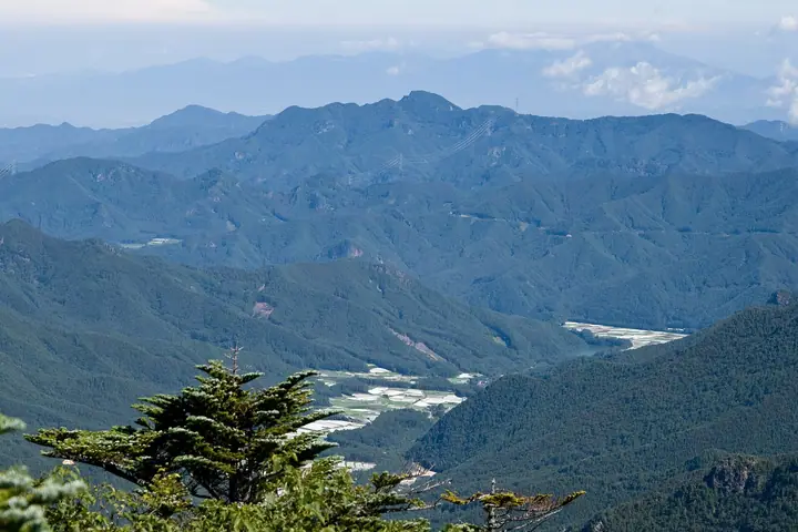
Mount Ogura is a 2,112 m peak straddling Kita-Aiki Village and Minami-Aiki Village (Minami-Saku District) in Nagano Prefecture, rising in the northwestern Kantō Mountains as a craggy landmark of the Saku basin. The name is said to derive from "mikura," the seat of the gods, and the mountain is listed in the Nihon Nihyaku Meizan and the Shinshū Hyakumeizan. Its narrow north-south summit ridge of bare rock commands a 360° view encompassing the Yatsugatake Range, the Northern and Southern Alps, and Mount Asama; in late May through mid-June rhododendron colonies along the trails come into flower. Three main trailheads serve the peak — Shiraiwa and Yamaguchi on the Kita-Aiki side, and Kuryū (via Fudō-no-Taki) on the Minami-Aiki side — with the Shiraiwa road-end to summit climb taking roughly three hours, and the route from Chōja-no-Mori about four. As a Nagano-designated trail it requires a filed climbing plan, and the practical climbing season runs from mid-April to mid-November.
Mount Ogura at a glance
- Weather: The most settled day in the next 7 days is Sun, November 8: clear, gusts up to 9 m/s.
- Route: The shortest is Minamiaiki: Mount Ogura Return over Mae-Ogura to the Rocky Summit: about 3 h 29 min, 4.4 km, about 740 m of climbing.
Mount Ogura weather (hourly, 14 days)
Sunrise today 06:09, sunset 16:49
| Tue, 11/3 | Wed, 11/4 | Thu, 11/5 | Fri, 11/6 | Sat, 11/7 | Sun, 11/8 | Mon, 11/9 | Tue, 11/10 | Wed, 11/11 | Thu, 11/12 | Fri, 11/13 | Sat, 11/14 | Sun, 11/15 | Mon, 11/16 | Tue, 11/17 | |||||||||||||||||||||||||||||||||||||||||||||||||||||||||||||||||||||||
|---|---|---|---|---|---|---|---|---|---|---|---|---|---|---|---|---|---|---|---|---|---|---|---|---|---|---|---|---|---|---|---|---|---|---|---|---|---|---|---|---|---|---|---|---|---|---|---|---|---|---|---|---|---|---|---|---|---|---|---|---|---|---|---|---|---|---|---|---|---|---|---|---|---|---|---|---|---|---|---|---|---|---|---|---|---|
| Japan time | 15 | 17 | 19 | 21 | 23 | 1 | 3 | 5 | 7 | 9 | 11 | 13 | 15 | 18 | 21 | 0 | 3 | 6 | 9 | 12 | 15 | 18 | 21 | 0 | 3 | 6 | 9 | 12 | 15 | 18 | 21 | 0 | 3 | 6 | 9 | 12 | 15 | 18 | 21 | 0 | 3 | 6 | 9 | 12 | 15 | 18 | 21 | 0 | 3 | 6 | 9 | 15 | 21 | 3 | 9 | 15 | 21 | 3 | 9 | 15 | 21 | 3 | 9 | 15 | 21 | 3 | 9 | 15 | 21 | 3 | 9 | 15 | 21 | 3 | 9 | 15 | 21 | 3 | 9 | 15 | 21 | 3 | 9 | 15 | |
  |   | | | | |   | |   | | | | |   | | | | |   | | | |   |  | | |  | | | | | | | | |   | | | | | | | | | | | | | | | | | | |   | | | |   | | |  | | | | | | | | | | | | | | | |   | | | | | | | ||
| Temperature | °C | 5° | 1° | 0° | 0° | 0° | 0° | -1° | 0° | 0° | 3° | 6° | 6° | 5° | 1° | 1° | 1° | 1° | 2° | 5° | 9° | 8° | 5° | 4° | 2° | 2° | 3° | 9° | 12° | 11° | 4° | 1° | -1° | -3° | -3° | 3° | 5° | 3° | -3° | -5° | -5° | -6° | -6° | 1° | 4° | 3° | -2° | -1° | -1° | -2° | -1° | 1° | 2° | -1° | -2° | 0° | 2° | -3° | -3° | -2° | -2° | -6° | -6° | 1° | 3° | -4° | -5° | 0° | 0° | -5° | -6° | 2° | 4° | -4° | -4° | 4° | 6° | 2° | 2° | 9° | 5° | -2° | -5° | 1° | 2° |
| Precipitation | mm | 0.1 | 0.3 | 3.5 | 9 | 5 | 0.1 | 1.5 | 0.2 | 1.5 | 0.4 | 0.7 | 0.4 | 3.2 | 9 | 0.5 | 0.2 | ||||||||||||||||||||||||||||||||||||||||||||||||||||||||||||||||||||
| New snow | cm | 0.3 | |||||||||||||||||||||||||||||||||||||||||||||||||||||||||||||||||||||||||||||||||||
| Snow depth | cm | 0 | 0 | 0 | 0 | 0 | 0 | 0 | 0 | 0 | 0 | 0 | 0 | 0 | 0 | 0 | 0 | 0 | 0 | 0 | 0 | 0 | 0 | 0 | 0 | 0 | 0 | 0 | 0 | 0 | 0 | 0 | 0 | 0 | 0 | 0 | 0 | 0 | 0 | 0 | 0 | 0 | 0 | 0 | 0 | 0 | 0 | 0 | 0 | 0 | 0 | 0 | 0 | 0 | 0 | 0 | 0 | 0 | 0 | 0 | 0 | 0 | 0 | 0 | 0 | 0 | 0 | 0 | 0 | 0 | 0 | 0 | 0 | 0 | 0 | 0 | 0 | 0 | 0 | 0 | 0 | 0 | 0 | 0 | 0 |
| Wind | m/s | 3 | 1 | 0 | 0 | 0 | 0 | 0 | 0 | 1 | 1 | 1 | 2 | 2 | 2 | 1 | 2 | 2 | 1 | 0 | 1 | 1 | 1 | 1 | 1 | 1 | 1 | 2 | 3 | 3 | 2 | 2 | 2 | 2 | 3 | 3 | 4 | 3 | 1 | 1 | 1 | 1 | 1 | 1 | 3 | 3 | 0 | 1 | 0 | 0 | 1 | 1 | 2 | 1 | 1 | 2 | 2 | 1 | 2 | 8 | 6 | 2 | 1 | 0 | 2 | 1 | 1 | 4 | 3 | 2 | 1 | 1 | 1 | 1 | 2 | 2 | 1 | 0 | 2 | 1 | 6 | 3 | 2 | 1 | 2 |
| Wind gusts | m/s | 9 | 7 | 2 | 2 | 2 | 2 | 2 | 2 | 3 | 4 | 5 | 6 | 6 | 6 | 6 | 6 | 6 | 6 | 4 | 4 | 5 | 4 | 4 | 5 | 6 | 6 | 7 | 10 | 10 | 9 | 7 | 7 | 8 | 8 | 11 | 12 | 12 | 10 | 5 | 4 | 4 | 4 | 5 | 8 | 9 | 8 | 4 | 4 | 4 | 4 | 5 | 7 | 5 | 4 | 6 | 7 | 6 | 10 | 24 | 25 | 17 | 7 | 4 | 7 | 6 | 4 | 12 | 15 | 10 | 6 | 4 | 6 | 5 | 5 | 6 | 8 | 6 | 10 | 9 | 16 | 16 | 8 | 5 | 7 |
| Wind dir. | ↓ | ↓ | ↓ | ↓ | ↓ | ↓ | ↓ | ↓ | ↓ | ↓ | ↓ | ↓ | ↓ | ↓ | ↓ | ↓ | ↓ | ↓ | ↓ | ↓ | ↓ | ↓ | ↓ | ↓ | ↓ | ↓ | ↓ | ↓ | ↓ | ↓ | ↓ | ↓ | ↓ | ↓ | ↓ | ↓ | ↓ | ↓ | ↓ | ↓ | ↓ | ↓ | ↓ | ↓ | ↓ | ↓ | ↓ | ↓ | ↓ | ↓ | ↓ | ↓ | ↓ | ↓ | ↓ | ↓ | ↓ | ↓ | ↓ | ↓ | ↓ | ↓ | ↓ | ↓ | ↓ | ↓ | ↓ | ↓ | ↓ | ↓ | ↓ | ↓ | ↓ | ↓ | ↓ | ↓ | ↓ | ↓ | ↓ | ↓ | ↓ | ↓ | ↓ | ↓ | |
Mount Ogura hiking routes
- Minamiaiki: Mount Ogura Return over Mae-Ogura to the Rocky Summit 4.4 km · Ascent 739 m 栗生登山口 (parking)
- Mount Ogura via Chojanomori Trail 10.7 km · Ascent 1,101 m parking
Hiking times are estimates calculated from the terrain.
Huts, campsites and lodging near Mount Ogura
Mountain huts
Campsites
- 長者の森キャンプ場
- 立原高原キャンプ場
Lists that include Mount Ogura
Japan 200 Famous Mountains · Japan's 300 Famous Mountains · Shinshu 100 Famous Mountains · Shinshu Mountain Cards · Elevations of 1003 Mountains of Japan · 1000 Mountains of Japan
Mount Ogura facts
- Elevation
- 2,112 m
- Location
- Kitaaiki, Nagano
36.034091, 138.606783 - Website
- www.vill.kitaaiki.nagano.jp
- Trail Map
- www.pref.nagano.lg.jp (PDF)
- Access Information
- db.go-nagano.net
- Wikipedia
- ja.wikipedia.org