
Mount Nōgō-Hakusan
能郷白山
Motosu, Gifu · Elevation 1,617 m
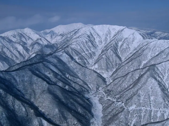
Mount Nōgō-Hakusan is a 1,617 m peak straddling Motosu City and Ibigawa Town in Gifu Prefecture and Ōno City in Fukui Prefecture, the highest summit of the southern Ryōhakusanchi range and the signature peak of the Oku-Mino region. It carries a first-order triangulation marker and is listed in the Nihon Nihyaku Meizan, the Ittō-Sankakuten Hyakumeizan, the Gifu Hyakusan, and the Hyakuteizan-Tōkai. Just below the summit stands an inner shrine of Nōgō-Hakusan-jinja, descended from the Hakusan-faith tradition, and Nukumi Pass on the prefectural border has been a long-standing Shugendō route linking Heisen-ji temple to Mino. Two main approaches are used: a 7–8-hour round trip up the Nōgō-dani valley from Motosu, and a shorter 4-hour round trip from Nukumi Pass on Route 157, accessible only after the road's late-spring opening, with the summit ridge filled with Nikkō-kisuge day lilies in early summer.
Mount Nōgō-Hakusan at a glance
- Weather: The most settled day in the next 7 days is Wed, November 4: clear, gusts up to 9 m/s. Fri, Nov 6, Sat, Nov 7: strong wind (gusts up to 20 m/s).
- Route: The shortest is Mount Nōgōhaku via Nukumi Pass Out-and-Back: about 3 h 43 min, 5.2 km, about 680 m of climbing.
Mount Nōgō-Hakusan weather (hourly, 14 days)
Sunrise today 06:17, sunset 16:58
| Tue, 11/3 | Wed, 11/4 | Thu, 11/5 | Fri, 11/6 | Sat, 11/7 | Sun, 11/8 | Mon, 11/9 | Tue, 11/10 | Wed, 11/11 | Thu, 11/12 | Fri, 11/13 | Sat, 11/14 | Sun, 11/15 | Mon, 11/16 | Tue, 11/17 | |||||||||||||||||||||||||||||||||||||||||||||||||||||||||||||||||||||||
|---|---|---|---|---|---|---|---|---|---|---|---|---|---|---|---|---|---|---|---|---|---|---|---|---|---|---|---|---|---|---|---|---|---|---|---|---|---|---|---|---|---|---|---|---|---|---|---|---|---|---|---|---|---|---|---|---|---|---|---|---|---|---|---|---|---|---|---|---|---|---|---|---|---|---|---|---|---|---|---|---|---|---|---|---|---|
| Japan time | 15 | 17 | 19 | 21 | 23 | 1 | 3 | 5 | 7 | 9 | 11 | 13 | 15 | 18 | 21 | 0 | 3 | 6 | 9 | 12 | 15 | 18 | 21 | 0 | 3 | 6 | 9 | 12 | 15 | 18 | 21 | 0 | 3 | 6 | 9 | 12 | 15 | 18 | 21 | 0 | 3 | 6 | 9 | 12 | 15 | 18 | 21 | 0 | 3 | 6 | 9 | 15 | 21 | 3 | 9 | 15 | 21 | 3 | 9 | 15 | 21 | 3 | 9 | 15 | 21 | 3 | 9 | 15 | 21 | 3 | 9 | 15 | 21 | 3 | 9 | 15 | 21 | 3 | 9 | 15 | 21 | 3 | 9 | 15 | |
 |   | | | | | | |   | | | |   |   | |   | |   |   | | | | | | | |   |   | | | | | | | | | | | |   | | | | |   | | | | | | | | | | | | |   | | | |  | | | | | | | | | | | | | | | | | | | | | | | ||
| Temperature | °C | 8° | 4° | 2° | 2° | 1° | 2° | 0° | 0° | 1° | 7° | 11° | 11° | 9° | 6° | 7° | 6° | 6° | 6° | 7° | 10° | 11° | 8° | 7° | 7° | 7° | 6° | 7° | 8° | 6° | 3° | 2° | 1° | -1° | -1° | 0° | 1° | 1° | -2° | -2° | -2° | -2° | -2° | 1° | 3° | 3° | 0° | 0° | 0° | 1° | 1° | 5° | 5° | 0° | -1° | 3° | 4° | 1° | -3° | -1° | 1° | -2° | -3° | 2° | 3° | -1° | 0° | 1° | 2° | -3° | -4° | 4° | 5° | 3° | 3° | 4° | 5° | 5° | 6° | 7° | 4° | -1° | -4° | 1° | 4° |
| Precipitation | mm | 1.3 | 7 | 3.9 | 2.6 | 0.3 | 0.7 | 0.4 | 3.9 | 1.1 | 1.0 | 1.6 | 0.9 | 0.8 | 0.6 | 0.4 | 0.9 | 0.8 | 0.6 | 0.6 | 0.2 | 0.3 | 0.6 | 7 | 4.3 | 0.2 | 0.5 | 1.4 | 0.7 | 0.4 | 0.2 | 0.9 | 9 | 12 | 2.3 | 1.8 | 0.3 | 1.0 | |||||||||||||||||||||||||||||||||||||||||||||||
| New snow | cm | 0.1 | |||||||||||||||||||||||||||||||||||||||||||||||||||||||||||||||||||||||||||||||||||
| Snow depth | cm | 0 | 0 | 0 | 0 | 0 | 0 | 0 | 0 | 0 | 0 | 0 | 0 | 0 | 0 | 0 | 0 | 0 | 0 | 0 | 0 | 0 | 0 | 0 | 0 | 0 | 0 | 0 | 0 | 0 | 0 | 0 | 0 | 0 | 0 | 0 | 0 | 0 | 0 | 0 | 0 | 0 | 0 | 0 | 0 | 0 | 0 | 0 | 0 | 0 | 0 | 0 | 0 | 0 | 0 | 0 | 0 | 0 | 0 | 0 | 0 | 0 | 0 | 0 | 0 | 0 | 0 | 0 | 0 | 0 | 0 | 0 | 0 | 0 | 0 | 0 | 0 | 0 | 0 | 0 | 0 | 0 | 0 | 0 | 0 |
| Wind | m/s | 4 | 3 | 3 | 4 | 4 | 3 | 3 | 2 | 2 | 1 | 2 | 3 | 2 | 1 | 1 | 0 | 2 | 0 | 1 | 1 | 1 | 1 | 2 | 2 | 2 | 4 | 4 | 6 | 5 | 5 | 5 | 5 | 6 | 4 | 6 | 7 | 7 | 5 | 5 | 4 | 4 | 4 | 4 | 5 | 4 | 2 | 1 | 1 | 1 | 2 | 3 | 4 | 1 | 1 | 3 | 3 | 4 | 7 | 8 | 7 | 5 | 3 | 2 | 4 | 2 | 3 | 5 | 6 | 4 | 1 | 3 | 3 | 3 | 2 | 3 | 3 | 3 | 1 | 4 | 7 | 6 | 3 | 1 | 1 |
| Wind gusts | m/s | 12 | 12 | 9 | 10 | 10 | 10 | 8 | 8 | 6 | 4 | 6 | 9 | 9 | 7 | 6 | 6 | 7 | 7 | 4 | 4 | 4 | 4 | 5 | 8 | 9 | 12 | 13 | 17 | 17 | 15 | 15 | 16 | 17 | 17 | 18 | 20 | 20 | 19 | 15 | 14 | 14 | 14 | 13 | 14 | 15 | 11 | 6 | 4 | 4 | 5 | 8 | 12 | 11 | 4 | 7 | 13 | 14 | 21 | 23 | 23 | 20 | 14 | 8 | 11 | 11 | 9 | 16 | 18 | 18 | 10 | 7 | 10 | 8 | 8 | 9 | 11 | 11 | 12 | 13 | 20 | 19 | 18 | 10 | 7 |
| Wind dir. | ↓ | ↓ | ↓ | ↓ | ↓ | ↓ | ↓ | ↓ | ↓ | ↓ | ↓ | ↓ | ↓ | ↓ | ↓ | ↓ | ↓ | ↓ | ↓ | ↓ | ↓ | ↓ | ↓ | ↓ | ↓ | ↓ | ↓ | ↓ | ↓ | ↓ | ↓ | ↓ | ↓ | ↓ | ↓ | ↓ | ↓ | ↓ | ↓ | ↓ | ↓ | ↓ | ↓ | ↓ | ↓ | ↓ | ↓ | ↓ | ↓ | ↓ | ↓ | ↓ | ↓ | ↓ | ↓ | ↓ | ↓ | ↓ | ↓ | ↓ | ↓ | ↓ | ↓ | ↓ | ↓ | ↓ | ↓ | ↓ | ↓ | ↓ | ↓ | ↓ | ↓ | ↓ | ↓ | ↓ | ↓ | ↓ | ↓ | ↓ | ↓ | ↓ | ↓ | ↓ | |
Mount Nōgō-Hakusan hiking routes
- Mount Nōgōhaku via Nukumi Pass Out-and-Back 5.2 km · Ascent 681 m parking
- Nogo-Hakusan via the Nogodani Route and Maeyama 16.7 km · Ascent 1,492 m
Hiking times are estimates calculated from the terrain.
Lists that include Mount Nōgō-Hakusan
Japan 200 Famous Mountains · Japan's 300 Famous Mountains · 100 Famous Mountains with First-order Triangulation Points · Tokai 100 Mountains · 100 Mountains of Hokuriku · 100 Mountains of Gifu · Motosu 7 Famous Mountains · Elevations of 1003 Mountains of Japan · 1000 Mountains of Japan
Mount Nōgō-Hakusan facts
- Elevation
- 1,617 m
- Location
- Motosu, Gifu
35.762389, 136.514059 - Website
- www.kankou-gifu.jp
- Wikipedia
- ja.wikipedia.org