
Mount Nōgō-Hakusan
能郷白山
โมโตซุ, กิฟุ · ความสูง 1,617 ม.
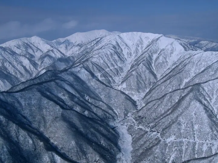
Mount Nōgō-Hakusan is a 1,617 m peak straddling Motosu City and Ibigawa Town in Gifu Prefecture and Ōno City in Fukui Prefecture, the highest summit of the southern Ryōhakusanchi range and the signature peak of the Oku-Mino region. It carries a first-order triangulation marker and is listed in the Nihon Nihyaku Meizan, the Ittō-Sankakuten Hyakumeizan, the Gifu Hyakusan, and the Hyakuteizan-Tōkai. Just below the summit stands an inner shrine of Nōgō-Hakusan-jinja, descended from the Hakusan-faith tradition, and Nukumi Pass on the prefectural border has been a long-standing Shugendō route linking Heisen-ji temple to Mino. Two main approaches are used: a 7–8-hour round trip up the Nōgō-dani valley from Motosu, and a shorter 4-hour round trip from Nukumi Pass on Route 157, accessible only after the road's late-spring opening, with the summit ridge filled with Nikkō-kisuge day lilies in early summer.
สรุป Mount Nōgō-Hakusan
- อากาศ: วันที่อากาศคงที่ที่สุดใน 7 วันข้างหน้าคือ พุธ 4 พฤศจิกายน: ท้องฟ้าแจ่มใส ลมกระโชกสูงสุด 9 ม./วินาที ศุกร์ 6 พ.ย., เสาร์ 7 พ.ย. ลมแรง (ลมกระโชกสูงสุด 20 ม./วินาที)
- เส้นทาง: เส้นทางที่สั้นที่สุดคือ Mount Nōgōhaku via Nukumi Pass Out-and-Back: ประมาณ 3 ชม. 43 นาที 5.2 km ขึ้นประมาณ 680 m
อากาศ Mount Nōgō-Hakusan (รายชั่วโมง 2 สัปดาห์)
วันนี้พระอาทิตย์ขึ้น 06:17 ตก 16:58
| อังคาร 3/11 | พุธ 4/11 | พฤหัส 5/11 | ศุกร์ 6/11 | เสาร์ 7/11 | อาทิตย์ 8/11 | จันทร์ 9/11 | อังคาร 10/11 | พุธ 11/11 | พฤหัส 12/11 | ศุกร์ 13/11 | เสาร์ 14/11 | อาทิตย์ 15/11 | จันทร์ 16/11 | อังคาร 17/11 | |||||||||||||||||||||||||||||||||||||||||||||||||||||||||||||||||||||
|---|---|---|---|---|---|---|---|---|---|---|---|---|---|---|---|---|---|---|---|---|---|---|---|---|---|---|---|---|---|---|---|---|---|---|---|---|---|---|---|---|---|---|---|---|---|---|---|---|---|---|---|---|---|---|---|---|---|---|---|---|---|---|---|---|---|---|---|---|---|---|---|---|---|---|---|---|---|---|---|---|---|---|---|
| เวลาญี่ปุ่น | 21 | 23 | 1 | 3 | 5 | 7 | 9 | 11 | 13 | 15 | 17 | 19 | 21 | 0 | 3 | 6 | 9 | 12 | 15 | 18 | 21 | 0 | 3 | 6 | 9 | 12 | 15 | 18 | 21 | 0 | 3 | 6 | 9 | 12 | 15 | 18 | 21 | 0 | 3 | 6 | 9 | 12 | 15 | 18 | 21 | 0 | 3 | 6 | 9 | 15 | 21 | 3 | 9 | 15 | 21 | 3 | 9 | 15 | 21 | 3 | 9 | 15 | 21 | 3 | 9 | 15 | 21 | 3 | 9 | 15 | 21 | 3 | 9 | 15 | 21 | 3 | 9 | 15 | 21 | 3 | 9 | 15 | |
 |   | | | |   | | | |   |   | | |   | |   |   | |   | | | | | |   | | | | | | | | | | | | |   | | | | |   | | | | | |  | | | | | | |   | | | |  | | | | | | | | | | | | | | | | | | | | | | | ||
| อุณหภูมิ | °C | 1° | 1° | 1° | 1° | 0° | 1° | 7° | 10° | 10° | 8° | 7° | 6° | 6° | 6° | 6° | 6° | 8° | 13° | 12° | 8° | 7° | 7° | 7° | 6° | 7° | 8° | 6° | 3° | 2° | 1° | -1° | -1° | 0° | 1° | 1° | -2° | -2° | -2° | -2° | -2° | 1° | 3° | 3° | 0° | 0° | 0° | 1° | 1° | 5° | 5° | 0° | -1° | 3° | 4° | 1° | -3° | -1° | 1° | -2° | -3° | 2° | 3° | -1° | 0° | 1° | 2° | -3° | -4° | 4° | 5° | 3° | 3° | 4° | 5° | 5° | 6° | 7° | 4° | -1° | -4° | 1° | 4° |
| ฝนและหิมะ | mm | 3.7 | 1.9 | 1.4 | 0.6 | 0.2 | 0.3 | 0.7 | 0.4 | 3.9 | 1.1 | 1.0 | 1.6 | 0.9 | 0.8 | 0.6 | 0.4 | 0.9 | 0.8 | 0.6 | 0.6 | 0.2 | 0.3 | 0.6 | 7 | 4.3 | 0.2 | 0.5 | 1.4 | 0.7 | 0.4 | 0.2 | 0.9 | 9 | 12 | 2.3 | 1.8 | 0.3 | 1.0 | ||||||||||||||||||||||||||||||||||||||||||||
| หิมะตก | cm | – | – | 0.1 | |||||||||||||||||||||||||||||||||||||||||||||||||||||||||||||||||||||||||||||||
| หิมะสะสม | cm | 0 | 0 | 0 | 0 | 0 | 0 | 0 | 0 | 0 | 0 | 0 | 0 | 0 | 0 | 0 | 0 | 0 | 0 | 0 | 0 | 0 | 0 | 0 | 0 | 0 | 0 | 0 | 0 | 0 | 0 | 0 | 0 | 0 | 0 | 0 | 0 | 0 | 0 | 0 | 0 | 0 | 0 | 0 | 0 | 0 | 0 | 0 | 0 | 0 | 0 | 0 | 0 | 0 | 0 | 0 | 0 | 0 | 0 | 0 | 0 | 0 | 0 | 0 | 0 | 0 | 0 | 0 | 0 | 0 | 0 | 0 | 0 | 0 | 0 | 0 | 0 | 0 | 0 | 0 | 0 | 0 | 0 |
| ลม | m/s | 3 | 3 | 3 | 3 | 2 | 2 | 1 | 2 | 3 | 2 | 1 | 1 | 1 | 0 | 1 | 1 | 1 | 1 | 2 | 1 | 2 | 2 | 2 | 4 | 4 | 6 | 5 | 5 | 5 | 5 | 6 | 4 | 6 | 7 | 7 | 5 | 5 | 4 | 4 | 4 | 4 | 5 | 4 | 2 | 1 | 1 | 1 | 2 | 3 | 4 | 1 | 1 | 3 | 3 | 4 | 7 | 8 | 7 | 5 | 3 | 2 | 4 | 2 | 3 | 5 | 6 | 4 | 1 | 3 | 3 | 3 | 2 | 3 | 3 | 3 | 1 | 4 | 7 | 6 | 3 | 1 | 1 |
| ลมกระโชก | m/s | 8 | 8 | 7 | 8 | 8 | 6 | 4 | 7 | 8 | 9 | 6 | 5 | 5 | 6 | 7 | 5 | 3 | 5 | 5 | 4 | 5 | 8 | 9 | 12 | 13 | 17 | 17 | 15 | 15 | 16 | 17 | 17 | 18 | 20 | 20 | 19 | 15 | 14 | 14 | 14 | 13 | 14 | 15 | 11 | 6 | 4 | 4 | 5 | 8 | 12 | 11 | 4 | 7 | 13 | 14 | 21 | 23 | 23 | 20 | 14 | 8 | 11 | 11 | 9 | 16 | 18 | 18 | 10 | 7 | 10 | 8 | 8 | 9 | 11 | 11 | 12 | 13 | 20 | 19 | 18 | 10 | 7 |
| ทิศทางลม | ↓ | ↓ | ↓ | ↓ | ↓ | ↓ | ↓ | ↓ | ↓ | ↓ | ↓ | ↓ | ↓ | ↓ | ↓ | ↓ | ↓ | ↓ | ↓ | ↓ | ↓ | ↓ | ↓ | ↓ | ↓ | ↓ | ↓ | ↓ | ↓ | ↓ | ↓ | ↓ | ↓ | ↓ | ↓ | ↓ | ↓ | ↓ | ↓ | ↓ | ↓ | ↓ | ↓ | ↓ | ↓ | ↓ | ↓ | ↓ | ↓ | ↓ | ↓ | ↓ | ↓ | ↓ | ↓ | ↓ | ↓ | ↓ | ↓ | ↓ | ↓ | ↓ | ↓ | ↓ | ↓ | ↓ | ↓ | ↓ | ↓ | ↓ | ↓ | ↓ | ↓ | ↓ | ↓ | ↓ | ↓ | ↓ | ↓ | ↓ | ↓ | ↓ | |
เส้นทางเดินป่า Mount Nōgō-Hakusan
- Mount Nōgōhaku via Nukumi Pass Out-and-Back 5.2 km · ความสูงสะสมขาขึ้น 681 m มีที่จอดรถ
- Nogo-Hakusan via the Nogodani Route and Maeyama 16.7 km · ความสูงสะสมขาขึ้น 1,492 m
เวลาเดินเป็นค่าประมาณที่คำนวณจากภูมิประเทศ
รายชื่อที่มี Mount Nōgō-Hakusan
200 ภูเขาที่มีชื่อเสียงของญี่ปุ่น · 300 ภูเขาที่มีชื่อเสียงของญี่ปุ่น · 100 ภูเขาที่มีชื่อเสียงซึ่งมีหมุดสามเหลี่ยมชั้นหนึ่ง · ภูเขา 100 แห่งของโทไก · ภูเขา 100 แห่งของโฮกูริกุ · ภูเขา 100 แห่งของกิฟุ · 7 ภูเขาที่มีชื่อเสียงของโมโตสุ · ระดับความสูงของภูเขา 1003 แห่งในญี่ปุ่น · ภูเขา 1000 แห่งของญี่ปุ่น
ข้อมูลพื้นฐาน Mount Nōgō-Hakusan
- ความสูง
- 1,617 ม.
- ที่ตั้ง
- โมโตซุ, กิฟุ
35.762389, 136.514059 - เว็บไซต์
- www.kankou-gifu.jp
- วิกิพีเดีย
- ja.wikipedia.org