
Mount Jakuchi
寂地山
Iwakuni, Yamaguchi / Masuda, Shimane / Yoshika, Shimane · Elevation 1,337 m
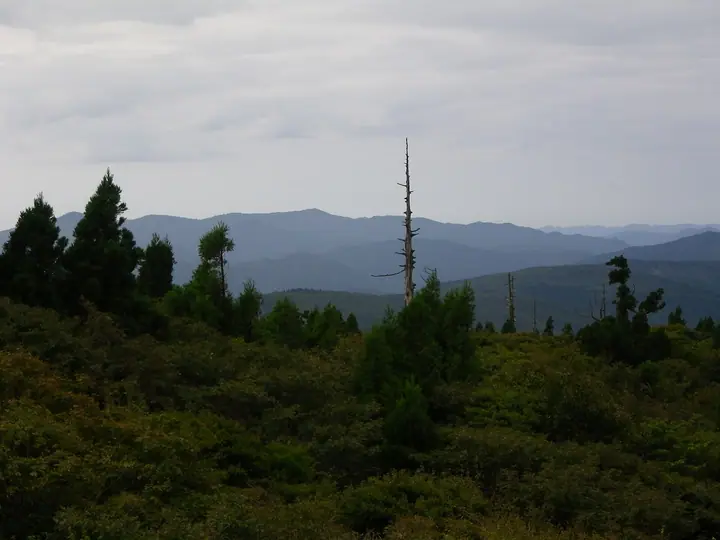
Mount Jakuchi (1,337 m) is the highest peak in Yamaguchi Prefecture, straddling the border with Yoshika Town in Shimane Prefecture. Within Western Chūgoku Mountains Quasi-National Park, it harbours one of the most extensive beech old-growth stands in the Chūgoku range. The Jakuchi Gorge at its foot — home to the Goryū five-tier waterfall listed in Japan's Top 100 Waterfalls — is celebrated for spring greenery and autumn foliage. The peak appears in the Chūgoku Hundred Famous Mountains and the Yamaguchi Hundred Famous Mountains.
Mount Jakuchi at a glance
- Weather: The most settled day in the next 7 days is Sun, November 8: clear, gusts up to 6 m/s. Fri, Nov 6, Sat, Nov 7: strong wind (gusts up to 19 m/s).
- Route: The shortest is Mount Jakuchi Circuit via the Five Dragon Falls of Jakuchi Gorge: about 6 h 43 min, 12.2 km, about 1,050 m of climbing.
Mount Jakuchi weather (hourly, 14 days)
Sunrise today 06:33, sunset 17:18
| Tue, 11/3 | Wed, 11/4 | Thu, 11/5 | Fri, 11/6 | Sat, 11/7 | Sun, 11/8 | Mon, 11/9 | Tue, 11/10 | Wed, 11/11 | Thu, 11/12 | Fri, 11/13 | Sat, 11/14 | Sun, 11/15 | Mon, 11/16 | Tue, 11/17 | |||||||||||||||||||||||||||||||||||||||||||||||||||||||||||||||||||||||
|---|---|---|---|---|---|---|---|---|---|---|---|---|---|---|---|---|---|---|---|---|---|---|---|---|---|---|---|---|---|---|---|---|---|---|---|---|---|---|---|---|---|---|---|---|---|---|---|---|---|---|---|---|---|---|---|---|---|---|---|---|---|---|---|---|---|---|---|---|---|---|---|---|---|---|---|---|---|---|---|---|---|---|---|---|---|
| Japan time | 15 | 17 | 19 | 21 | 23 | 1 | 3 | 5 | 7 | 9 | 11 | 13 | 15 | 18 | 21 | 0 | 3 | 6 | 9 | 12 | 15 | 18 | 21 | 0 | 3 | 6 | 9 | 12 | 15 | 18 | 21 | 0 | 3 | 6 | 9 | 12 | 15 | 18 | 21 | 0 | 3 | 6 | 9 | 12 | 15 | 18 | 21 | 0 | 3 | 6 | 9 | 15 | 21 | 3 | 9 | 15 | 21 | 3 | 9 | 15 | 21 | 3 | 9 | 15 | 21 | 3 | 9 | 15 | 21 | 3 | 9 | 15 | 21 | 3 | 9 | 15 | 21 | 3 | 9 | 15 | 21 | 3 | 9 | 15 | |
  |   |   | | | | | | |   | | | |   |   | | | | |   | |   | | | | |   |  | |  | | |   | | | | | | | | | | | | | | | | | | |   |   | | | | | | | | |  | | | | | | | | | | | | | | | | | | | | | | | ||
| Temperature | °C | 10° | 7° | 5° | 5° | 4° | 3° | 3° | 3° | 3° | 8° | 10° | 12° | 10° | 7° | 7° | 8° | 8° | 9° | 10° | 11° | 11° | 10° | 10° | 9° | 8° | 6° | 8° | 9° | 7° | 3° | 3° | 2° | 2° | 1° | 3° | 5° | 5° | 0° | -1° | -1° | -1° | -2° | 5° | 8° | 8° | 5° | 5° | 5° | 4° | 4° | 6° | 7° | 3° | 3° | 4° | 6° | 2° | 0° | 2° | 4° | 0° | 0° | 4° | 7° | 2° | 3° | 6° | 7° | -1° | -1° | 5° | 9° | 6° | 6° | 7° | 8° | 8° | 9° | 8° | 8° | 3° | -1° | 3° | 7° |
| Precipitation | mm | 0.3 | 0.9 | 2.2 | 6 | 2.1 | 1.1 | 0.6 | 0.1 | 0.3 | 1.0 | 0.2 | 0.4 | 2.1 | 0.8 | 0.9 | 13 | 21 | 1.1 | 2.7 | 2.7 | 0.3 | |||||||||||||||||||||||||||||||||||||||||||||||||||||||||||||||
| New snow | cm | ||||||||||||||||||||||||||||||||||||||||||||||||||||||||||||||||||||||||||||||||||||
| Snow depth | cm | 0 | 0 | 0 | 0 | 0 | 0 | 0 | 0 | 0 | 0 | 0 | 0 | 0 | 0 | 0 | 0 | 0 | 0 | 0 | 0 | 0 | 0 | 0 | 0 | 0 | 0 | 0 | 0 | 0 | 0 | 0 | 0 | 0 | 0 | 0 | 0 | 0 | 0 | 0 | 0 | 0 | 0 | 0 | 0 | 0 | 0 | 0 | 0 | 0 | 0 | 0 | 0 | 0 | 0 | 0 | 0 | 0 | 0 | 0 | 0 | 0 | 0 | 0 | 0 | 0 | 0 | 0 | 0 | 0 | 0 | 0 | 0 | 0 | 0 | 0 | 0 | 0 | 0 | 0 | 0 | 0 | 0 | 0 | 0 |
| Wind | m/s | 4 | 3 | 3 | 3 | 2 | 2 | 2 | 2 | 2 | 3 | 4 | 3 | 2 | 1 | 3 | 2 | 1 | 0 | 2 | 2 | 4 | 3 | 2 | 5 | 7 | 7 | 7 | 7 | 7 | 6 | 7 | 7 | 7 | 6 | 5 | 4 | 4 | 2 | 2 | 1 | 1 | 1 | 1 | 1 | 1 | 1 | 1 | 1 | 2 | 2 | 4 | 4 | 3 | 4 | 4 | 6 | 6 | 6 | 4 | 4 | 2 | 1 | 2 | 4 | 3 | 3 | 4 | 3 | 2 | 2 | 2 | 3 | 2 | 3 | 5 | 5 | 1 | 5 | 5 | 4 | 4 | 2 | 2 | 3 |
| Wind gusts | m/s | 10 | 10 | 8 | 8 | 7 | 6 | 5 | 5 | 6 | 8 | 10 | 10 | 8 | 7 | 8 | 7 | 5 | 4 | 5 | 7 | 11 | 14 | 8 | 13 | 16 | 17 | 18 | 19 | 18 | 17 | 17 | 17 | 18 | 17 | 15 | 14 | 12 | 10 | 6 | 5 | 3 | 4 | 4 | 5 | 6 | 4 | 3 | 2 | 5 | 7 | 10 | 10 | 10 | 10 | 13 | 16 | 17 | 16 | 16 | 11 | 9 | 4 | 6 | 10 | 9 | 10 | 10 | 10 | 7 | 5 | 7 | 9 | 8 | 9 | 13 | 16 | 13 | 13 | 13 | 13 | 11 | 9 | 6 | 8 |
| Wind dir. | ↓ | ↓ | ↓ | ↓ | ↓ | ↓ | ↓ | ↓ | ↓ | ↓ | ↓ | ↓ | ↓ | ↓ | ↓ | ↓ | ↓ | ↓ | ↓ | ↓ | ↓ | ↓ | ↓ | ↓ | ↓ | ↓ | ↓ | ↓ | ↓ | ↓ | ↓ | ↓ | ↓ | ↓ | ↓ | ↓ | ↓ | ↓ | ↓ | ↓ | ↓ | ↓ | ↓ | ↓ | ↓ | ↓ | ↓ | ↓ | ↓ | ↓ | ↓ | ↓ | ↓ | ↓ | ↓ | ↓ | ↓ | ↓ | ↓ | ↓ | ↓ | ↓ | ↓ | ↓ | ↓ | ↓ | ↓ | ↓ | ↓ | ↓ | ↓ | ↓ | ↓ | ↓ | ↓ | ↓ | ↓ | ↓ | ↓ | ↓ | ↓ | ↓ | ↓ | ↓ | |
Mount Jakuchi hiking routes
Hiking times are estimates calculated from the terrain.
Huts, campsites and lodging near Mount Jakuchi
Campsites
- 寂地峡
- 寂地峡キャンプ場
Lists that include Mount Jakuchi
Highest Peaks by Prefecture · Chugoku 100 Famous Mountains · Yamaguchi Prefecture 100 Famous Mountains · Elevations of 1003 Mountains of Japan · 1000 Mountains of Japan
Mount Jakuchi facts
- Elevation
- 1,337 m
- Location
- Iwakuni, Yamaguchi / Masuda, Shimane / Yoshika, Shimane
34.467363, 132.054398 - National Park
- 西中国山地国定公園
- Website
- yamaguchi-tourism.jp
- Trail Map
- kankou.iwakuni-city.net (PDF)
- Wikipedia
- ja.wikipedia.org