
Mount Ishidana
石棚山
Yamakita, Kanagawa · Elevation 1,351 m
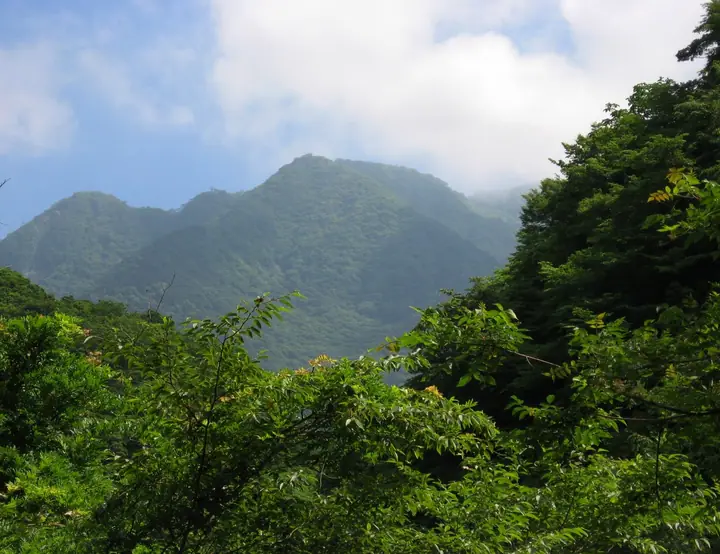
Mount Ishidana (1,351 m) lies in Yamakita Town, Ashigarakami District, Kanagawa Prefecture, on the Ishidana ridge that descends southwest from Mount Hinokibora-maru, the lord of western Tanzawa. The Ishidana ridge runs roughly 4.5 km with an elevation drop of about 1,100 m, descending toward Hōkizawa in the Nakagawa area. The peak lies within the Tanzawa-Ōyama Quasi-National Park and is listed in the 350 Mountains around Tokyo and the Kantō Weekend 160.
Mount Ishidana at a glance
- Weather: The most settled day in the next 7 days is Fri, November 6: clear, gusts up to 8 m/s.
- Route: The shortest is Mount Hinokiboramaru Tsutsuji Trail and Ishidana Ridge Circuit: about 7 h 40 min, 11.8 km, about 1,290 m of climbing.
Mount Ishidana weather (hourly, 14 days)
Sunrise today 06:06, sunset 16:48
| Tue, 11/3 | Wed, 11/4 | Thu, 11/5 | Fri, 11/6 | Sat, 11/7 | Sun, 11/8 | Mon, 11/9 | Tue, 11/10 | Wed, 11/11 | Thu, 11/12 | Fri, 11/13 | Sat, 11/14 | Sun, 11/15 | Mon, 11/16 | Tue, 11/17 | |||||||||||||||||||||||||||||||||||||||||||||||||||||||||||||||||||||||
|---|---|---|---|---|---|---|---|---|---|---|---|---|---|---|---|---|---|---|---|---|---|---|---|---|---|---|---|---|---|---|---|---|---|---|---|---|---|---|---|---|---|---|---|---|---|---|---|---|---|---|---|---|---|---|---|---|---|---|---|---|---|---|---|---|---|---|---|---|---|---|---|---|---|---|---|---|---|---|---|---|---|---|---|---|---|
| Japan time | 15 | 17 | 19 | 21 | 23 | 1 | 3 | 5 | 7 | 9 | 11 | 13 | 15 | 18 | 21 | 0 | 3 | 6 | 9 | 12 | 15 | 18 | 21 | 0 | 3 | 6 | 9 | 12 | 15 | 18 | 21 | 0 | 3 | 6 | 9 | 12 | 15 | 18 | 21 | 0 | 3 | 6 | 9 | 12 | 15 | 18 | 21 | 0 | 3 | 6 | 9 | 15 | 21 | 3 | 9 | 15 | 21 | 3 | 9 | 15 | 21 | 3 | 9 | 15 | 21 | 3 | 9 | 15 | 21 | 3 | 9 | 15 | 21 | 3 | 9 | 15 | 21 | 3 | 9 | 15 | 21 | 3 | 9 | 15 | |
  |   | |   | | | | | |   | | | | | | | | | |   | |   | | | | |  | | |  | | | |   | |   | | | | |   | |   | | | | | | | | | | | | | | | | | |   |  | | | | | | | | | | | | | | | | | | | | | | | ||
| Temperature | °C | 10° | 8° | 7° | 7° | 6° | 6° | 5° | 5° | 5° | 6° | 7° | 7° | 5° | 5° | 4° | 5° | 5° | 5° | 8° | 13° | 12° | 9° | 7° | 5° | 5° | 4° | 12° | 16° | 14° | 9° | 8° | 8° | 7° | 5° | 9° | 11° | 7° | 5° | 3° | 4° | 3° | 2° | 7° | 9° | 7° | 5° | 4° | 4° | 4° | 3° | 4° | 7° | 3° | 2° | 4° | 6° | 3° | 1° | 5° | 8° | -2° | -3° | 4° | 5° | 3° | -1° | 7° | 8° | 1° | 1° | 3° | 5° | 2° | 0° | 8° | 10° | 7° | 7° | 12° | 15° | 5° | 4° | 3° | 4° |
| Precipitation | mm | 0.2 | 0.3 | 0.1 | 0.2 | 0.5 | 0.7 | 1.6 | 4.8 | 9 | 16 | 9 | 3.7 | 0.3 | 1.7 | 0.2 | 2.8 | 0.5 | 1.5 | 1.3 | 0.3 | 0.6 | 0.1 | 9 | 25 | 0.8 | 0.1 | 0.3 | |||||||||||||||||||||||||||||||||||||||||||||||||||||||||
| New snow | cm | ||||||||||||||||||||||||||||||||||||||||||||||||||||||||||||||||||||||||||||||||||||
| Snow depth | cm | 0 | 0 | 0 | 0 | 0 | 0 | 0 | 0 | 0 | 0 | 0 | 0 | 0 | 0 | 0 | 0 | 0 | 0 | 0 | 0 | 0 | 0 | 0 | 0 | 0 | 0 | 0 | 0 | 0 | 0 | 0 | 0 | 0 | 0 | 0 | 0 | 0 | 0 | 0 | 0 | 0 | 0 | 0 | 0 | 0 | 0 | 0 | 0 | 0 | 0 | 0 | 0 | 0 | 0 | 0 | 0 | 0 | 0 | 0 | 0 | 0 | 0 | 0 | 0 | 0 | 0 | 0 | 0 | 0 | 0 | 0 | 0 | 0 | 0 | 0 | 0 | 0 | 0 | 0 | 0 | 0 | 0 | 0 | 0 |
| Wind | m/s | 2 | 1 | 1 | 1 | 1 | 2 | 2 | 2 | 2 | 2 | 2 | 2 | 2 | 2 | 2 | 2 | 2 | 2 | 2 | 2 | 2 | 0 | 1 | 0 | 0 | 1 | 0 | 2 | 2 | 1 | 1 | 0 | 2 | 1 | 1 | 1 | 2 | 1 | 0 | 0 | 1 | 1 | 1 | 3 | 2 | 1 | 1 | 1 | 1 | 1 | 2 | 2 | 2 | 3 | 2 | 3 | 1 | 1 | 5 | 3 | 1 | 0 | 1 | 2 | 1 | 1 | 1 | 3 | 1 | 1 | 1 | 2 | 0 | 0 | 1 | 3 | 1 | 0 | 2 | 2 | 2 | 1 | 1 | 2 |
| Wind gusts | m/s | 7 | 6 | 3 | 3 | 3 | 4 | 5 | 5 | 4 | 5 | 6 | 7 | 7 | 6 | 5 | 6 | 6 | 7 | 7 | 9 | 7 | 4 | 2 | 2 | 2 | 3 | 3 | 6 | 8 | 5 | 3 | 3 | 5 | 5 | 4 | 5 | 7 | 6 | 4 | 2 | 2 | 2 | 4 | 8 | 9 | 7 | 3 | 3 | 4 | 4 | 5 | 8 | 7 | 7 | 7 | 9 | 9 | 3 | 15 | 14 | 8 | 4 | 4 | 7 | 6 | 4 | 4 | 8 | 7 | 4 | 4 | 6 | 5 | 2 | 5 | 11 | 8 | 5 | 5 | 6 | 6 | 5 | 5 | 6 |
| Wind dir. | ↓ | ↓ | ↓ | ↓ | ↓ | ↓ | ↓ | ↓ | ↓ | ↓ | ↓ | ↓ | ↓ | ↓ | ↓ | ↓ | ↓ | ↓ | ↓ | ↓ | ↓ | ↓ | ↓ | ↓ | ↓ | ↓ | ↓ | ↓ | ↓ | ↓ | ↓ | ↓ | ↓ | ↓ | ↓ | ↓ | ↓ | ↓ | ↓ | ↓ | ↓ | ↓ | ↓ | ↓ | ↓ | ↓ | ↓ | ↓ | ↓ | ↓ | ↓ | ↓ | ↓ | ↓ | ↓ | ↓ | ↓ | ↓ | ↓ | ↓ | ↓ | ↓ | ↓ | ↓ | ↓ | ↓ | ↓ | ↓ | ↓ | ↓ | ↓ | ↓ | ↓ | ↓ | ↓ | ↓ | ↓ | ↓ | ↓ | ↓ | ↓ | ↓ | ↓ | ↓ | |
Mount Ishidana hiking routes
Hiking times are estimates calculated from the terrain.
Huts, campsites and lodging near Mount Ishidana
Mountain huts
- 青ケ岳山荘 2026: open all year · reservation required · sleeps 35
- Yushin Lodge
- 犬越路避難小屋 unstaffed
- 一軒家避難小屋 unstaffed
Campsites
- 西丹沢マウントブリッジキャンプ場
- 大石キャンプ場
- ウェルキャンプ西丹沢
- バウアーハウスジャパン キャンプ場
- 白石オートキャンプ場
Mount Ishidana facts
- Also known as
- デシチノ頭
- Elevation
- 1,351 m
- Location
- Yamakita, Kanagawa
35.463292, 139.086217 - National Park
- 丹沢大山国定公園
- Website
- www.pref.kanagawa.jp (PDF)
- Wikipedia
- ja.wikipedia.org