
Mt. Tōnodake
塔ノ岳
Yamakita, Kanagawa / Hadano, Kanagawa / Kiyokawa, Kanagawa · Elevation 1,491 m
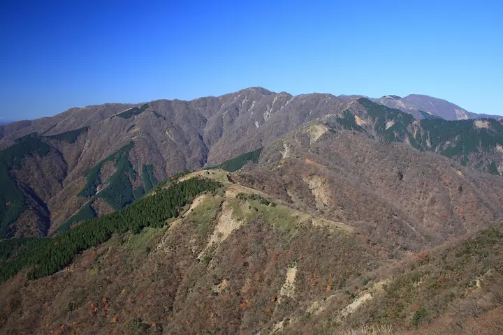
Mt. Tōnodake (1,491 m) is the highest summit of the Omote-Tanzawa front range, rising on the meeting point of Hadano City, Kiyokawa Village, and Yamakita Town in Kanagawa, within Tanzawa-Ōyama Quasi-National Park. Its name ("Pagoda Peak") comes from the Sonbutsu-iwa rock once enshrined at the summit; today the Sonbutsu Hut sits there. The peak is one of the metropolitan area's most popular hikes, served by the long Ōkura Ridge (nicknamed the "Idiot Ridge") and the front-ridge traverse from Yabitsu Pass. From the summit hikers can see Mt. Fuji, the Southern Alps, the Tanzawa main ridge with Mt. Hiru and Mt. Tanzawa, Sagami Bay, and Enoshima, and it is counted among the 100 Famous Mountains of Kantō and the 100 Low Mountains of Japan.
Mt. Tōnodake at a glance
- Weather: The most settled day in the next 7 days is Fri, November 6: clear, gusts up to 9 m/s.
- Route: The shortest is Mount Tonodake Out-and-Back via the Omote Ridge from Bodai Pass: about 8 h 4 min, 11.8 km, about 1,330 m of climbing.
Mt. Tōnodake weather (hourly, 14 days)
Sunrise today 06:06, sunset 16:48
| Tue, 11/3 | Wed, 11/4 | Thu, 11/5 | Fri, 11/6 | Sat, 11/7 | Sun, 11/8 | Mon, 11/9 | Tue, 11/10 | Wed, 11/11 | Thu, 11/12 | Fri, 11/13 | Sat, 11/14 | Sun, 11/15 | Mon, 11/16 | Tue, 11/17 | |||||||||||||||||||||||||||||||||||||||||||||||||||||||||||||||||||||||
|---|---|---|---|---|---|---|---|---|---|---|---|---|---|---|---|---|---|---|---|---|---|---|---|---|---|---|---|---|---|---|---|---|---|---|---|---|---|---|---|---|---|---|---|---|---|---|---|---|---|---|---|---|---|---|---|---|---|---|---|---|---|---|---|---|---|---|---|---|---|---|---|---|---|---|---|---|---|---|---|---|---|---|---|---|---|
| Japan time | 21 | 23 | 1 | 3 | 5 | 7 | 9 | 11 | 13 | 15 | 17 | 19 | 21 | 0 | 3 | 6 | 9 | 12 | 15 | 18 | 21 | 0 | 3 | 6 | 9 | 12 | 15 | 18 | 21 | 0 | 3 | 6 | 9 | 12 | 15 | 18 | 21 | 0 | 3 | 6 | 9 | 12 | 15 | 18 | 21 | 0 | 3 | 6 | 9 | 12 | 15 | 21 | 3 | 9 | 15 | 21 | 3 | 9 | 15 | 21 | 3 | 9 | 15 | 21 | 3 | 9 | 15 | 21 | 3 | 9 | 15 | 21 | 3 | 9 | 15 | 21 | 3 | 9 | 15 | 21 | 3 | 9 | 15 | 21 | |
  |   | | | |   |   | | | | | | | | | | |   |   |   |   | | | |  |   | | |  | |   | | | |   | | | | | | | | | | | | | | | | | | | | | | | | |   |  | | | | | | | | | | | | | | | | | | | | | | | | ||
| Temperature | °C | 7° | 7° | 6° | 6° | 5° | 5° | 6° | 5° | 5° | 5° | 5° | 5° | 5° | 5° | 6° | 6° | 10° | 12° | 12° | 9° | 7° | 6° | 5° | 5° | 13° | 15° | 14° | 10° | 8° | 7° | 7° | 5° | 9° | 10° | 8° | 5° | 2° | 3° | 3° | 2° | 6° | 8° | 7° | 4° | 4° | 3° | 2° | 2° | 3° | 4° | 5° | 3° | 2° | 4° | 6° | 3° | 3° | 6° | 9° | -1° | -2° | 5° | 5° | 4° | 0° | 8° | 7° | 0° | 1° | 3° | 5° | 2° | 1° | 8° | 10° | 8° | 7° | 12° | 14° | 5° | 3° | 3° | 4° | 2° |
| Precipitation | mm | 0.2 | 0.4 | 0.5 | 0.6 | 0.7 | 1.1 | 1.5 | 4.0 | 7 | 16 | 14 | 6 | 0.6 | 0.3 | 0.3 | 0.5 | 0.3 | 0.7 | 0.3 | 0.4 | 0.5 | 0.6 | 0.1 | 0.1 | 0.3 | 1.0 | 0.1 | 0.2 | 0.1 | 10 | 24 | 0.7 | 0.1 | 0.2 | 0.1 | |||||||||||||||||||||||||||||||||||||||||||||||||
| New snow | cm | ||||||||||||||||||||||||||||||||||||||||||||||||||||||||||||||||||||||||||||||||||||
| Snow depth | cm | 0 | 0 | 0 | 0 | 0 | 0 | 0 | 0 | 0 | 0 | 0 | 0 | 0 | 0 | 0 | 0 | 0 | 0 | 0 | 0 | 0 | 0 | 0 | 0 | 0 | 0 | 0 | 0 | 0 | 0 | 0 | 0 | 0 | 0 | 0 | 0 | 0 | 0 | 0 | 0 | 0 | 0 | 0 | 0 | 0 | 0 | 0 | 0 | 0 | 0 | 0 | 0 | 0 | 0 | 0 | 0 | 0 | 0 | 0 | 0 | 0 | 0 | 0 | 0 | 0 | 0 | 0 | 0 | 0 | 0 | 0 | 0 | 0 | 0 | 0 | 0 | 0 | 0 | 0 | 0 | 0 | 0 | 0 | 0 |
| Wind | m/s | 1 | 1 | 1 | 1 | 2 | 2 | 1 | 2 | 2 | 2 | 2 | 2 | 2 | 2 | 3 | 3 | 3 | 2 | 1 | 0 | 1 | 1 | 1 | 1 | 1 | 3 | 2 | 1 | 1 | 1 | 1 | 1 | 2 | 2 | 2 | 1 | 1 | 0 | 0 | 0 | 1 | 2 | 2 | 1 | 1 | 1 | 1 | 2 | 1 | 1 | 1 | 2 | 2 | 2 | 2 | 0 | 1 | 3 | 3 | 1 | 0 | 1 | 2 | 1 | 2 | 1 | 2 | 1 | 0 | 1 | 2 | 0 | 0 | 2 | 3 | 1 | 0 | 2 | 2 | 2 | 1 | 1 | 2 | 1 |
| Wind gusts | m/s | 2 | 3 | 4 | 4 | 5 | 5 | 6 | 6 | 7 | 7 | 7 | 7 | 8 | 9 | 9 | 11 | 11 | 11 | 7 | 3 | 5 | 6 | 8 | 8 | 7 | 9 | 9 | 7 | 5 | 4 | 6 | 7 | 6 | 7 | 8 | 6 | 5 | 5 | 4 | 3 | 5 | 7 | 7 | 5 | 4 | 4 | 5 | 5 | 5 | 5 | 5 | 7 | 6 | 6 | 7 | 7 | 6 | 14 | 15 | 9 | 6 | 5 | 9 | 7 | 6 | 6 | 7 | 6 | 4 | 4 | 6 | 6 | 3 | 8 | 13 | 11 | 10 | 7 | 8 | 7 | 7 | 5 | 6 | 5 |
| Wind dir. | ↓ | ↓ | ↓ | ↓ | ↓ | ↓ | ↓ | ↓ | ↓ | ↓ | ↓ | ↓ | ↓ | ↓ | ↓ | ↓ | ↓ | ↓ | ↓ | ↓ | ↓ | ↓ | ↓ | ↓ | ↓ | ↓ | ↓ | ↓ | ↓ | ↓ | ↓ | ↓ | ↓ | ↓ | ↓ | ↓ | ↓ | ↓ | ↓ | ↓ | ↓ | ↓ | ↓ | ↓ | ↓ | ↓ | ↓ | ↓ | ↓ | ↓ | ↓ | ↓ | ↓ | ↓ | ↓ | ↓ | ↓ | ↓ | ↓ | ↓ | ↓ | ↓ | ↓ | ↓ | ↓ | ↓ | ↓ | ↓ | ↓ | ↓ | ↓ | ↓ | ↓ | ↓ | ↓ | ↓ | ↓ | ↓ | ↓ | ↓ | ↓ | ↓ | |||
Mt. Tōnodake hiking routes
- Mount Tonodake Out-and-Back via the Omote Ridge from Bodai Pass 11.8 km · Ascent 1,335 m parking
- Yabitsu Pass to Mount Tanzawa via the Omote Ridge and Okura Ridge 19.8 km · Ascent 1,555 m Yabitsu pass (Bus stop) (parking) → Okura (Bus stop), Okura Parking
- Tanzawa Sanpo, a Long Traverse over Chains and Plank Bridges Linking Mount Tanzawa and Mount Tonodake 20.1 km · Ascent 1,853 m 三又路 (Bus stop) → Okura (Bus stop), Okura Parking
- Mount To–Mount Tanzawa–Mount Nabewari Circuit from Okura 23.5 km · Ascent 1,916 m Okura (Bus stop), Okura Parking
- Tanzawa Main Ridge Traverse from Nishi-Tanzawa to Okura 22.7 km · Ascent 2,241 m 西丹沢自然教室 (Bus stop) (parking) → Okura (Bus stop), Okura Parking
- Tanzawa Main Ridge Traverse from Yakeyama Trailhead to Okura 25.5 km · Ascent 2,123 m 伏馬田入口 (Bus stop) → Okura (Bus stop), Okura Parking
Hiking times are estimates calculated from the terrain.
Huts, campsites and lodging near Mt. Tōnodake
Mountain huts
- Sonbutsu Sanso 2026: open all year · reservation required
- Kinomata Hut 2026: open all year · sleeps 14
- Hanatate Sanso 2026: open all year · sleeps 25
- 鍋割山荘 2026: open all year
- Miyama Sanso 2026: open all year · reservation required
Campsites
- ユーシンロッジ
- Ookurakougen tent site
- BOSCO Auto Camp
- BOSCOオートキャンプベース
- 表丹沢野外活動センター
Lodging
- 国民宿舎丹沢ホーム
Lists that include Mt. Tōnodake
100 Low Mountains of Japan · Kanto 100 Famous Mountains · Elevations of 1003 Mountains of Japan · 1000 Mountains of Japan
Mt. Tōnodake facts
- Also known as
- 塔ヶ岳・尊仏山・孫仏山・御塔
- Elevation
- 1,491 m
- Location
- Yamakita, Kanagawa / Hadano, Kanagawa / Kiyokawa, Kanagawa
35.454072, 139.163319 - National Park
- 丹沢大山国定公園
- Website
- www.kankou-hadano.org
- Trail Map
- city.hadano.kanagawa.jp (PDF)
- Access Information
- kanagawa-park.or.jp
- Wikipedia
- ja.wikipedia.org