
Mount Ikeguchi
池口岳
Kawanehon, Shizuoka / Iida, Nagano · Elevation 2,392 m
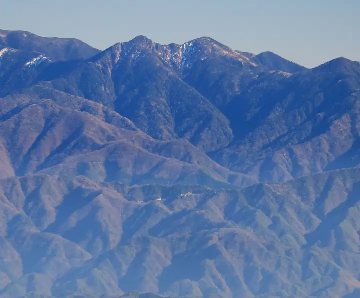
Mount Ikeguchi is a 2,392 m twin-peaked mountain (north summit) on the border between Iida City in Nagano and Shizuoka City in Shizuoka, rising in the deep-southern Akaishi Range — "Shin-nanbu" of the South Japanese Alps. The north summit and the 2,375.6 m south summit form a distinctive twin profile, and the area from Ikeguchi-dake to Mount Tekkari is designated as the Wilderness Area of Minami-Alps National Park. Listed in the Nihon Nihyaku Meizan, the Shinshū Hyakumeizan, and the Shizuoka no Hyakuzan, the mountain is prized for its moss-cloaked subalpine conifer forest and the open Shika-no-Taira meadow, which commands sweeping views of Mounts Hijiri and Tekkari. The sole approach is the long round trip from the Ikeguchi village trailhead in Minami-Shinano, Iida City, climbing via Kuro-nagi to the junction and on to the north peak — about eleven hours total — and is a designated registered trail under Nagano's mountaineering safety ordinance, requiring a filed climbing plan.
Mount Ikeguchi at a glance
- Weather: The most settled day in the next 7 days is Sun, November 8: clear, gusts up to 9 m/s.
Mount Ikeguchi weather (hourly, 14 days)
Sunrise today 06:10, sunset 16:53
| Tue, 11/3 | Wed, 11/4 | Thu, 11/5 | Fri, 11/6 | Sat, 11/7 | Sun, 11/8 | Mon, 11/9 | Tue, 11/10 | Wed, 11/11 | Thu, 11/12 | Fri, 11/13 | Sat, 11/14 | Sun, 11/15 | Mon, 11/16 | Tue, 11/17 | |||||||||||||||||||||||||||||||||||||||||||||||||||||||||||||||||||||||
|---|---|---|---|---|---|---|---|---|---|---|---|---|---|---|---|---|---|---|---|---|---|---|---|---|---|---|---|---|---|---|---|---|---|---|---|---|---|---|---|---|---|---|---|---|---|---|---|---|---|---|---|---|---|---|---|---|---|---|---|---|---|---|---|---|---|---|---|---|---|---|---|---|---|---|---|---|---|---|---|---|---|---|---|---|---|
| Japan time | 15 | 17 | 19 | 21 | 23 | 1 | 3 | 5 | 7 | 9 | 11 | 13 | 15 | 18 | 21 | 0 | 3 | 6 | 9 | 12 | 15 | 18 | 21 | 0 | 3 | 6 | 9 | 12 | 15 | 18 | 21 | 0 | 3 | 6 | 9 | 12 | 15 | 18 | 21 | 0 | 3 | 6 | 9 | 12 | 15 | 18 | 21 | 0 | 3 | 6 | 9 | 15 | 21 | 3 | 9 | 15 | 21 | 3 | 9 | 15 | 21 | 3 | 9 | 15 | 21 | 3 | 9 | 15 | 21 | 3 | 9 | 15 | 21 | 3 | 9 | 15 | 21 | 3 | 9 | 15 | 21 | 3 | 9 | 15 | |
 |   | | |   | | | |   |   | |   | |   |   | | | |   | | |   | |  | |   | | | | | | | | | | | | | | | | | | | | | | | | | | | | | | | |   | | |   |  | | | | | | | | | | | | | | | | | | | | | |   | ||
| Temperature | °C | 6° | 1° | 0° | -1° | -3° | -3° | -2° | -1° | 0° | 4° | 7° | 6° | 5° | 3° | 3° | 3° | 3° | 4° | 6° | 10° | 6° | 4° | 3° | 2° | 3° | 3° | 5° | 8° | 6° | 0° | -2° | -3° | -5° | -7° | -1° | 2° | 0° | -6° | -8° | -7° | -6° | -5° | 3° | 5° | 3° | -1° | -1° | -1° | -1° | -2° | 3° | 3° | -4° | -5° | 1° | 1° | -3° | -6° | -2° | 2° | -7° | -6° | -1° | 1° | -6° | -6° | 1° | 3° | -5° | -5° | 1° | 2° | -5° | -3° | 3° | 3° | 3° | 3° | 6° | 6° | -2° | -1° | 0° | 1° |
| Precipitation | mm | 0.3 | 0.1 | 2.7 | 7 | 9 | 6 | 0.2 | 1.4 | 0.3 | 1.6 | 0.9 | 0.2 | 0.3 | 0.4 | 0.8 | 20 | 25 | 1.9 | 1.1 | 0.2 | 0.7 | |||||||||||||||||||||||||||||||||||||||||||||||||||||||||||||||
| New snow | cm | 0.1 | |||||||||||||||||||||||||||||||||||||||||||||||||||||||||||||||||||||||||||||||||||
| Snow depth | cm | 0 | 0 | 0 | 0 | 0 | 0 | 0 | 0 | 0 | 0 | 0 | 0 | 0 | 0 | 0 | 0 | 0 | 0 | 0 | 0 | 0 | 0 | 0 | 0 | 0 | 0 | 0 | 0 | 0 | 0 | 0 | 0 | 0 | 0 | 0 | 0 | 0 | 0 | 0 | 0 | 0 | 0 | 0 | 0 | 0 | 0 | 0 | 0 | 0 | 0 | 0 | 0 | 0 | 0 | 0 | 0 | 0 | 0 | 0 | 0 | 0 | 0 | 0 | 0 | 0 | 0 | 0 | 0 | 0 | 0 | 0 | 0 | 0 | 0 | 0 | 0 | 0 | 0 | 0 | 0 | 0 | 0 | 0 | 0 |
| Wind | m/s | 3 | 1 | 0 | 0 | 0 | 0 | 0 | 0 | 0 | 1 | 2 | 1 | 1 | 2 | 3 | 2 | 1 | 0 | 1 | 1 | 1 | 0 | 0 | 1 | 1 | 2 | 2 | 4 | 3 | 2 | 2 | 2 | 2 | 2 | 3 | 4 | 2 | 2 | 1 | 1 | 1 | 1 | 1 | 2 | 2 | 0 | 1 | 0 | 0 | 1 | 2 | 3 | 0 | 1 | 2 | 3 | 2 | 5 | 4 | 2 | 1 | 0 | 2 | 2 | 0 | 1 | 2 | 2 | 0 | 0 | 1 | 2 | 0 | 0 | 1 | 1 | 0 | 0 | 3 | 3 | 1 | 1 | 1 | 2 |
| Wind gusts | m/s | 12 | 12 | 7 | 4 | 4 | 4 | 4 | 3 | 4 | 5 | 8 | 8 | 6 | 9 | 11 | 14 | 14 | 11 | 6 | 7 | 8 | 12 | 6 | 7 | 9 | 11 | 11 | 14 | 14 | 13 | 12 | 12 | 13 | 14 | 14 | 15 | 15 | 11 | 9 | 7 | 7 | 7 | 7 | 9 | 9 | 7 | 4 | 5 | 6 | 6 | 8 | 11 | 9 | 5 | 8 | 13 | 10 | 22 | 22 | 18 | 10 | 4 | 7 | 9 | 7 | 8 | 11 | 11 | 7 | 4 | 5 | 8 | 7 | 5 | 8 | 11 | 13 | 13 | 12 | 16 | 12 | 5 | 4 | 8 |
| Wind dir. | ↓ | ↓ | ↓ | ↓ | ↓ | ↓ | ↓ | ↓ | ↓ | ↓ | ↓ | ↓ | ↓ | ↓ | ↓ | ↓ | ↓ | ↓ | ↓ | ↓ | ↓ | ↓ | ↓ | ↓ | ↓ | ↓ | ↓ | ↓ | ↓ | ↓ | ↓ | ↓ | ↓ | ↓ | ↓ | ↓ | ↓ | ↓ | ↓ | ↓ | ↓ | ↓ | ↓ | ↓ | ↓ | ↓ | ↓ | ↓ | ↓ | ↓ | ↓ | ↓ | ↓ | ↓ | ↓ | ↓ | ↓ | ↓ | ↓ | ↓ | ↓ | ↓ | ↓ | ↓ | ↓ | ↓ | ↓ | ↓ | ↓ | ↓ | ↓ | ↓ | ↓ | ↓ | ↓ | ↓ | ↓ | ↓ | ↓ | ↓ | ↓ | ↓ | ↓ | ↓ | |
Huts, campsites and lodging near Mount Ikeguchi
Mountain huts
Lists that include Mount Ikeguchi
Japan 200 Famous Mountains · Japan's 300 Famous Mountains · Shinshu 100 Famous Mountains · 100 Mountains of Shizuoka · Shinshu Mountain Cards · Elevations of 1003 Mountains of Japan
Mount Ikeguchi facts
- Also known as
- 池口岳北峰
- Elevation
- 2,392 m
- Location
- Kawanehon, Shizuoka / Iida, Nagano
35.330256, 138.038363 - National Park
- 南アルプス国立公園
- Website
- blog.nagano-ken.jp
- Wikipedia
- ja.wikipedia.org