
Shakagadake (Fugendake)
普賢岳
Hita, Oita · Elevation 1,231 m
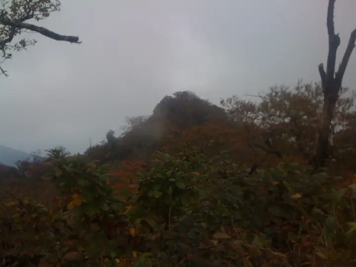
This 1,231 m summit, Fugendake, is the highest point of Shakagadake on the border of Hita City (Ōita) and Yame City (Fukuoka). Its Hon-Shaka peak (1,229.5 m) is the highest mountain in Fukuoka Prefecture, and Shakagadake is counted among the Kyūshū Hyakumeizan (100 Famous Mountains of Kyūshū). Known locally with Watagamidake and Gozendake as the 'Tsue Three Mountains,' it is climbed from trailheads such as Somano-sato Ravine Park on the Fukuoka side.
Shakagadake (Fugendake) at a glance
- Weather: The most settled day in the next 7 days is Sun, November 8: clear, gusts up to 5 m/s. Thu, Nov 5: strong wind (gusts up to 15 m/s).
- Route: The shortest is Mount Gozen, Mount Shaka and Fugendake Loop via Yabegoe: about 4 h 49 min, 8.1 km, about 860 m of climbing.
Shakagadake (Fugendake) weather (hourly, 14 days)
Sunrise today 06:36, sunset 17:24
| Tue, 11/3 | Wed, 11/4 | Thu, 11/5 | Fri, 11/6 | Sat, 11/7 | Sun, 11/8 | Mon, 11/9 | Tue, 11/10 | Wed, 11/11 | Thu, 11/12 | Fri, 11/13 | Sat, 11/14 | Sun, 11/15 | Mon, 11/16 | Tue, 11/17 | |||||||||||||||||||||||||||||||||||||||||||||||||||||||||||||||||||||||
|---|---|---|---|---|---|---|---|---|---|---|---|---|---|---|---|---|---|---|---|---|---|---|---|---|---|---|---|---|---|---|---|---|---|---|---|---|---|---|---|---|---|---|---|---|---|---|---|---|---|---|---|---|---|---|---|---|---|---|---|---|---|---|---|---|---|---|---|---|---|---|---|---|---|---|---|---|---|---|---|---|---|---|---|---|---|
| Japan time | 15 | 17 | 19 | 21 | 23 | 1 | 3 | 5 | 7 | 9 | 11 | 13 | 15 | 18 | 21 | 0 | 3 | 6 | 9 | 12 | 15 | 18 | 21 | 0 | 3 | 6 | 9 | 12 | 15 | 18 | 21 | 0 | 3 | 6 | 9 | 12 | 15 | 18 | 21 | 0 | 3 | 6 | 9 | 12 | 15 | 18 | 21 | 0 | 3 | 6 | 9 | 15 | 21 | 3 | 9 | 15 | 21 | 3 | 9 | 15 | 21 | 3 | 9 | 15 | 21 | 3 | 9 | 15 | 21 | 3 | 9 | 15 | 21 | 3 | 9 | 15 | 21 | 3 | 9 | 15 | 21 | 3 | 9 | 15 | |
  |   |   |   | | | | | | | | | |   | |   | | | |   |   |   | | | |   | |   |  |  | | | | | | | | | | | | | | | | | | | |   | | | | | | | | | | | | | | |  | | | | | | | | | | | | | | | | | | | | ||
| Temperature | °C | 11° | 9° | 8° | 7° | 6° | 6° | 6° | 7° | 7° | 8° | 13° | 15° | 15° | 10° | 10° | 9° | 9° | 9° | 12° | 13° | 12° | 12° | 12° | 11° | 10° | 7° | 9° | 11° | 10° | 4° | 4° | 2° | 0° | 0° | 3° | 7° | 7° | 2° | 0° | 0° | 0° | 0° | 7° | 9° | 9° | 6° | 5° | 6° | 6° | 5° | 7° | 9° | 3° | 1° | 6° | 7° | 3° | 2° | 4° | 7° | 0° | 1° | 6° | 8° | 2° | 1° | 7° | 10° | 4° | 1° | 8° | 12° | 7° | 9° | 13° | 11° | 11° | 10° | 9° | 12° | 5° | 5° | 6° | 10° |
| Precipitation | mm | 0.6 | 1.9 | 2.4 | 2.1 | 14 | 3.2 | 0.3 | 0.6 | 0.2 | 0.5 | 0.2 | 0.1 | 0.1 | 8 | 2.6 | 0.2 | 0.4 | 0.3 | ||||||||||||||||||||||||||||||||||||||||||||||||||||||||||||||||||
| New snow | cm | ||||||||||||||||||||||||||||||||||||||||||||||||||||||||||||||||||||||||||||||||||||
| Snow depth | cm | 0 | 0 | 0 | 0 | 0 | 0 | 0 | 0 | 0 | 0 | 0 | 0 | 0 | 0 | 0 | 0 | 0 | 0 | 0 | 0 | 0 | 0 | 0 | 0 | 0 | 0 | 0 | 0 | 0 | 0 | 0 | 0 | 0 | 0 | 0 | 0 | 0 | 0 | 0 | 0 | 0 | 0 | 0 | 0 | 0 | 0 | 0 | 0 | 0 | 0 | 0 | 0 | 0 | 0 | 0 | 0 | 0 | 0 | 0 | 0 | 0 | 0 | 0 | 0 | 0 | 0 | 0 | 0 | 0 | 0 | 0 | 0 | 0 | 0 | 0 | 0 | 0 | 0 | 0 | 0 | 0 | 0 | 0 | 0 |
| Wind | m/s | 3 | 3 | 3 | 4 | 3 | 3 | 3 | 3 | 3 | 4 | 3 | 1 | 1 | 3 | 2 | 2 | 1 | 1 | 2 | 4 | 6 | 3 | 4 | 3 | 4 | 4 | 4 | 5 | 4 | 3 | 4 | 4 | 4 | 4 | 4 | 3 | 3 | 2 | 2 | 2 | 2 | 2 | 1 | 1 | 0 | 1 | 1 | 1 | 1 | 2 | 3 | 3 | 2 | 1 | 3 | 4 | 3 | 3 | 5 | 3 | 1 | 0 | 1 | 2 | 1 | 2 | 3 | 3 | 3 | 2 | 1 | 2 | 2 | 3 | 5 | 4 | 1 | 3 | 4 | 4 | 2 | 4 | 3 | 3 |
| Wind gusts | m/s | 9 | 9 | 8 | 9 | 9 | 8 | 8 | 8 | 8 | 9 | 10 | 9 | 5 | 7 | 7 | 6 | 5 | 2 | 5 | 11 | 15 | 14 | 10 | 9 | 10 | 11 | 11 | 13 | 12 | 11 | 10 | 11 | 10 | 10 | 11 | 11 | 10 | 8 | 6 | 6 | 5 | 5 | 5 | 4 | 4 | 3 | 3 | 3 | 3 | 5 | 7 | 9 | 9 | 4 | 9 | 11 | 11 | 9 | 12 | 12 | 8 | 3 | 3 | 6 | 6 | 6 | 9 | 11 | 9 | 7 | 4 | 9 | 5 | 6 | 12 | 12 | 10 | 7 | 9 | 11 | 10 | 9 | 9 | 8 |
| Wind dir. | ↓ | ↓ | ↓ | ↓ | ↓ | ↓ | ↓ | ↓ | ↓ | ↓ | ↓ | ↓ | ↓ | ↓ | ↓ | ↓ | ↓ | ↓ | ↓ | ↓ | ↓ | ↓ | ↓ | ↓ | ↓ | ↓ | ↓ | ↓ | ↓ | ↓ | ↓ | ↓ | ↓ | ↓ | ↓ | ↓ | ↓ | ↓ | ↓ | ↓ | ↓ | ↓ | ↓ | ↓ | ↓ | ↓ | ↓ | ↓ | ↓ | ↓ | ↓ | ↓ | ↓ | ↓ | ↓ | ↓ | ↓ | ↓ | ↓ | ↓ | ↓ | ↓ | ↓ | ↓ | ↓ | ↓ | ↓ | ↓ | ↓ | ↓ | ↓ | ↓ | ↓ | ↓ | ↓ | ↓ | ↓ | ↓ | ↓ | ↓ | ↓ | ↓ | ↓ | ↓ | |
Shakagadake (Fugendake) hiking routes
Hiking times are estimates calculated from the terrain.
Shakagadake (Fugendake) facts
- Elevation
- 1,231 m
- Location
- Hita, Oita
33.187550, 130.888925 - Website
- www.city.yame.fukuoka.jp
- Trail Map
- www.city.yame.fukuoka.jp (PDF)
- Wikipedia
- ja.wikipedia.org