
Sannomine
三の峰
Agano, Niigata · Elevation 872 m
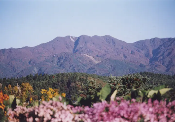
Sannomine is an 872-meter peak in Agano City, Niigata, one of the "Five Peaks of Gozu" (Ichinomine through Gonomine) that form the crown of Mount Gozu. Roughly the central of the five summits aligned along a northwest ridge, it lends its name to the Sannomine course climbed from the Deyu Onsen side. The area lies within Gozu-Renpo Prefectural Natural Park, on a mountain of religious tradition said to have been opened by Kobo Daishi.
Sannomine at a glance
- Weather: The most settled day in the next 7 days is Wed, November 4: clear, gusts up to 6 m/s. Sat, Nov 7: strong wind (gusts up to 19 m/s).
- Route: The shortest is Mount Gozu Return via the San-no-mine Trail from Hishigatake Trailhead: about 5 h 17 min, 8.6 km, about 880 m of climbing.
Sannomine weather (hourly, 14 days)
Sunrise today 06:09, sunset 16:43
| Tue, 11/3 | Wed, 11/4 | Thu, 11/5 | Fri, 11/6 | Sat, 11/7 | Sun, 11/8 | Mon, 11/9 | Tue, 11/10 | Wed, 11/11 | Thu, 11/12 | Fri, 11/13 | Sat, 11/14 | Sun, 11/15 | Mon, 11/16 | Tue, 11/17 | |||||||||||||||||||||||||||||||||||||||||||||||||||||||||||||||||||||||
|---|---|---|---|---|---|---|---|---|---|---|---|---|---|---|---|---|---|---|---|---|---|---|---|---|---|---|---|---|---|---|---|---|---|---|---|---|---|---|---|---|---|---|---|---|---|---|---|---|---|---|---|---|---|---|---|---|---|---|---|---|---|---|---|---|---|---|---|---|---|---|---|---|---|---|---|---|---|---|---|---|---|---|---|---|---|
| Japan time | 15 | 17 | 19 | 21 | 23 | 1 | 3 | 5 | 7 | 9 | 11 | 13 | 15 | 18 | 21 | 0 | 3 | 6 | 9 | 12 | 15 | 18 | 21 | 0 | 3 | 6 | 9 | 12 | 15 | 18 | 21 | 0 | 3 | 6 | 9 | 12 | 15 | 18 | 21 | 0 | 3 | 6 | 9 | 12 | 15 | 18 | 21 | 0 | 3 | 6 | 9 | 15 | 21 | 3 | 9 | 15 | 21 | 3 | 9 | 15 | 21 | 3 | 9 | 15 | 21 | 3 | 9 | 15 | 21 | 3 | 9 | 15 | 21 | 3 | 9 | 15 | 21 | 3 | 9 | 15 | 21 | 3 | 9 | 15 | |
 |  | | | |   | | |   | | | | | | |   |   | |   |   | | | |   |   |   | | |   | | | | | | |   | | | | | | |   | | | | | | | | | | |   | | | |   |   | | | | | | | | | | | | | |  | | |   | | | | | | | | | ||
| Temperature | °C | 9° | 5° | 5° | 4° | 3° | 3° | 2° | 2° | 3° | 9° | 11° | 12° | 12° | 6° | 9° | 9° | 7° | 8° | 9° | 10° | 13° | 9° | 9° | 9° | 9° | 9° | 10° | 14° | 10° | 8° | 6° | 5° | 4° | 3° | 3° | 6° | 5° | 3° | 3° | 3° | 2° | 2° | 5° | 6° | 5° | 4° | 4° | 3° | 3° | 3° | 5° | 4° | 2° | -1° | 6° | 10° | 3° | 1° | 4° | 4° | 3° | 4° | 5° | 7° | 3° | 3° | 5° | 5° | 4° | 3° | 6° | 7° | 1° | 1° | 8° | 12° | 6° | 7° | 8° | 5° | 3° | 2° | 4° | 5° |
| Precipitation | mm | 2.0 | 12 | 3.4 | 3.1 | 0.1 | 0.4 | 1.3 | 1.8 | 1.7 | 2.1 | 1.6 | 4.0 | 3.5 | 5 | 3.2 | 2.3 | 1.6 | 0.3 | 0.4 | 0.1 | 0.5 | 0.2 | 0.4 | 0.1 | 0.5 | 0.7 | 0.2 | 7 | 12 | 3.6 | 9 | 2.9 | 0.3 | 0.9 | 3.6 | 2.6 | 3.4 | 3.6 | 4.6 | 11 | 2.0 | 0.1 | 0.1 | 0.2 | ||||||||||||||||||||||||||||||||||||||||
| New snow | cm | <.1 | <.1 | <.1 | <.1 | <.1 | <.1 | ||||||||||||||||||||||||||||||||||||||||||||||||||||||||||||||||||||||||||||||
| Snow depth | cm | 0 | 0 | 0 | 0 | 0 | 0 | 0 | 0 | 0 | 0 | 0 | 0 | 0 | 0 | 0 | 0 | 0 | 0 | 0 | 0 | 0 | 0 | 0 | 0 | 0 | 0 | 0 | 0 | 0 | 0 | 0 | 0 | 0 | 0 | 0 | 0 | 0 | 0 | 0 | 0 | 0 | 0 | 0 | 0 | 0 | 0 | 0 | 0 | 0 | 0 | 0 | 0 | 0 | 0 | 0 | 0 | 0 | <1 | <1 | 0 | 0 | 0 | 0 | 0 | 0 | 0 | 0 | 0 | 0 | 0 | 0 | 0 | 0 | 0 | 0 | 0 | 0 | 0 | 0 | 0 | 0 | 0 | 0 | 0 |
| Wind | m/s | 3 | 1 | 1 | 0 | 1 | 1 | 1 | 1 | 2 | 1 | 1 | 2 | 2 | 1 | 6 | 7 | 6 | 3 | 1 | 1 | 1 | 2 | 1 | 1 | 1 | 3 | 4 | 5 | 4 | 1 | 3 | 2 | 3 | 4 | 4 | 7 | 6 | 4 | 3 | 3 | 2 | 1 | 5 | 5 | 3 | 1 | 1 | 1 | 1 | 0 | 2 | 3 | 1 | 1 | 1 | 5 | 4 | 2 | 2 | 4 | 2 | 0 | 2 | 3 | 3 | 2 | 5 | 5 | 2 | 1 | 0 | 2 | 1 | 2 | 2 | 0 | 2 | 2 | 0 | 6 | 4 | 2 | 0 | 2 |
| Wind gusts | m/s | 10 | 8 | 4 | 3 | 2 | 2 | 2 | 3 | 3 | 5 | 4 | 6 | 6 | 6 | 15 | 17 | 17 | 15 | 9 | 5 | 5 | 4 | 4 | 4 | 4 | 7 | 10 | 12 | 15 | 12 | 8 | 10 | 9 | 11 | 13 | 19 | 19 | 15 | 11 | 9 | 8 | 7 | 13 | 13 | 12 | 7 | 4 | 3 | 3 | 3 | 5 | 10 | 8 | 4 | 4 | 13 | 17 | 12 | 11 | 15 | 12 | 6 | 6 | 7 | 7 | 7 | 13 | 13 | 13 | 6 | 3 | 6 | 5 | 4 | 6 | 7 | 6 | 11 | 6 | 16 | 15 | 11 | 5 | 6 |
| Wind dir. | ↓ | ↓ | ↓ | ↓ | ↓ | ↓ | ↓ | ↓ | ↓ | ↓ | ↓ | ↓ | ↓ | ↓ | ↓ | ↓ | ↓ | ↓ | ↓ | ↓ | ↓ | ↓ | ↓ | ↓ | ↓ | ↓ | ↓ | ↓ | ↓ | ↓ | ↓ | ↓ | ↓ | ↓ | ↓ | ↓ | ↓ | ↓ | ↓ | ↓ | ↓ | ↓ | ↓ | ↓ | ↓ | ↓ | ↓ | ↓ | ↓ | ↓ | ↓ | ↓ | ↓ | ↓ | ↓ | ↓ | ↓ | ↓ | ↓ | ↓ | ↓ | ↓ | ↓ | ↓ | ↓ | ↓ | ↓ | ↓ | ↓ | ↓ | ↓ | ↓ | ↓ | ↓ | ↓ | ↓ | ↓ | ↓ | ↓ | ↓ | ↓ | ↓ | ↓ | ↓ | |
Sannomine hiking routes
- Mount Gozu Return via the San-no-mine Trail from Hishigatake Trailhead 8.6 km · Ascent 878 m 菱ヶ岳登山口 (parking)
- Mount Gozu Sannomine–Gonomine Circuit 8.6 km · Ascent 851 m parking
- Mount Hishigatake and Mount Gozu Loop via the Sannomine Trail 11.1 km · Ascent 1,066 m 菱ヶ岳登山口 (parking)
Hiking times are estimates calculated from the terrain.
Huts, campsites and lodging near Sannomine
Mountain huts
Campsites
- どんぐりの森キャンプ場
- 奥村杉キャンプ場
- 中ノ沢渓谷森林公園 カッパ広場
Lodging
- 出湯温泉 清廣館
- 珍生館
- 大石屋旅館
- 旅館中喜屋
- 弓月
Sannomine facts
- Elevation
- 872 m
- Location
- Agano, Niigata
37.801443, 139.337636 - Website
- agano-spot.com
- Trail Map
- www.city.agano.niigata.jp (PDF)
- Access Information
- agano-spot.com
- Wikipedia
- ja.wikipedia.org