
Mt. Tenpai
天拝山
Chikushino, Fukuoka · Elevation 257 m
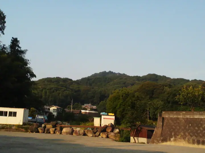
A 257.4-meter low mountain in Chikushino City, Fukuoka Prefecture, whose name ("praying-to-heaven mountain") recalls the tradition that Sugawara no Michizane, exiled to Dazaifu, repeatedly climbed it to plead his innocence before the heavens. Tenpai-san Shrine (Sugawara-jinja) and the Goji-ei-no-iwa rock associated with Michizane stand at the summit, and the "Kaiun-no-michi" trail is lined with eleven stone steles inscribed with his Chinese poems. The standard climb via Arahō-jinja on the mid-slope reaches the top in 30–40 minutes, opening to a panorama over the Chikushi Plain and Hakata Bay. Bushōji — said to be Kyūshū's oldest temple — and the Tenpai-san Rekishi-Shizen Park sit at the foot, hosting a wisteria festival in spring and a moon-viewing gathering in autumn. Listed in Fukuoka Choteizan and the Bunken Tozan Guide for Fukuoka.
Mt. Tenpai at a glance
- Weather: The most settled day in the next 7 days is Sun, November 8: clear, gusts up to 6 m/s.
- Route: The shortest is Mount Tenpai Return from Tenpaizan Historical Nature Park: about 1 h 9 min, 3.4 km, about 210 m of climbing.
Mt. Tenpai weather (hourly, 14 days)
Sunrise today 06:38, sunset 17:25
| Tue, 11/3 | Wed, 11/4 | Thu, 11/5 | Fri, 11/6 | Sat, 11/7 | Sun, 11/8 | Mon, 11/9 | Tue, 11/10 | Wed, 11/11 | Thu, 11/12 | Fri, 11/13 | Sat, 11/14 | Sun, 11/15 | Mon, 11/16 | Tue, 11/17 | |||||||||||||||||||||||||||||||||||||||||||||||||||||||||||||||||||||
|---|---|---|---|---|---|---|---|---|---|---|---|---|---|---|---|---|---|---|---|---|---|---|---|---|---|---|---|---|---|---|---|---|---|---|---|---|---|---|---|---|---|---|---|---|---|---|---|---|---|---|---|---|---|---|---|---|---|---|---|---|---|---|---|---|---|---|---|---|---|---|---|---|---|---|---|---|---|---|---|---|---|---|---|
| Japan time | 21 | 23 | 1 | 3 | 5 | 7 | 9 | 11 | 13 | 15 | 17 | 19 | 21 | 0 | 3 | 6 | 9 | 12 | 15 | 18 | 21 | 0 | 3 | 6 | 9 | 12 | 15 | 18 | 21 | 0 | 3 | 6 | 9 | 12 | 15 | 18 | 21 | 0 | 3 | 6 | 9 | 12 | 15 | 18 | 21 | 0 | 3 | 6 | 9 | 15 | 21 | 3 | 9 | 15 | 21 | 3 | 9 | 15 | 21 | 3 | 9 | 15 | 21 | 3 | 9 | 15 | 21 | 3 | 9 | 15 | 21 | 3 | 9 | 15 | 21 | 3 | 9 | 15 | 21 | 3 | 9 | 15 | |
  |   | | | |   | |   | | | | |   | | | |   |   | |   |   | | |  | |  | | | | | | | | | | | | | | | | | | | | | | | |   | |   | | |   | | | | |  | | | | | |   | | | | | | | | | | | | | | | | | ||
| Temperature | °C | 11° | 11° | 12° | 11° | 11° | 11° | 14° | 16° | 18° | 18° | 16° | 14° | 14° | 14° | 14° | 14° | 14° | 16° | 18° | 17° | 16° | 15° | 14° | 12° | 16° | 16° | 14° | 11° | 10° | 9° | 7° | 7° | 10° | 12° | 12° | 8° | 6° | 5° | 4° | 5° | 11° | 13° | 14° | 11° | 10° | 10° | 9° | 9° | 13° | 15° | 8° | 7° | 11° | 13° | 9° | 8° | 10° | 12° | 6° | 4° | 9° | 14° | 6° | 5° | 11° | 15° | 9° | 6° | 11° | 17° | 11° | 12° | 13° | 15° | 14° | 14° | 15° | 17° | 11° | 10° | 11° | 15° |
| Precipitation | mm | 0.2 | 1.0 | 2.4 | 6 | 2.8 | 2.7 | 0.4 | 0.2 | 0.4 | 0.2 | 0.1 | 1.9 | 16 | 11 | 0.3 | 0.9 | 0.2 | |||||||||||||||||||||||||||||||||||||||||||||||||||||||||||||||||
| New snow | cm | – | – | ||||||||||||||||||||||||||||||||||||||||||||||||||||||||||||||||||||||||||||||||
| Snow depth | cm | 0 | 0 | 0 | 0 | 0 | 0 | 0 | 0 | 0 | 0 | 0 | 0 | 0 | 0 | 0 | 0 | 0 | 0 | 0 | 0 | 0 | 0 | 0 | 0 | 0 | 0 | 0 | 0 | 0 | 0 | 0 | 0 | 0 | 0 | 0 | 0 | 0 | 0 | 0 | 0 | 0 | 0 | 0 | 0 | 0 | 0 | 0 | 0 | 0 | 0 | 0 | 0 | 0 | 0 | 0 | 0 | 0 | 0 | 0 | 0 | 0 | 0 | 0 | 0 | 0 | 0 | 0 | 0 | 0 | 0 | 0 | 0 | 0 | 0 | 0 | 0 | 0 | 0 | 0 | 0 | 0 | 0 |
| Wind | m/s | 2 | 2 | 2 | 2 | 1 | 1 | 2 | 2 | 2 | 3 | 2 | 1 | 2 | 1 | 0 | 0 | 2 | 4 | 4 | 2 | 2 | 2 | 4 | 3 | 4 | 5 | 5 | 3 | 3 | 4 | 4 | 4 | 4 | 4 | 4 | 2 | 1 | 1 | 1 | 1 | 1 | 2 | 2 | 1 | 1 | 1 | 1 | 2 | 1 | 4 | 1 | 1 | 1 | 5 | 0 | 3 | 3 | 4 | 0 | 0 | 1 | 3 | 1 | 0 | 0 | 3 | 2 | 1 | 1 | 2 | 1 | 1 | 3 | 3 | 0 | 1 | 3 | 4 | 3 | 3 | 3 | 3 |
| Wind gusts | m/s | 5 | 4 | 5 | 4 | 4 | 4 | 5 | 6 | 7 | 6 | 7 | 5 | 5 | 4 | 3 | 2 | 6 | 9 | 11 | 11 | 6 | 5 | 8 | 9 | 10 | 13 | 13 | 12 | 8 | 10 | 9 | 9 | 10 | 11 | 10 | 9 | 4 | 3 | 3 | 3 | 4 | 5 | 6 | 6 | 3 | 2 | 3 | 4 | 4 | 9 | 9 | 3 | 4 | 12 | 11 | 8 | 8 | 10 | 9 | 2 | 3 | 7 | 7 | 2 | 3 | 8 | 7 | 4 | 4 | 6 | 5 | 3 | 8 | 10 | 8 | 5 | 7 | 11 | 10 | 7 | 7 | 9 |
| Wind dir. | ↓ | ↓ | ↓ | ↓ | ↓ | ↓ | ↓ | ↓ | ↓ | ↓ | ↓ | ↓ | ↓ | ↓ | ↓ | ↓ | ↓ | ↓ | ↓ | ↓ | ↓ | ↓ | ↓ | ↓ | ↓ | ↓ | ↓ | ↓ | ↓ | ↓ | ↓ | ↓ | ↓ | ↓ | ↓ | ↓ | ↓ | ↓ | ↓ | ↓ | ↓ | ↓ | ↓ | ↓ | ↓ | ↓ | ↓ | ↓ | ↓ | ↓ | ↓ | ↓ | ↓ | ↓ | ↓ | ↓ | ↓ | ↓ | ↓ | ↓ | ↓ | ↓ | ↓ | ↓ | ↓ | ↓ | ↓ | ↓ | ↓ | ↓ | ↓ | ↓ | ↓ | ↓ | ↓ | ↓ | ↓ | ↓ | ↓ | ↓ | ↓ | ↓ | |
Mt. Tenpai hiking routes
Hiking times are estimates calculated from the terrain.
Huts, campsites and lodging near Mt. Tenpai
Campsites
- 基山町キャンプ場
Lodging
- 大丸別荘
- 二日市温泉 大観荘
- ウイークリーイン・二日市
- グランドエンパイアホテル
Mt. Tenpai facts
- Elevation
- 257 m
- Location
- Chikushino, Fukuoka
33.481782, 130.506206 - Website
- www.crossroadfukuoka.jp
- Trail Map
- www.chikushino.org (PDF)
- Access Information
- www.city.chikushino.fukuoka.jp
- Wikipedia
- ja.wikipedia.org