
Mount Kusenbu
九千部山
Tosu, Saga · Elevation 847 m
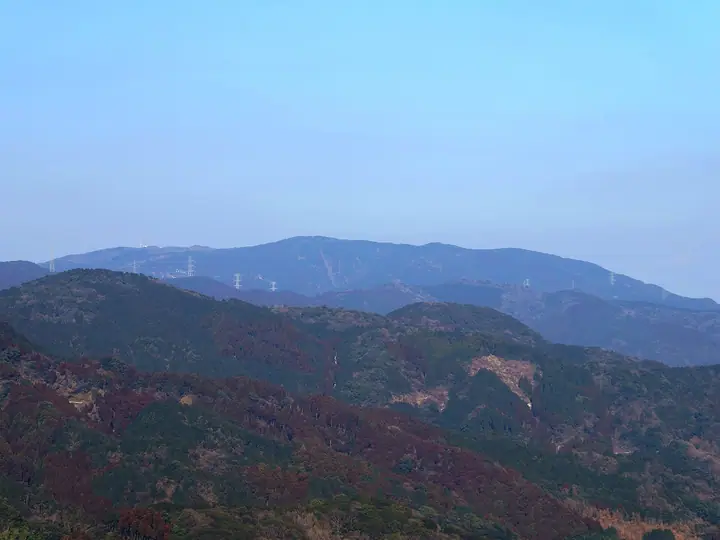
Mount Kusenbu is an 847.5 m peak in the eastern Sefuri Range straddling the border of Tosu in Saga and Nakagawa in Fukuoka, traversed by the Kyūshū Nature Trail. A three-storey observation tower at the summit gives a 360-degree panorama from Hakata Bay in the north to the Tsukushi Plain and Ariake Sea in the south. The name comes from a legend that the Heian-era monk Ryūshin set out to chant the Lotus Sutra ten thousand times here but lost his focus after the nine-thousandth (kusenbu) recitation, and the mountain is counted among the Hundred Famous Mountains of Kyūshū.
Mount Kusenbu at a glance
- Weather: The most settled day in the next 7 days is Sun, November 8: clear, gusts up to 5 m/s. Fri, Nov 6: strong wind (gusts up to 15 m/s).
Mount Kusenbu weather (hourly, 14 days)
Sunrise today 06:38, sunset 17:26
| Tue, 11/3 | Wed, 11/4 | Thu, 11/5 | Fri, 11/6 | Sat, 11/7 | Sun, 11/8 | Mon, 11/9 | Tue, 11/10 | Wed, 11/11 | Thu, 11/12 | Fri, 11/13 | Sat, 11/14 | Sun, 11/15 | Mon, 11/16 | Tue, 11/17 | |||||||||||||||||||||||||||||||||||||||||||||||||||||||||||||||||||||||
|---|---|---|---|---|---|---|---|---|---|---|---|---|---|---|---|---|---|---|---|---|---|---|---|---|---|---|---|---|---|---|---|---|---|---|---|---|---|---|---|---|---|---|---|---|---|---|---|---|---|---|---|---|---|---|---|---|---|---|---|---|---|---|---|---|---|---|---|---|---|---|---|---|---|---|---|---|---|---|---|---|---|---|---|---|---|
| Japan time | 15 | 17 | 19 | 21 | 23 | 1 | 3 | 5 | 7 | 9 | 11 | 13 | 15 | 18 | 21 | 0 | 3 | 6 | 9 | 12 | 15 | 18 | 21 | 0 | 3 | 6 | 9 | 12 | 15 | 18 | 21 | 0 | 3 | 6 | 9 | 12 | 15 | 18 | 21 | 0 | 3 | 6 | 9 | 12 | 15 | 18 | 21 | 0 | 3 | 6 | 9 | 15 | 21 | 3 | 9 | 15 | 21 | 3 | 9 | 15 | 21 | 3 | 9 | 15 | 21 | 3 | 9 | 15 | 21 | 3 | 9 | 15 | 21 | 3 | 9 | 15 | 21 | 3 | 9 | 15 | 21 | 3 | 9 | 15 | |
  |   |   |   | | | | | |   | | | |   | | | | | |   | |   | | |   | | |  | |  | | | | | | | | | | | | | | | | | | | | | |   | | | | |   | |   | |   | | | |  | | | | | | | | | | | | | | | | | | | | ||
| Temperature | °C | 14° | 12° | 10° | 9° | 9° | 8° | 8° | 9° | 8° | 10° | 14° | 16° | 15° | 11° | 11° | 11° | 11° | 11° | 13° | 15° | 16° | 14° | 14° | 12° | 12° | 10° | 13° | 13° | 11° | 8° | 7° | 6° | 5° | 5° | 7° | 8° | 8° | 5° | 4° | 3° | 3° | 3° | 8° | 10° | 11° | 9° | 7° | 7° | 7° | 7° | 10° | 11° | 6° | 5° | 9° | 10° | 7° | 6° | 7° | 9° | 4° | 3° | 7° | 11° | 5° | 5° | 9° | 12° | 7° | 5° | 8° | 14° | 9° | 9° | 10° | 13° | 10° | 12° | 12° | 13° | 8° | 7° | 9° | 12° |
| Precipitation | mm | 0.7 | 0.5 | 0.2 | 2.7 | 0.8 | 1.9 | 0.5 | 0.3 | 0.8 | 0.4 | 0.2 | 0.6 | 0.1 | 0.2 | 4.6 | 17 | 10 | 0.9 | 1.7 | 0.2 | 0.2 | |||||||||||||||||||||||||||||||||||||||||||||||||||||||||||||||
| New snow | cm | ||||||||||||||||||||||||||||||||||||||||||||||||||||||||||||||||||||||||||||||||||||
| Snow depth | cm | 0 | 0 | 0 | 0 | 0 | 0 | 0 | 0 | 0 | 0 | 0 | 0 | 0 | 0 | 0 | 0 | 0 | 0 | 0 | 0 | 0 | 0 | 0 | 0 | 0 | 0 | 0 | 0 | 0 | 0 | 0 | 0 | 0 | 0 | 0 | 0 | 0 | 0 | 0 | 0 | 0 | 0 | 0 | 0 | 0 | 0 | 0 | 0 | 0 | 0 | 0 | 0 | 0 | 0 | 0 | 0 | 0 | 0 | 0 | 0 | 0 | 0 | 0 | 0 | 0 | 0 | 0 | 0 | 0 | 0 | 0 | 0 | 0 | 0 | 0 | 0 | 0 | 0 | 0 | 0 | 0 | 0 | 0 | 0 |
| Wind | m/s | 3 | 3 | 2 | 2 | 2 | 2 | 2 | 2 | 1 | 2 | 2 | 2 | 2 | 2 | 1 | 1 | 1 | 1 | 2 | 4 | 4 | 2 | 2 | 2 | 4 | 4 | 5 | 6 | 5 | 4 | 3 | 5 | 5 | 5 | 5 | 4 | 4 | 2 | 1 | 1 | 1 | 1 | 1 | 1 | 2 | 1 | 0 | 1 | 1 | 2 | 1 | 4 | 1 | 1 | 2 | 5 | 2 | 3 | 3 | 4 | 0 | 0 | 1 | 2 | 1 | 0 | 1 | 3 | 1 | 1 | 1 | 2 | 1 | 1 | 4 | 3 | 0 | 2 | 3 | 5 | 3 | 2 | 2 | 4 |
| Wind gusts | m/s | 9 | 9 | 7 | 7 | 6 | 6 | 5 | 6 | 5 | 5 | 7 | 7 | 6 | 6 | 5 | 4 | 4 | 3 | 6 | 11 | 13 | 11 | 7 | 8 | 11 | 11 | 12 | 15 | 15 | 14 | 11 | 14 | 13 | 12 | 13 | 13 | 12 | 10 | 5 | 4 | 3 | 4 | 4 | 5 | 5 | 5 | 3 | 2 | 4 | 5 | 5 | 11 | 11 | 4 | 7 | 13 | 13 | 11 | 9 | 11 | 10 | 2 | 3 | 7 | 7 | 3 | 4 | 8 | 7 | 4 | 4 | 7 | 6 | 5 | 12 | 14 | 10 | 6 | 9 | 12 | 12 | 8 | 7 | 10 |
| Wind dir. | ↓ | ↓ | ↓ | ↓ | ↓ | ↓ | ↓ | ↓ | ↓ | ↓ | ↓ | ↓ | ↓ | ↓ | ↓ | ↓ | ↓ | ↓ | ↓ | ↓ | ↓ | ↓ | ↓ | ↓ | ↓ | ↓ | ↓ | ↓ | ↓ | ↓ | ↓ | ↓ | ↓ | ↓ | ↓ | ↓ | ↓ | ↓ | ↓ | ↓ | ↓ | ↓ | ↓ | ↓ | ↓ | ↓ | ↓ | ↓ | ↓ | ↓ | ↓ | ↓ | ↓ | ↓ | ↓ | ↓ | ↓ | ↓ | ↓ | ↓ | ↓ | ↓ | ↓ | ↓ | ↓ | ↓ | ↓ | ↓ | ↓ | ↓ | ↓ | ↓ | ↓ | ↓ | ↓ | ↓ | ↓ | ↓ | ↓ | ↓ | ↓ | ↓ | ↓ | ↓ | |
Huts, campsites and lodging near Mount Kusenbu
Campsites
- モンベルクライミングウォール那珂川町
Lists that include Mount Kusenbu
Mount Kusenbu facts
- Elevation
- 847 m
- Location
- Tosu, Saga
33.416684, 130.446044 - Website
- sagamichi.jp
- Trail Map
- sagamichi.jp (PDF)
- Wikipedia
- ja.wikipedia.org