
Mt. Takanosu
鷹巣山
Okutama, Tokyo · Elevation 1,737 m
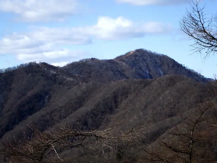
Mt. Takanosu (1,737 m) rises in Okutama Town in western Tokyo as one of the principal peaks of the Okutama region within Chichibu-Tama-Kai National Park. Sitting near the centre of the Ishi-One ridge that links Mt. Kumotori (Tokyo's highest peak) to Okutama Station, it is the highest summit lying entirely within Tokyo Prefecture. The name ("Hawk's Nest Mountain") is said to come from the Edo period, when the area was reserved as a shogunal falconry ground; the Inamura-iwa Ridge route up from Higashi-Nippara is counted as one of Okutama's three steepest ascents. Its broad, south-facing summit offers sweeping views of Mt. Fuji and the Okutama and Tanzawa ranges, and it is listed among the 100 Famous Mountains of Kantō and the 100 Mountains of Tama.
Mt. Takanosu at a glance
- Weather: The most settled day in the next 7 days is Fri, November 6: clear, gusts up to 7 m/s.
- Route: The shortest is Mount Takanosu in Okutama, Sengen Ridge Return from Oku in the Mineya Valley: about 5 h 33 min, 8.5 km, about 850 m of climbing.
Mt. Takanosu weather (hourly, 14 days)
Sunrise today 06:07, sunset 16:48
| Tue, 11/3 | Wed, 11/4 | Thu, 11/5 | Fri, 11/6 | Sat, 11/7 | Sun, 11/8 | Mon, 11/9 | Tue, 11/10 | Wed, 11/11 | Thu, 11/12 | Fri, 11/13 | Sat, 11/14 | Sun, 11/15 | Mon, 11/16 | Tue, 11/17 | |||||||||||||||||||||||||||||||||||||||||||||||||||||||||||||||||||||||
|---|---|---|---|---|---|---|---|---|---|---|---|---|---|---|---|---|---|---|---|---|---|---|---|---|---|---|---|---|---|---|---|---|---|---|---|---|---|---|---|---|---|---|---|---|---|---|---|---|---|---|---|---|---|---|---|---|---|---|---|---|---|---|---|---|---|---|---|---|---|---|---|---|---|---|---|---|---|---|---|---|---|---|---|---|---|
| Japan time | 21 | 23 | 1 | 3 | 5 | 7 | 9 | 11 | 13 | 15 | 17 | 19 | 21 | 0 | 3 | 6 | 9 | 12 | 15 | 18 | 21 | 0 | 3 | 6 | 9 | 12 | 15 | 18 | 21 | 0 | 3 | 6 | 9 | 12 | 15 | 18 | 21 | 0 | 3 | 6 | 9 | 12 | 15 | 18 | 21 | 0 | 3 | 6 | 9 | 12 | 15 | 21 | 3 | 9 | 15 | 21 | 3 | 9 | 15 | 21 | 3 | 9 | 15 | 21 | 3 | 9 | 15 | 21 | 3 | 9 | 15 | 21 | 3 | 9 | 15 | 21 | 3 | 9 | 15 | 21 | 3 | 9 | 15 | 21 | |
  | |   | | |   | | | |   | | | | | | | |   |   |   | |  | | |  | |   |   | | | | | | | | | | | | | | | | |   | | | | | | | | | | | | | | |   |  | | | | | | | | | | | | | | | |   | | | | | | | | ||
| Temperature | °C | 4° | 4° | 3° | 3° | 3° | 3° | 4° | 5° | 5° | 3° | 3° | 2° | 3° | 3° | 4° | 4° | 7° | 11° | 10° | 7° | 5° | 4° | 4° | 4° | 12° | 15° | 12° | 7° | 6° | 3° | 0° | 2° | 7° | 9° | 6° | 1° | 0° | -2° | -2° | -3° | 4° | 6° | 4° | 2° | 0° | 0° | 0° | 0° | 2° | 3° | 2° | 1° | 0° | 1° | 3° | 0° | -4° | 3° | 3° | -4° | -3° | 3° | 3° | 1° | -3° | 6° | 6° | -4° | -3° | 2° | 4° | -1° | -3° | 5° | 7° | 5° | 5° | 11° | 11° | 2° | 1° | 0° | 2° | -1° |
| Precipitation | mm | 1.4 | 1.1 | 0.4 | 0.8 | 1.5 | 3.6 | 10 | 17 | 8 | 1.8 | 0.4 | 0.2 | 0.1 | 0.5 | 0.2 | 0.1 | 0.6 | 1.2 | 0.3 | 0.2 | 0.2 | 4.0 | 15 | 0.1 | ||||||||||||||||||||||||||||||||||||||||||||||||||||||||||||
| New snow | cm | ||||||||||||||||||||||||||||||||||||||||||||||||||||||||||||||||||||||||||||||||||||
| Snow depth | cm | 0 | 0 | 0 | 0 | 0 | 0 | 0 | 0 | 0 | 0 | 0 | 0 | 0 | 0 | 0 | 0 | 0 | 0 | 0 | 0 | 0 | 0 | 0 | 0 | 0 | 0 | 0 | 0 | 0 | 0 | 0 | 0 | 0 | 0 | 0 | 0 | 0 | 0 | 0 | 0 | 0 | 0 | 0 | 0 | 0 | 0 | 0 | 0 | 0 | 0 | 0 | 0 | 0 | 0 | 0 | 0 | 0 | 0 | 0 | 0 | 0 | 0 | 0 | 0 | 0 | 0 | 0 | 0 | 0 | 0 | 0 | 0 | 0 | 0 | 0 | 0 | 0 | 0 | 0 | 0 | 0 | 0 | 0 | 0 |
| Wind | m/s | 0 | 1 | 1 | 0 | 1 | 1 | 1 | 2 | 1 | 2 | 1 | 1 | 1 | 1 | 1 | 2 | 2 | 2 | 1 | 1 | 1 | 1 | 1 | 1 | 1 | 2 | 2 | 1 | 1 | 1 | 1 | 0 | 1 | 2 | 3 | 0 | 0 | 1 | 1 | 1 | 1 | 1 | 2 | 1 | 1 | 1 | 1 | 0 | 1 | 2 | 1 | 1 | 2 | 2 | 3 | 1 | 1 | 7 | 5 | 2 | 0 | 1 | 2 | 1 | 1 | 3 | 4 | 1 | 0 | 1 | 1 | 0 | 0 | 1 | 1 | 1 | 0 | 1 | 5 | 4 | 0 | 1 | 2 | 1 |
| Wind gusts | m/s | 2 | 3 | 4 | 3 | 3 | 3 | 4 | 6 | 6 | 5 | 5 | 4 | 4 | 5 | 5 | 6 | 7 | 7 | 5 | 4 | 5 | 6 | 6 | 6 | 5 | 6 | 7 | 5 | 3 | 5 | 5 | 4 | 4 | 7 | 8 | 8 | 3 | 4 | 4 | 3 | 4 | 6 | 6 | 5 | 4 | 5 | 5 | 4 | 5 | 6 | 6 | 5 | 5 | 5 | 8 | 8 | 5 | 23 | 24 | 16 | 6 | 4 | 8 | 5 | 4 | 10 | 16 | 11 | 4 | 4 | 7 | 5 | 3 | 5 | 8 | 6 | 7 | 6 | 14 | 18 | 10 | 4 | 6 | 5 |
| Wind dir. | ↓ | ↓ | ↓ | ↓ | ↓ | ↓ | ↓ | ↓ | ↓ | ↓ | ↓ | ↓ | ↓ | ↓ | ↓ | ↓ | ↓ | ↓ | ↓ | ↓ | ↓ | ↓ | ↓ | ↓ | ↓ | ↓ | ↓ | ↓ | ↓ | ↓ | ↓ | ↓ | ↓ | ↓ | ↓ | ↓ | ↓ | ↓ | ↓ | ↓ | ↓ | ↓ | ↓ | ↓ | ↓ | ↓ | ↓ | ↓ | ↓ | ↓ | ↓ | ↓ | ↓ | ↓ | ↓ | ↓ | ↓ | ↓ | ↓ | ↓ | ↓ | ↓ | ↓ | ↓ | ↓ | ↓ | ↓ | ↓ | ↓ | ↓ | ↓ | ↓ | ↓ | ↓ | ↓ | ↓ | ↓ | ↓ | ↓ | ↓ | ↓ | ↓ | ↓ | ↓ | |
Mt. Takanosu hiking routes
- Mount Takanosu in Okutama, Sengen Ridge Return from Oku in the Mineya Valley 8.5 km · Ascent 854 m
- Okutama, up the Mizunesawa Valley to Mount Takanosu and down the Ishione Ridge to Okutama Station 18.2 km · Ascent 1,450 m 水根バス停 (Bus stop), 水根 (Bus stop), 奥多摩湖バス停 (Bus stop), Okutamako (Bus stop) (parking) → Times, Oku-Tama (Station), Okutama Station (Bus stop), 下栃久保 (Bus stop)
Hiking times are estimates calculated from the terrain.
Huts, campsites and lodging near Mt. Takanosu
Mountain huts
- Takanosu Hut (non staffed) unstaffed
- Nanatsuishi-Koya Lodge 2026: open all year · reservation required · sleeps 10
Campsites
- 七ツ石小屋 テント場
- 水根沢キャンプ場
Lists that include Mt. Takanosu
Kanto 100 Famous Mountains · 100 Mountains of Tama · 1000 Mountains of Japan
Mt. Takanosu facts
- Also known as
- 入奥山
- Elevation
- 1,737 m
- Location
- Okutama, Tokyo
35.829892, 139.012322 - National Park
- 秩父多摩甲斐国立公園
- Website
- okutamavc.ces-net.jp
- Access Information
- www.okutama.gr.jp (PDF)
- Wikipedia
- ja.wikipedia.org