
Mt. Shizugatake
賤ヶ岳
Nagahama, Shiga · Elevation 421 m
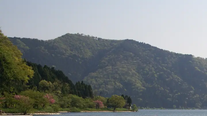
Mt. Shizugatake is a 421.13-meter peak in Nagahama City (former Kinomoto Town, Ika District), Shiga Prefecture, within Lake Biwa Quasi-National Park. It is best known as the main battlefield of the 1583 Battle of Shizugatake between Hashiba Hideyoshi and Shibata Katsuie — a decisive engagement in the unification of Japan — and a battle monument and war-dead cenotaph stand at the summit. The peak commands a view of Oku-Biwako, Chikubu-shima Island, the Hira Range, Yogo-ko Lake, and Mt. Ibuki; "Fresh Snow at Shizugatake" is one of the Eight Views of Lake Biwa. It is reached on foot from Yogo Station/Yogo-ko Lake and Kinomoto, and a chairlift (opened 1959, operated by Oku-Ibuki Tourism) carries visitors near the summit. The peak is featured in the Kansai Hyakumeizan, Nihon Hyaku-Teizan, Ōmi Hyakuzan, and other regional lists.
Mt. Shizugatake at a glance
- Weather: The most settled day in the next 7 days is Wed, November 4: clear, gusts up to 9 m/s. Fri, Nov 6, Sat, Nov 7: strong wind (gusts up to 17 m/s).
- Route: The shortest is Mount Shizugatake from the Lift Base Station: about 1 h 45 min, 2.5 km, about 310 m of climbing.
Mt. Shizugatake weather (hourly, 14 days)
Sunrise today 06:18, sunset 17:00
| Tue, 11/3 | Wed, 11/4 | Thu, 11/5 | Fri, 11/6 | Sat, 11/7 | Sun, 11/8 | Mon, 11/9 | Tue, 11/10 | Wed, 11/11 | Thu, 11/12 | Fri, 11/13 | Sat, 11/14 | Sun, 11/15 | Mon, 11/16 | Tue, 11/17 | |||||||||||||||||||||||||||||||||||||||||||||||||||||||||||||||||||||||
|---|---|---|---|---|---|---|---|---|---|---|---|---|---|---|---|---|---|---|---|---|---|---|---|---|---|---|---|---|---|---|---|---|---|---|---|---|---|---|---|---|---|---|---|---|---|---|---|---|---|---|---|---|---|---|---|---|---|---|---|---|---|---|---|---|---|---|---|---|---|---|---|---|---|---|---|---|---|---|---|---|---|---|---|---|---|
| Japan time | 21 | 23 | 1 | 3 | 5 | 7 | 9 | 11 | 13 | 15 | 17 | 19 | 21 | 0 | 3 | 6 | 9 | 12 | 15 | 18 | 21 | 0 | 3 | 6 | 9 | 12 | 15 | 18 | 21 | 0 | 3 | 6 | 9 | 12 | 15 | 18 | 21 | 0 | 3 | 6 | 9 | 12 | 15 | 18 | 21 | 0 | 3 | 6 | 9 | 12 | 15 | 21 | 3 | 9 | 15 | 21 | 3 | 9 | 15 | 21 | 3 | 9 | 15 | 21 | 3 | 9 | 15 | 21 | 3 | 9 | 15 | 21 | 3 | 9 | 15 | 21 | 3 | 9 | 15 | 21 | 3 | 9 | 15 | 21 | |
 |   | | | |   | | |   |   |   |   | |   |   | |   | | | | | | | |   |   | |   | | | | | | | | | | | | | | | | | | | | | | | | | | | | | | | | | |  | | | | | |  | | | | | | | | | | | | | | | |  | ||
| Temperature | °C | 9° | 9° | 8° | 8° | 8° | 8° | 13° | 16° | 16° | 16° | 14° | 13° | 12° | 11° | 12° | 12° | 15° | 18° | 18° | 15° | 14° | 14° | 13° | 12° | 13° | 17° | 13° | 11° | 9° | 8° | 7° | 6° | 8° | 9° | 9° | 7° | 7° | 7° | 7° | 6° | 8° | 10° | 10° | 7° | 7° | 7° | 7° | 7° | 11° | 14° | 12° | 7° | 6° | 10° | 11° | 8° | 6° | 9° | 9° | 7° | 6° | 9° | 11° | 7° | 8° | 9° | 10° | 6° | 4° | 10° | 13° | 8° | 9° | 12° | 14° | 12° | 12° | 13° | 12° | 7° | 6° | 7° | 10° | 6° |
| Precipitation | mm | 1.6 | 1.0 | 2.7 | 0.4 | 0.9 | 7 | 7 | 1.7 | 1.5 | 1.1 | 1.9 | 0.7 | 0.4 | 0.8 | 1.1 | 1.2 | 1.4 | 1.4 | 0.7 | 0.3 | 0.4 | 0.3 | 0.3 | 1.6 | 5 | 3.8 | 0.3 | 1.6 | 2.1 | 6 | 10 | 2.6 | 2.3 | 0.2 | ||||||||||||||||||||||||||||||||||||||||||||||||||
| New snow | cm | ||||||||||||||||||||||||||||||||||||||||||||||||||||||||||||||||||||||||||||||||||||
| Snow depth | cm | 0 | 0 | 0 | 0 | 0 | 0 | 0 | 0 | 0 | 0 | 0 | 0 | 0 | 0 | 0 | 0 | 0 | 0 | 0 | 0 | 0 | 0 | 0 | 0 | 0 | 0 | 0 | 0 | 0 | 0 | 0 | 0 | 0 | 0 | 0 | 0 | 0 | 0 | 0 | 0 | 0 | 0 | 0 | 0 | 0 | 0 | 0 | 0 | 0 | 0 | 0 | 0 | 0 | 0 | 0 | 0 | 0 | 0 | 0 | 0 | 0 | 0 | 0 | 0 | 0 | 0 | 0 | 0 | 0 | 0 | 0 | 0 | 0 | 0 | 0 | 0 | 0 | 0 | 0 | 0 | 0 | 0 | 0 | 0 |
| Wind | m/s | 3 | 3 | 3 | 4 | 4 | 3 | 2 | 1 | 1 | 1 | 0 | 0 | 1 | 1 | 2 | 0 | 0 | 1 | 1 | 1 | 3 | 2 | 4 | 3 | 4 | 7 | 5 | 4 | 4 | 5 | 4 | 4 | 5 | 7 | 7 | 5 | 4 | 5 | 4 | 4 | 5 | 6 | 5 | 3 | 1 | 0 | 1 | 1 | 2 | 4 | 5 | 1 | 1 | 3 | 2 | 3 | 8 | 8 | 7 | 4 | 3 | 3 | 4 | 0 | 1 | 6 | 6 | 4 | 3 | 1 | 3 | 2 | 3 | 3 | 4 | 3 | 1 | 4 | 7 | 6 | 5 | 4 | 3 | 1 |
| Wind gusts | m/s | 8 | 7 | 7 | 9 | 9 | 9 | 7 | 5 | 4 | 5 | 3 | 2 | 3 | 3 | 4 | 5 | 4 | 5 | 5 | 4 | 6 | 9 | 12 | 10 | 12 | 16 | 17 | 14 | 12 | 13 | 13 | 12 | 14 | 17 | 17 | 16 | 11 | 12 | 12 | 11 | 13 | 14 | 14 | 12 | 7 | 3 | 2 | 2 | 5 | 11 | 12 | 9 | 3 | 8 | 10 | 9 | 18 | 20 | 20 | 17 | 11 | 8 | 10 | 9 | 5 | 14 | 16 | 15 | 11 | 7 | 8 | 7 | 6 | 8 | 11 | 10 | 10 | 11 | 18 | 18 | 15 | 13 | 10 | 8 |
| Wind dir. | ↓ | ↓ | ↓ | ↓ | ↓ | ↓ | ↓ | ↓ | ↓ | ↓ | ↓ | ↓ | ↓ | ↓ | ↓ | ↓ | ↓ | ↓ | ↓ | ↓ | ↓ | ↓ | ↓ | ↓ | ↓ | ↓ | ↓ | ↓ | ↓ | ↓ | ↓ | ↓ | ↓ | ↓ | ↓ | ↓ | ↓ | ↓ | ↓ | ↓ | ↓ | ↓ | ↓ | ↓ | ↓ | ↓ | ↓ | ↓ | ↓ | ↓ | ↓ | ↓ | ↓ | ↓ | ↓ | ↓ | ↓ | ↓ | ↓ | ↓ | ↓ | ↓ | ↓ | ↓ | ↓ | ↓ | ↓ | ↓ | ↓ | ↓ | ↓ | ↓ | ↓ | ↓ | ↓ | ↓ | ↓ | ↓ | ↓ | ↓ | ↓ | ↓ | ↓ | ↓ | |
Mt. Shizugatake hiking routes
Hiking times are estimates calculated from the terrain.
Huts, campsites and lodging near Mt. Shizugatake
Lodging
- 余呉湖荘
- ゲストハウス ミエイ
- Seisenkaku
- 草野旅館
Lists that include Mt. Shizugatake
Kansai 100 Famous Mountains · Tokai 100 Mountains · Omi 100 Mountains
Mt. Shizugatake facts
- Elevation
- 421 m
- Location
- Nagahama, Shiga
35.506099, 136.193100 - National Park
- 琵琶湖国定公園
- Website
- www.biwako-visitors.jp
- Trail Map
- www.city.nagahama.lg.jp (PDF)
- Access Information
- www.shizugatakelift.jp
- Wikipedia
- ja.wikipedia.org